• CONTACT US if you have any problems registering for the forums.

South West "Wonderful North Devon" with PC Coaches, April 2019

Eleanor

1000+ Posts
Five days in North Devon, based at Bideford

Details and thoughts


The family were away for a week in the Easter Holidays meaning I was free of grandparenting duties. Searching for suitable holidays I decided on five days in North Devon with PC Coaches, a company based in Lincoln. I have used them twice previously with mixed experiences. One trip was good. The next disappointing.

After a third trip, the jury is still out. It was a good break staying at a very nice hotel in East the Water, just over the river from Bideford. We had a free day to explore under our own steam with a full day trip to Lynmouth and Lynton with an afternoon in Dunster. On our last day we visited the RHS gardens at Rosemoor.

It was a long drive there and back. The company covers all of Lincolnshire with feeder services. I was the only person travelling from Scunthorpe and was picked up by taxi from Scunthorpe bus station. We then picked up another two people from Brigg before being dropped at the Lincoln depot where we got on the coach. We had a short stop at Grantham Services where we picked up more passengers.

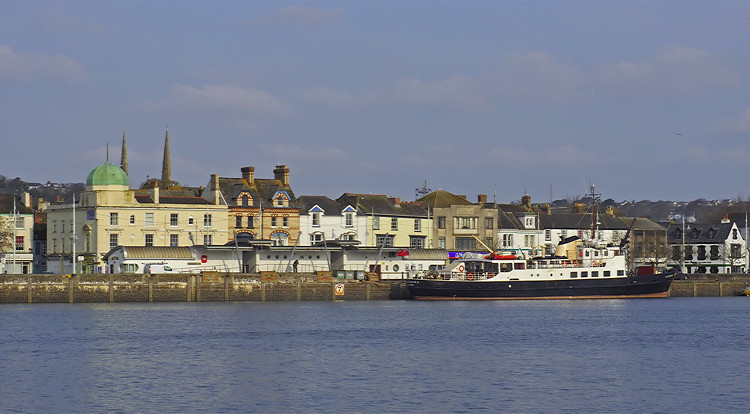
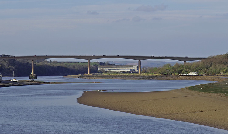
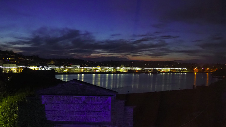
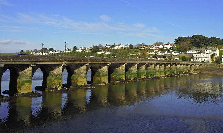
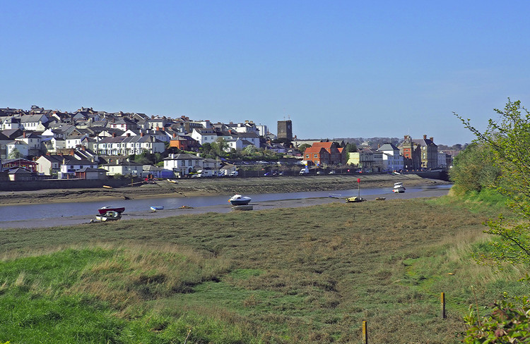
We had been told we would have a lunch break at a garden centre near Gloucester, only the driver missed the turn so we continued to the next service area for lunch. From there we headed to Bideford, arriving just turned 4pm. We stopped at the Royal Hotel in East the Water, just across the river from Bideford. It was a very comfortable hotel in a good location and the food was excellent.

full


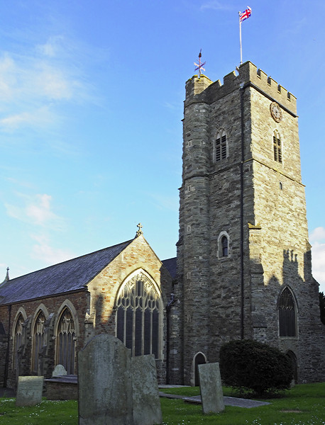
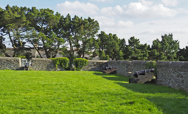
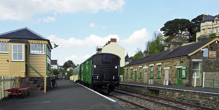
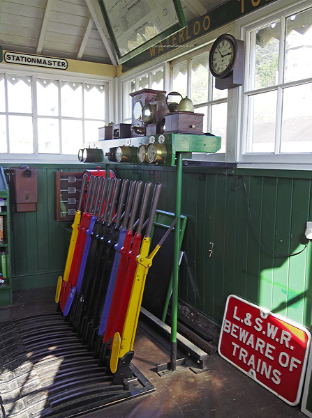
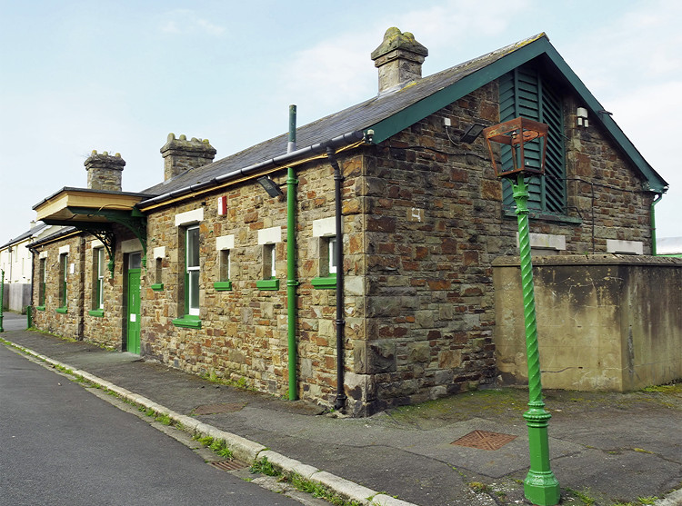
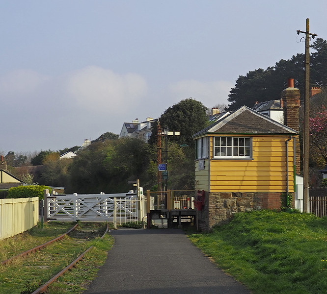
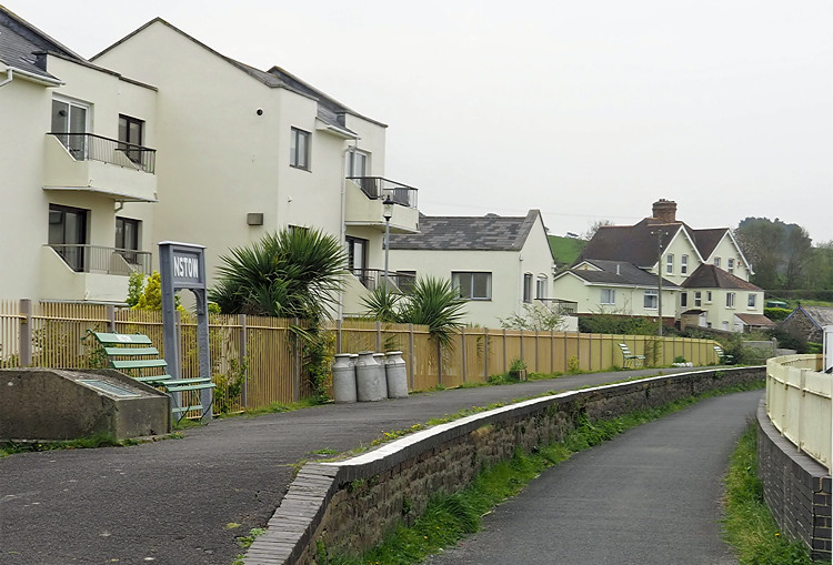
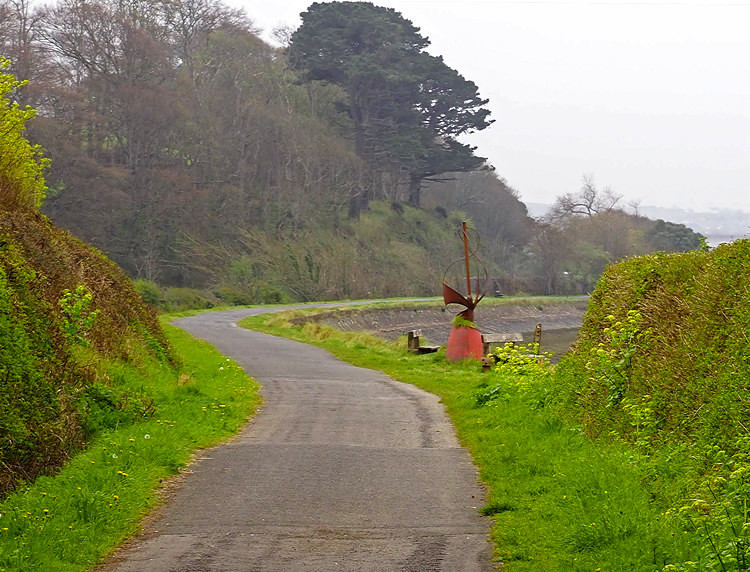
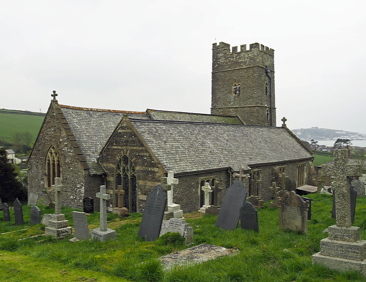
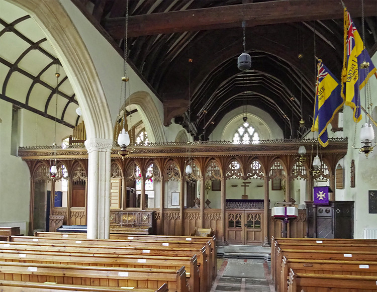
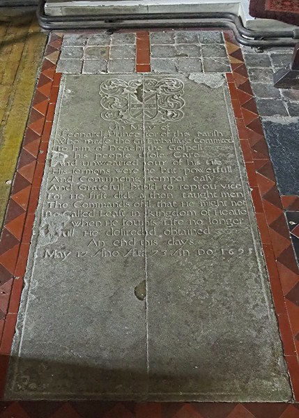
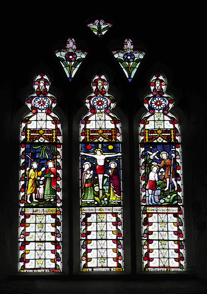
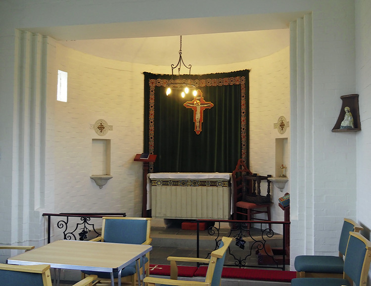
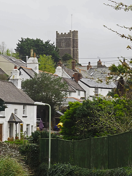
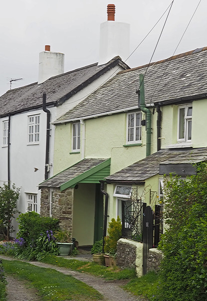
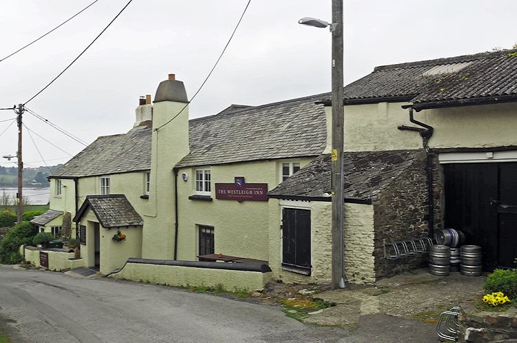
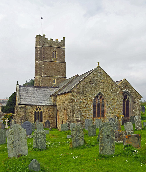
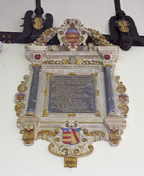
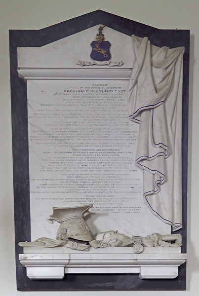
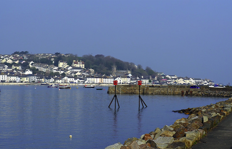
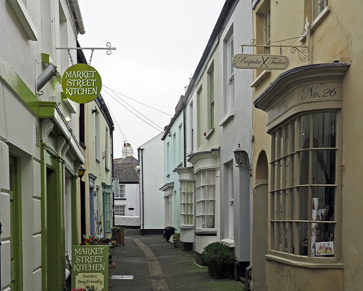
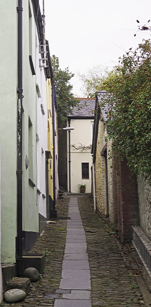
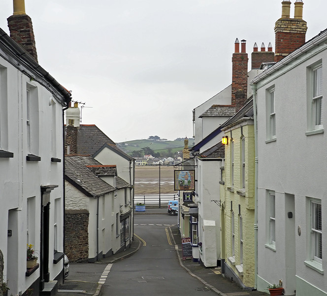
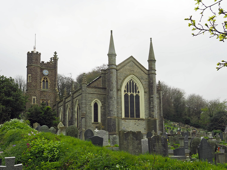
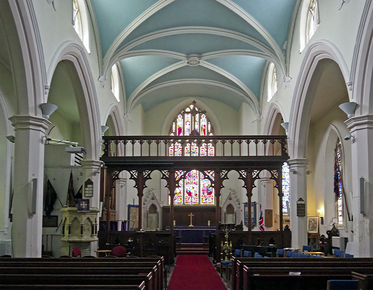
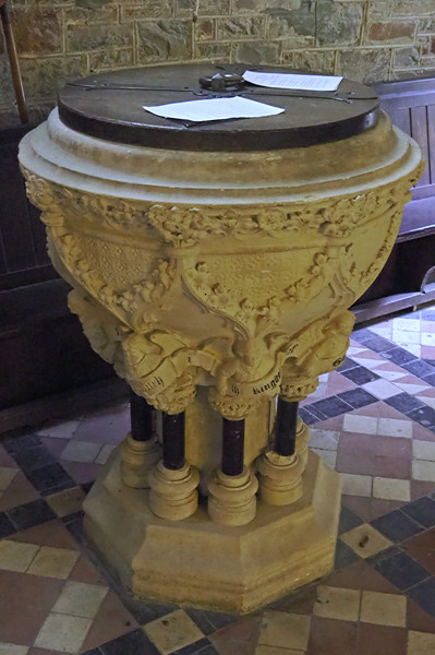
The following day I caught the bus to Instow where I walked along the Promenade and up to the church at the far end of the village. After visiting the restored signal box, I walked back along the disused railway line along the Tarka Trail to Westleigh. The village is on the hillside above the railway and I went to visit the church. I caught the bus back to Bideford and then another bus to Appledore. After visiting the church and exploring I had an ice cream, from Hocking’s Ice Cream on the quayside before catching the bus back to Bideford.

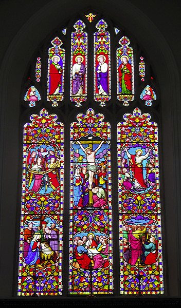
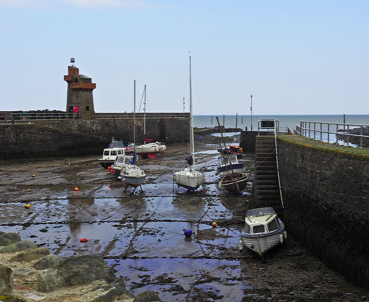
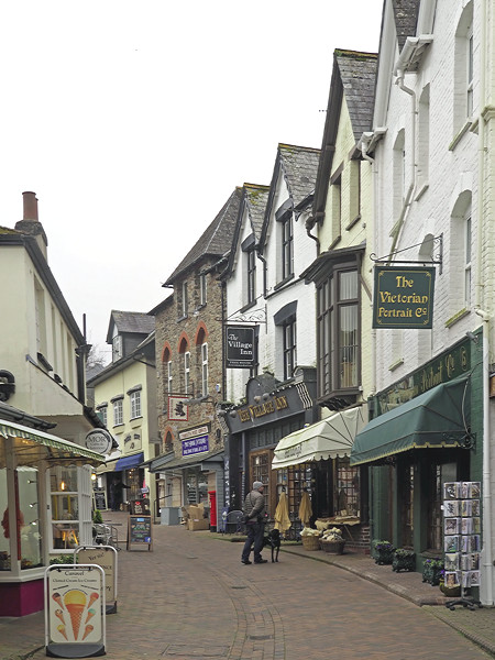
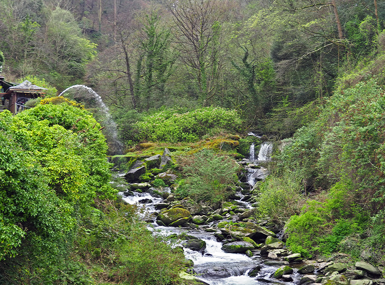
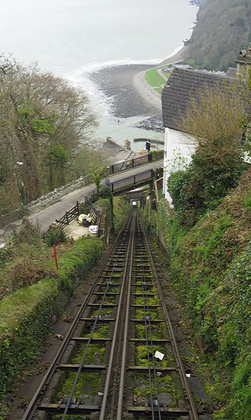
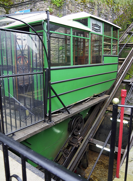
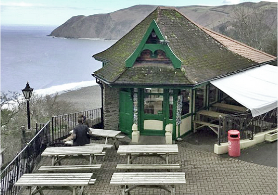
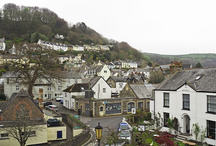
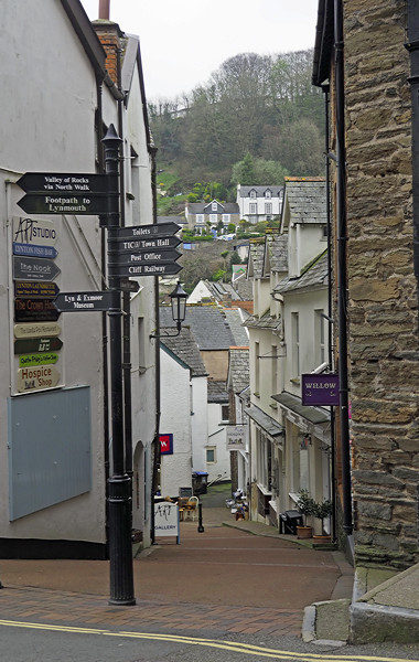
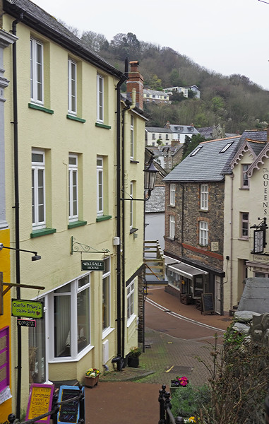
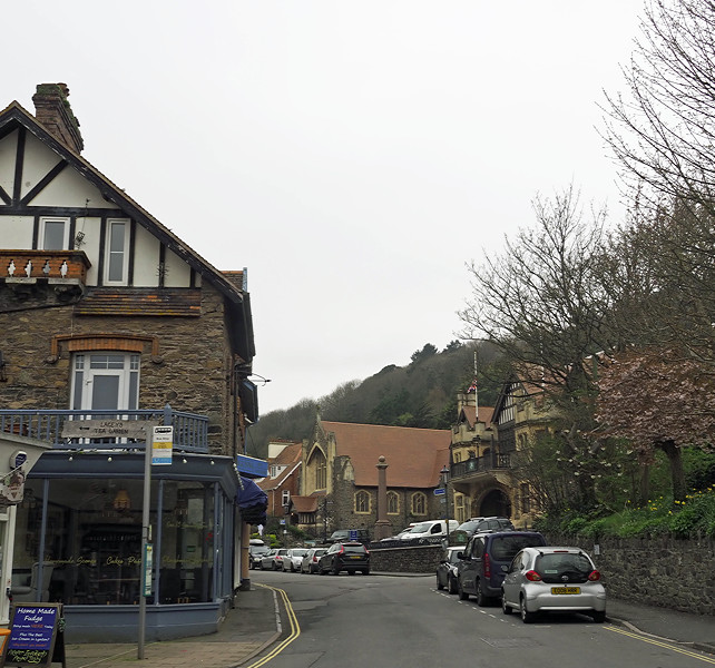
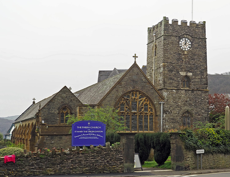
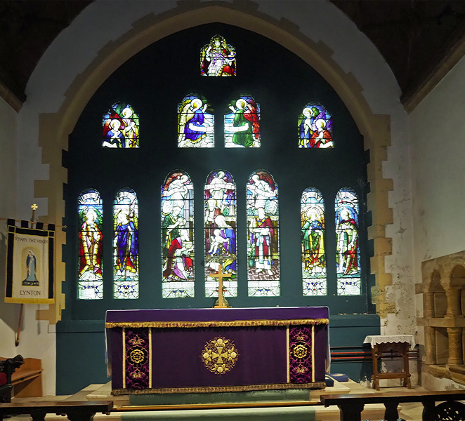
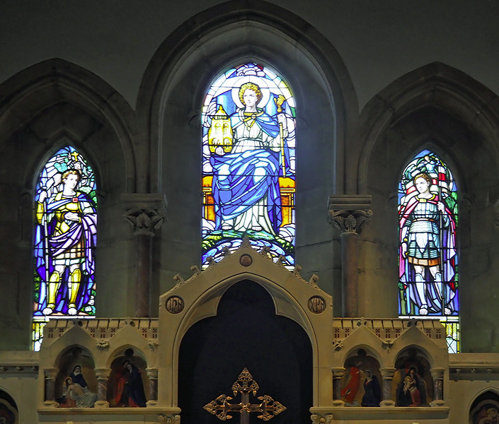
Lynmouth and Lynton are on the north coast and just over an hours drive from Bideford along some marrow and winding roads. We were dropped off in Lymouth and had 2.5 hours to explore on a very cold and dull morning. After visiting Lynmouth Church I walked past the harbour to the cliff Railway up to Lynton. I visited the church and explored the town with its steep and narrow streets.

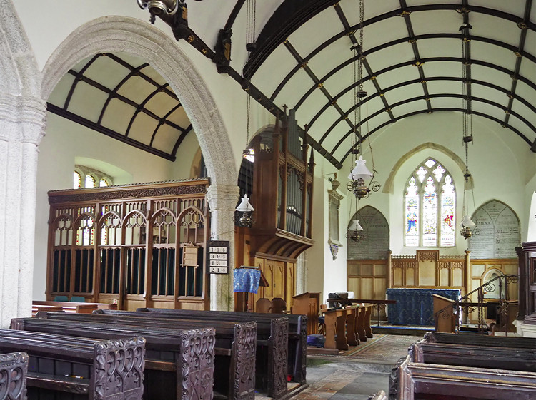
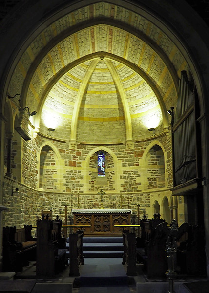
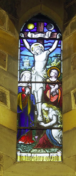
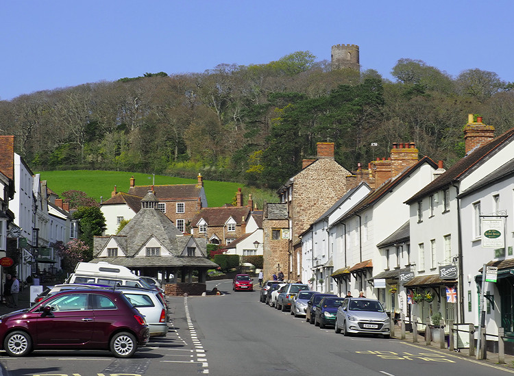
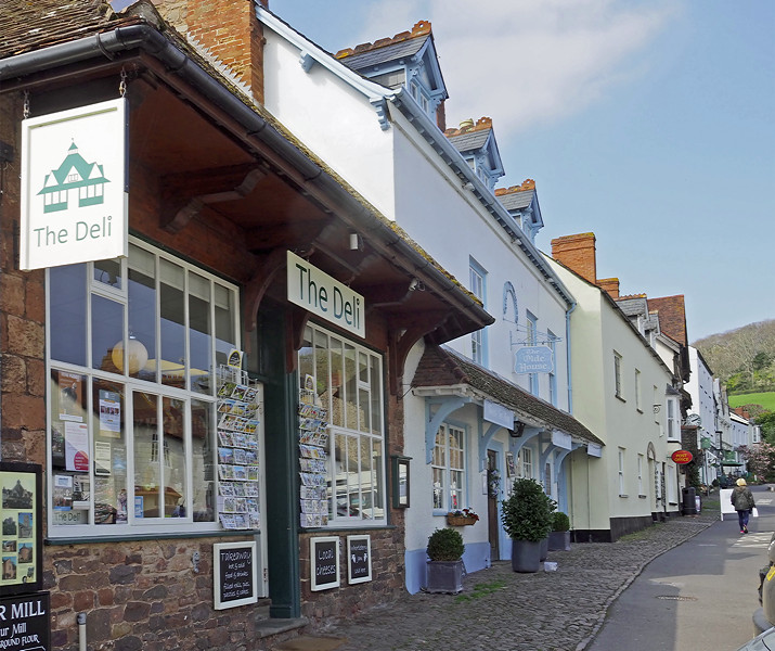
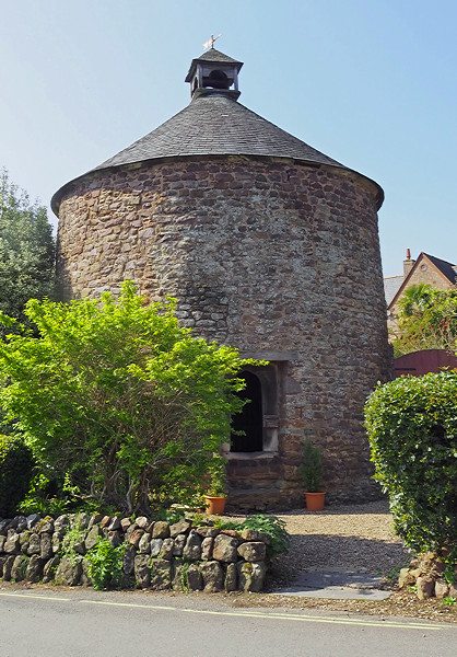
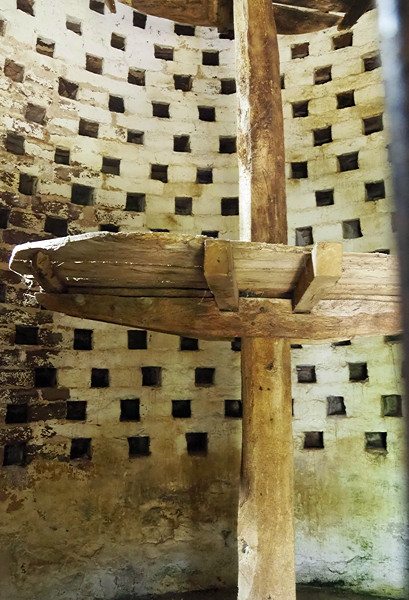
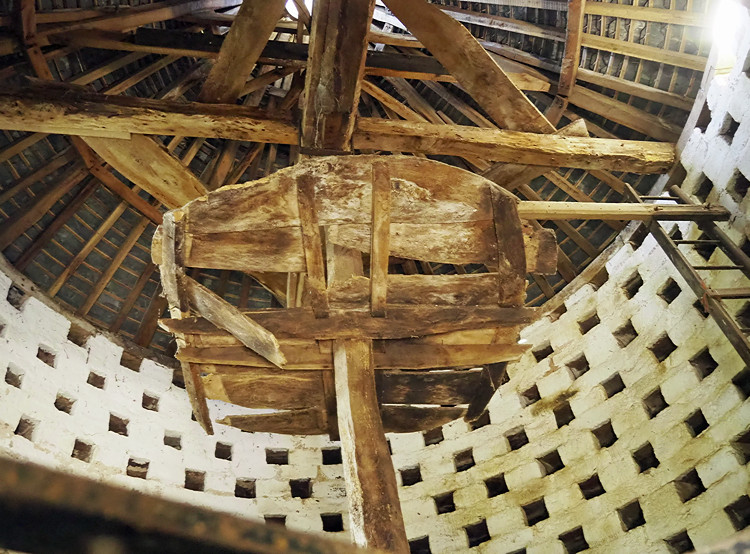
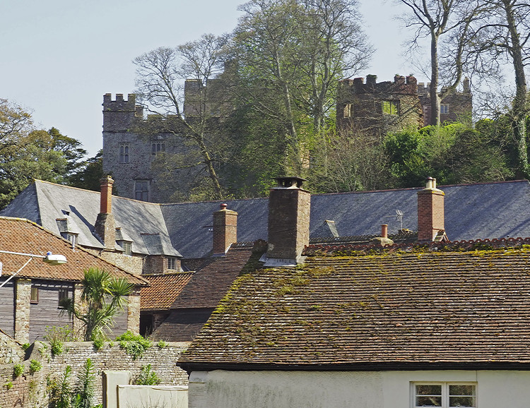
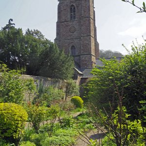
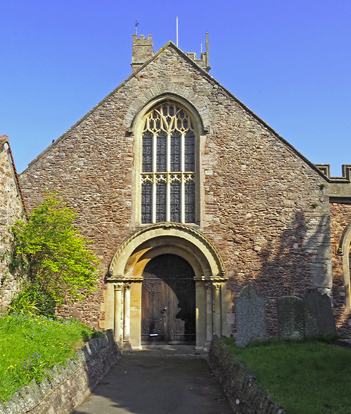
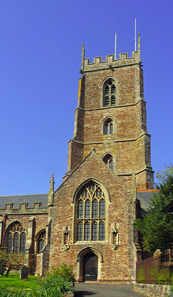
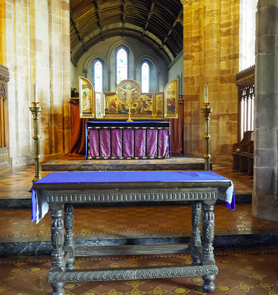
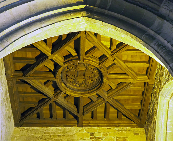
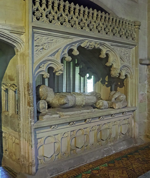
After Lynton we continued into Somerset, over Porlock Hill with its 1 in 4 gradient and the steepest A road in Britain to Dunster. By now the sun had come out and it turned into a beautiful afternoon. Dunster is a delightful village with castle, dove cot, tithe barn and yarn market. The church was originally a priory with the monks and parish sharing (and arguing over) the same building. It was agrees the monks should use the chancel with the parish using the rest of the church including the transepts and side aisles. It is one of the few examples of a monastic choir. We had 90 minutes here which I felt wasn’t long enough and didn’t give time to visit the castle. It was a long drive back to Bideford and I did wonder whether the day justified the four hours we spent travelling in the coach.

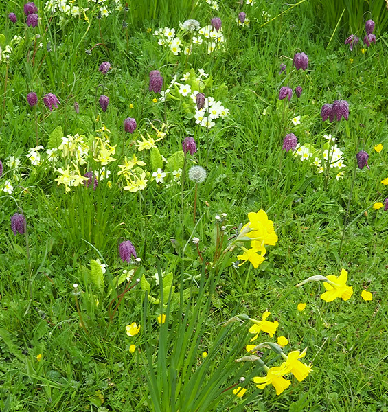
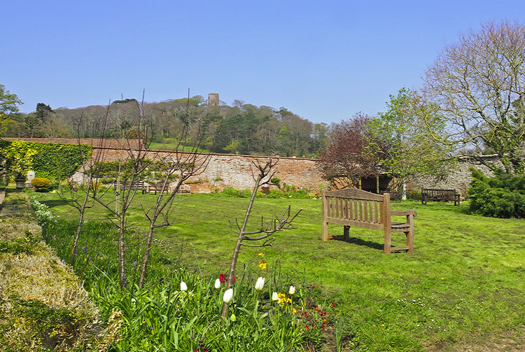
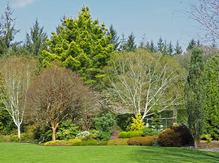
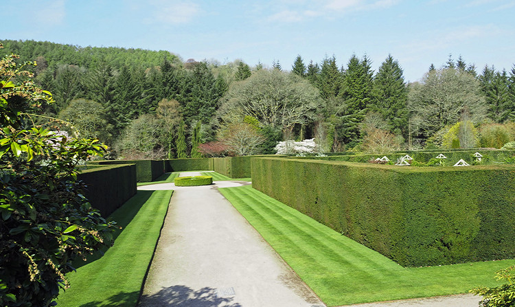
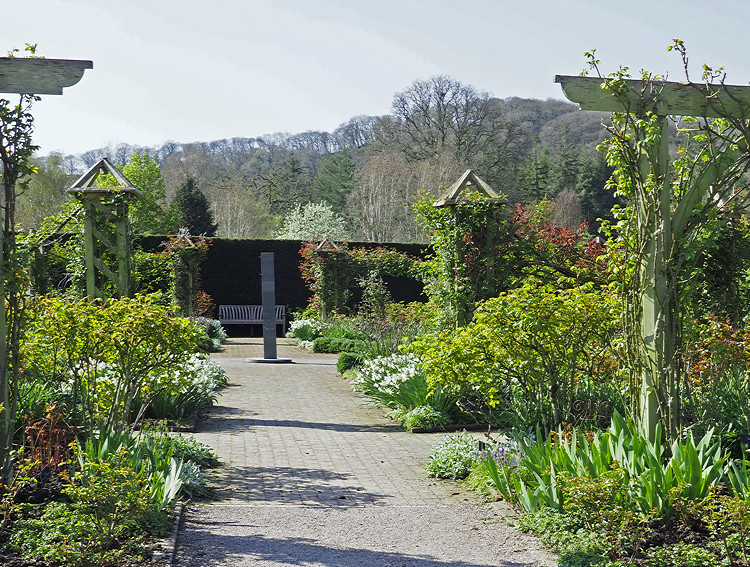
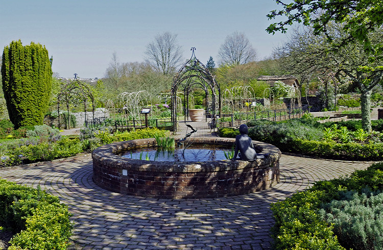
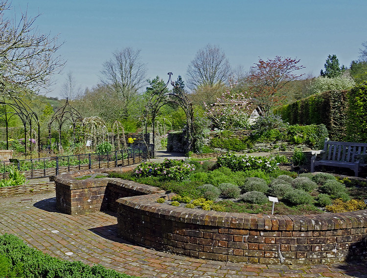
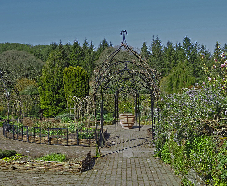
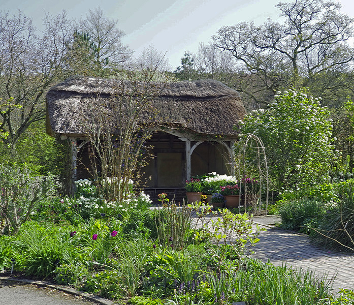
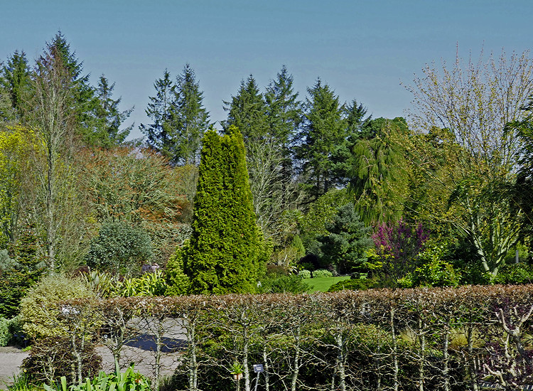
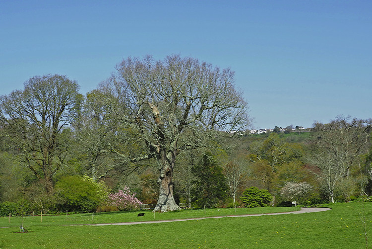
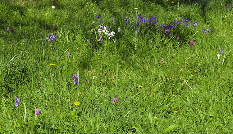
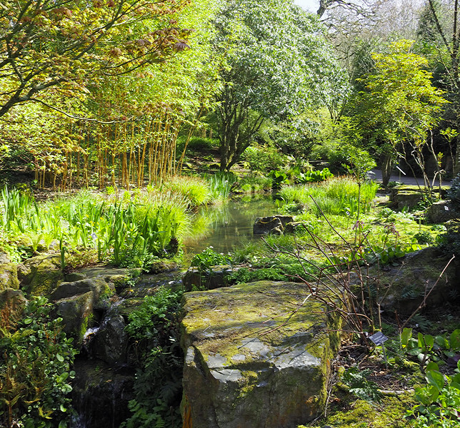
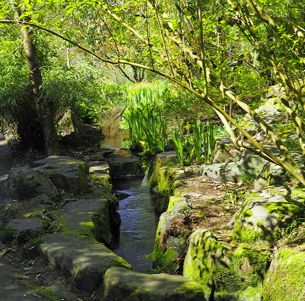
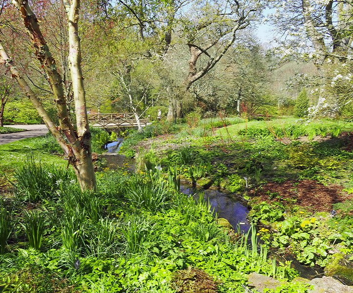
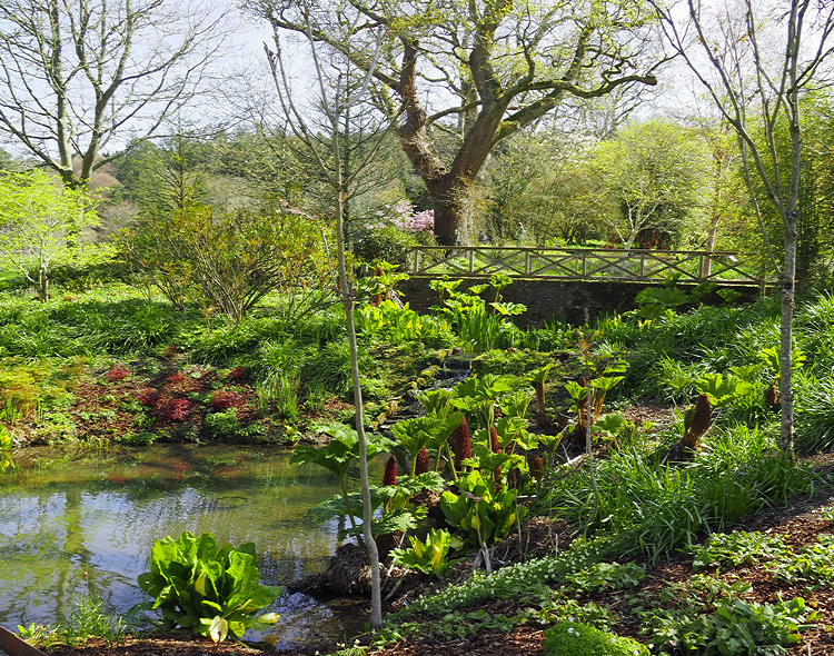
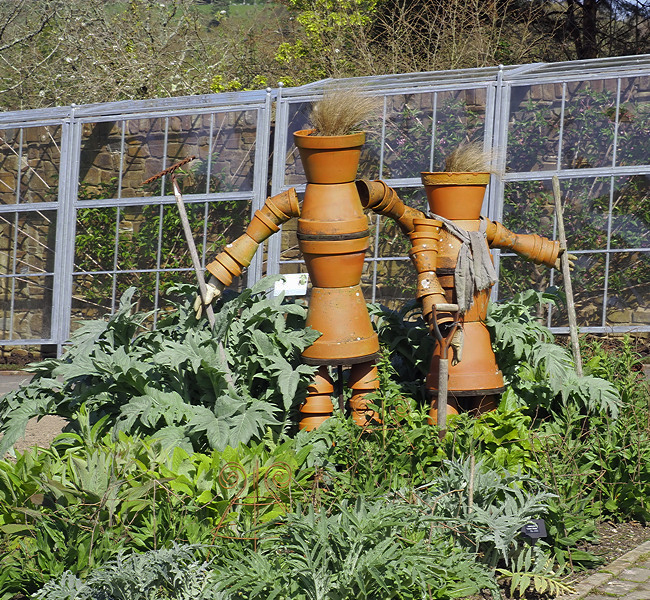
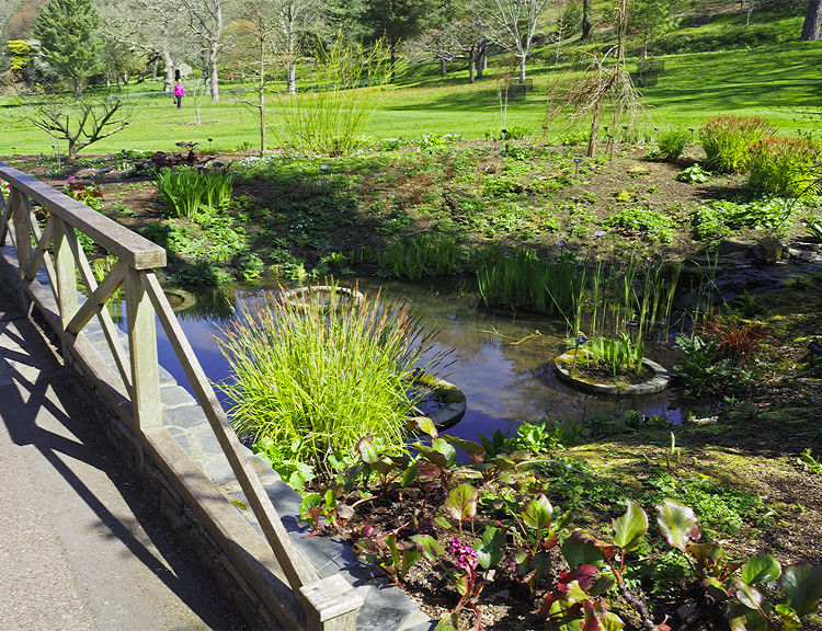
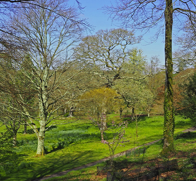
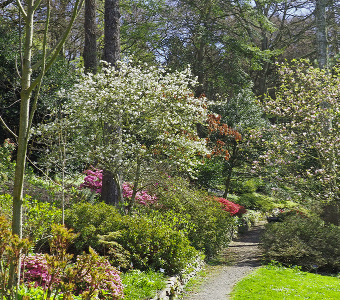
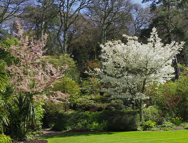
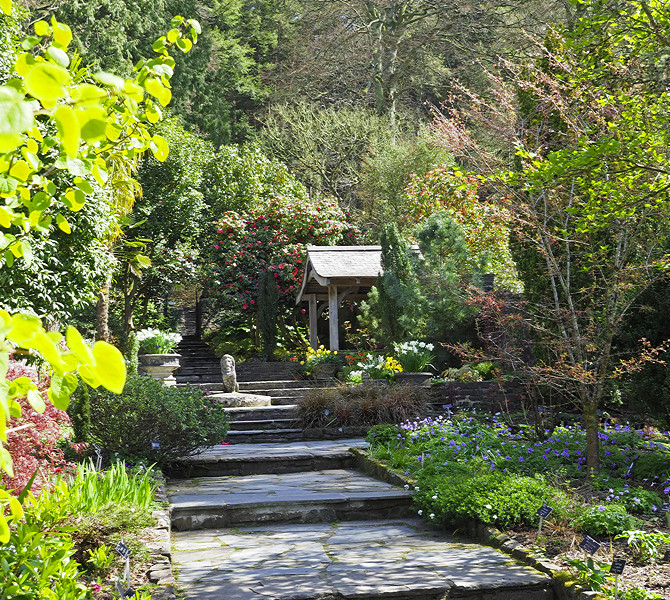
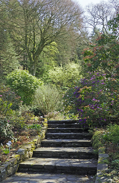
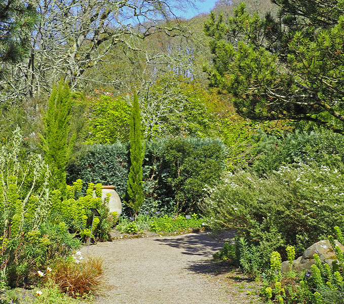
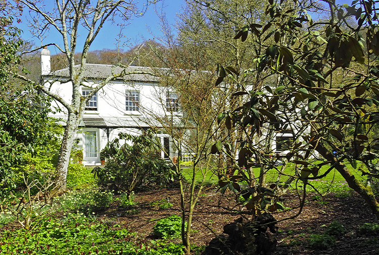
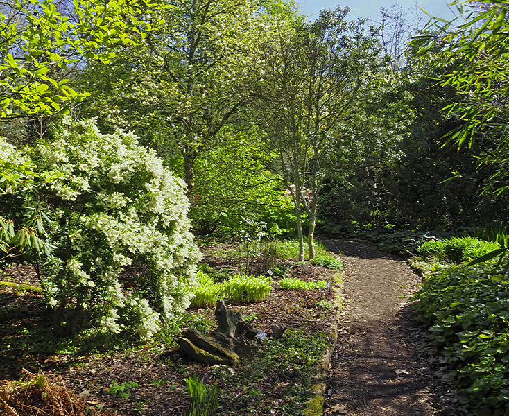
The final day was spent at the RHS gardens at Rosemoor a few miles south of Bideford near Great Torrington. These are wonderful gardens and in mid April there was plenty of colour with blossom and spring bulbs. We had 4.5 hours here which gave ample time to enjoy the gardens. Fortunately it was a warm and sunny day. It wouldn’t have been much fun if it had rained as three was little shelter.

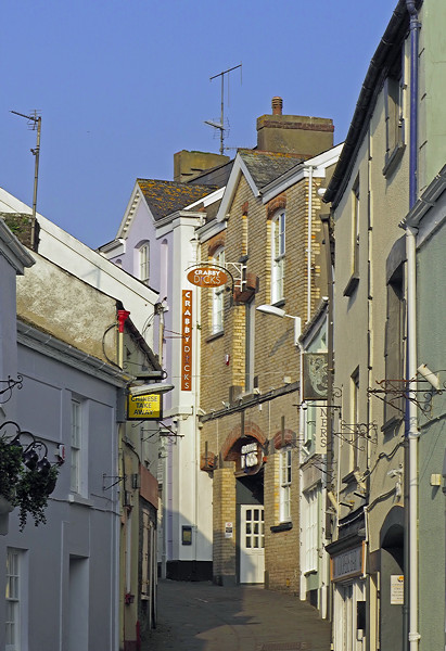
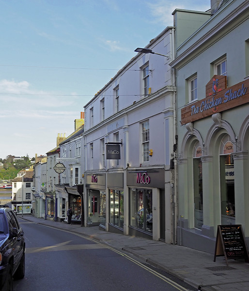
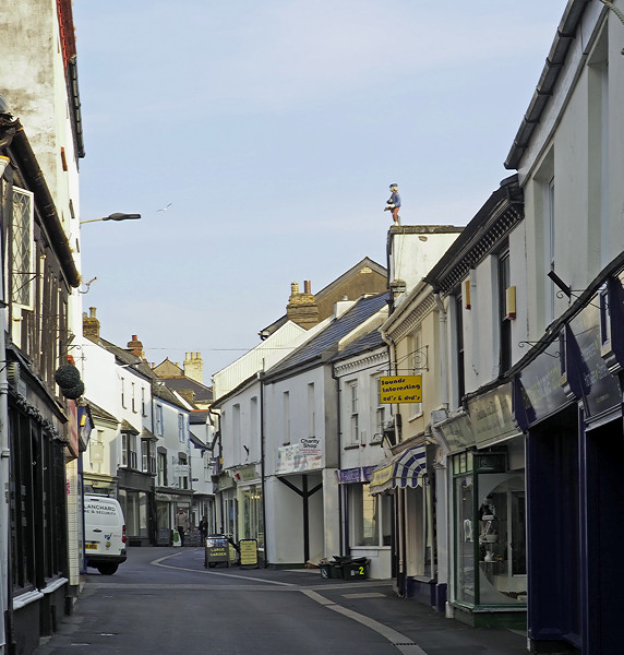
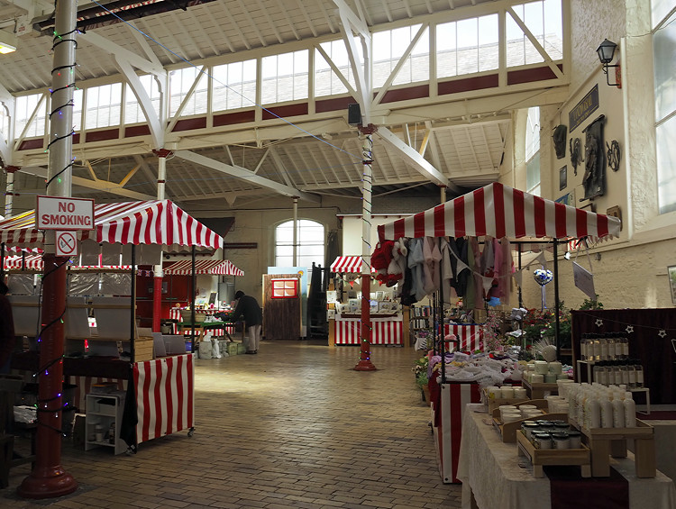
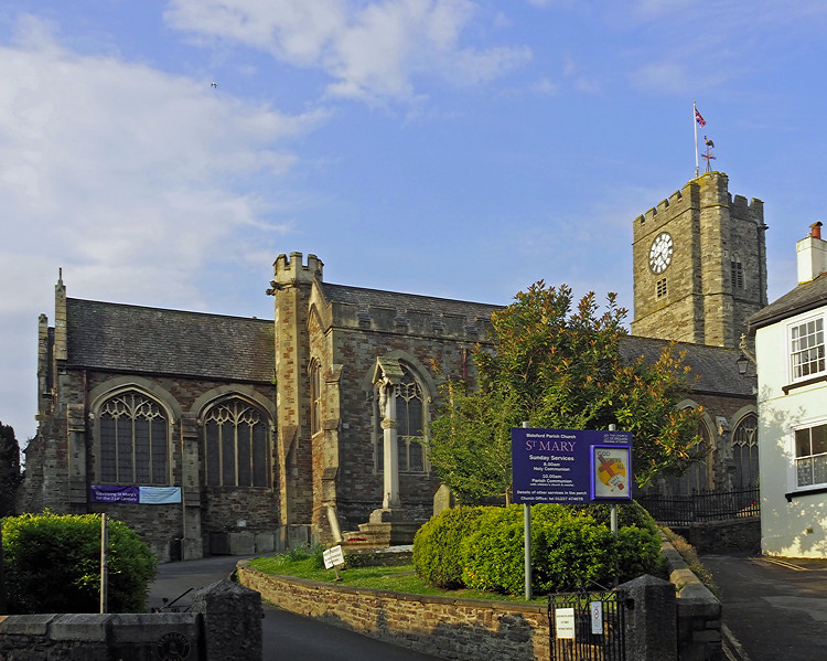
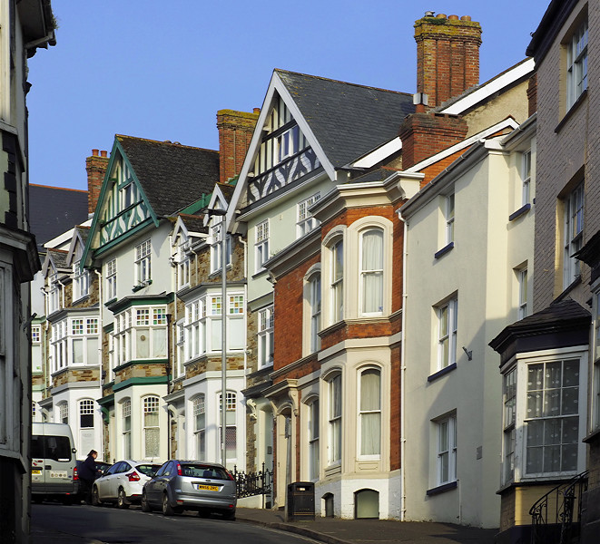
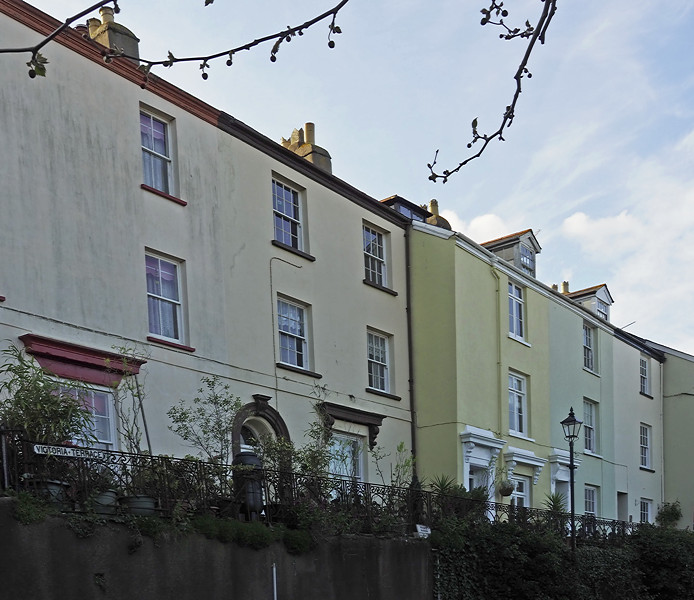
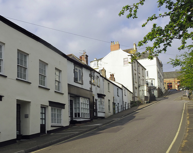
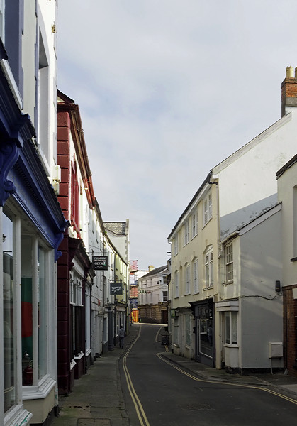
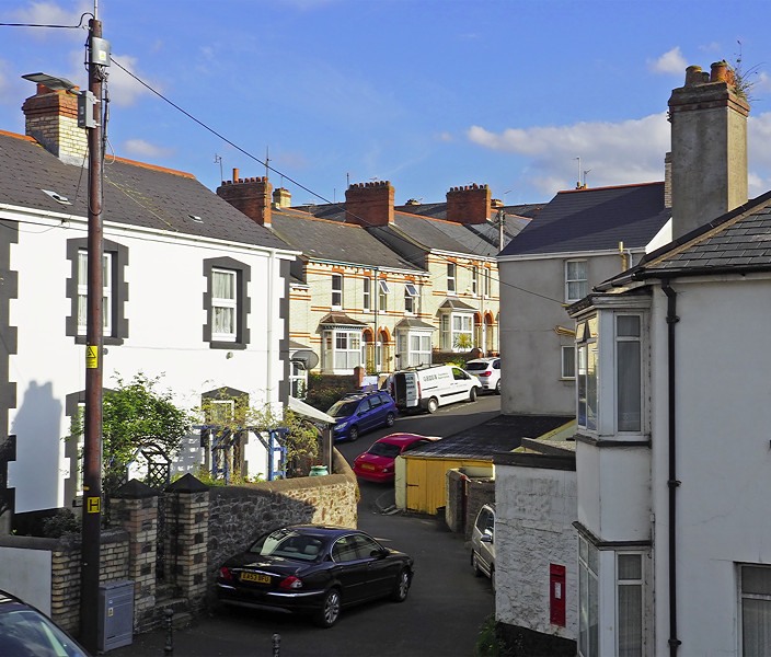
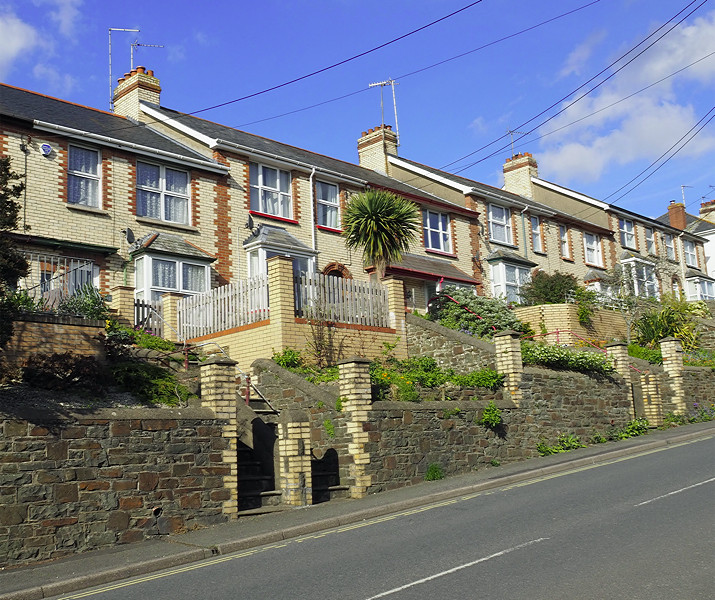
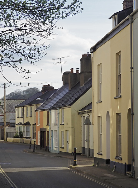
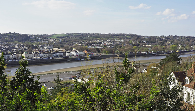
I had time to explore Bideford and East the water the afternoon we arrived and also before the excursions.

It took us all the final day to travel back to Lincolnshire. We stopped at a ‘garden centre and country park’ on teh way back for lunch. This was on the edge of Evesham and a three hour journey. Actually the description was inaccurate as it was a garden centre in a retail shopping park. This was a shopping experience. When we arrived there was plenty of information about the shops but not the country park. I asked the driver who gave a rather vague answer that the park was all round the shops. Fortunately the staff in one of the outdoor shops could enlighten me. Rather than shopping I spent the time wandering around a fishing lake and down to the river. From the non committal replies when the driver asked us if we’d enjoyed the break I suspect others hadn’t been over keen either. I suspect their may have been a back hander in bringing us there.

We then had another stop at Grantham Services before Lincoln where I was brought back to Scunthorpe by taxi and the driver kindly dropped me off at home rather than the bus station.

I enjoyed north Devon, although I had forgotten how hilly it was.

My only criticism of the holiday was the driver and the radio which was on permanently when we were travelling in the coach. PC coaches is the only coach company I’ve used who ‘inflict’ the radio on its passengers. At no time were we asked if we wanted the radio on. Sound quality was poor and worse when at speed when it became almost unlistenable. The driver also talked too much and it was a bit like listening to a (not very good) stand up comic at a working men’s club. I didn’t warm to hi and have feeling that may have been mutual. There was no information about the area and I suspect the driver didn’t know anything about it.

The holiday cost £415 with £40 single supplement. I did feel it was expensive for what was provided.

The following pages give lots more detail about what I did...
 
Last edited by a moderator:
Bideford - An attractive town on the banks of the River Torridge

At a ford on the River Torridge, the area has been settled for over 2000 years. The estuary is tidal was an important route for early traders from the Mediterranean in search of tin, copper and lead. The Vikings used it to attack coastal settlements in the C9th. Domesday Book records fisheries and salt pans here. The estuary was also used by ships to shelter from or repair damage from Atlantic storms.

The first bridge was built across the estuary in 1290. This prevented sea going ships from travelling further upstream and Bideford became established as a major port below the bridge with river barges reaching settlements further up the river.

The port grew rapidly in the middle ages and, for a time, was the third largest port in Britain until being overtaken in importance by Bristol. From the C15th it was one of the main ports for departure to the fishing grounds off Newfoundland. In the C16th and C17th it was one of the main ports for the colonisation of the Americas and also import of tobacco.

Originally, early vessels would have grounded on the sloping bed of the river and unloaded their cargoes onto the river bank. Narrow streets and alleys referred to as ‘drangs’ carried goods to and from the water front. The market place was at the bottom of High Street.
full


full


The quay was first developed in 1663 for the rapidly increasing trade with the American colonies. The ships carried locally made pottery and woollen goods to the colonies and returned ladened with tobacco. Trading links were also developed with Northern Europe and Ireland where good quality Maryland tobacco was traded for other goods.

By the C18th, the port began to decline in importance. It is still a working port with exports of ‘ball clay’ along with timber and aggregates being shipped out. The Lundy Ferry also sails from here and takes day trippers from April to October.
full


Bideford is still a thriving market town serving the local area. The main shopping area is along High Street. Narrow, pedestrianised Mill Street retains many small family owned shops.
full


full


Some even retain their original frontages with curved glass.
full


The town centre has survived the arrival of the large supermarkets and also a large out of town retail outlet offering reductions on well known brands.

Bideford was granted a Market Charter by Henry III in 1271. Originally on the riverside at the bottom of High Street, the market moved to its present position on Granville Street in the C16th, when the quay got too busy. This was an open market for both goods and animals. By the C19th traders were demanding better conditions and the present Pannier Market was built in the late C18th to house a fish market, butchery stalls and corn exchange. Traders were still transporting their goods by packhorse in large pannier baskets, hence the name. Farmer’s wives came to sell butter, cream and eggs and there were separate areas for the meat and fish stalls. A separate livestock market was built.
full


Butcher’s Row on the ground floor retains its traditional Victorian appearance and houses craft workshops including stained glass, wood carving and pottery. Some shops still retain the old meat hooks hanging from the ceiling.
full


Upstairs is the market hall with cafe, and varied stalls selling everything from crafts, plants, home made produce to second hand books.
full


The Market is open Tuesdays to Fridays from 10-4. A free shuttle bus runs a 20 minute service between the Pannier Market and Victoria Park.

Long Bridge was first built in 1280 from wood and is still the longest arched bridge in Devon, joining Bideford with East the Water. It had 24 arches of differing widths, probably indicating where the original builders could secure pillars. A chapel was originally built at each end of the bridge. The wood bridge was encased in stone in the early C16th. This was the lowest bridging point of the river and carried all the traffic on the busy A39. It was renovated and widened in 1925, retaining its character.
full


In 1968, heavy traffic caused the collapse of two of the arches, bringing chaos to the area as all traffic had to be diverted with local traffic carried by ferry across the river. A new bridge was built further downstream and opened in 1987.
full


Victoria Park at the northern end of the town was opened in the early C20th to celebrate the reign of Queen Victoria. It is an attractive park with trees and flower beds as well a bandstand, open air paddling pool, skateboard park and children’s play area. The C16th ‘Armada’ guns were discovered in the late C19th during work to widen the quay. They may have come from a Spanish ship captured by Sir Richard Grenville on his return from Americas in late C16th.

Burton Art Gallery in Victoria Park includes the Tourist Information Centre. The building dates from the mid C20th and was built to commemorate the death of Mary Barton, a talented local artist. it still displays work of local artists and has permanent and touring exhibitions of art as well as displays of ceramics and pottery. The museum has a section on history section. There is a gift shop and cafe.

At the end of the Long Bridge is the Town Hall, an ornate red brick building dating from the mid C19th, with the mayor’s parlour, court room and council chambers. Next to it is the library which was added in 1905 when the town received a grant from the millionaire library benefactor, Andrew Carnegie, to fund a library.
full


Near the Town Hall is St Mary’s Parish Church.
full


This is the third church to be built on this site. Nothing is left of the original cob and wattle Saxon Church which was replaced by a stone church in the C13th. By the C19th this was in a very poor state of repair and was demolished apart from the tower and a new nave and chancel were built. It is a very large church, reflecting the wealth and importance of Bideford at the time. The church is kept locked and only open for services or if there is a prayer meeting.

Bideford is an attractive town to walk round with streets of large well maintained houses.
full


full


full


Allhalland Street runs behind the quay, linking Long Bridge with High Street before the quay was built.
full


Booklets of a Heritage Trail around Bideford are available from Tourist Information. Alternatively, details of town trail can be found here. There is also a very good free Town Guide with lots of information about the town and surrounding area.

Bideford is proud of its heritage and holds an annual Manor Court when members of the public can bring local issues to be considered by the town council and also ideas or projects to make Bideford a better place.

There is the Mayor’s Parade in early June after a new mayor has been appointed.

In December there is Signing the Lease marking the Town Council taking over the lease of the Pannier Market, when the Mayor and Councillors dispense mead and mince pies

The town is popular with tourists, either day trippers or those staying longer. It is a vibrant place buzzing with activity throughout the year. There is a regatta, water festival, carnival and Bideford Fair. Turning on the Christmas Lights is marked by Rudolf and his reindeers along with a street market and fair. New Year’s Eve celebrations include a fancy dress party on the quay followed by a firework display. You don’t need to wait until then as the quay is lit up by lights all year after dark.
full
 
Last edited:
St Mary’s Parish Church, Bideford

This is a large and splendid church, reflecting the wealth and importance of Bideford. Its tower dominates the view of Bideford seen across the river.
full


Unfortunately it is kept locked, although it may be possible to gain entry on a Monday morning when the 'Holy Duster' brigade clean the church or else on a Friday when it is open to prepare food for the midday Friday Diner.

This is the third church to be built on this site. Nothing is left of the original cob and wattle Saxon Church which was replaced by a stone church in the C13th. By the C19th this was in a very poor state of repair and was demolished apart from the tower and a new nave and chancel were built.
full


full


The inside is impressive with arcades of pillars with pointed arches separating the nave and side aisles and hung with brightly coloured banners. Embroidered kneelers are propped up on the pew benches adding more colour.
full


The oak screen at the base of the tower was made from old pew ends.
full


The chancel has a simple altar with embroidered front piece and simple wooden reredos.
full


The brightly coloured C19th east window depicts the Crucifixion.
full


Between the chancel and the south aisle is the tomb chest of Sir Thomas Grenville who died in 1513 and, along with the tower, is one of the few parts of the earlier church to survive.
full


The south aisle has a small altar at the east end.
full


The back of the south wall is covered with memorial slabs.
full


All Saints’ Chapel in the north aisle was the area reserved for the mayor and corporation, but has now been turned into a small modern chapel for private prayer. It is separated from the nave by a glass screen with engravings including the baptism of Jesus, St Anne, and a local fisherman. Now reached from the north porch, it has a simple stone altar and the Memorial Book.
full


In front of the glass screen is the Norman font, dating from 1080.
full


Near it is the pulpit carved from Devon marble in 1894.
full
 
Last edited:
East the Water - across the river from Bideford

Connected to Bideford by the Long Bridge, this is now mainly a residential suburb.
full


full


The wharves along the river have gone and St Peter’s Church is no longer used.

Station Hill is lined with splendid brick built villas.
full


Houses along Torrington Street near the river are smaller.
full


During the Civil War, Bideford was strongly Parliamentarian and Major General Chudleigh, who was in charge of the Parliamentary Force, built a defensive eight gun earthwork artillery fortress on a hill overlooking the River Torridge in 1642. Chudleigh Fort fell to the Royalists and was abandoned. In the C19th it was rebuilt as a stone folly with battlements and gun emplacements.
full


full


The site was bought by public subscription in 1921 and is now a public park in memory of those who fell in the First World War. A war memorial was built.
full


The park was landscaped and paths added. This is now an attractive place to sit and has very good views across the river to Bideford.
full


The North Devon Railway Company arrived in East the Water in 1855 from Barnstaple, carrying both freight and passengers. The line was extended south to Great Torrington a few years later. The building of Landcross Bridge to the south shifted the river’s deep-water channel from the eastern side of the river to its western side. This led to a decline in the quays at East the Water.

Passenger services finished in 1965 as part of the Beeching cuts, although freight traffic continued until 1982. The track was lifted and the trackbed bought by Devon County Council as part of the Tarka Trail. The Bideford Heritage Railway Society were formed with plans to reopen the station and part of the line. They collected some rolling stock and a small diesel locomotive and operated a service over a short distance of track until the loco was vandalised and services stopped.
full


A replica signal box, painted in Southern Railway colours of green and cream, has been built which is open to the public with signal levers and a token machine.
full


full


A Mark 1 carriage is now a small tea room. Next to it is a parcels and miscellaneous van which has a small exhibition about the railway with a replica of a Southern Railway booking office, complete with a rack of tickets and date stamping machine.
full


full


A small guards van and diesel loco are awaiting restoration.
full


The station buildings are owned by the Royal Hotel and not open.
full


Bideford Station is also a good starting point for walking along the Tarka Trail. This is a well made path for both cycles and walkers, along the side of the Torridge estuary.
full


There are good views across the salt marsh and mud flats to Bideford.
full
 
Instow - Down the river from East the Water

Instow is a long linear settlement on the shore of the Torridge estuary, opposite Appledore. A tidal ferry connects the two.
full


It is renowned for its long expanse of sheltered sandy beach which popular with dog walkers. At the far end are sand dunes. Marine Parade runs along the front with a few hotels, post office and Johns of Instow, a cafe and deli. Anstay Way is the main road though the settlement. The grass verges have been planted with a wild flower mix, which was at its best in late April.
full


The railway arrived in Instow in 1855. The signal box at the south end of the village was built by the London and South Western Railway in 1873, replacing a crossing keepers cottage. It controlled the level crossing at Marine Parade. At its height, there were up to 14 trains a day including both passenger and freight (ball clay and milk).
full


The box was closed in 1979 and has been beautifully restored by members of the Bideford Railway Heritage Centre and is painted in Southern Railway colours of green and cream. It is open on occasional Sundays and Bank Holiday afternoons. It still has its sixteen lever frame which operated the signals and points. There was a large wheel to open and close the level crossing gates. Two semaphore signals have been replaced as well as a short section of track and the level crossing gates.

The station is still there but the station building is now used by the Royal North Devon Yacht Club
full


The Tarka Trail runs from Instow Station along the shore of the River Torridge to Bideford.
full


The Church of St John the Baptist is on top of a hill at the northern end of the village, surrounded by large graveyard. It is open daily from 10-5 but be patient if the key holder is a bit late!

The church is one of several pre-Norman churches founded in the area by Celtic missionaries in the C6th. Domesday Book records a priest here, although there is no trace left of this church, apart from the font. The chancel is C13th but the rest of the church is later, with the north aisle being added in the C16th. The very tall tower was probably a landmark for seafarers. The church was sensitively restored in the late C19th, when the pews were replaced, an organ and heating installed and a vestry added.
full


It is a big church with an arcade separating the nave from the massive north aisle. The south transept is small. The nave has a wood beam roof. The north aisle being later has a plaster roof with wooden ribs with carved bosses. Gas lights hang from the ceiling, although they have been adapted to take electric light bulbs. Stained glass is C19th. A wooden screen separates the nave from the chancel. The organ is at the end of the north aisle.
full


There is a wood screen across the base of the tower which has a small gallery above. There is a list of rectors by the door dating from 1260. The Simple Norman font is just inside the door.
full


full


There are old grave slabs in the nave floor.
full


The chancel contains C17th Barnstaple tiles.
full


A candelabra hangs from the chancel roof. The table altar has a simple wood cross. On either side are the Ten Commandments.
full


full


The south transept has a splendid monument to John Downe, son of the Rector who died during his second year at Oxford University.
full


As the church is quite a walk from the village, Napier Orphoot, a Scottish Architect, gifted a Chapel of Ease to the village in 1936, in memory of his wife who had died in childbirth. The land on Anstay Road was donated by her sister, as they both had close connections to the area as their father had been Vicar of Westleigh Church a couple of miles away.

The Chapel of Ease was much more accessible for early morning or evening services, although it was not used for weddings, baptisms or funerals.

Now called All Saints’ Chapel, this still has a weekly service from November to Easter but monthly during the rest of the year, It is also increasingly used as a community centre by the village. It is open Tuesday and Thursday mornings for coffee and homemade cakes.
full


It is an attractive small white building with a chancel apse and small bell cot, set below the main road through the village. The inside is simple with white washed walls and a small altar in the chancel apse.
full


Being a sucker for home made cakes, to join the several ladies enjoying a chat over their coffee and cakes. They were intrigued by a visitor and I was made very welcome. The fruit cake was excellent and I was charged the princely sum of £1 for my cake and drink.
full
 
Last edited:
Westleigh - a small hilltop village above the River Torridge

Westleigh is a very attractive small village set on a ridge above the River Torridge, and a short drive from the A3233 Barnstaple Street. Narrow lanes with well tended houses cluster round the church.
full


Much of village (houses recognisable by their green painted doors) was originally owned by the Tapeley Estate just to the north of the village and many estate workers lived here.
full


The C15th Westleigh Inn is in the centre of the village.
full


St Peter’s Church is at the top of the village and surrounded by a large graveyard. The church dates from the early C14th and the tower is C15th. Along with Instow church, it is one of the oldest in the area and is open daily.
full


Entry is through the south porch with its carved bosses. There is a massive wood door leading into the church. The latch is unusual as you have to turn it to open.
full


The church was originally cruciform with south and north transept but the north transept was extended at the start of the C15th, forming the north aisle.

Inside it is a large church with a barrel plaster ceiling with wood ribs with carved gilded bosses. At the base of the ribs are carved angels holding shields. The windows contain C19th stained glass. Oil lamps hang from the ceiling although these have been adapted to take electric light bulbs. There is a wood screen across the end of the north aisle, which encloses a vestry. The organ is between the chancel and the vestry.
full


full


There is another wood screen across the base of the tower with bell ropes hanging down.
full


The chancel has a simple table altar with a wooden reredos. On either side are boards with the Creed, Ten Commandments and the Lord’s Prayer. The C19th east window depicts the Crucifixion.
full


The old wooden pews in the nave have wonderful carved end, each one different.
full


full


There are C15th floor tiles, which were probably made by the Barnstaple Pottery.
full


full


The font at the back of the nave is early English and has a splendid wood cover.
full


The old parish chest is in the south transept.
full


On the wall is a splendid monument to Thomas Challacombe who died in 1681.
full


Also on hanging on the wall is a hatchment.
full


Monuments in the north aisle commemorate members of the Clevland family of Tapeley Park.
full


full
 
Last edited:
Appledore - an attractive small village on the Torridge Estuary - and don't forget the ice cream....

Appledore is an attractive village of narrow streets and brightly coloured house running down to quayside. A tidal ferry runs between Appledore and Instow, across the estuary.
full


It was originally an important fishing port and ship building centre. Local fishermen still sell catch from their boats and. until recently, it still had a small privately owned indoor shipyard. The North Devon Maritime Museum in a Georgian building that would have been the home of one of the ship owners, tells the story of Appledore’s maritime heritage.

The Lifeboat Station on Irsha Street to the north of the village has been here since 1825. Their shop is close by.

The Quay was constructed in 1845. Before that the houses on Market Street would have had jetties and wharves at the ends of their gardens. Market Street is the main shopping street and the shops retain their old fashioned bow front windows.
full


The village still has a maze of narrow lanes, some too narrow for cars. This is a place to be explored on foot.

Some alleyways still retain their cobbles. Houses are plastered covered and painted in attractive pastel colours.
full


full


The tiny terraces near the quay would have been home for the fishermen who depended on salmon, cod and bass for their livelihoods, as well as cockles and mussels collected at low tide.
full


full


The larger houses would be those of the ship owners.
full


Appledore is now has thriving community of local artists and craftspeople. Appledore Crafts Company is the place to go for locally produced work.

There is a book festival as well as a carnival involving the local community.

And finally don't forget an ice cream. Hockings Ice Creams have been making ice cream for eighty years and have a van on the quayside.
full
 
Last edited:
St Mary's Church, Appledore

St Mary’s Church is at the northern end of the Quay, overlooking the Torridge estuary and is open daily. It is surrounded by a large graveyard which contains the graves of many sailors drowned when attempting to cross the sand bank which forms a barrier to the Torridge estuary at low tide.

Like Instow across the estuary, the site has been used for Christian worship since the C6th. Before St Mary’s Church was built in the C19th, there was a small chapel near here dedicated to St Anne, on a site still known locally as Chapel Field.

In 1834, the Rector wrote to the Bishop of Exeter asking permission to build a new and larger church in Appledore. Money was raised quickly and the new church was consecrated two years later. The nave was widened and a clerestory added at the end of the C19th, and these alterations can be recognised by the different stone used. As the population of Appledore continued to grow, the gallery was removed and the west end enlarged and the tower built in 1909. The clock came from the United Services College at nearby Westward Ho!
full


full


It is a surprisingly large church inside with very wide central nave with arcade octagonal pillars and pointed arches and narrow side aisles. Small plain glass clerestory windows were added when the nave was widened. Walls are whitewashed and the nave ceiling is painted blue with white ribs with carved bosses. There are small plaster cherubim heads at the base of the ribs. The side aisles have flat plaster ceilings. There is a wooden screen between the nave and chancel.
full


The chancel has a simple altar with a panelled reredos behind.
full


The brightly coloured east window has the Crucifixion in the centre. At the bottom is the Last Supper with the Nativity and Ascension on either side. At the top are the four evangelists.
full


The tiny St Anne’s Chapel at end of south aisle was dedicated in 1988. Above the altar is the Lundy Window with St Helena, the patron saint of Lundy carrying a boat and St Michael with an aeroplane. Sea birds include a puffin.
full


full


On the south wall of St Anne’s Chapel is a memorial window to the war dead of the Second World War, and especially Lord Glanely, a great benefactor of the church. It depicts Jesus stilling the storm with the patron saints of sailors (St Nicholas), soldiers (St George) and airman (St Michael) with a list of the war dead. On either side are the Colours of HMS Appledore.
full


full


Near it in the south aisle is the First World War window, which was given by Lord Glanely, listing the names of the dead along with two angels. One holds the chalice and the other a Martyr’s crown. Before them are figures representing those who lost their lives including a soldier, sailor, nurse and priest.
full


full


The Roll of Honour by the north door also commemorates the dead from the First World War. The names are on either side of a picture of the Crucified Christ looking down on a fallen soldier.
full


There is a small Royal Coat of Arms above the north door. At the back of the church and somewhat hidden behind table and chairs is a modern mural entitled ‘The Industrial Christ’ depicting the dependence of Appledore on the sea. In the centre is Christ. On his left are three coastal craft with a selection of traditional ship building tools. On the right is an Appledore shipyard with a selection of modern welding and cutting equipment.

The carved stone pulpit continues the nautical theme with the stand representing a rope coil. The shields have the initials of the donor and family members.
full


At the back of the nave is the carved stone font.
full


full


In the north aisle is the lovely Garden of Gethsemane window with Christ and and angel in the foreground. In the background is Jerusalem with the figures of Judas and the High Priests coming to arrest Christ.
full
 
Last edited:
Lynmouth - the flood village

Lynmouth was originally a fishing village until the herring disappeared in the late C18th, It was ‘discovered’ by the Romantic poets in the beginning of the C18th, and given the name ‘Little Switzerland’. Paddle steamers from Bristol, Swansea and other Bristol Channel ports brought increasing numbers of holiday makers. Its popularity increased rapidly after RD Blackmore’s ‘Lorna Doone ‘ was published in 1869.
full


Lynmouth is set in the very steep gorge of the River East Lyn entered the history books after the devastating flood in 1952 which is still one of the worst natural disasters in British history.
After days of torrential rainfall over Exmoor, fifteen inches of rain fell on 15th August. The saturated soils could hold no more water and flood water surged down the narrow valleys of the West and East Lyn rivers, sweeping boulders, trees and debris with them. Bridges collapsed and the flood water swept through Lynmouth demolishing nearly hundred buildings, 28 bridges and 132 vehicles. Over 114,000 tons of debris were deposited and 34 people lost their lives.

The beach is still a mass of boulders.
full


The wall of the tidal harbour was rebuilt to direct the flow of the river into the sea. The Rhenish Rhenish Tower at the end of the breakwater is is a reconstruction of the 1850 tower which was destroyed in the flood. Named after its resemblance to the look out towers on the River Rhine, this was built in the late 1850s to store salt water for indoor baths.
full


full


Before the flood, the only road in Lynmouth was the now pedestrianised Lynmouth Street, with its shops.
full


Riverside Road was built after the flood on what was the river bed.
full


The River West Lyn flows down a steep gorge into the East Lyn in the village. The Glen Lyn Gorge walk is a series of footpaths leading to waterfalls and viewing areas with information about renewable energy.
full


The Church of St John the Baptist is a small stone building in the centre of the village next to the River East Lyn. It is open daily and surrounded by an attractive memorial garden. Although t was flooded in the 1952 floods, it was one of the few buildings to escape with little structural damage. The now unused south aisle has an exhibition with display panels about the village and the flood.

The church was built in 1870 and the south aisle was added later. The small belfry was added in 1921 as a memorial to the dead of the Great War.
full


It is a simple building with nave and apse chancel and an arcade of round pillars and pointed arches leading into the large south aisle. The style with its lancet windows is very much Early English rather than Victorian Gothic.
full


The nave has a wood beamed roof. The apse has a vaulted stone roof. The wood altar has a carved front. The east window depicts the crucifixion.
full


full


The elaborately carved stone font is at the back of the church.
full
 
Last edited:
Lynton - the cliff top settlement

Lynton is on top of the cliffs above Lynmouth and has good views across Lynmouth Bay to Countisbury Cliffs.
full


It is connected to Lynmouth by a Cliff Railway. Because of the remoteness of the area, and rugged geography, roads were poor, Villagers had to rely on the sea for deliveries of coal, lime, foodstuffs and other essentials, which had then to be carried by packhorses or horse drawn carts up the steep hill from Lynmouth to Lynton.

When visitors started to arrive in Lynmouth in the early C19th, ponies, donkeys and carriages were available for hire, but the steep gradients led to the animals having only short working lives.

In the late C19th there was a major proposal to extend the pier to increase excursion traffic, extend the esplanade and build a cliff railway, operated by water, to take visitors and goods up to Lynton.

An Act of Parliament was passed for the railway and another giving it perpetual rights to water from the Lyn Valley. Construction began in 1887 and took three years to build. The Lynmouth and Lynton Cliff Railway is 862’ long and the top station is 500’ above the quay. The incline is 1:1.75 or 58%
full


full


It is the only cliff railway still powered entirely by water. Others have been electrified or use a closed water system which recycles water between the top and bottom cars.

Water is brought from the West Lyn River by gravity and is store in a reservoir. Each car has a 700 gallon tank mounted between the wheel below the car, with a reserve 10 gallon tank for the braking system. The cab can be removed to provide a flat bed to carry large items of freight and was even used to carry cars.
full


full


The cars are connected by a continuous cable which goes round a large pulley at both ends. A second cable are tail balance cables that counteract the weight of the hauling cables.

The railway is operated by gravity. When both tanks are full, the cars are in balance. When loaded with passengers, the drivers use a system of bells to communicate to release the brakes, which are permanently locked on by 120lb lead weights when the cars are stationary. The driver of the lower car releases just enough water to make it lighter than the upper car.

The heavier top car now descends by gravity pulling up the lighter bottom car. If the lower driver releases too much water, the cars will accelerate too fast and governors on the wheels will slow the cars down to a pre-set speed. when the car reaches the top, its reservoir tank is topped up again.
full


The Cliff Top Cafe at the top station used to be the waiting room for passengers.
full


The town is a short walk from the Cliff Railway. Lynton grew up as a market centre based on sheep farming. It is the larger settlement with all the shops.
full


It straggles over the hillside and has many steep and narrow streets.
full


full


full


Most of the buildings date from the C19th when tourism began to take off. It has an impressive town hall which was opened in 1900 by Sir Arthur Conan Doyle and is an eclectic mix of mock Gothic, neo-Tudor and Art Nouveau architecture.
full


Lyn and Exmore Museum is in Lynton’s oldest domestic building. As well as information about the Lynmouth flood it also has agricultural and domestic artefacts from around the area. There is also a small section on Natural history as well the Lynton to Barnstaple Railway.
 
Last edited:
Church of St Mary the Virgin, Lynton

The church is at the top of the town, near the cliff railway and is open daily. There has been a church in Lynton for hundreds of years. The tower is C13th and the nave was enlarged in the C18th but most of the church was rebuilt in the C19th.
full


It is a large church with arcades of octagonal pillars and pointed arches separating the nave and side aisles. The nave has a massive wood roof. The chancel roof is made of narrow slats of wood with darker wood ribs with carved bosses.
full


full


Steps lead up to the chancel with a simple altar set below the east window, depicting the Nativity with angels and archangels. At the top is the risen Christ.
full


There is a three seater sedilia and ambry on the south wall.
full


The Lady Chapel is at the end of the north aisle and has a full size statue of the Virgin Mary. The altar front and stations of the Cross are made of beaten copper. The stone reredos has paintings showing the Annunciation, Nativity, Death and Resurrection. The centre panel originally had a carving of the Crucifixion with the Virgin Mary and Mary Magdalene. This so horrified the parishioners it had to be removed and the panel is now covered with blue velvet. On either side are the signs of the four apostles.
full


full


full


The South Aisle has organ at end and is the kid’s corner. The tower is at the back of the south aisle and has a wooden screen across the base. In front of it is the font with a Jacobean oak lid.
full


The pulpit is carved wood.
full


Most of the windows are plain glass and are described as Benedicite windows. This was an ancient text calling on all creation to sing praises to its creator. There are lead outlines of fish, birds, animals and flowers.
full


full


full
 
Last edited:
Dunster - possibly one of the best preserved Medieval villages in England

Dunster is a pretty village on the north east edge of Exmoor near the coast. The years have treated the village kindly and it is still unspoilt and possibly one of the best preserved medieval villages in England.

William the Conqueror granted the area to William de Mohun who built a motte and bailey castle here and asked monks from Bath Abbey to establish a priory. Little now is left of the priory apart from the Priory Church which is now the parish church and the monks’ lodging, now a private house attached to the church, and two of the medieval gateways into the village.
full


full


Dunster’s wealth came from wool and the production of cloth. In the C12th, Dunster was on the coast at the mouth of the River Avill and was the main trading port for Exmoor. By the C17th the harbour had silted up and the sea had receded. Today this area is low lying marsh.

Gallox packhorse bridge crossed the River Avill on the main route from the south to Dunster. It was built in the C15th for packhorses carrying fleeces from Exmoor to Dunster.

The High Street runs the length of the village and is lined with C17th buildings and is the main shopping street.
full


full


The Yarn Market on High Street, was built in 1607. Before then, wool and cloth was traded in the street and very much subjected to the English weather. It is an octagonal building built around a central wooden post. The tiled roof has wide eaves which helped keep traders and goods dry. The windows helped light the interior. A bell at the top was rung to indicate the start of trading.
P4101094.jpg


The Butter Cross was originally near the Yarn Market. Dating from the C14th or C15th, this was where farmer’s wives would sell their fresh produce, laid out on the steps of the cross. The cross was moved sometime in the early C19th to the edge of the village on Alcombe Road. All that is left is the base and part of the shaft.

The C14th Tithe Barn originally belonged to the Priory although it has been much altered since then and has recently been restored as a community hall and event venue. It is a massive stone building with a tiled roof and heavy oak doors.
full


Across the road is the Dovecote. This originally belonged to Dunster Priory and may have been built as early as the C14th. It has thick stone walls with 549 nesting holes. The pigeons were a source of meat throughout the year and particularly in winter when livestock were slaughtered for lack of feed.
full


In the C18th, the floor level and door were raised and the lower rows of holes were blocked as protection against brown rats which arrived in Britain in 1720 and had reached Somerset by 1760. A revolving ladder, known as a "potence", was installed to allow the pigeon keeper to reach the nest holes more easily. In the 19th century two feeding platforms were added to the axis of the revolving ladder.
full


full


Dunster Watermill is on the River Avill to the south of the village. A mill was recorded on this site in the Domeday Book. The present building dates from 1780 and has two overshot wheels. It has been restored by the National Trust and is used to grind wholemeal flour and oats.

Dunster Castle on a wooded site at the south end of the village. Still with its medieval gatehouse and ruined tower, this was converted into a lavish and very comfortable house in the late C19th. It was the home of the Luttrell family for over 600 years and is now in the care of the National Trust.
full


Conygar Tower stands on top of Conygar Hill to the north of the village. Built as a folly in the late C18th by Henry Luttrell it is tall enough to be seen from the Castle on the opposite hillside. It seems to have had no significant strategic or military function.

The railway arrived in Dunster in 1874 and brought tourists to the area. The station was a mile to the north of the village. The line was closed in 1971 but reopened in 1976 as the West Somerset Heritage Railway. At just over 20 miles, this is one of the longest standard gauge heritage railway in the United Kingdom, running between Minehead and Bishp’s Lydyard.

Dunster Museum and Doll Collection on the High Street, has one of the largest collections of dolls in the country, as well as local artefacts.

The walled Village Gardens off Church Street were originally the kitchen garden for the Castle. They were bought by the village in 1980 and are now a pleasant amenity area to sit and enjoy the sunshine.
full


The Priory Gardens to the north of the church on the site of the cloisters were given by the Luttrell family as a war memorial. They are reached through a gateway in the wall and laid out with flower beds.
 
Last edited:
Parish and Priory Church of St George, Dunster

Set behind the main street, this is a large church and one of the few churches that has a Monastic Choir. It is open daily.

Christianity was brought to the area in the C6th by Welsh Missionaries, who preached from wooden crosses. There is evidence of a stump of an early preaching cross in the churchyard.
A small church was built here in the C11th when William I gave the land to the de Mohun family. Only the west door and part of the north wall of this church survive. The door is still used for special occasions.
full


At the end of the C11th, William de Mohun granted land to the monks of Bath to build a daughter house here. The church was rebuilt in the C13th The majority of the present building dates from the C13th, although the top of the tower was rebuilt and heightened in the C15 and new side aisles were added. Chantry chapels were endowed by wealthy parishioners. There was a major restoration of the church in the late C19th. It is a large church and almost impossible to photograph all the outside.
full


With the growth of the wool trade and rapid population expansion, there was pressure for the townsfolk to have their own church, resulting in the Priory Church being shared by the monks and the parishioners. The Priory were responsible for maintaining the Lady Chapel and north transept. The parish were responsible for the St Lawrence Chapel and the south transept. The tower was the responsibility of the Prior with contributions from the parish. By 1357, difficulties of sharing were beginning to emerge with disputes over the time of services, payment of fees and use of the bells. The Prior drew up an agreement setting out how the church was to be used by each group.

This worked for over 100 years but in 1498 trouble blew up again between priory and parish resulting in the townsfolk imprisoning the monks in the east end of the church. After arbitration in Glastonbury, agreement was reached, largely in favour of the town. This gave the priory the choir and chancel and the parish the nave and side aisles. A carved rood screen was constructed to separated the two with the parish using the area to the west and the monks the original chancel.

The Priory was dissolved in 1539 and its buildings and land passed into the hands of the Crown. They were then leased to John Luttrell of Priory Farm. He was the uncle of John Luttrell who had recently inherited the castle. The chancel previously used by the monks became a private chapel of the Luttrell family and their family mausoleum.

By the early C19th the priory end of the church was neglected and dirty with rain coming through the roof and windows. The nave used by the village was in slightly better condition. There was also concern about unhealthy burials under the nave. There was a major restoration of the church at the end of the C19th. Carried out by GE Street, plaster was stripped from the walls, monuments moved and windows altered. The church was reroofed and ceilings removed. A new chancel was made under the tower.

The eastern part of the church is still the property of the Luttrells and is no longer used.

The cloister garden to the north of the church was given by the Luttrells as a war memorial. Reached either from the north transept or by a side road by the priory dovecote.

Entry to the church is either through the north transept from the cloister garden of through the south porch.

On entering the church, the first impression is size. The C15th rood screen cuts the church in two and, at 60’ long, is thought to be the longest in Europe. It divides the nave from the parochial choir and chancel under the tower. The enclosed monastic choir is beyond and is flanked by the Lady Chapel (now the vestry) to the north and St Lawrence Chapel (now the Luttrell Chapel) on the south.
full


full


The screen is beautifully carved and would originally have been painted and had a rood on the top.
full


The nave ceiling has a barrel roof with carved bosses.
full


Beyond the rood screen is the choir and chancel, set under the tower.
full


The massive oak beam tower roof has a trap door at the centre, used when the bells were removed and later replaced after being recast in the mid C20th.
full


The pews have carved ends; each one is different.
full


The carved stone pulpit is C19th and replaced an earlier wooden pulpit which now sits disused in the north transept.
full


full


The font at the back of the church dates from around 1530 and and is carved with the wounds of Christ and Instruments of the Passion. The tall wooden cover is C19th and is raised by weight above.
full


The Royal Coat of Arms of Charles II are on the north wall.
full


The organ is in the north transept and has been recently restored.
full


continued.......
 
Last edited:
continued....

Parish and Priory Church of St George, Dunster

The south aisle has a flat ceiling with square ribs and carved bosses.
full


An archway in the south aisle contains part of the original Rood Screen, removed in the C15th when the church was divided. There is a small shop and refreshment area here.
full


The original Norman stone font is found here.
full


St Lawrence Chapel at the end of the south aisle is the Luttrell family mausoleum. It is dominated by a huge monument erected in 1613 to Thomas Luttrell who died in 1571 and his son George. Thomas and his wife are on the left. George lies next to the kneeling figure of his wife on the right.
full


On the floor is a C15th grave slab to Dame Elizabeth Luttrell.
full


There are three old strong chests in the Luttrell chapel. One has a sloping lid and may also have been used as a writing desk.
full


full


The Luttrell Chapel leads into the now disused monastic choir, which is enclosed by wooden screens. It still has a small altar beneath the east window.
full


full


Hatchments of the Luttrell family hang on the walls.
full


By the altar is the Easter Sepulchre with the remains of an effigy of Sir Hugh Luttrell and his wife.
full


On the opposite wall is an effigy thought to be Christian de Mohun.
full


To the north of the Monastic Choir is the former Holy Trinity Chapel, and is now the de Mohun Chantry. It is the only remaining chantry chapel and is now reserved for private prayer.

The stone altar still has the five consecration crosses representing the five wounds of Christ. The cross dates from the 1200s and has a very eroded Madonna and Child carved on it. It was originally the top of the churchyard cross.
full


full


It still has the original medieval tiles on the floor.
 
Last edited:
RHS Garden Rosemoor, Torrington

Some Background


These wonderful gardens are in the steep wooded Torrington Valley. They are designed to provide colour and interest throughout the year. In Mid April, there were still spring bulbs in flower, lots of blossom, particularly cherry blossom and fritilleries naturalised in the meadowland. There is something for everyone to enjoy with woodland, meadows, ornamental gardens, a bog garden along the lake and stream and not forgetting fruit and vegetable gardens. The younger visitors are not forgotten either with play areas provided for them. As one would expect with RHS, they are carefully maintained with a heavy mulch of chipped bark keeping weeds down. Nearly all the plants are labelled and there are small information boards around the gardens.

The house and gardens around it were bought by the father of Lady Anne Berry as a fishing lodge and she inherited the estate in 1931. She notably described the gardens as ‘dull and labour intensive, typically Victorian with a great use of annuals in beds around the house.’ The stone garden was created by Lady Anne’s mother and with its steps and dwarf flowering shrubs was the first attempt to create interest.

Lady Anne was in Spain in 1959, recuperating from measles where she met Collingwood ‘Cherry’ Ingram who was a keen plant collector and gardener. He introduced her to the glories of gardens and gardening. She gradually developed the gardens around the house over the next thirty years, travelling around the world to collect plants for it. The gardens were opened to the public in 1974 and a small nursery established specialising in rare and unusual plants.

The house with 8 acres of gardens around it and another 32 acres of mainly coniferous woodland were left to the Royal Horticultural Society in 1988. Since then, the Society has more woodland on the other side of the A3124. A visitor centre has been built. Commercial conifers have been felled and replanted with deciduous or ornamental conifers. Grassland has been returned to wild flower meadow and pond dug and a stream and bog garden created. New formal gardens have been created as well as orchards and walled vegetable and fruit garden. The gardens are evolving all the time with a new cool gardens opening this year.

Bisected by the A3124, the gardens form two very distinct areas, linked by an underpass.

Leaving the Visitor Centre takes you into the newest part of the garden with a brightly coloured border filled with seasonal bedding. Below is the Formal Garden with its neatly trimmed yew hedges dividing it into different areas. To the left are the winer and model gardens. Beyond on the far slope, is woodland. To the right of the Formal Gardens is an area of wildflower meadow with the pond and stream garden. Beyond that is the orchard and walled fruit and vegetable garden.

The underpass leads to the Bicentenary Arboretum and woodland. At the far end is the house and Lady Anne’s original garden.

The gardens are open all year and visitors are given a map with a trail highlighting areas and plants of interest at the time. Make sure you choose a dry day to visit as there is no shelter in the gardens. There is a cafe and shop selling a wide range of plants by the visitor centre. The Wisteria Tea room in the house is open end of March until September and sells cakes, ice creams and drinks. Shepherd’s Rest in the stream field sells wraps, cakes and drinks.

The Formal Garden area

The Model Gardens are an area of grassland and trees to the left of the Formal Garden, featuring a terrace garden a ‘small town garden’ and an area of shade loving plants which have the RHS Award of Garden Merit. When we visited, some of the trees were decorated by knitted bands and crochet items by local craft groups.
full


The Winter Garden runs along the edge of the Formal Garden. As well as decorative conifers and winter flowering heathers, this has deciduous shrubs with brightly coloured stems or highly scented flowers.
full


full


The Formal Garden is surrounded by neatly trimmed yew hedges which divide it into different areas.
full


Running down the centre is the long border, planted with flowering perennial plants and at its best from May to October.
full


Side paths frame vistas to the woodland beyond.
full


A Cool Garden was being laid out when I visited in April 2019, due to open later in the year. Along with pale stone paths and steps, this will feature white and blue plants with a small pond area. It is designed to complement the Hot Garden next to it, which is at its peak from July until Mid September with vibrant red, orange and yellow flowers.

The Queen Mother’s Rose Garden is planted with modern roses. The Shrub Rose Garden next to it contains old fashioned varieties of roses. Clematis and once flowering rambler roses scramble up wooden garden features. Early flowering bulbs and later flowering cottage garden perennials provide additional colour.
full


full


At the centre of the Shrub Rose Garden is a modern stone sundial.
full


This leads into the Herb, Potager and Cottage Garden. The Herb Garden has beds around a central pool.
full


full


The Potager is an ornamental kitchen garden based on French Renaissance gardens, with symmetrical circular beds. Flower beds are surrounded by willow hurdle edges. Grape vines are trained up wrought iron arches.
full


full


At the far end is the Cottage Garden which features a thatched summer house built of local oak wood with wattle and daub walls.
full


This is a small, secluded garden filled with flowering shrubs and flowers characteristically associated with cottage gardens. Clematis scrambles up the walls. Plants are allowed to self set, giving the garden a very informal feel.
full


full


full


The Foliage Garden depends on plant form, texture and colour rather than flower colour. Conifers and evergreen shrubs are interwoven with lighter and more graceful grasses.
full


full


continued...
 
Last edited:
continued...

RHS Garden Rosemoor, Torrington cont...

Meadows, Stream Garden, Fruit and Vegetable Gardens


Beyond the Formal Garden is an open area of Meadow which is gradually being restored to wild flower meadows. The area was seeded with the semi parasitic Yellow Rattle which helps weaken the grasses. Bulbs have been planted along with wild flowers. The meadows are cut in August and the grass left of a few days to allow any remaining wild flower seeds to fall. Close cutting then continues until the grass stops growing in the winter.
full


full


A small stream originating in the woodland above Lady Anne’s Garden has been channelled through a series of small cascades and pools to form the Stream Garden. The stream has been landscaped with small bridges and rocks to form a very attractive bog garden, with Gunnera, Skunk Cabbage, Marsh Marigolds and other water loving plants.
full


full


full


full


full


full


The stream flows into a Lake which was created to form an irrigation reservoir for the gardens.
full


Beyond the stream is the Orchard planted with old fashioned varieties of fruit trees, including cider apples, that were one common through out Devon and the South West. As well as looking colourful, the wild flower meadows also encourage pollinating insects.

The Fruit and Vegetable Garden is sheltered by south and west facing stone walls which provide ideal conditions for growing peaches, nectarines and figs. Glass screens are placed in front of the peaches and nectarines in November until the end of May, to protect against peach leaf curl. This is caused by a fungus and the spores are dispersed by rain.

Apples are trained along wires surrounding the fruit beds.
full


full


continued....
 
Last edited:
continued...

RHS Garden Rosemoor, Torrington cont...

Lady Anne’s Gardens


These are reached from the underpass beneath the A3124. There is a small sitting area with display panels about Lady Anne and the garden.The Upper Bog Garden has been developed for the National Collection of Water Iris which flower in May and June.
full


The Stumpery was completed in 2017. These were very popular in Victorian Gardens. Not only did the upturned stumps provide architectural interest, they also provided perfect growing conditions for new fern species being introduced into Britain. Stumps collected from the woodlands have been used to develop the stumpery which is being planted with ferns and other shade loving plants.
full


The Bicentennary Arboretum contains trees from the temperate regions in the Northern Hemisphere which have been planted according to their geographical origins. Many of the species are becoming rare in their natural habitats. This included species of Whitebeam which are only found in localised areas in Devon. The C18th gazebo was moved here from Palmer House in Great Torrington and provides a view across the arboretum.
full


full


The Woodland Garden on the steep south west facing slope above the arboretum forms part of Lady Anne’s original Garden. As well as native deciduous trees, it includes a variety of ornamental woodland trees and flowering shrubs, including some of the cherry species given to her by Collingwood Ingram.
full


full


full


Around the house are a series of small gardens create by Lady Anne. The Exotic Garden was previously the old vegetable garden and the garden is planted with plants with an exotic appearance.
full


Next to it is the Stone Garden which is one of the oldest parts of the garden, having been designed by Lady Anne’s mother in 1932. It is a very attractive garden with stone steps lined with Japanese maples, cherries and azaleas, under planted with flowering plants.
full


full


The Mediterranean Garden gets sun all day and the plants have been chosen to survive hot dry soils. The ornamental terra cotta pots add a Mediterranean feel.
full


full


The house is a lovely old whitewashed building with a grassy area with flower beds in front of it.
full


full


full


By it is Lock’s Trail. Peter Lock was Lady Anne’s garden from 1967 and stayed with the garden when it was given to the RHS until he retired in 2001. The trail follows is daily path to work and is planted with trees, shrubs, ferns and plants that need a sheltered woodland setting.
full


It contains several unusual species, including this unidentified one...
full
 
Last edited:

How to Find Information

Search using the search button in the upper right. Search all forums or current forum by keyword or member. Advanced search gives you more options.

Filter forum threads using the filter pulldown above the threads. Filter by prefix, member, date. Or click on a thread title prefix to see all threads with that prefix.

Sponsors

Booking.com Hotels in Europe
AutoEurope.com Car Rentals

Recommended Guides, Apps and Books

52 Things to See and Do in Basilicata by Valerie Fortney
Italian Food & Life Rules by Ann Reavis
Italian Food Decoder App by Dana Facaros, Michael Pauls
French Food Decoder App by Dana Facaros, Michael Pauls
She Left No Note, Lake Iseo Italy Mystery 1 by J L Crellina

Share this page

Back
Top