• CONTACT US if you have any problems registering for the forums.

A week in the Faroe Islands, Spring 2006

Eleanor

1000+ Posts
Mention the Faroe Islands to most people and you get a blank look. A few recognise the name from the shipping forecast. They are a small group of islands between Scotland and Iceland which belong to Denmark, but are self governing.

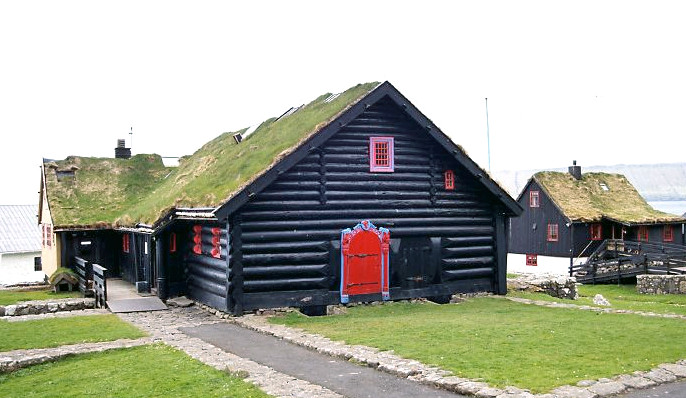
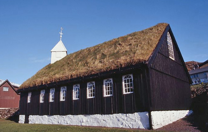
Many years ago I read an article about the Faroe Islands in the Daily Telegraph travel section, which had pictures of wooden houses with turf roofs set in stunning scenery. It sounded wonderful and definitely somewhere to add to the todo list.

We visited in 2007 when Smyril Line, the ferry serving Faroe and Iceland also called at Shetland. We drove to Aberdeen for the ferry to Shetland and picked up Smyril Line from there. This is no longer possible as the ferry just calls at Denmark and Norway. The alternative is to fly and hire a car.

We spent a week based in Torshavn. We decided we would spend our time exploring the islands of Streymoy, Vágar and Eysturoy as tunnels joined them. In the time available we decided not to attempt to use ferries to visit the other islands as we had read dire warnings about getting stuck on them due to sudden bad weather.

When we arrived there was snow to sea level and it was sleeting, windy and bitterly cold. Not the best of welcomes. We knew Faroe weather could be ‘iffy’ as they get a lot of low clouds and mist. The next day started dull but then cleared into a beautiful day. We did have some sunshine but many days were dull and not conducive to good photogrpahs. We could see the grass getting greener during the week. Spring is compressed here and it seemed strange seeing daffodils, tulips and bluebells in flower in the gardens all at the same time.


Impressions of the Faroe Islands

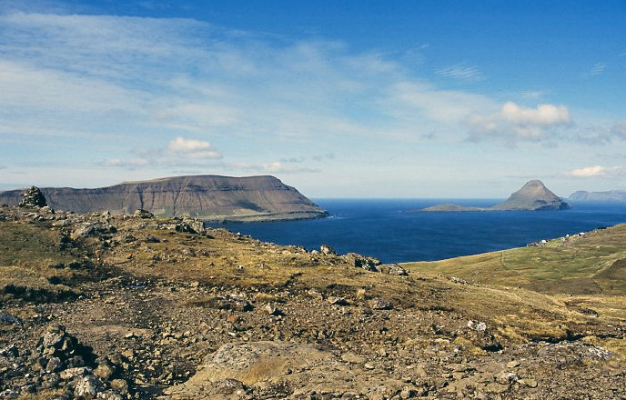
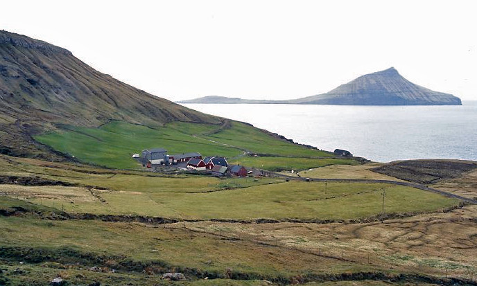
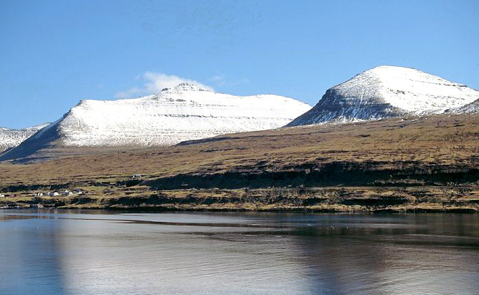
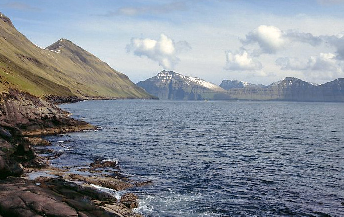
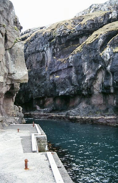
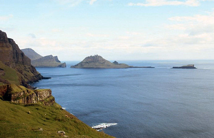
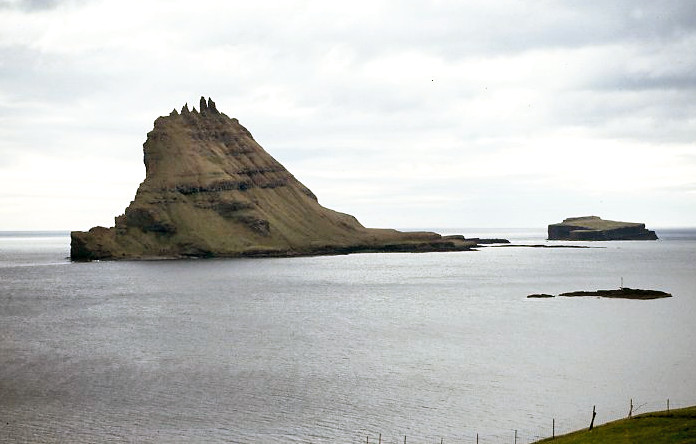
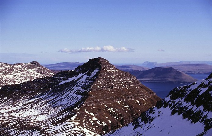
The islands rise up out of the sea in a series of jagged peaks.

full


full


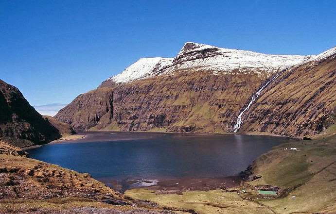
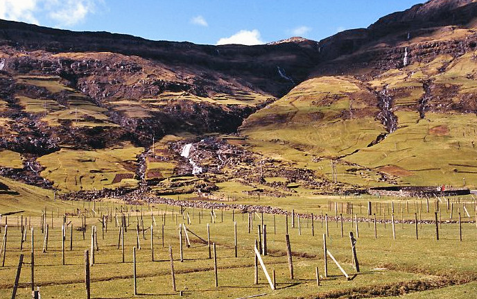
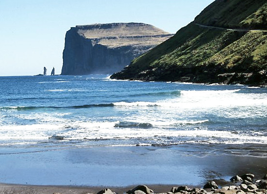
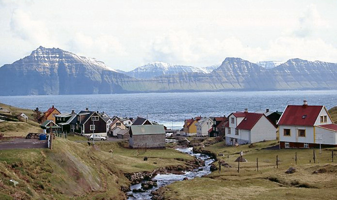
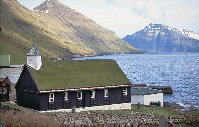
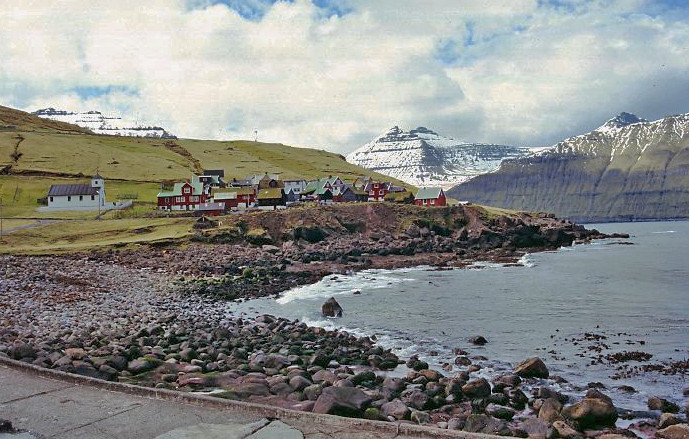
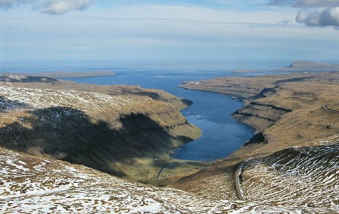
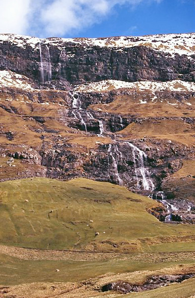
The top of many islands is flat with horizontal strata which fall into the sea in a series of stepped cliffs. In places waterfalls cascade down the sides of the hills.

full


full


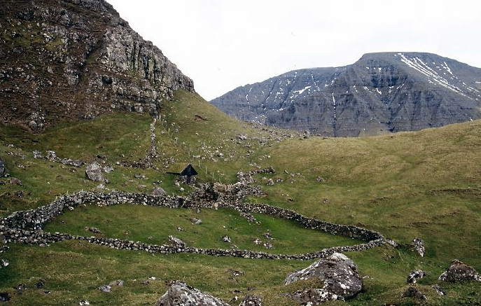
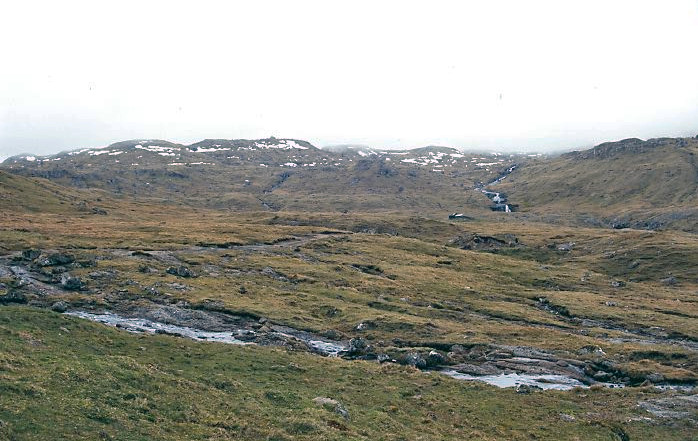
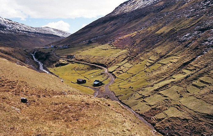
The tops are wet moorland and unsuitable for agriculture.

full


The highest point on the main island of Streymoy is Sornfelli at 749m which has a military station at the summit, reached by Highway 10 which is a long winding road. There is a car park at the top and there are wonderful views across the island.

full


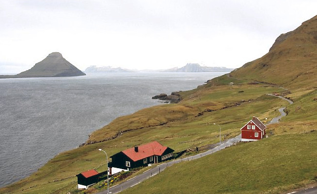
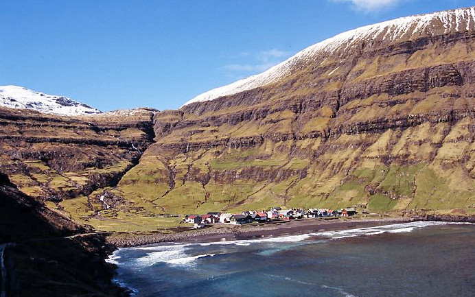
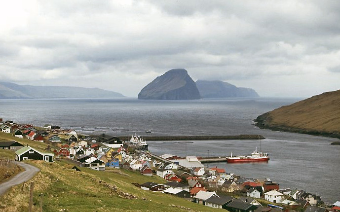
All the settlement is along the coast.

full


full


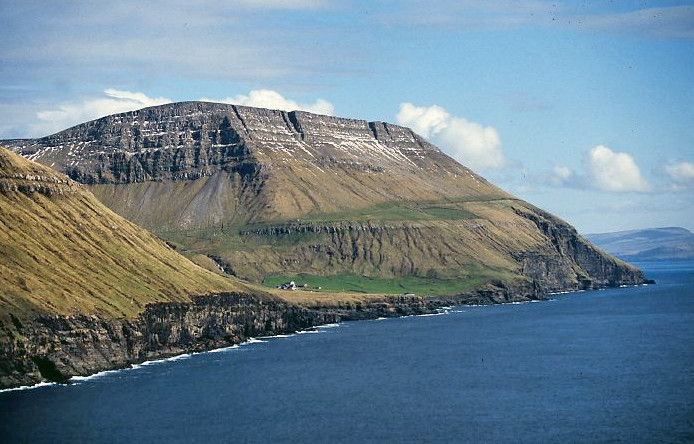
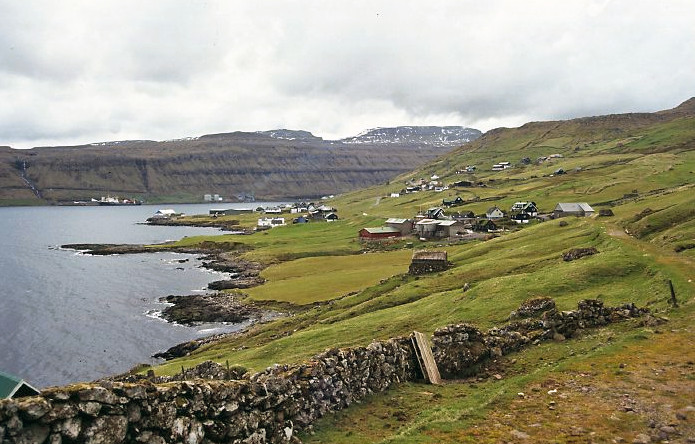
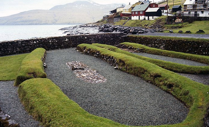
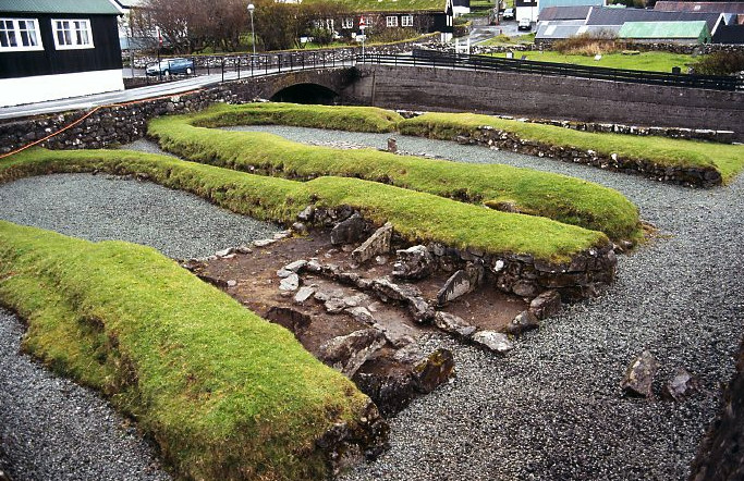
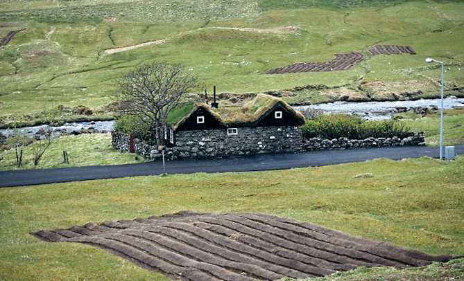
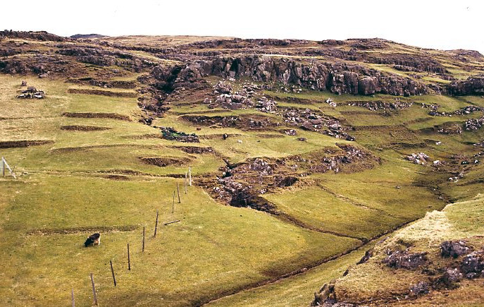
Flat land is at such a premium that terraces have been built around the villages to increase the cultivatable area.

full


full


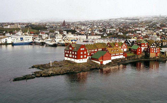
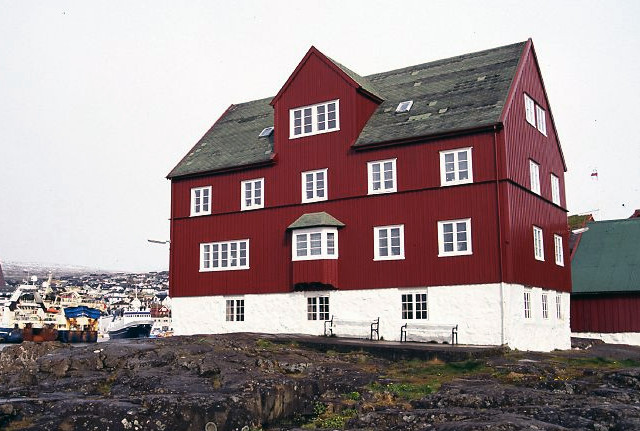
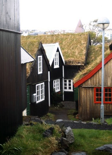
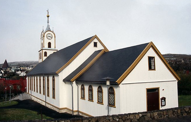
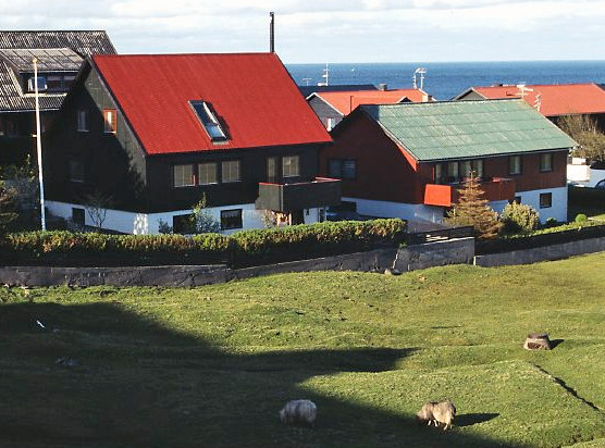
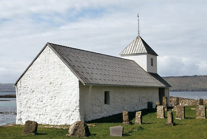
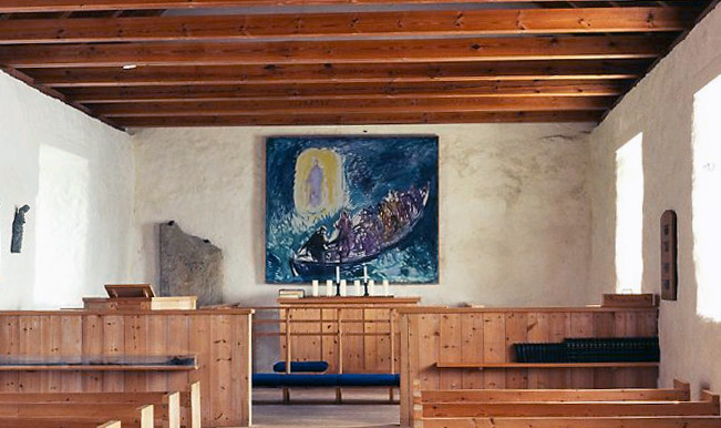
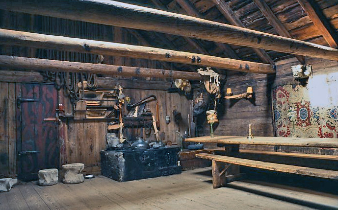
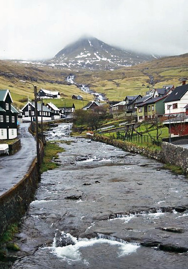
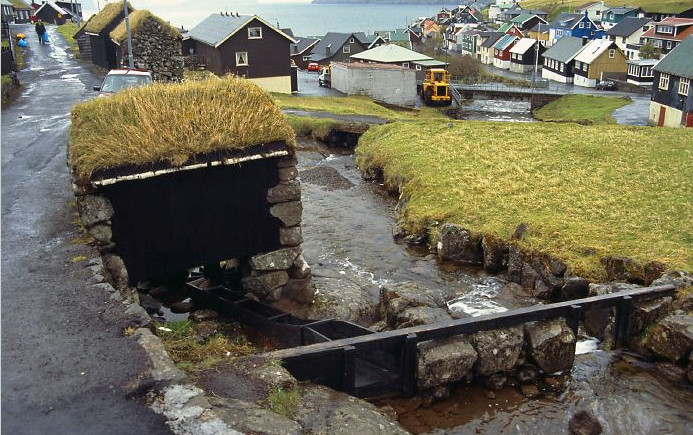
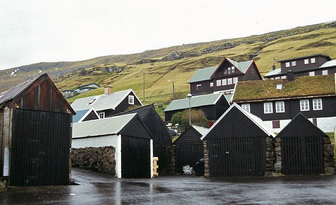
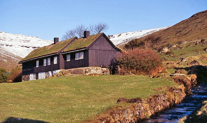
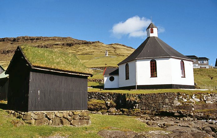
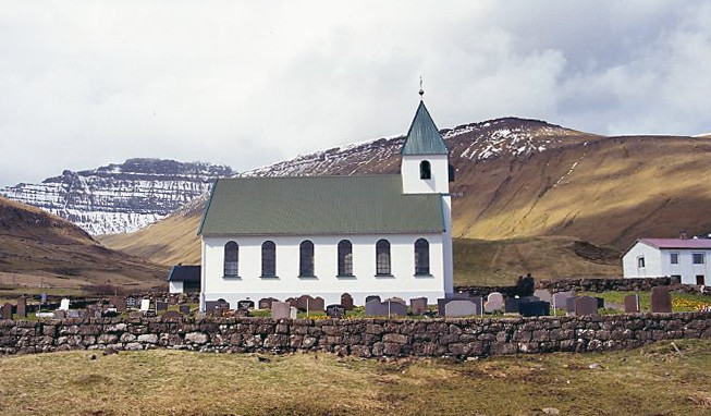
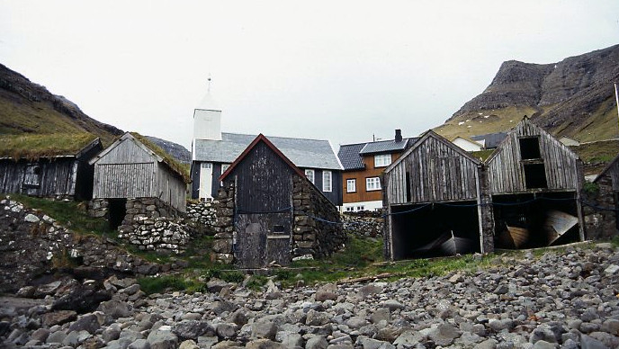
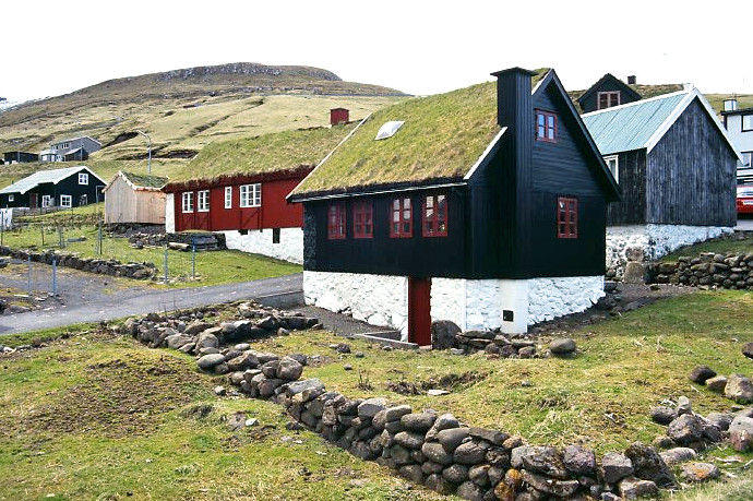
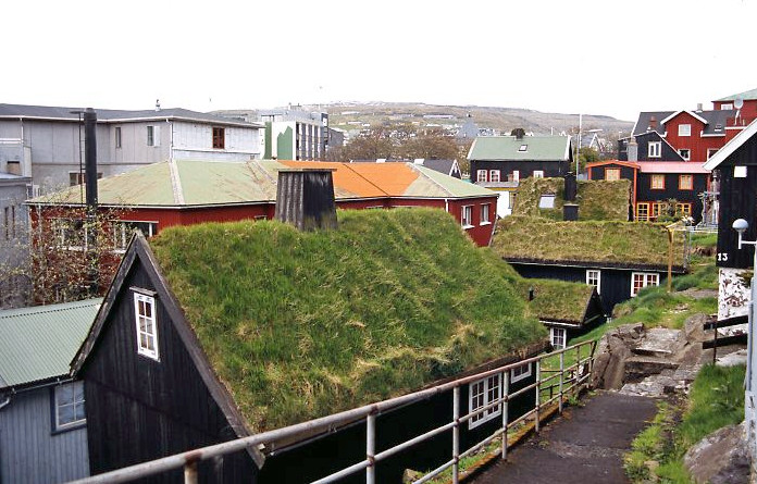
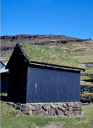
Traditionally houses were made of wood painted with black tar with white window frames. Some still have the traditional turf roofs. The older houses are found round the church and pier. Newer houses tend to be painted white and are built where ever there is space.

full


full


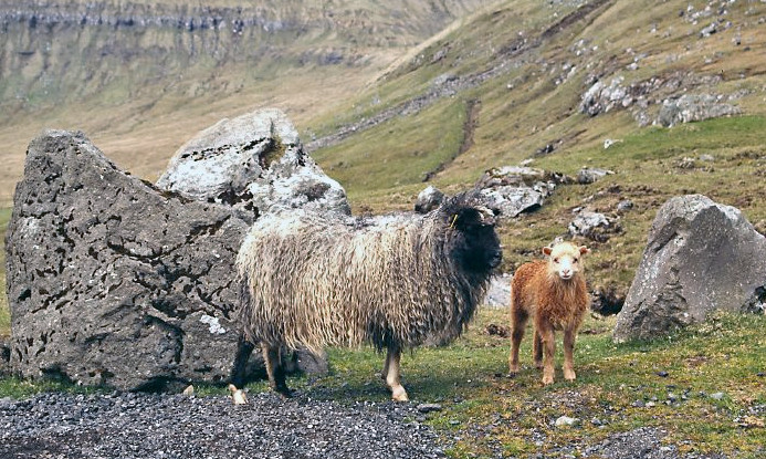
Fishing and sheep are the mainstays of agriculture with potatoes and rhubarb as the main crops grown. Rhubarb grows everywhere and seems to be the main source of vitamin C. It is said there are more sheep than people on the Faroes and it certainly seemed like it. Their fleece is all colours from black through brown to orange to white.

full


Sheep are a hazard when driving and have a death wish. They will ignore you until the car in almost opposite and then jump out. We had a few near misses. If you hit a sheep you have to telephone the police.
We had hoped to be able to buy Faroese lamb but all we could find in the supermarkets was frozen New Zealand lamb. We later found out that one third of the sheep are killed each year but is all eaten locally. Nearly every house has a wooded drying shed. The lamb is hung to dry (some may be salted first, the rest is hung up fresh) and is used to feed the family for the following year.

full


Roads are good and very quiet. Road signs are virtually non-existent, possibly because there are so few road junctions and everyone knows where they are going. They tend to be a small board on a lamppost by a junction with a number on it. I missed quite a few before I realised the significance of them.

Underwater tunnels now connect several islands. Tunnels have also been built to connect remote settlements. Some of the older tunnels built in the 1970s are single track, unsurfaced and unlit.
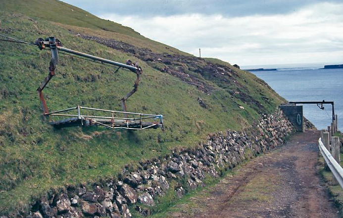
The last remaining settlement to be connected to the road network was a tiny place called Gásadalur. This is a handful of houses surrounded by a huge amphitheatre of cliffs. Before that, the only access was by a cairned track over the mountains which was used by the post man. The guide books described this as difficult (it looked impossible to us), or by helicopter three days a week.
 
Last edited:
Tórshavn

Tórshavn is the capital of the Faroe Islands. The Vikings settled and founded the first parliament on a small peninsula called Tinganes.

full


A Viking sundial can be seen carved into the rock surface.

full


Tinganes is still the seat of government with the offices of the Prime Minister.

full


full


The other buildings would originally have been stores but are now other government offices. There is no security and you are able to wander freely among the old buildings. These are made of wood and painted a deep brown with white window frames and many still have grass roofs.

full


Across the harbour from Tinganes is Skansen, a stone star shaped fort built in the 16thC to protect against pirate attack and later against the French and British. There are still four cannons inside the fort as well as two guns from World War Two when it served as the Headquarters for the British Navy based in the Faroe Islands. The fort is no longer used and there is a red and white lighthouse built inside it.

full


The old town grew up round Tinganes and is still a confusion of narrow winding passages and lanes with black tarred houses with grass roofs. Havnar Kirkja, the cathedral is a small white wooden building in the old town with a small belfry with clock and a grey slate roof. Unfortunately it has very restricted opening times and we never managed to get inside.

full


The Tourist Information Centre is in a brown painted wooden building in the centre of the town. It has a good range of free tourist literature as well as books for sale and excellent craft and gift shop.

The new town spreads across the hillside above the harbour and is a jumble of low rise wooden houses painted in bright colours. There is plenty of space between the houses and fields with sheep grazing.

full


full


Vidarlundin Park is a pleasant area of woodland along the sides of a small stream with ponds and geese and ducks. This is the only real woodland in the islands.

Niels Finsens Gota is the main shopping street with a selection of small shops. On the outskirts of the town is the SMS Shopping Centre on R.C. Effersøersgøta, with shops, fast food outlets and Miklagardur, a big and very pleasant supermarket with a good range of produce.

A short drive from Tórshavn at Hoyvík is Føroya Fornminnissavn, the Historical Museum. This is well worth a visit, especially for the 600 year old carved pew ends and bishop’s throne from Kirjubøur. English descriptions are provided.

full


full


There are also exhibits of maritime artefacts, boats, fishing and navigation. There is information on farming and old household equipment as well as displays on the Vikings.

Nearby is the open air museum at Hoyvíksgardur. The old settlement with two farmhouses barns and storage huts was lived in until the 1960s and has been restored as a museum. Unfortunately there is no information in English and when we visited, staff had no English.


Kirkjubøur

Kirkjubøur is the southernmost village on Streymoy. The area was first settled by Irish hermits but they were driven out by the Vikings. It was a significant settlement in the middle ages with around 50 houses, although many of these were washed away in a fierce storm in the C16th. Tidal currents washed ashore driftwood which could be used for building and kindling and there was plenty of seaweed to fertilise the land.

full


full


This was the original ecclesiastical centre of the island with the remains of St Magnus Cathedral. Often referred to as ‘Mururin’ (the wall), it was built around 1300 with locally quarried stone. It served as the cathedral until the reformation in 1538. It is thought it was never completed. It seems the Bishop overestimated the islanders capability to construct such a vast monument but it is not known whether building stopped after a bloody uprising against the extortionate taxes to build it or as a result of poverty after the Black Death. Today the 1.5m thick walls still stand to their original height of 9m. An avalanche in 1772 brought down the roof. Problems with water mean the building now has a protective cover over the top of the walls.

The small whitewashed Olavskirkjan surrounded by a small graveyard and standing at the edge of the sea is the oldest surviving building. It is C12th although has been extensively rebuilt to stop it falling into the sea. Many church valuables were removed during the 1874 renovation and taken to Copenhagen for safe keeping. They have now been returned to the Føroya Fornminnissavn museum. The carved wooden pew ends are one of the highlights of the museum. The inside of the church is very modern with pale wood pews and a modern painting of a boat above the simple altar. This is the only church from the middle ages which is still used as a church. Unlike many churches in Faroe, it is not locked.

full


full


The oldest building is the Roykstovan, which was built on the foundations of the Bishop’s palace and part of the C11th palace still survives in part of the building. This is now a farm and has belonged to the same family for 17 generations.

full


It is a typical Faroese wooden building with tarred walls and a turf roof. The oldest part of the building is open as a small museum reflecting the life of a large and prosperous farm. The living, working and dining area would have had a central fire with the smoke escaping through a hole in the roof. This is now replaced with a cast iron stove. There are chopping blocks and utensils hanging from the walls.

full


Before the road was built there was a cairned track over the hill from Kirkjubøur to Tórshavn. This is now a popular walk with good views across to the islands of Koltur and Hestur and also of Tórshavn.

full
 
The West Coast of Streymoy

To the north of Kirkjubøur there are a number of tiny isolated settlements built on a flat land above the sea.

full


Until the arrival of roads in the 1980s they were dependent on the sea for transport. Places like Sydradalur and Nordradalur are at the end of narrow roads, which drop steeply down from the mountains. They are not for the faint hearted. There are no safety barriers unless there is a very steep drop off the side of the road.

full


Further up the coast is the settlement of Kvívík. A river runs down the centre of the village with a series of small water mills on it.

full


full


This was a fishing settlement and still has the old fishing sheds just above the harbour.

full


Near the church are the excavated remains of a C10th/11th Viking longhouse and byre. The remains of the central hearth can be seen in the longhouse. The byre was divided into two parts; a cowshed with stalls for 12 cows and a storage area.

full


full


Vestmanna at the end of the road is the second largest settlement on Streymoy and is an unattractive place. Hydro electric power stations here provide electricity for the island. It is a major fishing port with a big fish factory. It used to be the ferry port for Vágar before the tunnel was built. It is now the centre for boat trips to the bird cliffs.


North Streymoy

The north of the island is more rugged with deep valleys and craggy cliffs. Apart from Saksun, the west coast is uninhabited. It faces the full force of the north Atlantic seas.

Kollafjørdur is large settlement heading north from Tórshavn and is a text book example of a linear village. The houses are scattered for 10 kilometres along the main road on the northern side of fjord.

full


full


The original settlement was a few houses around the church which is still the focal point of the village. The church is a typical Faroese wooden church on a stone foundation with black tarred walls, white window frames, doors and bell tower and a grass roof.

full


full


The road runs along the coast with views across to Eysturoy.

full


The tiny settlement of Saksun is reached by a long drive through the mountains. The sides of the valley are terraced to increase cultivatable land.

full


The few houses and the church are at the end of the road, surrounded by high cliffs with waterfalls dropping down them. The river inlet was a good harbour until the entrance was blocked by sand after a storm, resulting in the formation of a tidal lagoon. This makes a lovely walk at low tide to the sea, but it is necessary to watch the tide as water floods back in quickly.

full


full


Haldarsvík is an attractive small village built on a small inlet surrounded by steep cliffs which are terraced to provide fields. Buildings are scattered over the hillside and many have a wooden drying shed. The church is built of stone, painted white and is the only octagonal church in the Faroe Islands. The river Klufta tumbles down the hillside in a series of cascades. The small harbour is sheltered from currents in Sundini, the narrow channel between Streymoy and Eysturoy.

full


full


Beyond Haldarsvík, the road climbs round the headland to Tjørnuvík, the northernmost village on Streymoy at the head of a deep fjord. The road is very narrow with few passing places and clings to a ledge above the sea with a steep drop down. It was one of the last bits of the road network to be built and again is not for the faint hearted. Before that, Tjørnuvík was reached by a steep and treacherous track.

It is worth the journey as Tjørnuvík is in a stunning setting at the head of a small sandy bay surrounded by an amphitheatre of steep cliffs. The houses are clustered together and a network of dykes and dry stone walls offer protection from falling rocks which have twice destroyed the village. All available land is terraced to increase cultivation. The valley bottom can be wet and channels are dug to improve drainage.

full


Wetter areas unsuitable for cultivation are used for growing hay and there are hay drying racks.

full
 
Eysturoy

Eysturoy is the second largest island and most of the settlement is to the south with Faroes third largest town, Runavík.

The south is flatter and more built up than the north. Exploring Eysturoy can be slow as most of the settlement is at the end of long dead end roads. In the south east of the island there are long modern ribbon developments along the roads and by Faroe standards it felt very built up. There was little of note in the settlements and they did all seem to merge into each other. About the only place worthy of mention is Toftir where the Faroes international football stadium is built on a flat piece of land blasted out of the hills above the village. Scenically this area isn’t as attractive as the north of the island or Streymoy. It was a dull damp day when we visited, we weren’t impressed and didn’t take any photographs.

The north of Eysturoy is mountainous with three major peaks, Vadhorn (726m); Slaettaratindur (882m); Grafelli (857m).

full


The two sea stacks of Risin and Kellingin off the north coast are best seen from Tjørnuvík on Streymoy.

full


The road from the bridge across to Eysturoy runs up the west coast with views across to Streymoy and passes the hydroelectric power station fed by a dammed lake in the hills. Land along the coast is fertile and used to grow potatoes.

Eidi is a small village with brightly painted cluster of houses on the northwest coast and is dependent on fishing. There is a pleasant walk past the lake and over the sandbar to the football pitch on the shore. At the end of May, Arctic terns were wheeling and calling overhead.

From Eidi, the road swings east through the mountains and over the narrow pass between Slaettaratindur and Vadhorn. It then drops steeply down through hair pin bends to the junction for the road to Gjógv. The Gjógv road drops down a long valley to the village. This is a popular stopping place for coach trips.

full


Gjógv is Faroese for ‘cleft’, as the harbour is in a steep ravine below the village, reached by 69 concrete steps. In rough weather the fishing boats winched out of the water to prevent them smashing against the rocky walls.

full


The houses are built along the Dalsa river, with a white painted church at the edge of the village.

full


There are good views across to the island of Kalsoy, with its jagged mountainous ridge with steep cliffs.

full


The road to Funningur drops 300m in 3km through a series of long hair pin bends to the settlement.

full


The wooden houses and drying sheds are clustered around the stream with the small church standing by the sea.

full


full


The road runs along the shores of Funningsfjørdur. Valley sides are steep and there is no settlement here.

full


Elduvik is a tiny and very traditional settlement at the end of the road tucked away round two headlands.

full


full


Sheep are kept and the land is still farmed with hay being cut on the lower slopes of the mountain. Around the bay are small boat houses.

full


A narrow track from the village leads to a deep cleft in the cliffs with a small landing stage.

full


Fuglafjørdur is the largest settlement on Esturoy, set in a sheltered bay surrounded by high cliffs. This has a good harbour and is an important fishing harbour.

full


full
 
Vágar

Vágar is the island to the west of Streymoy and reached by a tunnel. The airport was built by the British during World War Two on the only flat bit of land. The site was hard to see from the surrounding sea and any potential German warship.

There is just one road linking settlements on the south and west coast. The north is untouched wilderness. Two settlements (Vikar and Slaettanes) are still marked on some maps but these are now deserted as they were so isolated.

The first settlement is Sandavágur with an attractive white church with red roof. By Faroe standards there is quite a bit of flat land round here which is cultivated, especially for potatoes.

full


Next is Midvágar, which is the largest settlement and was the site of an early parliament (Ting). It stretches along the shore with a pier for small ships and has an attractive white painted church.

full


full


The road then runs alongside the side of a large lake, Sorvagsvatn, which the British Army used as a base for sea planes in the war. Vatnsoyrar at the head of the lake is the only settlement not by the sea and is built on reclaimed boggy marshy land.

Bøur is a tiny village of traditional wooden houses tucked under the slopes of the mountains with superb views of the uninhabited islands of Gáshólmur and Tindhølmur.

full


This is a fishing settlement with boathouses built above the shore.

full


The tiny black tarred church is delightful and was one of the few churches to be open during our holiday. The inside was simply furnished with pale wooden pews with a pulpit, small wooden lectern and font and plain altar surrounded by a semicircular rail.

full


full


The last settlement is Gásadalur, a tiny settlement with a population of 17 and many deserted houses. Until the road reached here in 2006 this was very isolated and the only way it could be reached was by helicopter flights three times a week or by a steep track over the mountains. It is built on a shelf 150m above the sea so fishing boats had to be kept at Bøur.

full


full


There is a very narrow cleft, which can be reached by a steep path and steps. In the past, goods were hauled up using a winch and cradle.

full


full


On a sunny day it is an idyllic place and there is easy and pleasant walking. It must be very different in winter.

full
 
Fascinating: but a bit daunting....
 

How to Find Information

Search using the search button in the upper right. Search all forums or current forum by keyword or member. Advanced search gives you more options.

Filter forum threads using the filter pulldown above the threads. Filter by prefix, member, date. Or click on a thread title prefix to see all threads with that prefix.

Sponsors

Booking.com Hotels in Europe
AutoEurope.com Car Rentals

Recommended Guides, Apps and Books

52 Things to See and Do in Basilicata by Valerie Fortney
Italian Food & Life Rules by Ann Reavis
Italian Food Decoder App by Dana Facaros, Michael Pauls
French Food Decoder App by Dana Facaros, Michael Pauls
She Left No Note, Lake Iseo Italy Mystery 1 by J L Crellina

Share this page

Back
Top