• CONTACT US if you have any problems registering for the forums.

East Iceland - land of hot springs, volcanics and ice

Eleanor

1000+ Posts
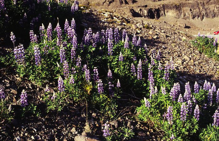
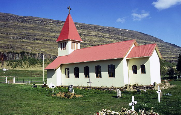
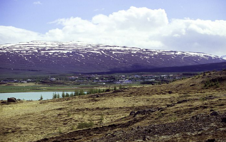
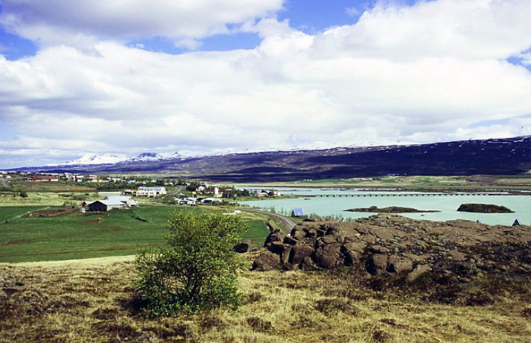
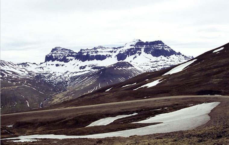
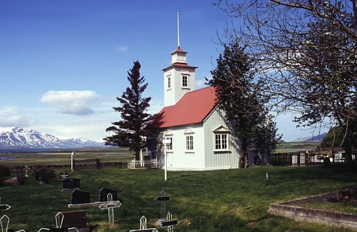
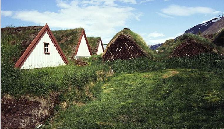
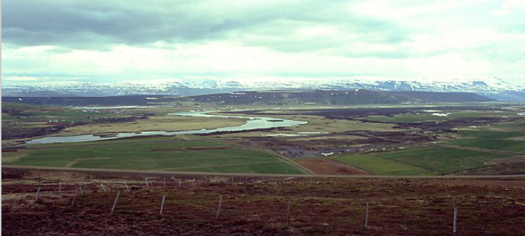
This is a report of just over two weeks spent in the eastern side of Iceland in 2006.

We took our car using Smyril Line to get us there. Unfortunately this is no longer possible as Smyril now only sail from Denmark.

Background to the trip

We had spent several holidays in Norway which we loved and our thoughts turned to Iceland. On holiday in Shetland we discovered that Smyril Line operated a complex ferry service from Shetland to Faroe Islands and Iceland. We began to plan a week in Faroe followed by two weeks in Iceland. Still being new to holidays of this sort, we used the Smyril office in Shetland to make all the reservations including accommodation. We decided book Iceland for the first two weeks in June, before the main holiday period which begins 15th June and before the worst of the flies. Iceland is just south of the Arctic Circle, so we had 24 hours daylight while we were there.

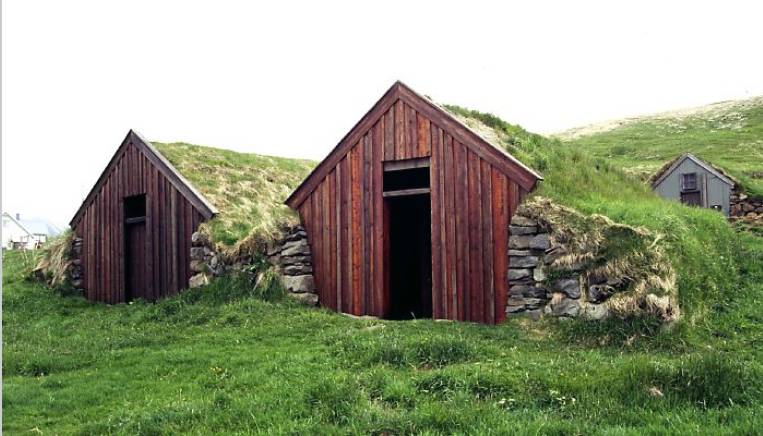
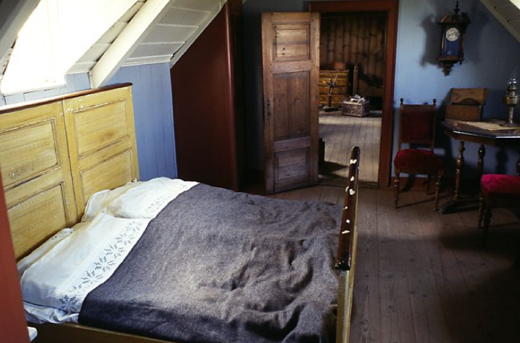
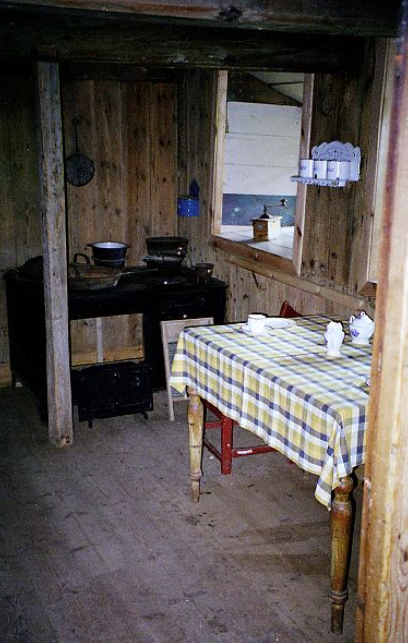
Accommodation and food in Iceland is expensive so we decided to book B&Bs which also provided self catering facilities so we could prepare our own meals. These varied considerably and some were decidedly basic. There could be problems if there were other groups wanting to use them at the same time. Most days we were able to buy bread, cheese, salad and yogurts for the evening meal. We also had pasta with packet sauces for times we were unable to buy fresh food. Packs of long life ryebread were a useful standby for days we couldn’t find bread for lunch.

Accommodation was simple. Most had a basin in the room but we had to share bathrooms. Nowhere had washing machines so we tried to pack enough clothes without having to wash. A few did have a clothes line and pegs.

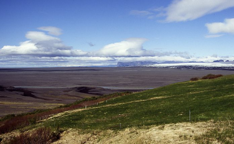
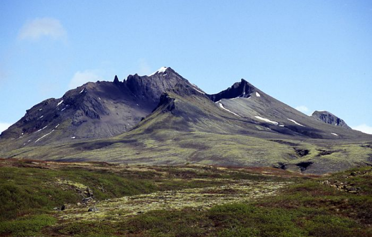
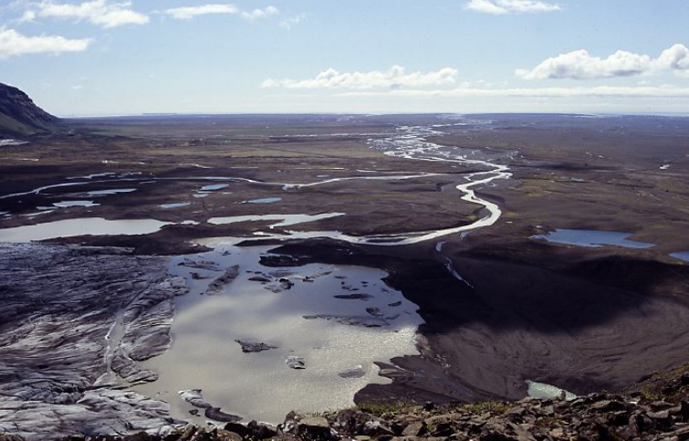
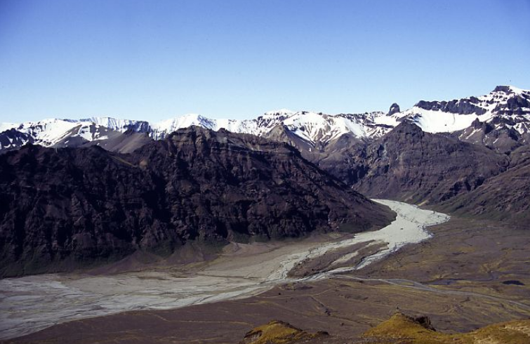
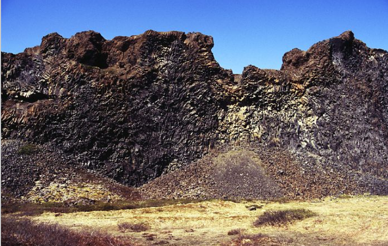
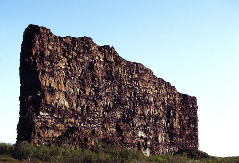
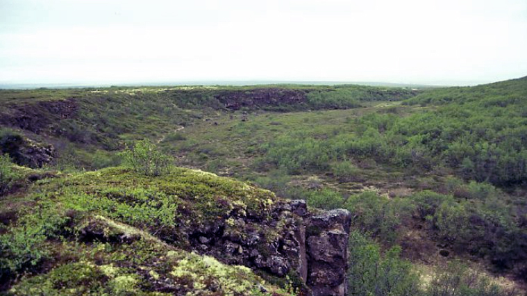
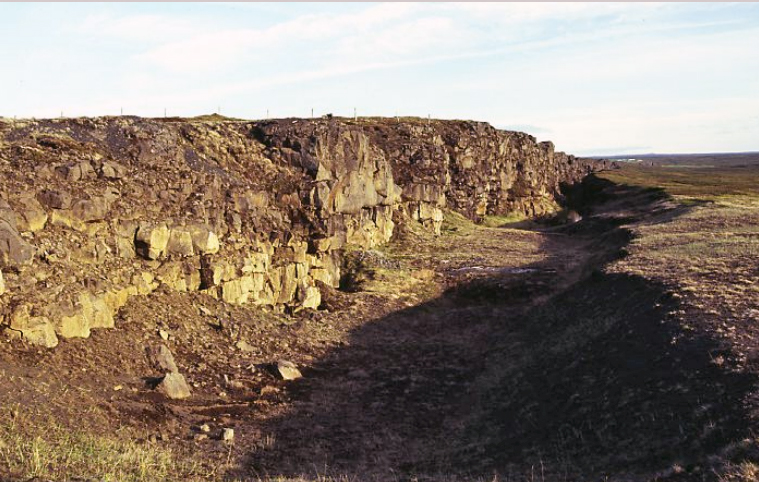
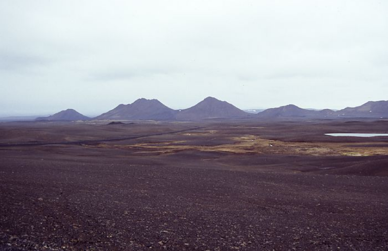
We decided to concentrate on the eastern side of Iceland rather than attempt to drive all the way round on the Ring Road. We decided this would mean a lot of driving across what at times could be monotonous scenery. The sandur along the south coast stretches for mile after mile after mile along a straight road with nothing to see but dark volcanic dust. It is impressive but after a couple of hours driving across what seems identical scenery does become a bit boring.
full


full


This did mean we doubled back on ourselves and at times drove the same bit of road twice. The scenery was so amazing, this was no hardship.

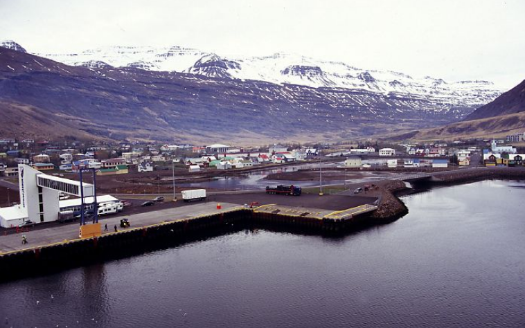
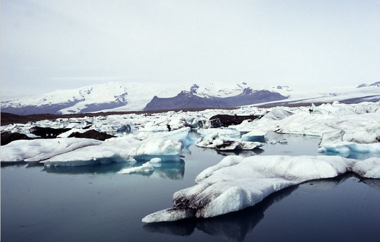
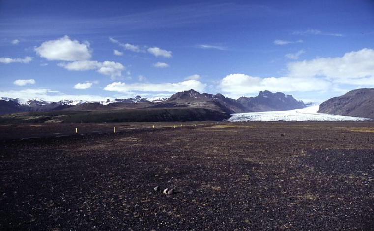
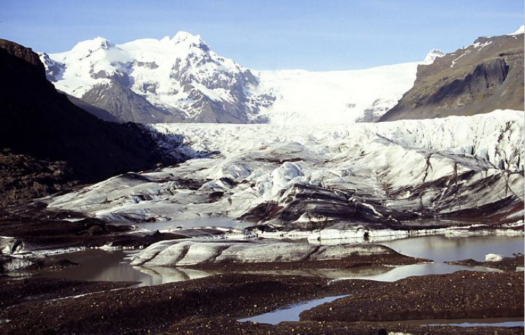
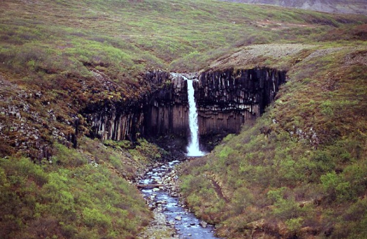
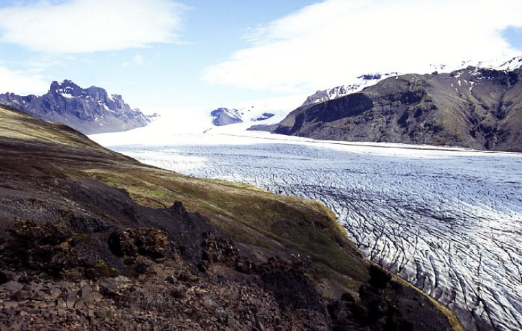
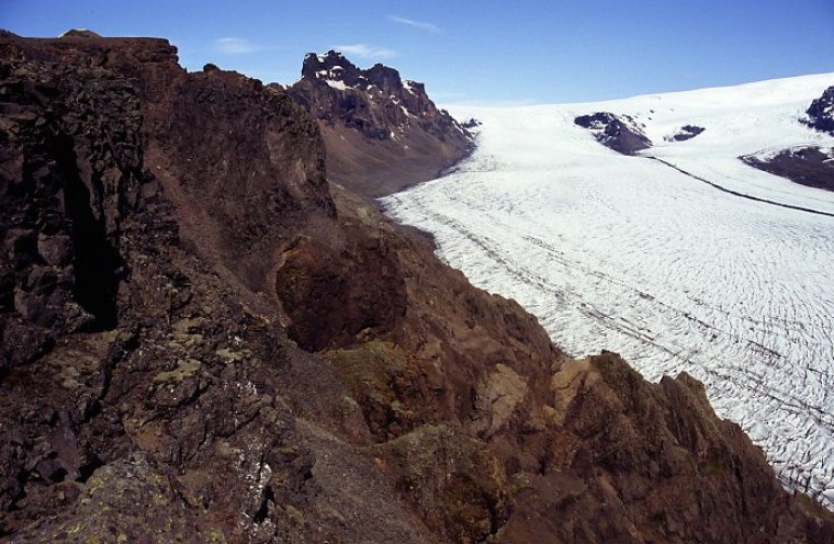
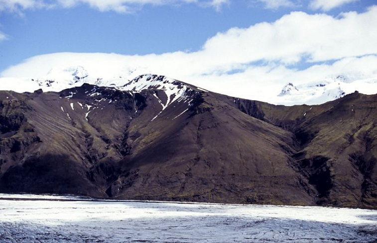
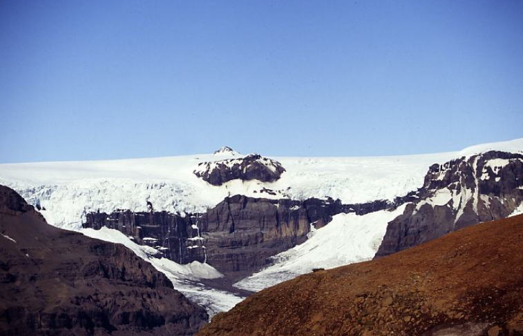
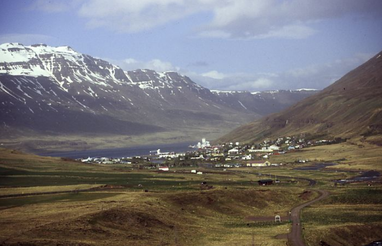
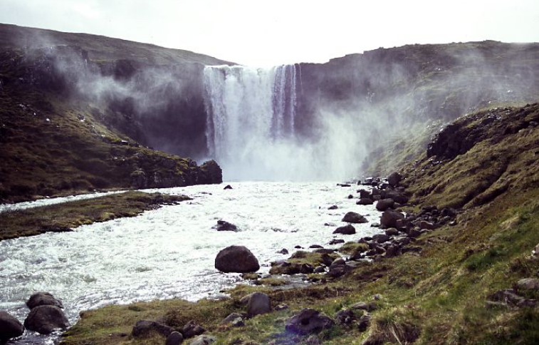
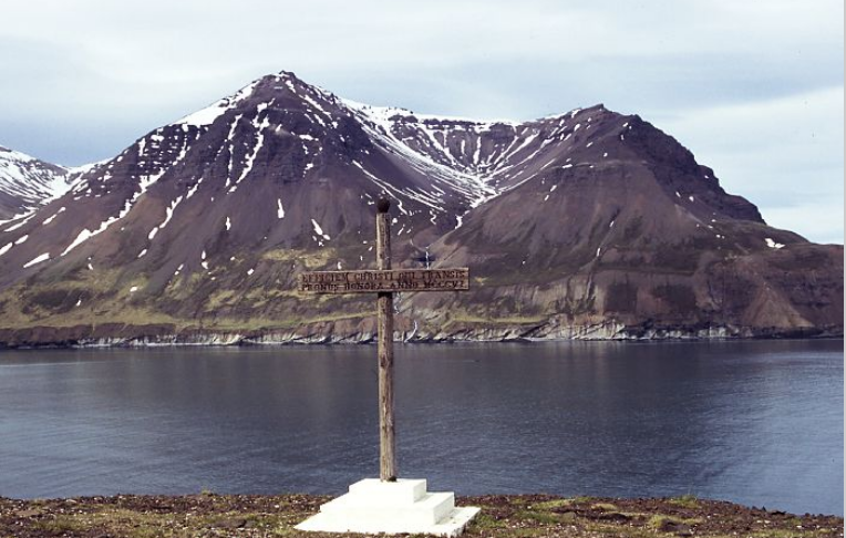
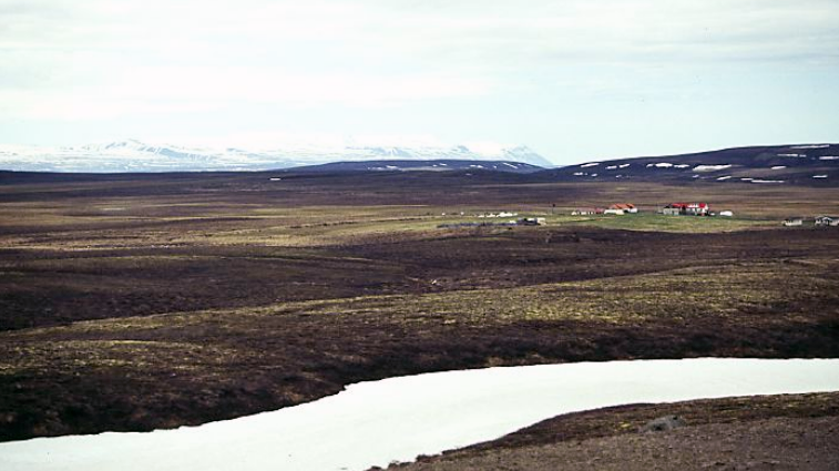
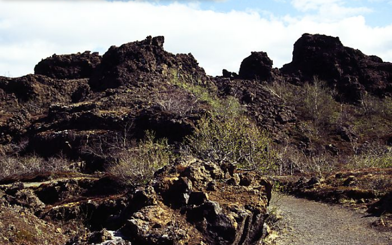
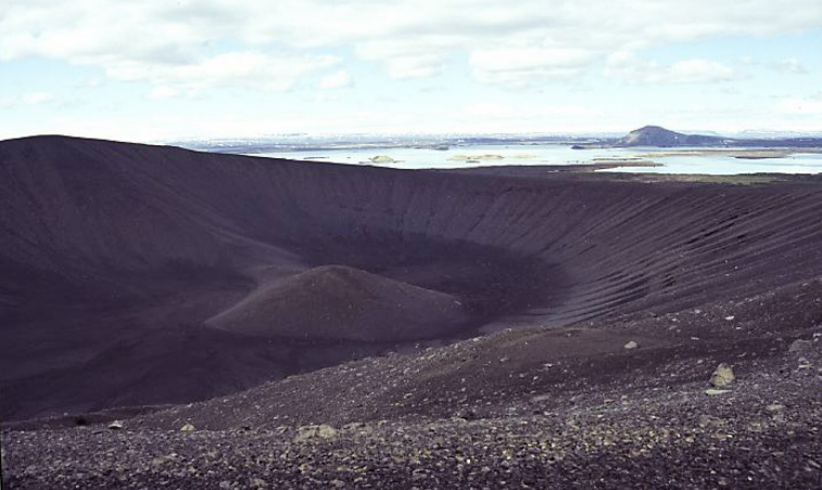
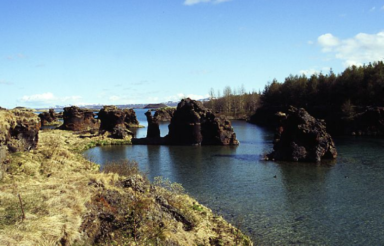
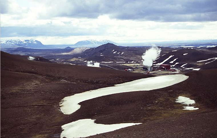
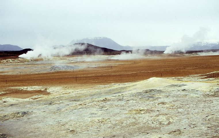
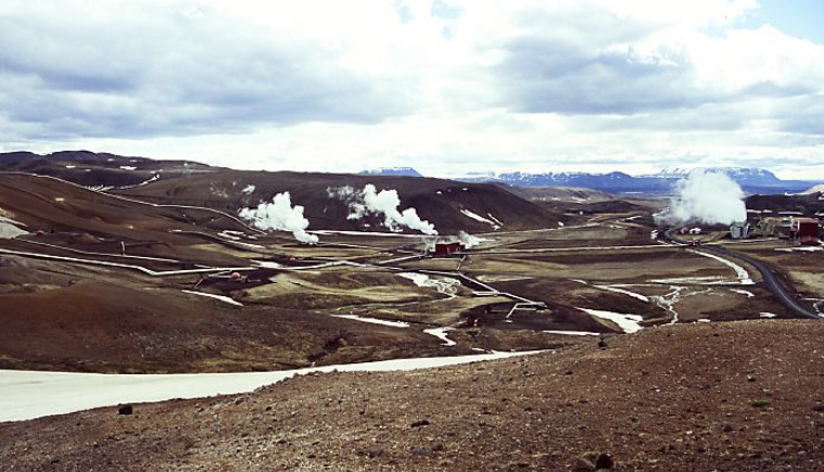
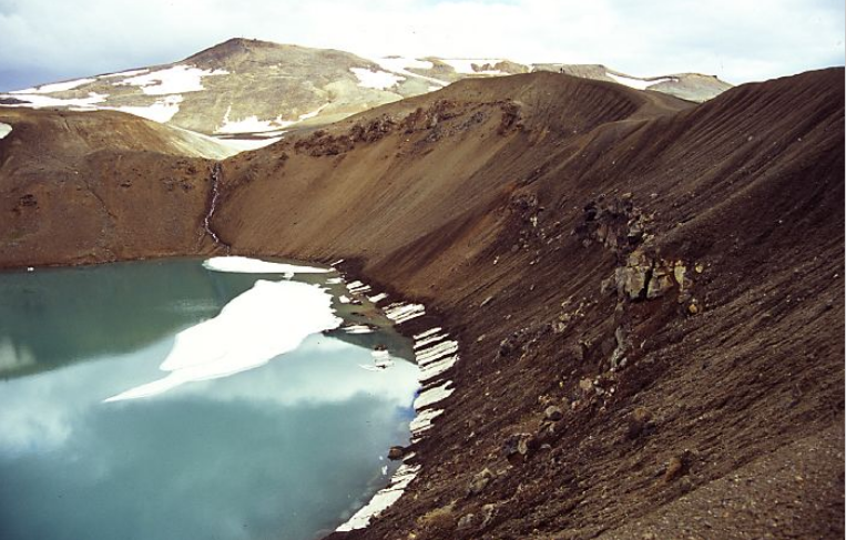
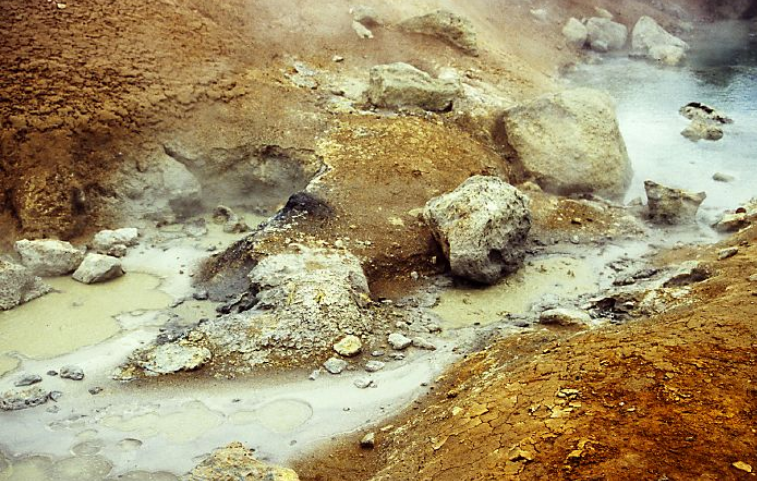
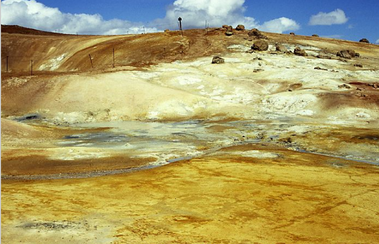
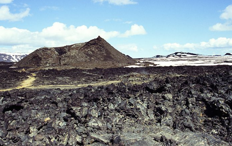
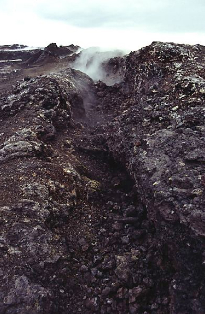
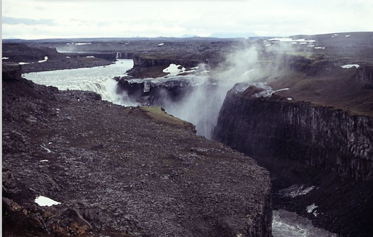
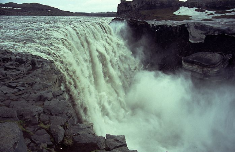
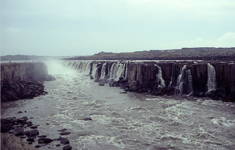
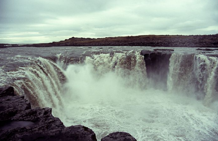
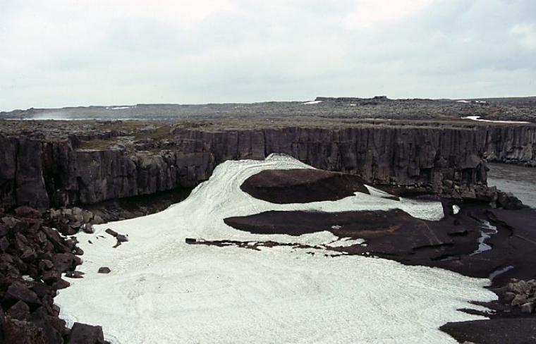
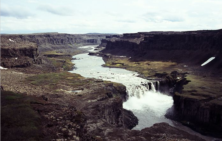
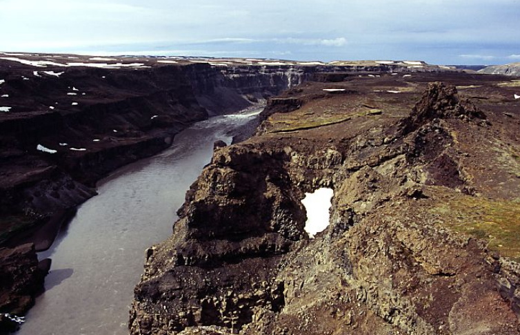
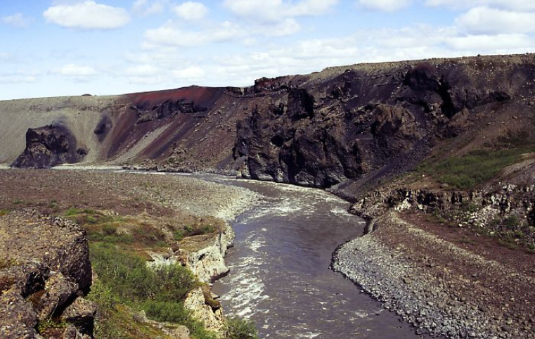
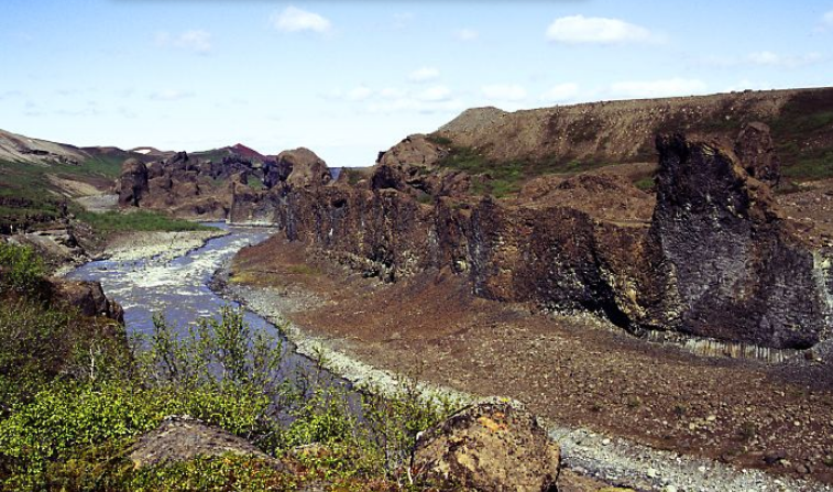
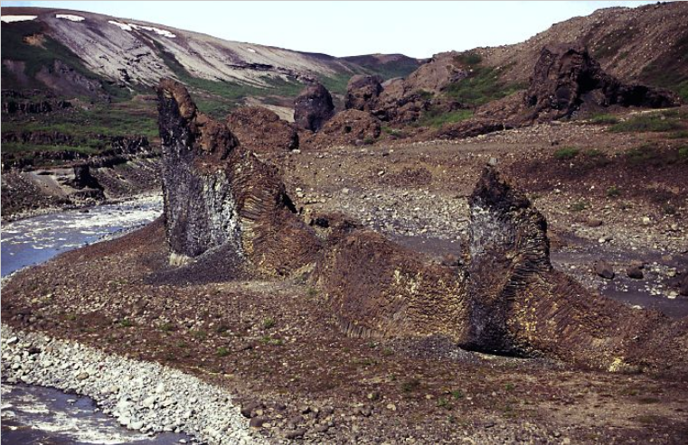
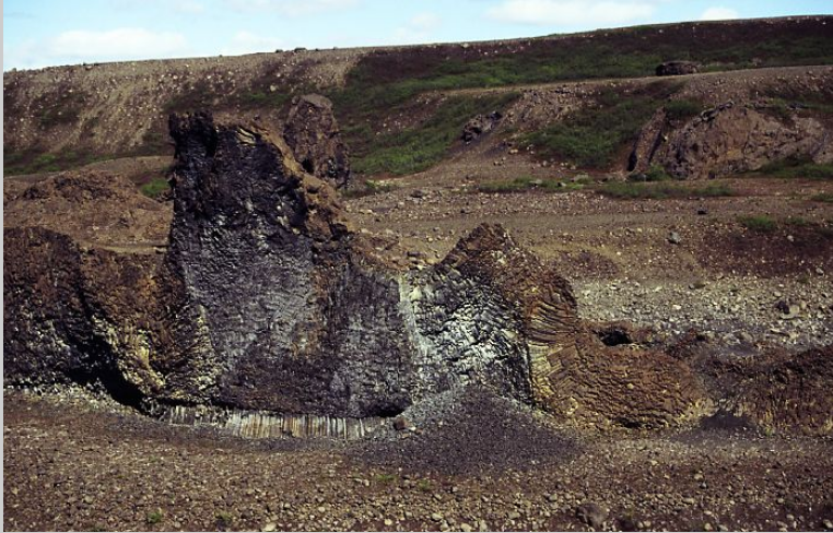
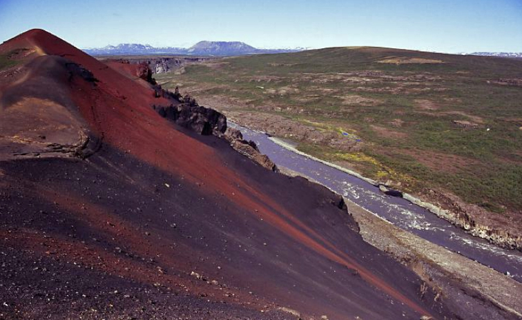
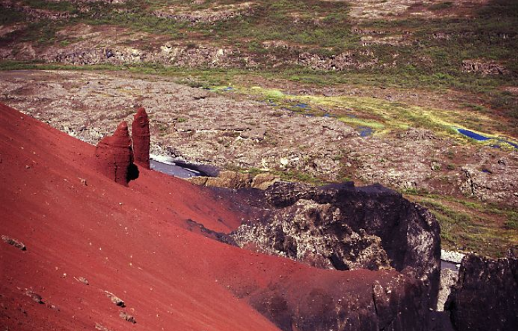
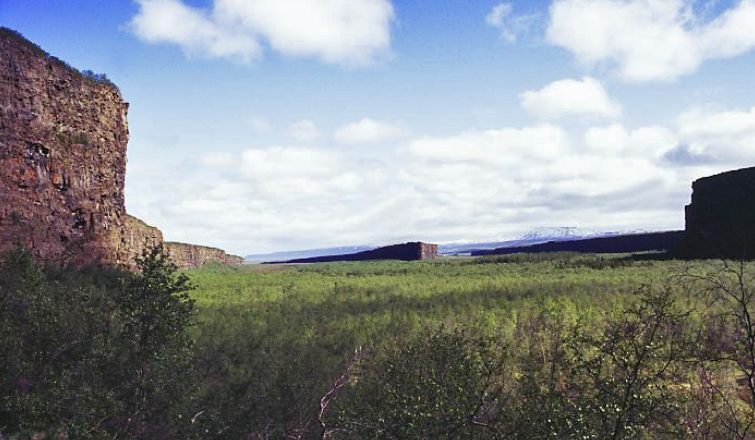
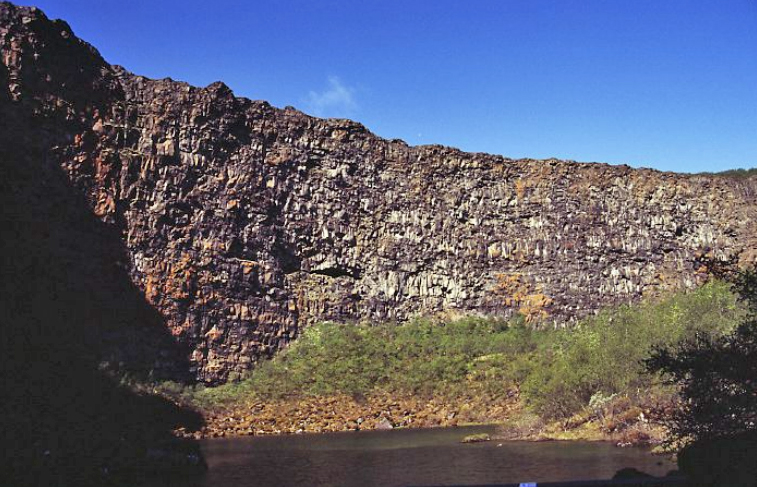
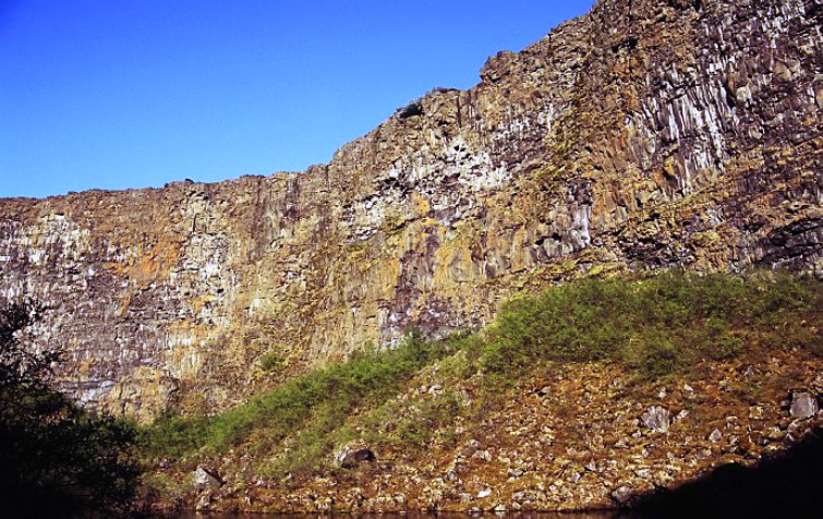
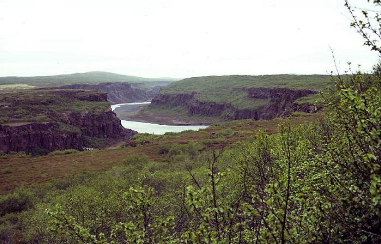
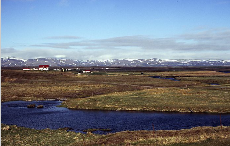
We chose four bases, Skaftafell in the south for the glaciers, Egilsstadir in the middle (and near the ferry port of Seydisfjördur), Myvatn for the volcanics and Jökulsárgljúfur for waterfalls and gorges.

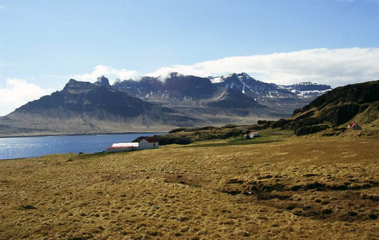
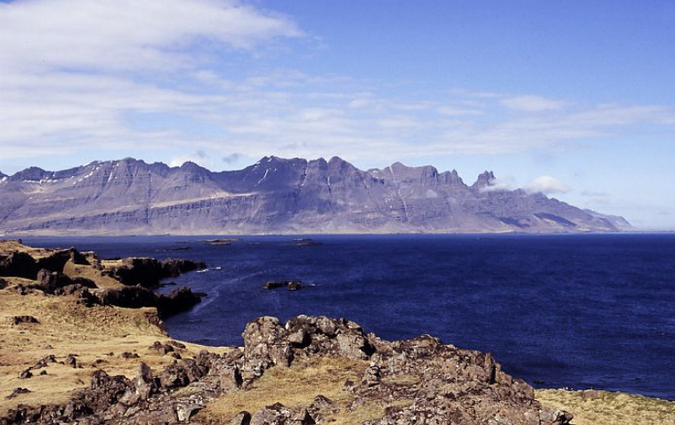
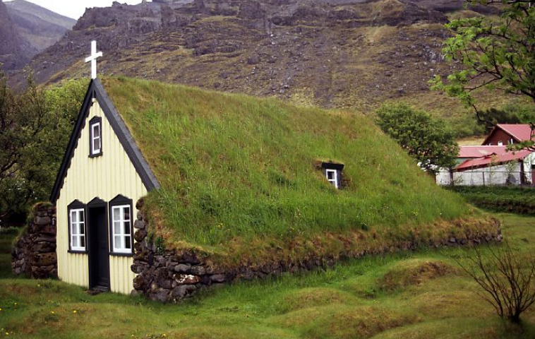
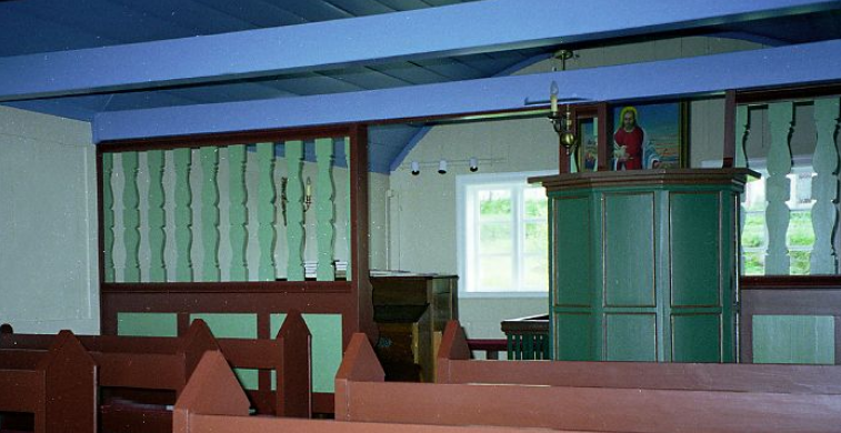
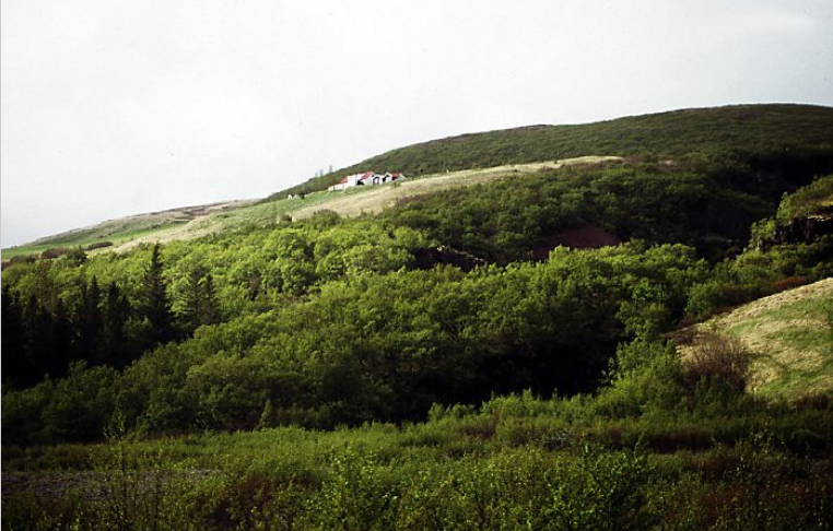
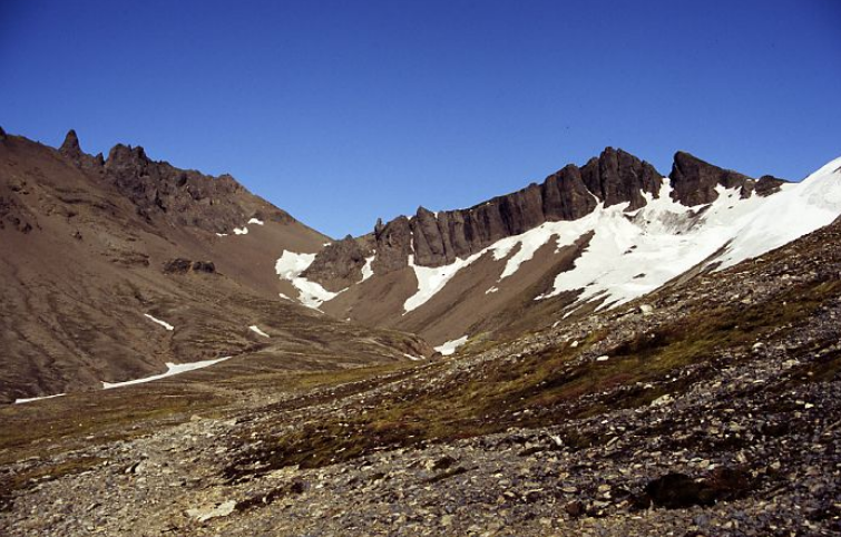
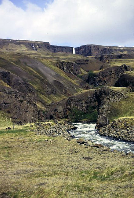
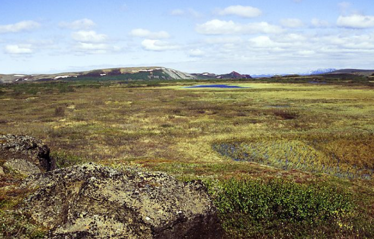
We loved Iceland - the wildness and the scenery. We rapidly ran out of superlatives to describe the view round the next bend in the road. The choice of stops meant we saw a range of different scenery. In early June everywhere was still quiet and there were few tourists around. We enjoyed being able to relax and spend several days exploring each area.

We were still using slide film for photography, working on 1x36 exposure film per day. Slides were later scanned for the web, which explains some of the poor colour in some pictures.

A bit about the roads...
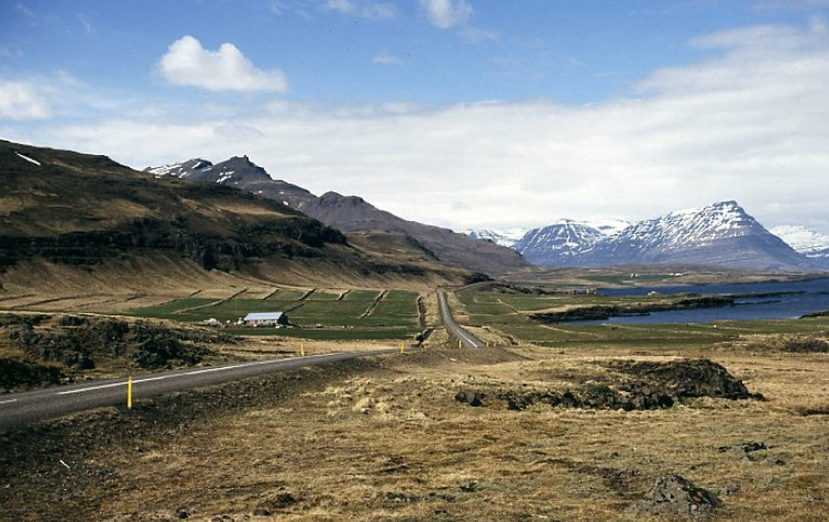
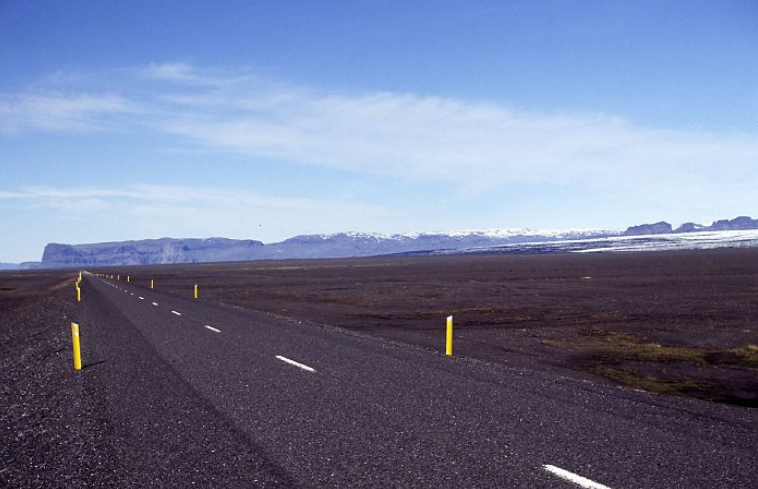
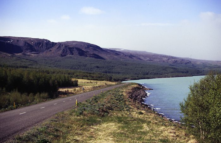
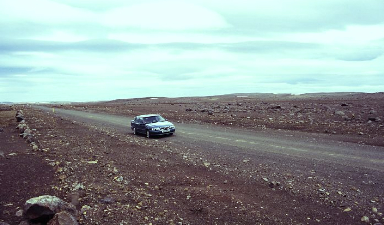
Roads in major settlements are tarmac, with a white line down the middle as is a lot of the Ring Road.
full


full


There are many gravel roads (and even parts of the Ring Road are gravel).
full


full


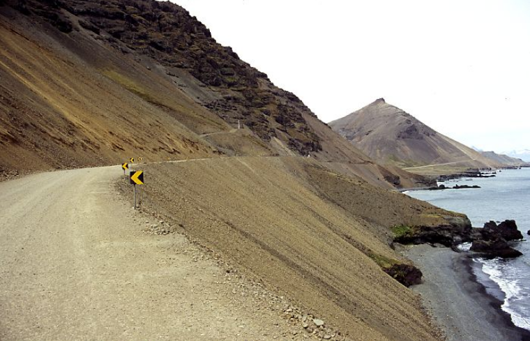
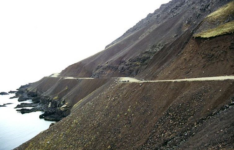
These have a lower speed limit and you need to take extra care when breaking. These are narrower than the tarmac roads and in places run along the side of the mountain. Scree can fall down the side of the mountain and you have to watch out for quite large boulders on the road. Barriers seem to be kept for places you will kill yourself if you come off the road...
full


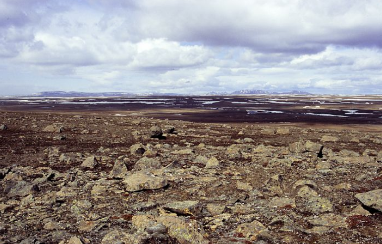
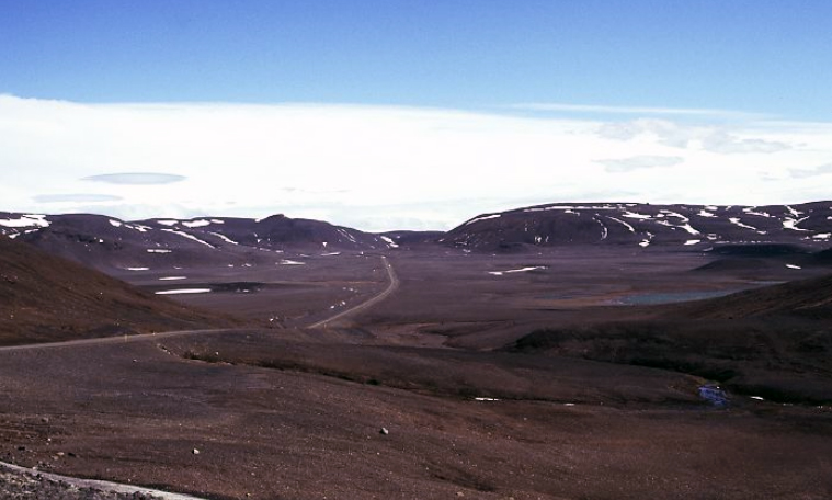
Once away from the major centres of population, roads are very quiet and it is possible to drive for hours through deserted countryside without seeing another car or habitation. Make sure you have plenty of petrol in the tank !
full


In places well away from any settlement, small ‘self service areas’ are provided at the side of the road with a drinks and snack dispenser and shelter with a picnic table. Reading comments in the book, it seems that many people put money only to find the machine wasn’t working.
full


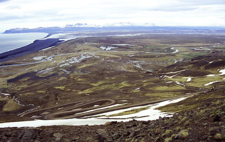
In places where roads climb over the mountains there can be many hairpin bends to negotiate.
full


Headlights have to be used at all times. Speed limits are strictly enforced and there are hefty penalties if caught. There is a zero tolerance policy for alcohol too.

The ring road is kept open throughout the year, but many of the unsurfaced gravel roads are closed during the winter months. Once clear of snow roads remain closed for some time to allow them to dry out and consolidate, so preventing rutting and damage to the surface. This affects the road to Dettifoss which may not open until the beginning of June.

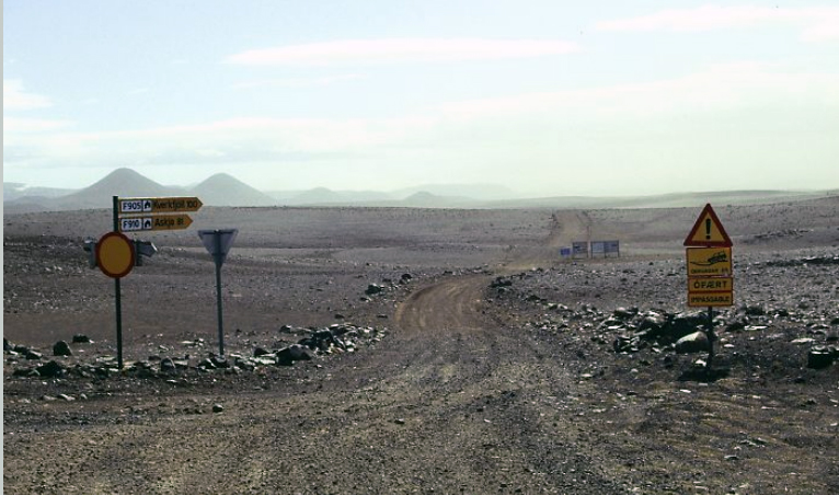
We didn’t have a 4 wheel drive car, so F roads in the interior of Iceland were off bounds for us. These are very rough unmade roads with rocks and stream crossings. These can be no more than a trickle of water in the morning, but rise rapidly as the snow begins to melt during the day. Driving off road is forbidden and there are severe penalties if caught breaking this as it can cause damage to the environment which can take decades to recover.
full


There is more information about driving in Iceland here.
 
Last edited:
From Seydisfjördur to Skaftafell

full


The ferry docked at midday and, allowing for time to disembark and clear customs (very slow), we decided to break journey and spend a night at Höfn. This would give us chance to drive the slower coastal road rather than the Ring Road. The road to Egilsstadir was busy with ferry traffic including a lot of slow moving camper vans. We were pleased to stop at the supermarket in Egilsstadir to stock up on bread, vegetables and fruit and allow the worst of the traffic to clear.

The coastal road is slow and mostly unsealed.
full


full


For miles it is cut out of a ledge along the side of the steep mountain sides, high above the sea. In places the road is cut through massive scree slopes and if you stop and get out of the car, you can hear and see the scree sliding down the cliff face.
full


Poles mark the edge of the road. Railings are only used in places where you are certain to kill yourself if you drive off the road. It was an amazing drive. The road passes through a few small fishing settlements but we needed to watch the time and didn’t have chance to stop.
full


full


Höfn is quite a large settlement on a peninsula and is a thriving fishing centre with a large fish processing plant. We had time for a quick walk to find a supermarket before heading back to Árnanes Guest House for the night.

Next morning was an early start on what turned out to be a dull, drear day. Back on the Ring Road, our first stop was Jökulsárlón, the lagoon at the mouth of a glacier. Even though we had seen little traffic, the parking area off the road was busy. This early in the year, the lagoon was full of icebergs in different shades of white and blue. In the distance we could see the snout of the glacier. Boat trips (expensive) take you out into the lagoon among the icebergs. We had just missed on trip and it was quite a long time to wait for the next. We decided to walk along the edge of the lagoon instead. Four days later, temperatures had warmed up and there were fewer icebergs and it wasn’t such an impressive sight.
full


full


We did a short detour off the Ring Road to the tiny wooden church at Hóf with its turf roof reaching down to the ground. This is similar to the early churches built by the Vikings.
full


Inside it is a delightful building and typical of the other Icelandic Churches we visited. The walls were painted green with a blue ceiling. There were brown benches with a small wooden alter screen, large pulpit and a painting above the altar.
full


It was raining steadily by the time we reached Skaftafell. Apart from the large Visitor Centre (which sells a selection of very basic snacks) an expensive Hotel, and small petrol station with basic shop, there is little here. We were stopping at Bölti Farm Guest House, which unfortunately is now closed.
full


It is set high on the hillside with superb views across the Sandur and views across to the mountains with their glaciers.
full


This was no longer a working farm as they had to stop farming after the formation of Skaftafell National Park as sheep were not allowed in the park.

By now the rain was increasingly heavy and the sight of boots and waterproofs hanging up in the windows of the bunk house in an attempt to dry did little to raise the spirits. In the sunshine it was a magical place to stay and very quiet, apart from the snipe who Michael was convinced called all night.
 
Skaftafell National Park

We had three days to explore the park. The next morning started dull and damp. After a stop at the Visitor Centre to pick up a walking map. There are several well marked circular trails in the area.
full


We put on waterproofs and did the walk everyone does to the snout of the Skaftafellsjökull Glacier. This takes you along a made track across the moraine with posts marking the position of the snout as it has receded over the last 50 years.
full


From a distance glaciers look white. Close too they are dirty and grey from moraine and dust.
full


There was a small lake at the snout of the glacier with a few small icebergs, surrounded by piles of moraine. In the dull damp conditions it looked unattractive.
full


On the way back the rain eased off and it began to brighten, so we decided we better do the walk again.
full


Svínafellsjökull the next glacier is a much more attractive snout.
full


It is a short drive along a rough but passable road and gets fewer visitors. Alaskan blue lupins grow wild on the moraine. These were introduced in an attempt to stabilise the loose soil but have been too successful and spread everywhere. This is even worse now there are no sheep in the park to eat the young shoots. There is now major effort to eradicate them but seeds remain viable in the ground for many years.
full


There is a path along the side of the glacier which gives good views of the rough surface. At the head of the valley the glacier can be seen falling from the Vatnajökull icefield.

We also did the short walk to Svartifoss, an attractive waterfall surrounded by hexagonal pillars of volcanic larva.
full


Below it is the smaller waterfall of Hundafoss and the remains of a small hydro electric power station.
full


This had been built in the 1920s by two brothers who had no knowledge of electricity and relied on a book for instructions and used parts salvaged from ships that had been wrecked on the sandur. Power was only available in spring and autumn. In winter the water source was frozen. In summer it dried up. The pipes supplying the water and the turbines are still there.
full


Above Bölti is the old farm of Sel which was abandoned after the war. It is still complete with its wooden buildings with turf roofs. This is open and can be visited any time.
full


full


full
 
Last edited:
Walking trails at Skaftafell - Kristínartindar and Morsárdalur

We spent a full day doing the loop round the base of the twin peaked Kristínartindar.
full


By now the weather had improved, the sky was blue and the sun was shining. This is a superb walk swinging high on the hillside above the Skaftafellsjökull Glacier. From this height the glacier did look white. We could look down on the jagged surface with huge crevasses. Along the sides was the grey streak of lateral moraines.
full


full


Looking the other way, we could see the glacier snout with its morraine dammed lake and the sea on the far horizon.
full


The ice scraped valley sides above the glacier were very folded with jagged rocks in varying shades of greens, reds and browns.
full


full


There is a path to the top of Kristínartindar but it looked steep and the guide book warned of strong winds as you cross the saddle. We decided to give this a miss and took the path along the flanks. At this altitude, there was still snow lying in the hollows. This had been thawing and refreezing so was quite slippery to cross.
full


The path then brings you round above the Morsàrdalur valley with its braided river meandering across the valley moraine.
full


full


This was a long days walk but we had been rewarded with magnificent scenery.
 
Egilsstadir

We spent 3 nights in a Lutheran Bible School in Eyjólfsstadir just south of Egilsstadir and above the shore of the large inland lake of Lagarfljót. The eastern side of the lake is wooded. The woods are protected from grazing and the Icelandic Forestry Commission has sponsored forestation projects.
full


In the hills beyond a huge hydro electricity plant has been built to provide power for a massive ALCO smelter. When we visited in 2006 the plant was still being constructed and there were major concerns about environmental damage. The lake was visibly discoloured by the work. A surfaced road leads to the power plant and makes a good drive into the bare interior plateau.
full


We spent a pleasant morning driving round the lake and visited the small church at Valpjófsstadur with its red roof and white painted walls.
full


full


The original wooden doors with their beautiful carvings on the inside are now in the National Museum and replaced by a modern replica. The top carving depicts a battle scene, the lower one is a typical Norse design of swirling patterns.
full


We admired the hanging falls of Hengifoss from the road. It was too windy to walk to them.
full


The northern end of the lake is flat and fertile farmland.
full


Egilsstadir is in Icelandic terms, a large modern town which is the capital of East Iceland and a major commercial and transport hub. It has a couple of supermarkets and a range of shops.
full


Across the river in Fellabaer was an excellent bakery.
full


Seydisfjördur, the ferry port is a fifteen mile drive from Egilsstadir.
full


Without ferry traffic this makes an interesting drive as there are several waterfalls to admire.
full


Despite being the main ferry port it is a pretty settlement of many old wooden houses along the flat land along the edge of the fjord at the base of the mountains.
full


full
 
Bakkagerdi

From Egilsstadir, we spent a day driving to Bakkagerdi (Borgarfjordur-Eystri), the small settlement at the end of Highway 94 at the north eastern tip of Iceland. There is no settlement along the road apart a self service area which consisted of a polythene tent with automats for drinks and sweets and a more solid metal hut with a picnic table. Comments in the visitors' book suggested the machines didn't always deliver the goods.
full


There is a refuge hut on the pass over Ósfjöll, for traveller's caught out in bad weather.
full


This involves driving over what is described as one of the more dangerous roads in Iceland. The road is carved out of the loose scree along the side of the mountain. Landslips involving quite large rocks are common. A cross has been erected to protect travellers.
full


full


full


Bakkagerdi is a small scattered settlement of wooden houses and a pretty church surrounded by superb scenery.
full


full


full


full


Fishing and fish processing, along with a little tourism, are the only source of income, and the population is decreasing. Cod is salted and sold to Spain. The heads can be seen drying on the traditional wooden racks and are sold to Nigeria.
full


There is good walking in the hills. Beyond at the end of the road is the tiny harbour of Hafnarholmi where there is a large puffin colony with stairs leading to a viewing platform.
full


full


full
 
Lake Myvatn

Lake Myvatn is ringed by impressive mountains and craters and is in the heart of the volcanics. There are many good walking trails in the area.

Lava flows have created a maze of islands and inlets.
full


full


Moonlike pseudocraters caused by hot magma resulting in explosive evaporation of water are found to the south of the Lake near the tiny settlement of Skútustadir. There is a short walk which goes over and round them but views are just as impressive from the road.
full


full


It is a popular stop for tourists who are normally based at Reykjahlíd where there are hotels, tourist craft shop, small supermarket, post office and petrol. We had asked to avoid this area and stopped at Stöng Farm in an isolated settling along an unsealed road to the south of Lake Myvatn. This was still a working farm with sheep and cattle. These are kept inside apart from the few short summer months. This was a delightful spot and we loved it.
full


Overall we were disappointed by the Lake itself. The lake derives its name from the profusion of midges that pervade the area, and there were plenty. Most of them were black flies which didn’t bite but flew in a mass around your face and got everywhere.

Dimmuborgir is an area of eroded lava formations and there are a series of way marked walk through them. Many are given names. You are asked to keep to the paths to prevent damage to the lava and it would be easy to get lost.
full


Nearby is the conical shape of Hverfjall, the remains of a huge crater of consolidated ash and pumice from an eruption 2500 years ago. There is a track up to the rim of the crater which leads to an easy circular walk round the rim of the crater. This has superb views across the lake and Krafla.
full


full


full


There is a privately owned nature park at Höfdi on a forested headland on the south east shore of the lake. We got in free as the ticket office had not opened for the season. There is a pleasant trail through the trees with good views of the lake and the lava pillars (klaskar) standing up from the water. This is one of the classic photo spots on the lake.
full
 
Krafla and the Volcanics

Technically Krafla is the name of the mountain but is now used to describe the whole region and the geothermal power station.
full


There have been intermittent eruptions here over the last 3000 years. The last major eruption was in 1724 when Viti was formed. More recently earthquakes between 1977-84 reopened a series of fissures with small scale eruptions of lava called the Krafla Fires. These are still steaming gently.

Coming from the west on the Ring Road, the first signs of volcanic activity is at Hverir where there is an area of hot springs, mud pools and solfataras just off the road.
full


There is a large car park. Although we had seen virtually no traffic as we drove, this was full of coaches and cars. There is a viewing platform and you can wander round the pools on a series of marked paths. There are large warning notices about leaving the paths as the surface crust is very thin in places. It is an impressive site with the blue and grey mud pools bubbling away like a witch’s caldron in a landscape of yellow and oranges. There is a strong smell of sulphur everywhere.
full


full


From the Ring Road a road to the north goes to the heart of the Krafla region with its futuristic power station gently steaming and surrounded by a network of pipes across the hillside.
full


The road ends at a car park by Víti with its deep blue lake. Most people only go as far as the viewing area. This is a pity as there is a superb walk around the rim of the crater. In early June the far side was still blocked with snow and it seemed incongruous to see hot springs, bubbling mud pools and snow side by side.
full


full


full


Just below Víti another car park gives access to Leirhnjúkur. The hillside is bright yellow and gold from sulphur deposits.
full


A marked track leads across this to an area of hot springs and a thermal lake, smelling strongly of sulphur.
full


Beyond is the lava field and remains of an old volcanic cone.
full


full


This is the area of the Krafla fires and the ground is still hot to the touch and fissures steam gently.


full


full


The first evening we visited was dull and slightly damp. The area was really atmospheric with steam issuing from the ground. We enjoyed the walk so much we went back the following day. It was a bright sunny day. The views were superb but the steam could no longer be seen.
full
 
Last edited:
On the way to Jökulsárgljúfur - Laufás Farm Museum


These are two small folk Museums off the Ring Road, Laufás and Grenjadarstadur Farm Museums which we visited on the way to Jökulsárgljúfur. Both survived as they were large important church farms belonging to the local priest.


Lufas near Grenivík, is in a beautiful setting on the side of a fjord just off the Ring Road, next to the wooden church.
full


full


The farm was built around 1840 and was also the rectory. It is a five gabled building with a turf roof.
full


The front of the building is made of wood, but the rest of the walls are made of blocks of turf arranged in a herring bone pattern for extra strength.


full


full


Although it looks like five separate buildings the insides are connected by passageways.
full


At its height there would have been 20-30 people living here as many farmhands were needed for haymaking, fishing and collecting eider down. The farm was lived in until 1936 when the family moved to a newer building next door. This was lived in until 2000 and is now a small restaurant. 


Walls of the living quarters were lined with wood for extra insulation. The building has been furnished as it might have been at the beginning of the C20th, with the priest’s rooms, rooms for visitors, domestic staff, pantry, kitchen and store rooms.
full


full


full


full


full


One was used solely for cleaning and preparing eider down as there are numerous eider nesting sites nearby. 


full
 
On the way to Jökulsárgljúfur - Grenjadarstadur Farm Museum

Grenjadarstadur is on the far side of Husavik. This was a flat and fertile area.
full


The farm buildings are next to the wooden church which replaced an earlier turf church.
full


full


Again they are made up of five interjoined buildings and was one of the most important farms in the area. The priest also lived in he farm. The area has been settled for over a thousand years, although the buildings date from 1865. The building also served as the local post office and was lived in until 1949.
full


Here, the local lava was used for the walls rather than turf, although the roof was still turf.
full


full


Internal passageways were also constructed from lava.
full


Internal walls were lined with wood for insulation.
full


There was no heating apart from the stove in the kitchen which was used for cooking.
full


The original kitchen still survives with central stone cooking area with no chimneys. 

full


full


Again the rooms are furnished as they might have been at the start of the C20th. 


full


full


full


These were both interesting visits. There is little information about either of them on the web or in guide books.
 
Jökulsárgljúfur National Park - Detifoss 


This was our final base in Iceland, chosen for the scenery. There is little accommodation in the area and we stopped a few miles from the park in the buildings of the old boarding school at Skúlagardur.

Being off the Ring Road, this area gets few tourists although the National Park is a popular spot for outdoor activities for the Icelanders.

Jökulsárgljúfur means 'glacial river canyon', and this is where the Jökulsá á Fjöllum, nearing the end of its 120 mile run from Vatnajökull icecap, runs in a gorge 300 feet deep and up to a mile wide. The gorge is thought to have been created by flooding meltwater from volcanic eruptions under the ice. It is often described as Iceland’s answer to the Grand Canyon.
full


At the head of the gorge are two waterfalls: Dettifoss (claimed to be Europe's largest waterfall) and Selfoss. The road to Detifoss is gravel and doesn’t open until early June. There is a huge car park and it is a short walk to the edge of the gorge and the mighty Detifoss. Spray from it can be seen half a mile away and sunlight often forms a rainbow in the spray.
full


full


There are no safety barriers and the rock drops away beneath your feet to the river below. The noise is deafening as up to 500 cubic metres of water plunge over ever minute.
full


There is a rough track upstream to Selfoss which is not as high as Detifoss but the water streams over the rock over a much longer area.
full


full


Above Selfoss, the river has cut down to form another canyon. It had been a late spring when we visited and there was still a lot of snow around in Mid June.
full


Downstream from Detifoss is the much smaller Hafragilsfoss, in one of the deepest parts of the canyon. There is a pleasant walk to this along the edge of the canyon. Very few people walk this which is a shame as the views of the canyon and its lava sides are impressive.
full


full


full
 
Last edited:
Jökulsárgljúfur National Park - Vesterdalur

Vesterdalur is a side valley further downstream from Detifoss. It is reached by a rough unsurfaced road. There are signed walks to the north and south of the small car park. These are easy through some amazing scenery with different rock formations and colours of rocks. It is a much wider valley with grassy meadows and lakes as well as amazing volcanic rock formations.
full


full


The area is no longer inhabited although we found the remains of an old farm slowly collapsing back into the earth.
full


The canyon here is less impressive than at Detifoss
full


full


The hexagonal rock formations more than make up for this. In places these look like starbursts or sunflowers. Fantastic to look at but almost impossible to do justice to on photographs.
full


full


full


Intense heat has turned the rocks at Raudhólar a vivid scarlet. They really are this red!
full


full
 
Jökulsárgljúfur National Park - Ásbyrgi


Ásbyrgi is a huge horse shoe shaped depression ringed by cliffs. The National Park Centre is here and has walking maps of the area with information about the different trails.
full

full


From here there is a good circular walk to the top of Eyjan, the long oval shaped hill in the middle of the horse-shoe.
full


The top is gently sloping with low growing vegetation and ends at a sheer cliff face. There are good views of the canyon from here.
full


full


From the car park at the far end of the road, it is a short walk through the trees to the tall cliffs with a small lake with ducks at the base.
full


full


We also did the Ashföfdi Klappir Jokulsa Circuit. We parked by the petrol station and small shop at the entrance to the horse-shoe and walked along the edge of Asjörn lake as this avoided the rope assisted climb up the side of the cliffs. This had looked decidedly hairy as it involved a series of ladders with a lot of scrambling up the sheer rock face pulling yourself up with the rope.
full


The path took us through woodland towards Jokulsargljufur canyon. We climbed up to the Ashföfdi viewpoint.
full


full


Back down we followed the path with views down into the Jokulsargljufur canyon. The path then swings inland across open moorland to a view point for views of the canyon.
full


By now the cloud was coming down and it was beginning to rain and sleet. This was also the furthest point from the car. We decided to continue rather than turning back. This was a mistake. Up to now the path had been good but now began to drop steeply across boulders. The easiest way down was to slide on our bottoms and hope for the best. On a nice day this may have been fun. Another time we would walk as far as the viewpoint over Ásbyrgi, and return the same way. 


The area to the west of Ásbyrgi is known as Kelduhverfi. This is on the Mid-Atlantic Ridge separating Europe and America. The two tectonic plates are moving apart leaving many fissures like this.
full


The area is off the main tourist route of those who are doing the Ring Road. It lacks the immediate impact of some parts of Iceland but we found it enchantingly beautiful.
full


It had been a good two weeks and we ran out of superlatives to describe Iceland.
 
Last edited:

How to Find Information

Search using the search button in the upper right. Search all forums or current forum by keyword or member. Advanced search gives you more options.

Filter forum threads using the filter pulldown above the threads. Filter by prefix, member, date. Or click on a thread title prefix to see all threads with that prefix.

Sponsors

Booking.com Hotels in Europe
AutoEurope.com Car Rentals

Recommended Guides, Apps and Books

52 Things to See and Do in Basilicata by Valerie Fortney
Italian Food & Life Rules by Ann Reavis
Italian Food Decoder App by Dana Facaros, Michael Pauls
French Food Decoder App by Dana Facaros, Michael Pauls
She Left No Note, Lake Iseo Italy Mystery 1 by J L Crellina

Share this page

Back
Top