• CONTACT US if you have any problems registering for the forums.

Western Australia: Fremantle to Broome and The Kimberly

Galgano

100+ Posts
Sydney to Perth

Perth, Western Australia

Jun 8, 2016


It was an uneventful flight from Sydney to Perth. Ches and I like to book seats on opposite sides of the aisle and on this flight it was a wide bodied jet with spare seats beside both of us, so we could spread out and read and doze.

I had booked a cheap rental car, which turned out to be from a division of Hertz. A 10 minute drive on their bus to a depot where ex Hertz cars with 90K on the clock are rented. OK with us as it turned out to be fine for the five days we were in Perth.

It was not so uneventful when we picked up keys for our apartment and then tried to find the carpark. The address of the apartment is different to the carpark which is accessed via a back street. Sorted that out, parked and dragged our luggage to the lift. The apartment is in a 9 story block of 1960's apartments. All very dated and tired and ours was no exception. Freshly painted with new furniture however stank of tobacco, lights didn’t work, toiles seat fell off on contact, no heater ….. This generated an email expressing disappointment to which they responded on the Friday morning with some repairs and attention.

A quick circuit of the immediate vicinity around 4pm established that this part of Freo isn’t particularly active … its close to the docks, so perhaps that explains it. We bought basic provisions for breakfasts and returned to the apartment to check the internet for a decent restaurant for dinner.

We ended up at Limones Café & Restaurant, a 4 star in East Fremantle, just a couple of km away. What a find. Wednesday was the second consecutively day of the lowest June temperature in Perth since 2011 and prior to that in living memory ….just 15.1c and by the time we went for dinner at 6.30 (8.30 Sydney time), considerably lower.

We could have picked anywhere in Fremantle to eat and just happened to luck out at a restaurant that not only served great food and wine, but also had a second dining space with an open fire. As the evening wore on and more people filled the room and the fire built, it became lovely and warm.

We warmed the insides with a braised lamb shoulder on Venitian Polenta (white). Unfortunately they didn’t offer W.A. wines by the glass however I managed another wonderful Yarra Valley Pinot. For desert, Ches had an Orange Crème Brule and I had the sticky Fig Pudding. All good stick to the ribs food absolutely suited to the cold weather.
 
The Pinnacles

Fremantle, Western Australia

Jun 9, 2016

My cousin Trish (Bowden) phoned us early Thursday morning. Trish and Rob have a property at Williams, several hours south of Perth, and a holiday apartment at Cottesloe. Trish had
arranged for a family reunion with all her cousins to be held at Errol & Sally's home, also at Cottesloe , on Friday afternoon. They had already arrived at Cottesloe and were looking after grandchildren for the day, however we arranged to meet for dinner on that evening.

At 10.00,we headed off north to the Pinnacles , a 3.5 hour drive. I never fail to have the totally wrong perceptions of almost every place we holiday. My perceptions of the hinterland of Perth were of a city clinging to the coast with scrubby desert right on the doorstep. So what did we actually discover? For the first thirty km or so north of Perth heading toward Indian Ocean Drive, it was eucalypt forest similar to the east coast except for the dense clusters of Grasstrees (P.I. "Black Boys") . For most of the drive, 200k or so, it was in fact, coastal scrub, much like you see at West Head, North and South Head and
parts of Middle Head. Nothing much over a couple of meters high, flowering shrubs and bottle brushes. The most noticeable feature are the massive sand dunes that have been marching inland for centuries.

It’s such scrubby country up the coast that it was not of any use to the settlers and so
left unexplored. So unexplored that The Pinnacles were only opened up for tourist access in 1967, and the Indian Ocean Drive to make access easier, only built in 2010. I’m not prepared to hazard a guess at what the country is like inland of this 200km coast is like. There were stretches that appeared to have been cleared and used for farming however that’s as far as I’ll go. Our guide the following week on the Dampier Peninsular declared that everything south of the Swan River is magnificent green and everything north a desert.

The Indian Ocean Dive is basically a dual carriageway, not a motorway, with infrequent
overtaking lanes and therefore not a fast drive to The Pinnacles. We were getting a little peckish, or at least in need of a coffee after a couple of hours however the options aren’t great. 200km north of Perth is Lancelin, 6km off to the coast and 280k or so is Cervantes, 15km past the Pinnacles, again on the coast. We decided that a 12km diversion to Lancelin wasn’t a great option so pressed on to The Pinnacles. It’s a couple of km inland from the Indian Ocean Drive and when you arrive, you can see the coast not that far away but no
sign of Cervantes.

As usual, I speculated on the origin of a Spanish name for a town on the coast of a W.A. desert, however as there were no windmills or signs of delusional knights, Ches wouldn’t accept any of them. Cervantes is one of Western Australia's newest towns. It was as
recently as 1962 that the government removed 505 hectares from the northwest corner of the Nambung National Park to establish a town.

Cervantes takes its name from an American whaling ship which was wrecked off the coast in 1844. Apparently the Cervantes was anchored off Thirsty Point, the promontory which lies to the west of the town and separates Nambung Bay (to the south) from Ronsard Bay in the north, when a gale blew up and the ship was blown ashore on an island to the south of the point. The ship was not badly damaged but due to difficulty of repairs all the contents were sold on the site. The island was named Cervantes and, in 1963, it was given to the small township which had sprung up on the mainland.

The Pinnacles offered cold drinks, icecreams and chocolate so we made do with the
first two before walking along the boardwalk to the top of the ridge. There, spread out in several small valleys among the scrub were acres of the rock pinnacles.

Sighting a 'lost city’

Imagine you are sailing on the sea and checking out the coast. Suddenly you notice domes of various size in a patch of land. “A city!” it springs to your mind. Eager to explore this supposed ancient city you anchor and rush to the place you’ve spotted. But what do you find? Limestone pillars!

This actually has happened to William Dampier’s sailors who spotted these structures in 1699. While the name “pinnacle” is quite realistic, the Aboriginals named the area “Nambung” which means “crooked”. It refers to the river which flows through the park during winter.

The Aboriginal people of this region belong to the south-west region of Australia and are referred to as Nyoongar (also: Nyungar, Noongar). Nambung National Park belongs to the area of the Yuat and Wajuk language groups.

Some say that Aboriginal people avoid the Pinnacles. They think they’re fossilised ghosts, a view which might come from the open landscape which is exposed to wind and provides no place to rest. [Cherny, ‘Magisch Reisen’] However, there must have been some Aboriginal occupation as artefacts have been found which are at least 6,000 years old.

No evidence of recent Aboriginal activity could be found, indicating that the Pinnacles were exposed 6,000 years ago and then covered by sand again.

The Nambung River makes a chain of waterholes through part of the park before it disappears into a cave system - two reasons why Aboriginal presence is very likely. Waterholes and caves were common parts of everyday Aboriginal life.

Of course there’s a scientific explanation for the pinnacles. Ancient sea shells of an earlier epoch were broken down into lime-rich sands that were blown inland. Winter rain leached the lime from these sands, cementing grains of sand together in the lower levels of the dunes.

With time a hard layer of calcrete formed over the softer limestone below. Through cracks in this calcrete layer water seeped down and leached away the soft limestone.

These channels filled up with quartz sand. As the vegetation dies, erosion sets in and winds blow away the sand covering the eroded limestone. The pinnacles appear

It is highly likely that they remained hidden under sand dunes until around 400 years
ago when the dunes crept further inland. Photographs and videos don’t do them justice.
I photographed the spirit out of them. I think I photographed every pinnacle.

We spent several hours walking the desert and when we were almost back to the information
building, had to negotiate a narrow path between scrub where the last downpour
had left puddles. Gotta say that the fine red sand when wet is as sticky as a baby’s nappy. It took us 15 minutes to clean our shoes off before returning to the car.

Despite the fact that we were to have dinner with Trish and Rob at 7.00pm, we were so hungry we had to take the detour to Lancelin on the way back to Perth. What’s to say; a small fishing and holiday town on the coast with a garage that put together basic takeway. A shared toasted sandwich and a corn flake and honey patty to keep the wolf at bay.

Two stops to photograph the politically incorrect “Black Boys” (forever hereafter referred to as “Grass Trees” and we were back to Freemantle with an hour to have a 15 min. nap and change to go for dinner.

We joinedTrish and Rob at their favourite restaurant in Cottesloe. Lamonts Wine Store, a wine maker and wine distributor, they have a restaurant with tables scattered among racks and racks of wine. Rob’s first words were, “your family is in for a shock, they are all short *****, where did you come from?”

We had a very relaxed meal. The conversation came easily and we eventually discussed various bits and pieces of the family history … but that’s for the next edition of the family history book.

Entrée of whiting for me and salmon with black garlic aioli for Cheryl followed by Beef
Pie for me and beef cheek for Cheryl (all entrée sizes). Wines: I discovered a fantastic W.A. Pinot Noir. Howard Park, Great Southern, Flint Rock. As good as any Mornington Peninsular Pinot.

Back home to our cold unwelcoming apartment but with one thing right; a comfy warm bed and
pillow.

1549160380166.png
1549160446015.png
1549160509928.png
1549160577833.png
 
Last edited:
Family Union

Fremantle, Western Australia

Jun 10, 2016


We spent the morning walking the streets of Freo. First to the Markets where we bought Baklavas for Errol and Sally who would be hosting the family gathering at 2.00pm today and Cheese for Trish who had organised it.

We wandered the streets down to the Round House, The Roundhouse is the oldest public building in the State of Western Australia. Opened in January 1831, just 18 months after settlement, it was built to hold any person convicted of a crime in the settlement and was used until 1886.

After it ceased being used as a jail it became a Police Lock-up until the late 1890s and then was used as accommodation for the Water Police, and afterwards as a
storage facility for Fremantle Ports. When threatened with demolition in the
1920s it was saved and later control went to the State Government before it was
deeded to the City of Fremantle.

We really didn't do much except orient ourselves to the town and visit the information centre.

The afternoon was even more than I could have hoped for. Briefly, my grandfather’s brother Jim was taken to Kalgoorlie by my GGrandfather Bob when he was 15. Bob bought the Carbine mine, struck payable gold and Jim eventually took over the mine and had five children, two boys and three girls. Two of the sons and two of the daughters had children and 9 of them were at Errols to meet us. With one son and some of their partners, there were some 17 of us.

We spent a wonderful 4 hours getting to know each other and tell yarns about the family.
 
York and Northam

York Western Australia, Western Australia

Jun 11, 2016


Today was to be a leisurely drive out to York, the oldest inland town in W.A. then up to Northam, the biggest inland town and then back to Freo. Basically a drive to the original wheat producing area closest to Perth with more historic building between them than anywhere except Freo. Probably no more than 300+Km for the day.

Again lots of photogenic Grass Trees along the way through Eucalypt forests that eventually opened up into lush farming country.

Basically, we drove, we parked, we wandered through the "Boot Sale" in York, we wandered and photographed almost everything in York, drove on to Northam and had lunch overlooking the “Pool” then drove home.

The “Pool”? Both York and Northam are located on the banks of the Avon River which eventually feeds into the Swan River. There were originally 26 “Pools” in the Avon River. Basically, the river widens and deepens forming a large lake like formation. These would retain water when the rest of the river dried up during summer. This not only provided water for the Aboriginal people but maintained fish and bird life.

I guess not a lot to talk about, just a pleasant day in the country. One observation however when driving back home; the transport system. As Perth expands, they have built motorways with enough space to widen if necessary in the future, but more significantly, the railway running down the middle between the motorway and at each stop, parking stations and bus interchanges. Yes, slow moving traffic on the motorway during peak hour, however I dare say, not as slow or for as long as on Sydneys.

York is the oldest inland town in Western Australia, situated 97 kilometres (60 mi) east of Perth, and is the seat of the Shire of York. The York district and town taking its name from York County, Western Australia (in turn named after Prince Frederick, Duke of York and Albany), was first settled in 1831, two years after Perth was settled in 1829. A town was established in 1835 with the release of town allotments and the first buildings were erected in 1836.

With the increasing population of the Swan River Settlement in 1830, it became evident that suitable land would have to be discovered for the growing of crops needed to provide necessary food.

Ensign Robert Dale, a 20-year-old officer of the 63rd Regiment, led a small party in the first exploratory journey over the Darling Range during the winter months of 1830, into what was later to become known as the Avon Valley.[5][6]

As a result, Lieutenant-Governor Stirling decided that the new district should be thrown open for selection and this was done by Government Notice on 11 November 1830. By December 1830, 250,000 acres had been allotted, and in January 1831, 80,000 acres. Before the end of 1831 a further 6,030 acres in small lots had been taken up.[7]

In September 1831 Dale escorted the first party of settlers to the district, reaching the Avon valley on 16 September. They immediately set about the construction of huts, the preparation required for their stock and the cultivation of new land. Dale proposed an area two miles south of the summit of Mt Bakewell as the site for a future town to serve the district.[8]

In September 1833 a garrison of eight troops of the 21st North British Fusiliers was stationed at York.[9][10] Rules and regulations for the assignment of town allotments at York were gazetted in September 1834 and allotments were advertised for sale from July 1835.[2][11]

A township did not begin to appear until 1836. In July 1836 York comprised two houses, a barn, an army barracks and some out-houses, with about 50 acres of cleared land.[7]

The first decade of settlement in the Avon Valley showed steady progress and a clear indication that the whole district should develop into a rich and prosperous farming area. Following the discovery of gold in the Yilgarn in 1887, the town was teeming with miners, all alighting from the train and preparing to make the long journey across the plains to the goldfields.

York has so many important heritage buildings, some dating from the 1850s and 1860s, and many from the Gold Rush period (1885 to 1900), that the entire town site of York has been listed as an Historic Town on the Register of the National Estate of the Commonwealth of Australia. Many of York's older homes and buildings have now been sensitively restored and, while some have retained their original use, some others have been adaptively re-used with success. The Victorian Georgian style Resident Magistrate's House, one of the oldest houses in York (dating from the 1840s) now houses the Residency Museum. York churches include the Victorian Romanesque style Holy Trinity Anglican Church (completed in 1854); St Patrick’s Roman Catholic Church (designed in the Gothic Revival style by the convict architect Joseph Nunan and completed in 1886); and the York Uniting Church constructed of local granite in the Gothic style (1888). The 19th century Western Australia Government Architect, George Temple Poole, designed a number of York’s heritage buildings, namely the Federation Arts and Crafts style Post and Telegraph Office (1893); the Courthouse (c. 1896); the Federation Arts and Crafts style York Hospital (opened in 1896); and the 19th century portion of York Primary School: all are on the State Heritage Register. Other Gold Rush buildings include: the railway station buildings, now a museum (built in 1885); the York Roller Flour Mill, a major source of employment, at the entrance to York (1892); and the Victorian Filigree style Imperial Hotel (built in 1886 to accommodate the gold miners). Among early 20th century buildings are the Federation Free Classical style Town Hall (designed by Wright, Powell and Cameron and built in 1911), and the Federation Filigree style Castle Hotel (c.1905).

Northam is a town in Western Australia, situated at the confluence of the Avon and Mortlock Rivers, about 97 kilometres (60 mi) north-east of Perth in the Avon Valley. At the 2011 census, Northam had a population of 6,580.[1] Northam is the largest town in the Avon region. It is also the largest inland town in the state not founded on mining.

The area around Northam was first explored in 1830 by a party of colonists led by Ensign Robert Dale, and subsequently founded in 1833. It was named by Governor Stirling, probably after a village of the same name in Devon, England. Almost immediately it became a point of departure for explorers and settlers who were interested in the lands which lay to the east.

This initial importance declined with the growing importance of the other nearby towns of York and Beverley, but the arrival of the railway made Northam the major departure point forfossickers and miners who headed east towards the goldfields.

A number of older buildings have local heritage significance and still serve the community in the 21st century.

Northam The town of Northam is firmly situated in Ballardong Noongar booja (country). Noongar people have lived in this part of booja since the Nyittiny – creation times.

Pre Contact

Nearly 100 Noongar cultural sites exist in and around the towns of Northam, York, Toodyay, Mundaring, Kondinin, Hyden and the Avon Valley National Park. Throughout these areas there are mythological paintings, scar trees, animal traps, quarries, caves, stone arrangements and artefact scatters between 30,000 and 40,000 years old.

In the York area there are two significant caves which are Noongar sites of art and rituals. Dale’s Cave contains hand stencilling and a circular motif painted in ochre, which is a pigment made from different soils. Frieze’s cave features 'short, parallel orange-ochre painted strokes’.[ii] In the Hyden area another significant cave is Mulka’s Cave. It has a hand print on the ceiling of the cave.

Burlong Pool, just outside Northam on the Avon River, is an important place for ceremonies, hunting and camping for Noongar people.[iii] The pool is a spiritual and mythological site to which the river serpent, the Waugal, travelled underground from Bolgart. There the Waugal stayed in the long and deep pool during the summer months. [iv] Several Noongar sites exist near Burlong. These include mythological sites, paintings, and a reserve.[v]

1830s

Richard Ensign Dale, soldier and early explorer, travelled east of the Darling Mountains where he came to the Avon River. Although this was Noongar land, allotments were made available for Europeans for agricultural settlement by October 1830.

The Avon River also flooded that year. Noongars recounted that the flood of 1830 was so great and the land so marshy that kangaroos became bogged in it. [vi]

1832: Hostility between Noongars and Europeans increased as more explorers arrived in the Avon Valley area.[vii] As Europeans expanded their number of sheep and crops, Noongar people were deprived of their water holes and hunting grounds. The settlers demanded that soldiers were posted at York to protect them from the increasing conflict, and an outpost was established there.[viii]

1833: The town of Northam was gazetted.

1834: Agriculturalist, H.G. Smith travelled to Northam to view his grant of land with five volunteers and one Noongar man named Weenit. Noongar people, like Weenit, acted as guides for most European settlers.

Smith’s description of the Avon River is published in the Perth Gazette: The country he described was lush with native flora and fauna, with the Avon ‘abounding in kangaroos, musk and common wild ducks; also cockatoos.’ [ix]

1835-40

As colonisation progressed there was continued resistance from Noongar people, as Europeans attempted to settle the outer eastern reaches from Perth, east of York.[x] There were numerous reports about the conflict in the area, including Gingin and Toodyay. Ongoing conflict led to measures being taken by the formative government, which put soldiers in charge of the district around Northam and York.

Violence continued between Noongars and Europeans. Noongars fought to take back what was once rightfully our land and resources. The Europeans resented their food and stock being taken. When settler, Sarah Cook and her infant were speared at Norrilong (between Beverley and York) to satisfy tribal lore, Governor Hutt created a Native Police Force to deal with the conflict.

Two brothers, Doodjeep and Barrabong were arrested and tried for ‘wilful murder’ in July 1840. They were later hung in chains at the scene of the crime. A year later, a Noongar man named Yambup was also convicted of the same crime and was sent to Wadjemup – Rottnest prison.[xi]

Under John Drummond, the Native Police forcefully suppressed Noongar resistance to European settlement.[xii]

1840s-50s

After 1841, relations between Europeans and Noongars were generally peaceful.[xiii]

Noongar people were employed as shepherds for European farmers, allowing us to stay on our own country and to live and practice traditional Noongar ways. We let the sheep range freely and relied on our tracking skills to locate the animals and bring them in each afternoon.[xiv]

Noongar women worked as domestic servants in the kitchen and gardens of farmhouses. Usually we lived in humpies or mia mias in the vicinity of the homestead. [xv]

1850s

Northam town site evolved, as more settlers took up land. Noongar people moved to camps around the Avon Valley, ‘where they lived on animals and plants that they could find. They also received rations from settlers and the Government’. [xvi]

Fires were a major problem for settlers throughout the 1850s. Many fires were caused by mismanagement or neglect by Europeans. [xvii] It caused severely denuded pastures, unsuitable for stock or crops.

Noongar people would ‘fire the ground’ or set it on fire, as a natural way to regenerate growth and find game, such as kangaroos. This caused enormous conflict with the settlers who did not appreciate (or comprehend) this practice.

Noongar people from the Avon Valley guided explorers travelling inland looking for new pastoral lands.

1870s-80s

A report in The Perth Gazette in 1871 [xviii] reflects the attitudes of the time:
A Noongar woman died whilst saving her child from drowning in a well

Pastoralist and writer, Edward Curr referred to the ‘Ballardong or Ballerdokking’ area in his influential four-volume commentary, The Australian Race: Its Origins, Languages, Customs, published between 1886 and 1887.[xix]

The 1891 Census (one of the first of its kind), estimated that 173 Noongar people resided in the Northam -Toodyay region. These figures Noongars take with a grain of salt, as not all Noongars could possibly be recorded.

Noongars mainly earned a living as shepherds or as servants on stations and in homesteads. When pastoral areas were fenced, Noongar shepherds lost their jobs. Many took up work in ‘fencing, clearing, and railway construction works. Others earned a living as kangaroo hunters and police-assistants.’ [xx]

1890s

As a sign Noongar lore and custom was still very much vibrant, a big corroboree was held in Northam, near the hospital.[xxi]

1899: A large group of Noongars gathered for another corroboree at the Government Well reserve, one and a half miles from Northam. Most had been shepherding for station owners and they came back to their traditional country where they met other family groups for ceremonies and meetings.

A European observer described the corroborees: ‘Dances were held every evening and they took up a collection from the Europeans who went to watch.’[xxii] About 35 of the Noongars were from the Northam district, the remainder came from Victoria Plains, Newcastle, York, Southern Cross and Coolgardie.[xxiii]

Aboriginal people all over Australia follow this practice of returning to country at periodic intervals for ceremony and cultural reasons. It is often mistakenly referred to as ‘walkabout’ or ‘going on pinkeye’.

A letter to the editor in the Northam Advertiser, calling for sympathy, noted the poor living conditions and health of Noongars.[xxiv]

1905-10

In 1903, the Chief Protector of Aborigines, Henry Prinsep, moved elderly Noongar people from Northam, York and Beverley to Welshpool Reserve.[xxv] Economic changes in the south had forced more elderly Noongars onto rations. By centralizing the rations at Welshpool, there was further control over Noongar people’s movements.

1927

Northam resident, A.J. Hope, wrote a letter to the council about an Aboriginal burial ground, which was the last resting place for about 20 Noongars. He described an Aboriginal funeral some forty years ago, ‘when the deceased had been buried with all his accoutrements and weapons’.[xxvii] His suggestion to set aside an Aboriginal burial ground between the river and the grass tennis courts in Northam was dismissed.

1933

Chronic unemployment and major disruption to the traditional way of life affected Noongar people who had to rely on rationing to survive.

In response to complaints to A.O. Neville (Chief Protector) from European townspeople, the Premier of WA authorized the entire Noongar population of the Northam district (90 people) to be removed to Moore River Native Settlement by train.[xxviii] In fact, under the 1905 Act, ‘only “Aboriginal natives” and the unemployed were allowed to be removed’. [xxix]

In 1986, Jack Davis wrote the play No Sugar, which documented these events.

1940s

3rd May 1940 – The town of Northam was declared ‘an area in which it shall be unlawful for natives not in lawful employment to be or remain’.[xxx] The law was revoked in 1954.

Northam Army Camp was used as a military training centre. It also became an internment camp for Italian prisoners of war.[xxxi] Many Noongar men served in thearmed forces.

1944-55

The Avon River experienced severe flooding in 1945.[xxxii]

In the summer of 1955, the river flooded again, threatening to deluge Northam town.[xxxiii]

Noongar elder, Gus Ryder remembers this well: “All of a sudden when I woke up in the morning… all you could see when you were there, was the leaves of the trees’.

1968

109 Year-old Man Dies ‘Possibly the oldest resident of the Toodyay district, Mr James Gillespie, died in Northam on August 15, aged 109 years.
An [Noongar] Aboriginal, Jimmy Gillespie was widely known and respected throughout the district. He was employed for a greater part of his life on the Wicklow Hills property, which is now owned by Mr E.D.P Hayes.
Mr. Gillespie, whose wife died some years ago, was the father of seven children, two of whom are now deceased.
Mr. Gillespie was the proud possessor of a message from Queen Elizabeth II, following his 100th birthday.’

From the Northam Advertiser, 22 August 1968

2010

The Ballardong claim for Native Title was made in July 2000.

Celebration at Burlong Pool: On July 19th, a group of Noongar people, including Elder, Glenis Yarren, and the Northam Deputy Shire President, unveiled the new interpretive signage acknowledging the area at Burlong Pool as Noongar country.

Located on the Gulga Bilya, Burlong Pool is a special site for the Ballardong Noongar people. The pool has a long history as the summer home of the Waugal. It consists of natural deep water pools 50m wide, one km long and six metres deep.
 
Fremantle

Fremantle, Western Australia

Jun 12, 2016


Not a lot to report for the day spent walking the streets of Fremantle .... what was I thinking? We stumbled upon a gallery selling aboriginal artwork. Two stories and five rooms of fantastic paintings. I'll let some of the images speak for themselves.

We then followed modern aboriginal art with the Shipwrecks Museum. Apart from salvaged artefacts from numerous wrecks of the 19th century, it's hard to drag yourself away from the rooms of artefacts from the Batavia and the actual restored rear port section of the hull. This was a massive ship for the era.

After several hours in the museum (entry by donation would you believe?), we walked up to the Cappuccino Strip. Here in approx. 3 blocks, 50% of the population of Fremantle and every tourist were having lunch or afternoon tea. We joined them for a late lunch. Our café was almost French in that the tables and chairs our front were set facing the street to watch the passing parade.

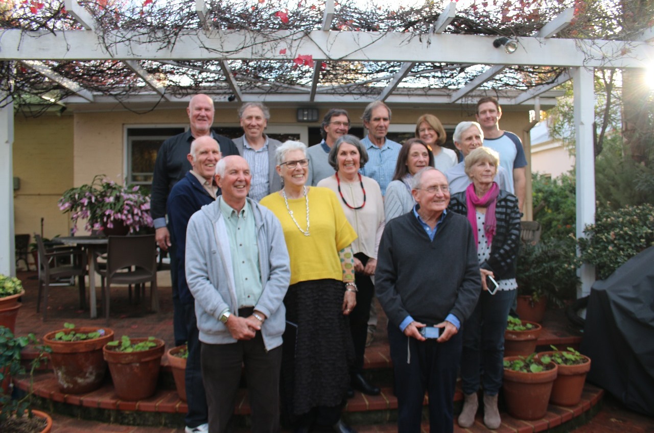
After a long leisurely afternoon tea, we set off back up to Cottesloe for afternoon tea with Trish and Errol. Errol hadn't had much time to talk to us at the family gathering so we decided on a couple of hours at a café on the beachfront. By the time we arrived, the weather had changed to torrential driving rain, so we sat in the café overlooking the ocean and discussed the life and times of all our 7 children and grandchildren.

Back home we packed for our departure for Broome.

Batavia's HistoryVoyage The VOC's flagship Batavia (VOC Chamber Amsterdam) left Texel, Holland on her maiden voyage to the East Indies. She sailed under the command of Francisco Pelsaert - one of the VOC's most experienced merchants - in a fleet of seven ships. The main cargo consisted of silver coins and two antiquities belonging to the artist Rubens for sale to an Indian Mogul ruler, but it also carried pre-fabricated sandstone blocks for a portico to be erected as gatehouse in the city of Batavia. This was the new headquarters of the VOC in the East Indies situated in the north-western tip of Java.Officially, there were 341 people on board, but a few last-minute desertions were noted, as was relatively common at the time.

Of those who actually embarked, slightly more than two-thirds were the officers and men sailing the vessel. The remaining number was made up of about a hundred soldiers and, by far the smallest group, civilian passengers who were going, or returning to the Indies. Some of these passengers were women and children, either wives of Company employees or servants.

The journey had an inauspicious start with a violent storm on the North Sea separating most of the ships in the convoy. When calmer weather returned only three of the seven ships had sight of each other; Batavia, Assendelft and the Buren.Their voyage progressed well and they reached the Cape of Good Hope a month ahead of schedule. While there, it became clear that there was not much love lost between Pelsaert and the ship’s captain Adrian Jacobsz, whose drunken behaviour extracted a very public scolding from Pelsaert. This was to sow the seeds of disaster.

From Cape Town, the three ships were to “progress eastwards between 36° south and 39° south to 3,500 miles, then steer north-east until 30° latitude south, and you sight Eendracht’s land before sailing on to Java”. However, shortly after leaving Cape Town the ships lost sight of each other and the Batavia was alone.During the Indian Ocean crossing Pelsaert fell seriously ill and remained mostly in his cabin. This had a detrimental effect on the ship’s discipline. Then under merchant Jeronimus Cornelisz, the third most important person on board, was on much better terms with captain Jacobsz, rather then Pelsaert, whose absence brought out the worst in both.Cornelisz was a curious character in that he was the follower of the –at the time- much maligned philosophy of the painter Torrentius. “All religions restrict pleasure. In doing so they are contrary to the will of God, who put us on earth that we might, during our brief existence, enjoy without hindrance everything that might give us pleasure.”

This was not a popular view in 17th Century Holland and Torrentius was tortured for his trouble and exiled to England.The potent mix of many men and few women without the firm hand of control then lead to a very ugly incident. The 27 year old Lucretia van den Mylen was on her way to her husband in Batavia. Her social standing meant that she had her own alcove and was accompanied by her maid. Captain Jacobsz resented her, since she had spurned his advances.In mid-ocean Lady van den Mylen was assaulted by masked men who proceeded to, “hang overboard by her feet the Lady van den Mylen and indecently maltreat her body”. She later claimed to have recognised the voice of Jan Evertsz, a man devoted to the captain.

It has been argued that the incident was all part of a grand design to provoke Pelsaert into punishing the culprits, which in turn would be the trigger for the mutiny. It is, however, unclear if the events were that well planned (there was after all a lot of money on board, and that could have provided a motive).

FOURTH of JUNE, being Monday morning, on the 2 day of Whitsuntide, with a clear full moon (2) about 2 hours before daybreak during the watch of the skipper (Ariaen Jacobsz), I was lying in my bunk feeling ill and felt suddenly, with a rough terrible movement, the bumping of the ship's rudder, and immediately after that I felt the ship held up in her course against the rocks, so that I fell out of my bunk. Whereon I ran up and discovered that all the sails were in Top, the wind South west, that during the night the course had been north east by North, and that lay right in the middle of a thick spray. Round the ship there was only a little surf, but shortly after that heard the Sea breaking hard round about. I said, "Skipper, what have you done that through your reckless carelessness you have run this noose round our necks?" (from Pelsaert’s Journal)

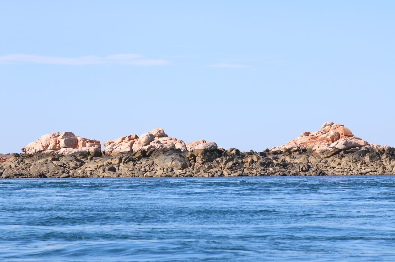
On the morning of the fourth of June 1629, the Batavia was wrecked on Morning Reef, on the Houtman Abrolhos (Lat. 28º 29.422S, Long. 113 º 47.603E), off the coast of Western Australia. She was the first of the Dutch ships lost off the west coast of Australia. The shipwreck was a prelude to an extraordinary tragedy.Immediately following, 180 persons – among them 30 women and children – were ferried off the ship, while some 70 odd men remained, including Jeronimus Cornelisz, the undermerchant.

The survivors landed on Beacon Island. Commander Pelsaert, Captain Jakobsz and some 40 men made camp on Traitor’s Island. They had rescued some ship’s provisions, barrels of biscuit and some water. That, however, was not going to sustain them for long, since there was no fresh water on these ‘coral shallows’.”At last, after having discussed it very well and weighed up that there was no hope of getting water out of the ship unless the ship should fall to pieces and it [water in barrels] should so float to land, or that there should be a good daily rain with which we could quench our thirst (but as these were all very uncertain means), resolved after long debating, as appears out of the resolution, that we should go in search of water on the islands most nearby or on the continent [vaste landt ] to keep them and us alive, and if we could find no water, that we should then sail with the boat without delay to Batavia, with God's grace there to relate our sad, unheard of, disastrous happening.” (Pelsaert’s Journal)Thus, Commander Pelsaert, all the senior officers (except Jeronimus Cornelisz, who was still on the wreck), some crew and passengers, 48 in all, deserted the 268 on two waterless islands, whilst they went in search of water. Quickly abandoning this fruitless search on the mainland coast, they then made their way to Batavia, to obtain help.

They took, in all, 33 days to get there. On arrival in Batavia, the ship Batavia’s high boatswain was executed, on Commander Pelsaert's indictment, for outrageous behaviour before the loss of the ship. Skipper Jacobsz was arrested, again on Pelsaert's word, for negligence.Governor General Coen dispatched Pelsaert seven days later in the jacht Sardam to effect a rescue of the survivors. With extraordinary bad luck, it took 63 days to find the wreck site, almost double the time it took the ship's boat to get to Batavia.

In the days following Commander Pelsaert’s departure the Batavia broke up completely drowning 40 men with her. Those who survived, which included Jeronimus Cornelisz, made it by flotsam and jetsam to the coral shallows of Beacon and Traitor islands.The departure of the Commander in their hour of need – or so they perceived it – had left all survivors bitter and distressed. It was therefore not too difficult for Cornelisz to hand pick 40 or so men with as little scruples as he had and assert himself over them. He had his sight set to seize any relief ship that might appear and take off with it. If that failed, to spend his remaining life according to Torrentius’ philosophy of seeking sensual pleasures.

In order to eliminate any opposition to his desires, he had to eliminate all remaining survivors and set out systematically to do just that. Firstly, he sent a party of cabin boys, men and women, about 45 in number, to Seals Island (Long Island) on the claim that there was water there (which there was not). He was not expecting them to survive.Then he instructed a group of soldiers under the command of Wiebbe Hayes to explore the ‘high islands’ that could be seen on the horizon.

Before they left, he confiscated their arms. He did not expect them to return. After all, that was the direction to which Pelsaert had gone and he had not returned.Next he drowned a good many by sending them out in boats on useless errands, where his accomplices would push them overboard. Having thus eliminated much potential opposition, Cornelisz set about organising the rest to be murdered, including the women and children, starting with the ill and infirm.

A few of the women were kept alive, for obvious reasons. This included, not surprisingly, Lucretia van der Mylen whom he took for himself. Noticing that the group he sent off to Seal Island lived longer than expected (they could see them wandering on the beach) he dispatched his henchmen to get rid of them, which they duly did. The predicant, Gijsbert Bastiaenz, was witness to all these horrible deeds without the courage or power to intervene. He himself lost his wife and all his children in the massacre save his eldest daughter who was coveted by Conrad van Huyssen, one of Cornelisz' conspirators.

Bastiaenz was one of the few to survive and he described his ordeal in a letter that survived.Then a smoke signal was received from one of the ‘high islands’, or Cats Island (now known as West Wallibi Island). Clearly Wiebbe Hayes and his soldiers had found water. This complicated matters greatly for Cornelisz. Firstly it meant they had a means to survive. Secondly, he was in danger of them warning any rescue ship approaching.After a failed attempt to persuade Hayes and his men to join forces (they had been forewarned by some Seal Island survivors) Cornelisz sent an attack force to eliminate them. After all, Hayes and his men did not have any weapons.

When his men returned defeated the furious Cornelisz took matters in his own hand, travelling to Cats Island to use his powers of persuasion to lure the men into a deadly trap.This is where he met the end of his gruesome reign. He and 5 of his men were overpowered and tied up.t Cornelisz was kept alive, but his companions were duly executed. It was at this point that rescue appeared on the horizon.

On 17 do. in the morning, with daybreak, lifted our anchor again, the wind North; were then about 2 miles from the High island, ran towards that for . (45) - Before noon, approaching the island, we saw smoke on a long island 2 miles West of the Wreck, also on another small island close by the Wreck, about which we were all very glad, hoping to find great numbers, or rather all people, alive. - Therefore, as soon as the anchor was dropped, I sailed with the boat to the highest island, which was nearest, taking with me a barrel of water, ditto bread, and a keg of wine; coming there, I saw no one, at which we wondered. I sprang ashore, and at the same time we saw a very small yawl with four Men rowing round the Northerly point; one of them, named Wiebbe Hayes, sprang ashore and ran towards me, calling from afar, ‘Welcome, but go back aboard immediately, for there is a party of scoundrels on the islands near the wreck, with two sloops, who have the intention to seize the Yacht.’ (from Pelsaert’s Journal)Wiebbe Hayes further explained what had happened and that he was holding Cornelisz as prisoner.

Pelsaert duly captured the remaining mutineers when they tried to board the Sardam. When they came over, we immediately took them prisoner, and we forthwith began to examine them, especially a certain Jan Hendricxsz from Bremen , (49), soldier, who immediately confessed that he had murdered and helped to murder 17 to 20 people, under the order of Jeronimus. I asked him the origin and circumstances of this, why had they practiced such cruelties. Said the he also wished to explain how it had been with him in the beginning, - saying, that the skipper [Ariaen Jacobsz] Jeronimus Cornelisz, the Highboatswain [Jan Evertsz] and still more others, had it in mind to seize the ship Batavia before it was wrecked; to kill the Commandeur [Pelsaert] and all people except 120 towards whom they were more favourably inclined, and to throw the dead overboard into the sea and then to go pirating with the ship. (from Pelsaert’s Journal)

questioning Cornelisz, who blamed everyone but himself for all the vile deeds, Pelsaert set out to capture the final mutineers on ‘Batavia’s Graveyard'. When they saw the Commandant, they lay down their arms and capitulated on the spot.In the evening I ordered the principal scoundrels and other accomplices whom I had bound here on the island, to be taken to Seals Island, from whence one could get them at an appropriate time if one wanted to examine them, so that in the meantime we would have more security. (from Pelsaert’s Journal)Pelsaert interrogated the mutineers and discovered all that had happened.

Among the litany of crimes the mutineers had committed was not only the murder of many people and the rape of women, but also the looting of VOC property and valuables belonging to passengers and crew alike. The various letters and agreements that Cornelisz had drafted and the mutineers had undersigned also implicating them in treason and treachery.JERONIMUS CORNELISZ, of Haarlem, Apothecary, and late under Merchant of the ship Batavia, on Monday, being the first of October, as he has requested to be baptised, [shall be taken] to Seals Island, to a place made ready for it in order to exercise Justice, and there firstly to cut off both his hands, and after shall be punished on the Gallows with the Cord till Death shall follow, with confiscation of all his money, gold, Silver, monthly wages, and all claims which here in India he may have against the profits of the Gen. East India Company, our Lord Masters.(Pelsaert’s Journal)

Following the confession of their crimes, the condemned mutineers were sentenced to their right hand cut off and in the case of Cornelisz both hands, prior to being put to death on the gallows. Seals Island was the place designated for the execution and this was carried out on 2 October 1629. Two men were left behind as punishment, while it was decided that some of the lesser offenders were to be taken back to Batavia.

Pelsaert, during this whole trial period, had diligently set about recovering the items stolen by the mutineers, as well as the chests of specie and other valuable items from the wreck, using divers from Gujarat.

On 5th December 1629, the Sardam returned to Batavia with the remaining survivors and salvaged cargo of coins and jewels. The lesser offenders, who had been flogged, keelhauled and dropped from the yard arm as punishment on the voyage home, were executed.Later in Batavia Wiebbe Hayes and some of his men were rewarded for resisting the mutineers with a promotion. Hayes was made Sergeant and the others Corporals, carrying a higher wage, of course.In the end, after it was all over and all the mutineers had been executed, out of 316 people aboard the Batavia, only 116 survived. The actual number is complicated because, from the number on board the vessel when it left Holland, some people deserted or died on the voyage, additionally one person was picked up in Sierra Leone and an unknown number of children were born on the voyage or died in the islands.
 
Flying Perth to Broome

Broome, Western Australia

Jun 13, 2016

Much of today was transiting from Fremantle to Perth Airport to Broome airport to Cable Beach.

By the time we landed in Broome in the early afternoon, we decided a taxi across the peninsular to Cable Beach was the best option. I don't know why I hadn't taken more time to plan this holiday. Well I do actually; partly because we had booked a 5 day package with a hotel in Broome and then two trips to bookend that accommodation. That is, two days camping on the Dampier Peninsular, 5 days at the hotel and then 5 days camping on the way to and from the Bungle Bungles. This means one night at the Beaches of Broome hotel, two days and one night away up at Cygnet Bay etc, then one night back at Beaches of Broome, then five nights at The Pearl, then away 5 days and 4 nights in the Kimberley and finally back to the Beaches of Broome for 1 night.

Can you see what's coming? Yup, it will all unfold as the blog progresses. Basically, I've been so distracted by work that I hadn't even looked at a map since making all the bookings last October. So, first discovery, all the major sights and activities are based around Broome itself while over on the other side of the peninsular (a 20 min bus trip) at Cable Beach, most of the hotels are set 100's of metres back from the beach, well spread out have little in the way of cafe's or restaurants. You have to walk a long way to almost everything and there isn't a lot to see when you get there. Had I looked at a map of Broome and just a few basic tourist websites, I would have realised that we would have been better of staying in Broome and just taking the bus across to Cable Beach for the sunset and camel walks .. and perhaps a swim.

Anyhoo!, that discovery was to come three days down the track.

We arrived at Beaches of Broome, checked in, discovered that there wasn't much around so caught the bus back to Broome. The bus runs every half hour roughly from 7.00am to 7.00pm. It follows the same route out and back from Cable Beach to Town Beach passing through the Broome town centre.

Arriving in Broome at 3.00 and all the cafes were closing. We thought we must be back in Italy however the difference is that they don't reopen later in the day in Broome. It's cafe's for Breakfast and Lunch and Bub's /Bar's for B/L/D..

We oriented ourselves to Broome and managed a burrito and toasted sandwich at a local pub that I suspect largely caters for the locals and the desperate tourist like us who left lunch till too late. The beer was cold!!!!!!

In busing back to Cable Beach, we discovered that as seniors, we qualified for half price $2.00 tickets and even 5 tickets for $9.00 ... bonus. The money we saved was subsequently ripped off us when we ventured to the bar adjoining the hotel (only opened for the evening) where it cost us $12.00 for a pint of beer and $24.00 for three 1" square pieced of pork belly. By my calculation, that pig was worth more than its weight in gold.

And that's that for another day.
 
Two Days on the Dampier Peninsular

Dampier Peninsular, Western Australia

Jun 15, 2016


This is a two day entry as we took a tour with 6 other travellers and our guide to the Dampier Peninsular.

On Tuesday we were picked up at 6.50 by Brenton in a 13 seater 4WD. Well 13 if no luggage, however with backpacks chucked around in the back section of the cabin, we were lucky not to be more than 6 travellers. Just up the road from our hotel we turned onto a red dirt road that for 90km rattled almost every nut, bolt, screw and filling loose. That's not to mention the need to have the seatbelt so tightly adjusted so that we weren't launched into the ceiling. It was like driving over corrugated iron and then every now and then launched out of our seats as we left the ground over humps in the road. Ches also likened it to driving in Naples. Brenton drove all over the road, including on the right hand side halfway up the embankment. The road in sections is so deep that I figured that another 100 years will have it the depth of the Grand Canyon.

The red dirt road ends at Beagle Bay where we stopped for morning tea. This aboriginal community has a population of 400, however quite a few are away during the week working in Broome. It has a school and well maintained homes and a stunning white church.

The community was established by Trappist monks around 1890. Beagle Bay has a history of caring for stolen children. In 1884, the first ever priest arrived to serve the Catholics in the Kimberley to try and convert the Aboriginal people. Bishop Matthew Gibney founded the Beagle Bay mission, developed in the land of the Nyul Nyul people; this became a site for the Aboriginal people in 1890.

The first Catholic School was established by the Trappist Fathers at Beagle Bay in 1892. In 1895, the Trappist monks of Sept-Fons in France, extend their missionary work from Beagle Bay to Broome. In 1901, Pallottine Fathers from Germany took over Beagle Bay Mission with two priests and four brothers.

In 1907, the St John of God Sisters began to run a mission school at Beagle Bay and in 1918 the famous church was opened. It features a pearl shell altar which is now a tourist attraction. The Beagle Bay Mission subsequently became home to Indigenous people from across the Kimberley
and further afield.

It was another 130km on from here to Ardyaloon or "One Arm Point", however all on paved roads. During the wet, all communities north of the red dirt road can access each other on bitumen roads ,however they are cut off from Broome.

Where to start describing this amazing place? Leaving the made road briefly, we drove a dirt road with the raging tidal race off to our right and the first of the more than 1,000 islands of the Buccaneer Archipelago in King Sound no more than 3 or 400 meters off shore. The tides are the 2nd highest in the world, reaching up to 11.8 metres and even the lower ones are fast running. Because the tide has to push the water in and out around the 1,000 islands, they are so fast they generate whirl pools in and around all the islands. We missed the highest tides, so didn't see the islands completely submerged and therefore the waterfall effect when the tide drops and the water drains off the islands.

We drove out to the point where the local Bardi people (350 or so) have established a hatchery, restocking the reefs with Trochus shell and breeding fish. They harvest the mature shell and create jewellery etc. We had an excellent tour of around ten tanks and then drove back along the beach to have lunch with Kevin and Donna Ejai and their children and Kevin's elderly mother.

Kevin talked about growing up here and rafting out to his island between tides. Donna about rehabilitating people of the stolen generation and offering them the opportunity to develop a connection to "Country". Lotsa stuff to write about later when I have more time.

We drove on to Cygnet bay and took a boat trip among the islands before dropping us off on a beach where we made camp for the night.

Traditional Owner, Kevin Ejai, was raised on
Jackson Island just off the coast of One Arm Point on the Dampier Peninsula.
Kevin and his partner Donna Edgar have long held ambitions to operate a tourism
business on Jackson Island and with the support of Morrgul are now in the early
stages of negotiating a Joint Venture partnership with Kimberley Wild
Expeditions to setup a semi-permanent eco camp on a small parcel of land on the
Island. All going well, Kevin’s island enterprise will be operational in 2015.
Morrgul is helping Donna and Kevin navigate through the various steps in the
land assembly process of Aboriginal Lands Trust, the Kimberley Land Council,
the Bardi Jawi Prescribed Body Corporate and the Department of Lands.

In the meantime, Morrgul has supported Kevin and Donna to start a small cultural tour business
at One Arm Point, guiding boaties around the swirling currents of the Archipelago whilst providing cultural history and tales of Kevin’s upbringing on the Islands.

Kevin and Donna are still working toward setting up the camp on his island. In the meantime, they have a palm frond shelter built above the beach near the hatchery and joined us for lunch. We shared our food and they cooked damper and chatted to us about their life and local culture
 
Day 2

Dampier Peninsular, Western Australia

Jun 16, 2016


Breakfast on the beach where we had camped overnight. This bay is the next bay around from Cygnet Bay, between the Pearl farm and One Arme Point and the land belongs to Bruce Wiggan.

Bruce Wiggan is a Bardi man born at the mission on Iwany (Sunday Island), off the coast of the Dampier Peninsula, 200km north of Broome, Western Australia. As a senior man of the Bardi tribe that come from the tip of the Dampier Peninsula, Bruce shares custodianship of many of the sacred and ceremonial stories associated with the Bardi people and their ocean culture. Bruce is also an artist and pearl shell carver.

Highly prized as ornaments and ceremonial objects, goowarn (pearl shells) were exchanged along a vast system of inland trade routes that stretched from the Kimberley region in north Western Australia to central and southern Australia. Only Aboriginal men from the Kimberley region who were initiated to the highest degree wore decorated pearl shell, or Riji, during ceremonies. These shell were incised with sacred patterns which could be tribal insignia or have other meanings or stories to tell or pass on. Riji were associated with water, spiritual powers and healing due to the luminous shimmering quality of their surfaces.

Contemporary Aboriginal artists such as Bruce Wiggan continue to maintain cultural customs by engraving geometric or figurative designs on prepared goowarn, followed by a mixture of ochre or charcoal and resin or fat, which is rubbed into the grooves. Bruce feels that is is his role to continue and pass down the art of traditional pearl shell carving and the knowledge of ceremonial culture and traditions that goes with this. Through his art he also feels that he is able to pass on his own family stories in a contemporary style.

Bruce now lives in the One Arm Point Community on the Dampier Peninsula and continues to develop his skills as an artist and to pass on his cultural knowledge to younger members of the community. Bruce also works as a cultural guide for tourists travelling to the Dampier Peninsula, and spends as much time as possible along the coast and among the islands of the Buccaneer Archipelago – the sea country of the Bardi Jawi people.

After breakfast, the boat arrived to collect us. As it approached the shore, they cut the motor, started the second motor and the wheels descended to drive up on the sand for us to board. Then drove back into the water, raised the wheels, lowered the outboard and we were back to the Cygnet Bay Pearl Farm where Ches bought a Pearl for her charm bracelet.

Drove over to Cape Leveque (Kooljaman) for a swim and lunch. Amazing azure sea, white sand and red cliffs and rocks.

Drove home finishing with the 90km of red dirt road to wake you up.
 

How to Find Information

Search using the search button in the upper right. Search all forums or current forum by keyword or member. Advanced search gives you more options.

Filter forum threads using the filter pulldown above the threads. Filter by prefix, member, date. Or click on a thread title prefix to see all threads with that prefix.

Sponsors

Booking.com Hotels in Europe
AutoEurope.com Car Rentals

Recommended Guides, Apps and Books

52 Things to See and Do in Basilicata by Valerie Fortney
Italian Food & Life Rules by Ann Reavis
Italian Food Decoder App by Dana Facaros, Michael Pauls
French Food Decoder App by Dana Facaros, Michael Pauls
She Left No Note, Lake Iseo Italy Mystery 1 by J L Crellina

Share this page

Back
Top