• CONTACT US if you have any problems registering for the forums.

South West Cornwall 2019

Galgano

100+ Posts
January 2nd

After a very full week between Christmas and New Years Eve in London, we returned to Southampton on New Years day and than on the following day, headed off toward Cornwall. This was a Wednesday, and as our cottage in Mousehole wasn’t going to be available until the Thursday, we decided to break the journey in half, and stay in Exeter on the Wednesday night.

Drew and Keith drove in their car and we in a rental; a 6 gear manual Vauxhall Astra Turbo’ with just 700 miles on the clock. It was brilliant throughout the three weeks.

Drew had lost his favourite hat, so decided that as we would pass through Bridport where he had bought it, we would stop for morning tea, then on to Lyme Regis for lunch and Exeter for the night.

T. Snook Hatters and Outfitters isn’t just any old hat shop. It’s such an institution that since 2012, they now have an annual Hat Festival, that attracts some 9,000 people. https://www.dorsetlife.co.uk/2013/09/bridport-hat-festival/

I don’t know that it will be attracting Drew. Despite have phoned ahead to determine they would be open and that he was looking to replace a lost favourite, he arrived to find they were closing for lunch.

It was market day so parking was difficult to find and the café we had arranged as a meeting place was changed by text message without a clear direction to the alternative. I spat my dummy (pacifier).

The least said, the better. Then again. I had been looking forward to sharing Lyme Regis with Drew and Keith, however the decision was made that as they had just eaten in Bridport, while we had not, so we would just go on to Exeter where I had booked an Airbnb.

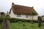
The reality. They went to Lyme Regis while we arrived in Exeter an hour or so ahead of them. In a foul mood and Ches upset, we passed through Chideock. I guess most people just pass through Chideock. It’s a main road, and consequently the traffic is never ending and fairly heavy. If you like thatched cottages, then this is a town that is thatch from end to end, however most is on this main road and unless you can find a way to turn off and park, there won’t be any opportunity to photograph them. It probably explains why there are so few images on the internet.

The other point of interest is that this is a town that is still predominantly Catholic and always was. Consequently, it didn’t; fair too well under Henry V111 and then the Civil War. https://en.wikipedia.org/wiki/Chideock

Ches was so upset, she didn’t even register the town as we drove through.

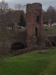
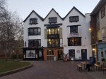
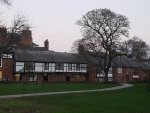
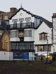
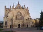
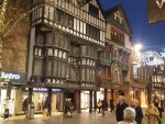
Our Airbnb was across the river from the center of town however close enough to walk to the Cathedral in around 15 minutes. With limited daylight left, once Drew and Keith arrived, we walked into town where Ches and Keith entered the Cathedral while I walked around the precinct and photographed as the light dwindled.

At the time, I didn’t appreciate that all the hording and scaffolding in the top corner of the Cathedral Green was the remains of the Royal Clarence Hotel. England’s oldest hotel had burned down in 2016 and restoration isn’t progressing too well. We were only told about what had and is happening by locals when we revisited some weeks later.

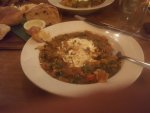
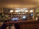
After some “retail therapy” in shops on the main street that were closing down, we set off in search of our pub/brewery for dinner. We were keeping our “pig” theme going. The “Fat Pig” is a micro brewery pub and I guess after a “trying’ day, it just didn’t make a significant impression. The barman was indifferent, there were only a couple of people in the bar and we were tired. The “Spiced winter vegetable and red lentil stew, crème fraiche & crusty bread - £15” was excellent, however I can’t remember much about the beers.

We were back at our Airbnb by 9:15. A two bedroom apartment just across the river where parking was easier than in the heart of the town. Our hostess had moved in with her boyfriend for the night, and left the heaters on and a very old building with a comfortable flat that we’d stay in again.
20190102_234940.jpgChideock.jpg20190103_000336.jpg20190103_023649.jpg20190103_031717.jpg20190103_032438.jpg20190103_032807.jpg20190103_032934.jpg20190103_033442.jpg20190103_035632.jpg20190103_055754.jpg20190103_074124.jpg20190103_074836.jpg
 
Last edited:
January 3rd 2019

As usual, my family are slow morning starters whereas I’m up at 6.00am summer or winter. It took me till 10.00 to get them on the road. As the road passes through Looe, we stopped briefly to photograph the river in town however still haven’t ventured to the harbor … maybe next trip.

We stayed in Polpero for several nights some 36 years ago and I was determined to return (as was Ches). While the old town hasn’t changed at all, the top end has significantly. There is now a massive car park as there is no entry into town. We remembered seeing a butcher delivering carcasses back then. He had to park with his door beside a shop door, exit the car into the shop, open a door to the shop around 3m back and then load the meat from the boot of his car (Mini Minor) into the shop.

Being mid-winter, it was much more quiet than last time (Easter). Many of the shops are closed for winter, however I managed to find a clothing shop. The inevitable happened. I now own a new heavy cotton jumper.

A shop that no longer exists is the one that used to sell Cornish Chunky jumpers. The ones worn by fishermen. Drew had loved the one we bought him here when he was just 14yo and we wanted to buy him one now for his upcoming 45th birthday at the end of January.

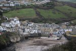
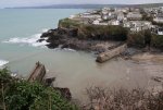
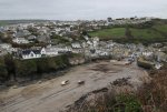
Most of the time we just wandered the streets around the harbor, photographing what could be the prettiest little fishing port in Devon. Both sides of the harbor are very steep and lined with white painted cottages right down to the walls of the harbor.

"In the late 18th century when Britain's wars with America and France precipitated the high taxation of many imported goods, making it worthwhile for the local fishermen to boost their income by the covert importation of spirits, tobacco and other goods from Guernsey and elsewhere. By the late 18th century, much of the success of the smuggling trade through Polperro was controlled by Zephaniah Job (1749–1822), a local merchant who became known as the 'Smugglers' Banker'. A more organised Coast Guard service was introduced in the 19th century together with the deterrent of stiff penalties, leading to much less smuggling." The narrow streets, in fact the entire village around the harbour just has that "smugglers" atmosphere.

Another interesting thing about Polperro is that like many fishing villages around the Cornish and Devon coasts the harbour walls haven't always been as safe and secure as they look today. In the course of the next two weeks, we discovered that many had suffered damage in storms.

In the case of Polperro, the original harbour walls were built closer to inner harbour than now. They were destroyed in a storm and a new wall build around where the walls are now. They in turn were badly damaged in 1774, repaired, and in 1817, thirty large boats, two seiners and many smaller boats were destroyed with many parts of the village including the Green and Peak Rock were consumed by the sea waters and a number of houses were swept away. The damage was estimated at £2,000 but no lives were lost. This storm, with hurricane-force winds, caused damage to property from Plymouth to Land's End; the fishing boats at Polperro ″shared in the common calamity and exposed the unhappy sufferers to distress from which the industry of years can scarcely be expected to relieve them″. In November 1824 the worst ever storm occurred: three houses were destroyed, the whole of one pier and half the other were swept away and nearly 50 boats in the harbour were dashed to pieces. Of the six boats that survived, only one of which was a Gaffer. Polperro's new pier was designed to afford better protection for the future. The East Indiaman Albemarle was blown ashore with a valuable cargo of diamonds, coffee, pepper, silk and indigo on 9 December 1708 near Polperro (the precise location of the wreck is yet to be discovered).

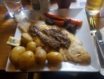
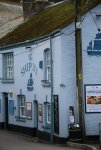
To cap off the experience, we headed to The Blue Peter for lunch. We found a table in the main bar, which was full, and the atmosphere was as good as 36 years ago. There was a warming fire, warm barmaid and great seafood. In fact, my Megrim Sole was among one of the best seafood meals I have ever experienced. Keith also had it, and was put off by the many small bones. I patiently lifted the flesh from the spine and the meat was amazingly sweet. The is not a fish to drown in sauces, however with lemon and capers was wonderful. The fish itself is exceedingly ugly, and the Cornish question if even it’s mother likes it.

As we were due to collect the keys for our rental cottage in Mousehole, from an industrial estate near St Ives, we had to leave at 2.30. I could have sat by the harbor all afternoon … as I did for several days 36 years ago.

Thank god we didn’t. Us southern hemespherers aren’t used to daylight that extends from 9.00am to 4.00pm. Dark and cold, we at least had satnav. Well, satnav that didn’t know the area much better than we did. She took us on a journey inland to Mousehole via narrow one car width lanes and dumped us out in the middle of town. Our cottage was on the edge, or at least, access to it was from the east where there is a very large “pay” carpark.

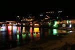
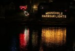
The car park was full and we had to wait for a spot to open up before we could unpack and settle into Coastguard Cottage which was down Coastguard Row (lane around 1 yard wide). Mousehole is always a major tourist attraction and even though it was winter, it was the last week of the school holidays and the last week of the Christmas lights in Mousehole harbor. It would seem that half the population of Cornwall were here to see the lights. The car park was L9.00 ($AUD16.00). Worse still, you could only pay with 1 or 2 pound coins. And the shopkeepers were reluctant to make change. At that rate for 10 days, I was starting to fume! Why hadn’t we been advised? I needed a beer or two or three.

Just to get this whole issue out of the way, what we resolved over the next couple of days was that we could occasionally find a parking spot within the harbor in the council owned car park for L3.00 per day. Better still, most days (once the Christmas lights finished on the Saturday night), we could park on the main road from Mousehole to Penzance for free. As for summer …. I wouldn’t even try.

We repaired to the Coastguard Hotel for that beer, before having a light dinner of toasted sandwiches and the Scones, Jam and Clotted Cream left for us by our hosts. Such a welcoming touch.

Our cottage was very small however beautifully appointed with a great kitchen. The stairs up to the bedrooms were so steep and narrow that we found it best to go on hands and feet, both up and down (backward), the same as I do on the ships and boats, when volunteering at the National Maritime Museum in Sydney.

20190104_004147.jpgIMG_6727.JPGIMG_6739.JPGIMG_6745.JPGIMG_6747.JPGIMG_6755.JPGIMG_6758.JPGIMG_6765.JPGIMG_6736.JPGIMG_6738.JPGIMG_6770.JPGIMG_6799.JPGIMG_6802.JPGIMG_6809.JPGIMG_6834.JPG
 
Last edited:
January 4th 2019

After a big week in London and the two days driving to Mousehole, I faced a mutiny. No one wanted to do much. Drew’s leg still required him to wear the boot when not driving, so he took it easy. Ches wandered the town and established that the majority of the shops would only open late afternoon, just before the Christmas lights would be switched on at 5.00pm. Keith decided to go for a run and I to walk the town and photograph everything and anything. I’m undiscriminating.

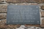
On the wall of one of the “pubs” was a plaque, in memory of the Landlord, Charles Greenhaugh. St Austell Brewery is the main brewer in Cornwall and they had placed this plaque after his death in 1981. He was one of eight local Mousehole men who died attempting to rescue people off a stricken ship off the coast from Lands End. The lost crew of the Solomon Browne: Trevelyan Richards (56) (Coxswain), James Stephen Madron (35) (2nd Coxswain/Mechanic), Nigel Brockman (43) (Asst Mechanic, fisherman), John Blewett (43) (Emergency Mechanic, telephone engineer), Kevin Smith (23), Barrie Torrie (33) (fisherman), Charles Greenhaugh (46) (landlord of Ship Inn, Mousehole), Gary Wallis (23)

To me, what was the worst thing about all these men losing their lives is that it was so unnecessary. The ship they went to the aid of was brand new and being skippered by a guy who had his wife, two teenage daughters and a crew of 4 on board. The engines stalled and they were being blown toward the rocky shore. A tug boat was near by and offered assistance. The captain rejected it because the owners would have had to pay a fee. By the time they were about to be wrecked, the Mousehole lifeboat arrived and rescued four people and returned for the other four only to lose their lives. I hope it was the captain’s wife and children who were rescued but couldn’t care less about him.

Between the hours of 8.00 and 9.00 pm on the 19th December, the Mousehole Christmas lights are switched off in memory of them.

The link tells the full story. https://www.cornwalls.co.uk/Mousehole/penlee_lifeboat.htm

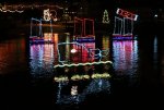
The Christmas lights are regarded as the best in Cornwall. “Each December for over 40 years the village becomes an illuminated spectacle with lights not only on the cottages and quayside, but in the harbour, on the hillside and a cross atop St Clement's Isle in the bay.

These lights take many weird and wonderful forms along with the usual festive symbols. To list but a few there is whale and serpent in the harbour and an enormous Merry Christmas / Happy New Year sign on the hillside which measures nearly 150ft. Throughout the harbourside there are coloured lanterns suspended and everyone gets involved.

The operation itself is mammoth, particularly when you consider it is run entirely by volunteers from the local community. Preparations begin as early as September with the team of around 30 spending in the region of 2,000 hours setting up and testing every one of the nearly 10,000 bulbs.
Such an undertaking requires some money and the Harbour Lights Committee can be seen shaking a bucket here and there for donations to fund next years lights.

The switching on of the Christmas lights is an event in its own right with a brass band and choir (usually Mousehole Male Voice Choir) providing a soundtrack to the proceedings. The ceremony takes place in mid December and is extremely popular”

Another event on the Mousehole Christmas calendar is Tom Bawcock's Eve on the 23rd of December. It is said that the residents of the village were starved of fish because of a stormy winter and that eventually fisherman Tom Bawcock set out into the huge waves. Tom returned with 7 types of fish and the village was saved. From then on, in his honour, Starry Gazey pie has been cooked and eaten on the day.

This lead to the writing of the children’s book “The Mousehole Cat” in which Tom’s cat accompanies him on his voyage to save the village. Now I find this to be a great way to remember the event, but I’m not so sure about “Starry Gazey” or “Star Gazy” pie. The thought of fish heads staring up at me out of the top of the pie isn’t a good one. In fact, I've resisted the urge to post a photograph as it is too disturbing.

I selected this recipe because it seems to come closest to the original available ingredients. I guess you could add other types of fish into the filling so it is in keeping with 7 types of fish he caught and baked into the pie.

Shortcrust pastry made with 10 oz plain flour
8 pilchards, sardines or small herrings
Salt, pepper
1 large chopped onion
Approx. 3 tablespoons chopped parsley
3 hard-bailed eggs
3 rashers streaky bacon
Beaten egg to glaze


Roll out pastry for double-crust plate pie. Cover the plate.
Brush the rim with water and roll out another piece for the lid. Keep it aside.
Preheat the oven to gas 6, 200C (400F)
Clean and bone the fish, leaving their heads in place. Season inside and stuff with finely chopped onion and parsley.
Fold back into shape.
Lay the fish on the pasty like the spokes of a wheel with their heads on the rim so that they can gaze upwards.
Fill the gaps in between with chopped bacon and hard boiled eggs.
Put the pastry lid in place, pressing dawn between the fish heads so that it meets the pasty of the lower rim, making a wavy effect. Brush with beaten egg.
Bake for 30 minutes, though if the fish are on the large side be prepared to give them
15 minutes more at the reduced heat of gas 4, 180C (350F).
Serve hot.

Recipe supplied by Felicity Sylvester, Appledore Festival.

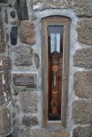
Also on a wall near the “pub” is a barometer and plaque. Admiral Fitzroy, the founder of the Meteorological Office leant the barometer to Mousehole. He required them to provide date to his office to warn of pending bad weather. It also meant the local fishermen had a warning system as well. It was finally gifted to the town in 2009.

There weren't many shops open, however the cafe fronting the harbour appears to be the one that stays open all year round. The Hole Foods Deli and Cafe was patronised by locals and tourists and we continued our search for the "best" Pastie in Cornwall by having lunch there. It was also the beginning of my substitution of coffee with rich dark hot chocolate. In winter, we discovered that if we could get the table in the front window, we had a great view of the harbour, the passing parade and the warmth of the sun.

By 3.00pm, we all headed off to Penzance, as much to buy provisions as to see the town. After all, 3.00 pm would only give us a bare hour before dark set in.

If you drive along the coast road from Mousehole toward Penzance, you also pass through Newlyn, so that we gained the impression that the two almost blend into one. While Penzance has a town center, Newlyn is just a big fishing harbor. In Cornish it is known as “Lulyn”. “Lu”- fleet and “Lyn” – pool. So, a large pool of water big enough to hold a fleet. I don’t think we say a bigger fishing fleet anywhere in Cornwall or Devon. I just checked on the internet and wasn’t surprised to find it’s the largest in the UK.

Mounts Bay (hence St Michaels Mount) is such a large body of water that it is largely protected from major storms, hence it’s growth into such a major port. There have only been two major events in its long history. In 1595, it along with Penzance and Mousehole were destroyed by a Spanish raid and in 1755, the Lisbon earthquake sent a tsunami that created a wave 10 feet high in ten minutes, and that caused damage and major loss of life all along the coast.

As for Friday afternoon, it was pretty quiet. We parked on the promenade and walked up into the town of Penzance … not a pirate in sight. In 1879 when G&S wrote their operetta, Penzance was a peaceful resort town, so thought to be amusing that it be the home of Pirates.

The search for a “Cornish Chunky” had now become serious. Every town we entered would be scoured from end to end for mensware shops that might stock them. We had parked on the far eastern end of Western Promenade Road, which as the name suggests, is flanked on the seaward side by a wide promenade. One of the few places in Cornwall we visited that didn’t have pay parking. All by chance, we crossed the road and found ourselves in Under Chapel Yard (a street) which curved around up the hill and became Chapel St. which leads right up into town to the Causewayhead shopping mall.

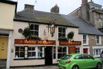
The first really interesting building we came across was The Turks Head bar/inn. The Turks Head is reputed to date from 1233 when, during the crusades, the Turks invaded Penzance, from Jerusalem. At that time the Turks were excommunicated by Pope Calixtus.

It was the first Inn, in England, to be named ‘The Turks Head’, others adopting the name in future times. Alterations were made during the 16th Century when part of the building was burnt down during the Spanish Invasion. The original building had a courtyard at the front (this is now the main bar).

During the 17th Century, the old cellar, which is now the dining room, was used by naval ratings. There was a smugglers tunnel leading directly to the harbour. The tunnel is still under the property and can be found to the right of the building, the whole of which used to be part of the Turks Head. The tunnel came in to the diner then up a shaft, arriving to the right of what is now the main bar, and then on to the first floor, where priests were hidden in the ‘Priest Holes’. These are still in existence. The second floor was a fisherman’s loft, with two large net doors leading onto the original courtyard. At the rear of the building there used to be both a Band Hall and a Cell for locking up drunks and undesirables.

We continued to cross and re-cross the street checking out every mensware store and now added Ches’s search for a coat/cape/top that she had seen worn by someone in Australia. Not really a coat or shawl and yet a vest perhaps, with sleeves that are split on the inside, so they kind hand around the arms, like a cloak would … get the idea? No, I struggled as well and yet continued to draw her attention to anything that looked like a cloak, shawl … whatever!

We also remained conscious of the fact that we needed to by food to take home for dinner. OK, we didn’t find any clothing but did find a great butcher on Chapel St and a Fruit and Veg shop on the mall. We bought a Cornish Chicken and bacon to drape over while roasting. So, what’s in a name? Cornish Chicken in Cornwall sounds unique however as a breed, the Cornish Chicken is the most popular chicken world wide, simply because it produces the most meat per bird. In the U.S., it was originally known as The India Game, then The Game and now Cornish. All because of perceived marketing strategies. In Australia it’s still the India Game. Nothing to do with “India”.

Whatever, our roasted chicken was a hit but the bacon even more so … but I won’t be diverted into a study of Cornish pigs.

We walked back to the car via Dock Lane, which surprisingly leads down to a Dock. A large Dry Dock where they had a Scilly Ferry in for a refit. The boats that do the run to the Scilly Isles are quite substantial as they cross some of the worst sea in the world.

As we walked from the Dry Dock back to the car, we passed a number of seafood wholesalers and I began to have dreams of eating “Megrim Sole”.

IMG_7049.JPGIMG_7050.JPGIMG_7059.JPGIMG_7076.JPGIMG_7079.JPGIMG_7081.JPGIMG_6994.JPGIMG_6995.JPGIMG_7020.JPGIMG_7022.JPGIMG_7052.JPGIMG_7105.JPGIMG_7106.JPGIMG_6992.JPGIMG_7000.JPG
 
January 5th

Sometimes we go from one extreme to another. After a quiet, slow day yesterday, today we decided that we could take in St Michaels Mount, St Ives, the Minack Theatre and Lands End. This on a day with a bare 7 hours of daylight. To make it even more of a challenge, we didn’t leave Mousehole till 10.00. That gave us 6 hours.

As it eventuated, we never felt rushed and the day was almost endless.

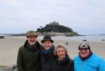
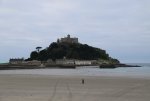
Within 20 minutes we were on the beach at St Michaels Mount. I’d already taken dozens of photographs of the castle, across Mount’s Bay from Mousehole in poor light with a telephoto lens. The light wasn’t a lot better, however the photos more satisfying.

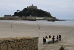
The tide was out, so we were able to walk the paved roadway across the sand flats to the island and castle. Drew in his ”boot” remained with his car. Keith with his long legs strode off into the distance and we meandered. While the castle and gardens are closed for the winter, we probably wouldn’t have wanted to enter any way. We’ve seen the interior of so many castles and grand houses that they all tend to blur together. I prefer the exteriors and their position in nature as better photo ops. I prefer the history and especially the social and bizarre history.

Having read so much more about St Michaels Mount since our visit, I should make an exception and try to return some time as it appears to be quite spectacular and have a fascinating history.

Having researched the ancient history of Australia recently, I am familiar with the change in the environment that came with the ending of the ice age and rising sea levels. It appears that there have been discoveries of flint and arrow heads on St Michaels Mount that date back to 8,000 BCE. Just as Aboriginal Australians have dreaming stories about the creation that align with geological evidence about rising sea levels with the melting of the post ice age, St Michaels Mount’s Cornish name is Karrek Loos yn Koos, meaning "hoar rock in woodland" or "the grey rock in a wood" . It therefore may represent a folk memory of a time before Mount's Bay was flooded, indicating a description of the mount set in woodland. There have even been discoveries of remains of trees under the sand/mud flats after storms.

In planning our trip and having targeted St Michaels Mount, I regularly made the mistake of referring to it as Mt Saint Michaels. Now I understand that there was in deed a connection. Edward the Confessor gave the island to Mt Saint Michaels and they established it as a priory. Some 400 years later, in 1424, it was taken back by Henry V. It seems to have passed from one hand to another at the whim or political strategy of the crown for hundreds of years and the Priory was added too and remodeled into a castle/home. Since 1649, it has been the home of the St Aubyn family and while now managed by the national trust, they still live in the castle, particularly in winter when free of tourists.

Apparently one of the highlights of the castle is the large hall known as the Chevy Chase Room, now used as a dining room. It is lined with an ornate plaster frieze depicting the Chevy Chase. Chevy Chase is a ballad that tells the story of a large hunting party upon a parcel of hunting land (or chase) in the Cheviot Hills (a range of rolling hills straddling the Anglo-Scottish border between Northumberland and the Scottish Borders), hence the term, Chevy Chase. The hunt is led by Percy, the English Earl of Northumberland. The Scottish Earl Douglas had forbidden this hunt and interpreted it as an invasion of Scotland. In response he attacked, causing a bloody battle after which only 110 people survived.

http://www.castlesfortsbattles.co.uk/south_west/st_michaels_mount.html https://en.wikipedia.org/wiki/St_Michael's_Mount https://en.wikipedia.org/wiki/St_Michael's_Mount https://en.wikipedia.org/wiki/The_Ballad_of_Chevy_Chase

We didn't know about the islands light railway, so didn't go looking for it. In the early 1900's, they cut a tunnel from the harbour up to the castle to transport luggage, building materials etc. Basically they cut a deep channel up the mount, laid the track and then roofed over and turfed the tunnel.

We spent around an hour walking the causeway and around the port buildings and gardens. Visiting the bathroom before leaving, we were amazed to find that on closing the door, there was a recorded message advising the sight impaired to “wave your hand in front of your face now”. This activated a recorded message telling the layout of the room and directions to toilets and wash basins. How civilized.

It was then off to St Ives, which was top of the list for Drew and Keith.

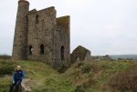
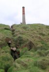
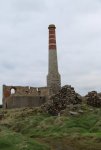
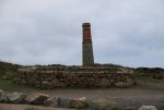
As we drove across the Penwith Peninsular, we stumbled on our first Tin mine. Cripplesease is a small hamlet with the ruins of an engine house of an old tin mine just beside the road and too close not to warrant stopping for the obligatory photograph or so. The name is believed to originate from the 19th century and meaning what it quite literally says, that it is a resting place after the climb up the long hill. There are lots of “cripples eases” required on the peninsular, as we discovered over the next week.

There seems to be some confusion about the mine's name with Wheal Reeth being given by some and Reeth Consols by others. Reeth Consols (Towednack) was also operated as Billia Consols and Durlo. A tin mine extracting cassiterite. In 1864 it employed 155 people. Over 1500 tons of black tin are reported to have been extracted up to 1867, worth £234,000.

On to St Ives. Being the last weekend of the school holidays, the place was packed. I dropped everyone off down near the main shopping street and then parked in the carpark closest to the railway station on the other side of the headland. This is one of the rare carparks where you don’t have to key in your registration number to be printed on your ticket. It means that it is possible to give a partially expired ticket to a new arrival and save them the fee. Didn’t work for us as I’d just purchased a ticket (20 seconds) when offered a ticket with 2 hours still to go. Parking isn’t cheap in the UK.

I joined the others in a café at the beginning of Wharf Road, which is actually a shopping mall. A cream tea which was OK and then the serious shopping began. Drew was successful in finding a Cornish Chunky. Around the 10th shop we tried, and a great range of woolen clothing. Ches also bought a jumper from another shop and numerous gifts for our family and friends at home. We shopped from one end to the other and back again and barely had time to stand on the waterfront and take in the harbor at low tide. On the way back, we participated in the search for the perfect “pasty”. As recorded on Facebook:

“Attempting to judge the best Pasty in Cornwall. Well, maybe just St Ives. Around 100 to choose from. The four of us shared a single Pasty from one shop that defies the CPA and another that claims "voted best Pasty in Cornwall".
In defiance of the CPA (Cornish Pasty Association) Pengenna crimp their Pasty along the top and have in excess of 12% beef which isn't diced fine enough. Pastry superior however it falls apart. Taste was superior.
Cornish Bakery, conforms to CPA standards, flakey pastry and could dispose of crimp when covered in tin dust. Nice peppery flavour from the Swede. Light on meat.
Vote was close.” That was lunch.

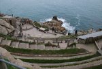
We made it along the narrow coast road to the Minack Theatre by 3.10. They were closing at 4.00 and we spent close to an hour absorbing the atmosphere of a theatre carved out of the granite cliffs above a dazzling deep blue sea.

As the tourism office writes “From above it looks as though some wandering Greeks, two thousand years ago, had carved a theatre into the granite cliffs of Porthcurno, Cornwall. In fact, it was just under eighty years ago that there was nothing there except a sloping gully of gorse and heather and below that, the sea of the Atlantic Ocean.”

Rowena Cade spent 45 years creating this theatre on her land. Maybe that’s why she lived to the age of 90. The following videos capture something of the dramatic and scenic atmosphere of the theatre.

https://video.search.yahoo.com/sear...=99715e867291e6a7d26ffc5907427b70&action=view

https://video.search.yahoo.com/sear...b011246700601c1fc9e827fd79437b52&action=click

All of us were taking photographs and mugging for the cameras. Ches and I were introduced on the stage in a college production back in 1967, so we are used to it. I was as much taken by the dramatic coastline and would love to return one day in summer.

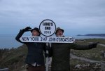
On to Lands End for sunset. Keith was hoping for a spectacular sunset at 4.34pm. It was a whimper, however we again mugged for the camera below the sign pointing across the Atlantic to New York and up to Scotland’s John O’Groats. The highlight was actually meeting Bob and his dog Dylan. Bob was in shorts (4c degrees mind you) and Dylan was wearing a very heavy coat … he’s a Newfoundland. Dylan always wears his coat but Bob only wore trousers three times last winter, on days when it snowed. I don’t know what I was thinking, however I didn’t get a photograph.

We arrived back in Mousehole in time to photograph Mousehole before they switched off the Christmas Lights for the year. We then repaired to the Coastguard Hotel for dinner at their restaurant. Keith and I had the Ray Wings, and struggled with bones or cartilage. What a disappointment. Ches had a white onion soup and Ox Tongue which was “stunning”. This was to be a farewell dinner as Drew and Keith would return to Southampton in the morning.
20190106_010034.jpgIMG_7133.JPGIMG_7136.JPGIMG_7139.JPGIMG_7209.JPGIMG_7216.JPGIMG_7292.JPGIMG_7297.JPGIMG_7303.JPGIMG_7433.JPGIMG_7235.JPGIMG_7256.JPGIMG_7276.JPGIMG_7279.JPGIMG_7286.JPG
 
January 6th

Drew and Keith left just before 10.00 to drive back to Southampton and the beginning of the academic year on Monday.

We pottered around for the morning and eventually went to "The Hole" for a cream tea. Ches had the traditional and I the cheese scone with chili jam and creme fraiche. It worked. So, at 2.00 with not a lot of daylight left, we set off for the tin mines.

This is what I posted at Facebook:

“Nary a Poldark or Pasty in sight. O.K., so it's mid winter and the children are back at school and their parents at work, however that's no excuse for how the tin mines of Cornwall are treated. There are signs directing you to the mines along the coast nearby, however no mention of the most famous of them all; the Botallack Mine. It's the one at the base of the cliffs with shafts and tunnels that run for a mile or so out under the Atlantic Ocean.

We had to ask two locals at different locations to find the narrow road that lead down to the mine. The shop that might sell coffee and Pasty's was closed, however there was a steady stream of maybe 20 people over an hour. Only Ches, I and another guy made the walk down the rocky steep track to the semi-base of the cliff.

Atmospheric. Wonderful!”

This is what really happened:

I read all the Poldark novels back in the 1970’s and some of the TV series in the late 70’s. I enjoyed them at the time but cannot say they loom large in my memory or provided any motivation to seek out the tin mines of the peninsular. I just like old stone buildings such as castles and towers and iron age forts in dramatic locations. What’s not to like about them when they are on the edge of cliffs or built down below cliffs? If you are a “Poldark Tragic” and want to look at the mines etc in relation to the TV series, here’s the best site I have found: https://www.intocornwall.com/features/poldark-trail.asp

The signage for almost all “touristy” places in Cornwall is abysmal. Often there isn’t one and if there is, it’s small, hidden in bushes or behind something.

In the case of the Levant mine, it is signposted but not that clearly. The sign points to a narrow track among cottages and when it becomes a fork, doesn’t indicate which track to take. I guess in summer there might be a steady stream of tourists to follow. In mid winter … not so much.

The most positive thing I can recollect is that from the road along the coast, you can see the clusters of engine houses and smoke stacks, so you at least know where they are, even if they don’t say which mine they are.

Because we were running out of daylight and specifically wanted to see the Botallack mine, we didn’t spend enough time at the Levant. Enough time for me to take a dozen or so photographs, but not enough to appreciate the significance of this site in the summer, tourist season.

“Levant with its working steam operated beam engine is owned by the National Trust and part of the Cornish Mining World Heritage Site.

A famous Cornish mine for having many lodes which extended for more than a mile from the cliffs under the sea Levant is known as a ’submarine’ mine. The constant threat of the sea breaking into the workings was just one of the many hazards that miners faced on a daily basis. The temperature, poor ventilation, difficult access and the sheer back-breaking work of extracting the ore made the miners’ lives very difficult and unpleasant.

Although there is a tendency to ‘glamourize’ and romanticize these activities today, the reality for the people that worked in these mines often meant short lives, work-related illnesses and untimely deaths. Levant Mine suffered one such tragedy in 1919 when its man-engine broke sending 31 men crashing to their deaths. When you visit Levant remember the people who worked here and the sacrifices they made every day in removing that rich copper and tin ore from the rock under your feet.”

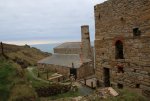
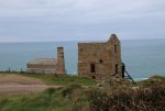
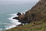
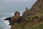
With assistance from a fellow tourist in the car park, we found the Botallack mine perched on the edge of the cliff. There were perhaps 8 or so people wandering around the site however only one guy walked down to the “famous” Crowns engine houses with us. There the ones at the bottom of the cliff. I must have take 100 photographs. Such a dramatic sight (and site), however I never for once thought of it in a “romantic” sense.

On returning home, I have found quite a bit of useful information, and it reinforces my thoughts that while it is scenically beautiful now, it must have been one hell of a place to live and work in the 1800’s through to the early 1900’s. That’s to live and die, and quite a few died dramatically. I’ll post the information at the end of this entry and it will really be worth reading.

Walking down and back up again, I stopped every ten meters of so to photograph. We struggled to find our way back up the final section to the carpark and discovered that all along the ridge there are remnants of buildings and smoke stacks hidden among the scrub and grass.

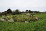
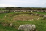
The light had almost gone and yet I had one last site to visit. In St Just, just a few miles down the road is a medieval amphitheater. You won’t be surprised to hear that signage is no existent. Unless you count the very small sign attached to the wall beside the entrance. From the road, the wall just looks like a village wall. Our guidebook (Lonely Planet) described the amphitheater as the site of medieval “mummers” plays and little more. As the following description attests, it was much more interesting than that.

Cheryl was underwhelmed. It’s probably a case of it’s history being more interesting than it’s physical presence today. The light was completely faded by the time we found it, so after a couple of photos, we headed back to Mousehole for the Closure Feast at the Coastguard Hotel. I’ll post the description of the

After paying a small fortune for dinner last night, tonight was L20.00 for a buffet dinner. Basically, everything they had left in the kitchen was cooked and placed out on a central table and it was a bunfight to share in the spoils. We might have been the only ones without dogs under our table, which was OK because we got to share our neighbors 4 dogs. The neighbors were interesting people as well and we enjoyed the evening.

"Situated in the centre of St Just to the west of the present parish church, the mediæval amphitheatre, playing place or plain-an-gwarry is a large circular enclosure retained by a 2 metre high dry stone wall, with two entrances cut into the north and south-east sides. Despite the fact that it almost disappeared in the 19th century, St Just’s plain-an-gwarry survives today as a good example of a rare and distinctively Cornish monument type.

When first recorded by William Borlase in the mid 18th century, the encircling bank stood 7ft high and 10ft high above the external ditch. His plan shows six tiers of stone steps or seats around the edge; although he admitted that the place ‘had been disfigured by injudicious repairs of late years’, and by the time John Swete visited in 1780, the seats were ‘lost to the eye’. In 1836, the Town Council was considering building a market house in the centre of the arena. Due to strong local opposition this did not happen (instead, it was built opposite the church and is now the Wellington Hotel), but dumping of household waste on the site and other misuse remained a notable problem. Eventually in the late 1870s a restoration was undertaken, overseen by local antiquarian WC Borlase. This appears to have involved re-arranging the rubbish to heighten and restore the degraded banks, spreading layers of china clay waste to level and help drain the interior, and re-turfing throughout. As well as a philanthropic venture, it also appears to have been a scheme intended to help the needy, for a newspaper report of the time noted that 'restoring the old amphitheatre…had taken off those who had been hanging about the corners of the town seeking for employment’.

Only two plain-an-gwarries, or playing places, survive in near-complete form today, the other being Piran Round at Perranzabuloe; however historical documentary evidence suggests the existence of many more, their distribution being very much linked to areas where the Cornish language survived in late mediæval times. The circular enclosure would have been used for many purposes including sport and as a local meeting place. It is most commonly known, however, for the performance of local miracle plays in the Cornish language. One documented cycle of three Cornish mystery plays known as the Ordinalia has been revived and performed at St Just in recent years. A 15th century manuscript of the plays survives and is written in Middle Cornish; the three plays, the Origo Mundi, the Passio Domini Nostri and Resurrexio Domini Nostri, would possibly have been performed on consecutive days during local parish festivals by local people and may have been part of an annual Corpus Christi festival associated with Glasney College at Penryn, one of the major centres for Christianity in the County. Designed as a means of teaching the Scriptures to ordinary people they were often noisy, bawdy and entertaining.

Various reports on the St Just plain-an-gwarry in the 19th century indicate that, as an open space at the centre of a busy industrial town, it was by then used for a wide range of activities. It is said that from time immemorial it had been used for cock-fighting, as a hurling-goal, and as a ring for wrestling, but it also provided a venue for travelling theatres, not to mention brush-salesmen! Before restoration, its dilapidated fence also allowed pigs in to root over the surface. Blocks of granite with holes still surviving on one side of the arena are from miners’ drilling competitions. In the 20th century, shrub-planting (another unemployment scheme) and a band-stand were proposed but vetoed and the arena was occasionally used for step-dancing competitions."


Botallack with its abundance of engine houses, calciner, labyrinth and mine chimneys is part of the Cornish Mining World Heritage Site.

The Botallack calciner and labyrinth are relatively modern, being built in 1906. Tin ore would be roasted in a furnace in the calciner building further down the cliff to remove the impurities it contained and the smoke drawn through the labyrinth of tunnels which you can see today. Originally, the labyrinth of tunnels was fully enclosed. The arsenic settled out from the smoke onto the walls of the labyrinth and when the furnaces had been shut down and the tunnels had cooled children and bal maidens (female mine workers) would enter the labyrinth to remove the arsenic with little more than a cloth over their mouth and nose to protect them from inhaling this deadly poison. One teaspoon of arsenic is enough to kill six people. This by product of tin production became a valuable commodity in its own right being used as a pesticide, in sheep dips, pigments and dyes and in glass manufacture. During the 1870s less than six Cornish mines produced half the world’s arsenic.

West Wheal Owles (pronounced ‘Oals’) produced over 8540 tons of black tin and 340 tons of copper between 1837 and 1893. At its peak in 1884 the mine employed 287 people - 105 underground and 182 on the surface. The mine was an amalgamation of several much older mines including Wheal Drea. It was Wheal Drea which proved to be its downfall when in January 1893 the miners broke into what is termed a ‘house of water’, the flooded workings of the former Wheal Drea mine. The huge surge of sea water which flooded into West Wheal Owles trapped more than 30 men. A few managed to escape but 19 miners and one boy were drowned. Their bodies were never recovered. You will see a plaque near the back of the engine house which commemorates those who lost their lives. Their names are: William Davey; William Eddy; James Rowe; William Roberts; John Taylor & Mark Taylor (brothers); James Edwards Trembath and Edward White who drowned on level 65; Thomas Ellis; Peter Dale; James Thomas; James Williams who drowned on level 75; Thomas Allen; John Grose &Thomas Grose (father and son); John Olds; William Stevens Thomas; Charles Hitchens Thomas; Lewis Blewett Wilkins and Edward Williams who died on level 85 of the mine.

Miners worked under one of two systems. In ‘tutwork’ the miners would be paid by the piece, usually by the fathom. Under the ‘tribute’ way of working the miners would agree a price before the work started based on the estimated value of the processed ore. To get the work they would often tender a low price. If the lode was rich and the ore was extracted quickly then it was worthwhile for them but if the lode was poor and it took longer than expected to extract the ore they could easily find themselves making a loss. Mine owners would also charge the miners for sharpening their tools, the cost of ore processing and assaying. Miners bought their candles and blasting powder from the mine shop and to add to their exploitation, the mine owners would often issue them with tokens which could only be used to make purchases at the mine’s own shop.


The following account was kindly provided by Lawrence Holmes of The Botallack Trust, part of the Carn Brea Mining Society:-

The Botallack Trust

The Botallack Trust is part of the Carn Brea Mining Society and was set up primarily to raise funds to restore the marvellous, evocative mining engine houses situated at the Crowns, St Just, Cornwall. In 1981 the Society became concerned at the deterioration of, arguably the most famous mining engine houses in the world, those of the Crowns at Botallack. A small sub committee of four members of the Society was formed and surveys, plans, specifications and costing were prepared for this major restoration project.

A 21 year lease was obtained from the Tregothnan Estate, the owners of the Crowns, and fund raising commenced in late 1981. In 1982 it was decided to form The Botallack Trust to administer the accumulated funds and carry out the restoration work. The Trust was finally declared in April 1984 and obtained charitable status in May 1984.

Over £20,000 was raised from many sources between 1982 and 1984. Largely due to the help of the late MP for Truro, Mr David Penhaligan, it was agreed that the labour was to be provided free of charge by the Manpower Services Commission. The work commenced in July 1984 and was completed in July 1985. The project became the largest privately sponsored mine engine house restoration project in Cornwall ever attempted up to that date, with a total value of work put at over £50,000. Work was only possible with the help of many bodies including the District and County Councils, Department of the Environment, private companies and Trusts and many individuals.

A little known aspect of the Crowns project was to secure the right of public access to the Crowns engine houses and few people realise that the houses were on private land owned by the Tregothnan Estate. The Trust also has the responsibility for maintenance of the houses for the duration of the 21 year lease.

The Botallack Trust is administered by six trustees who are all members of the Carn Brea Mining Society. The current Chairman is Lawrence Holmes. The objects of the Trust are not only to preserve and maintain the Crowns, but also to encourage and promote schemes to advance public education in all matters concerning the mining industry in the South West of England. The Trust, through the Carn Brea Mining Society, has been engaged in several projects in localities from west to mid Cornwall.

These include building restoration, old mine site clearance and preservation of old milling equipment at King Edward Mine near Troon, Camborne. The provision of the memorial plaque at Cargodna Shaft at Wheal Owles near St Just commemorating Cornwall’s third worst mining disaster and also a commemorative plaque at Newlyn East Village to pay tribute to the dead in Cornwall’s worst ever mining disaster at nearby East Wheal Rose in 1846. The Trust has also worked closely with the National Trust in the Wheal Edward/Owles/Kenidjack Valley area in West Penwith.

The Botallack Trust continued to maintain the two engine houses at the Crowns, pay the rent and the insurance until 26th February 2002 when the National Trust acquired the site. The Crowns at Botallack are now fully owned and maintained by the National Trust. The Trust have been so successful in promoting Botallack that many people assume the National Trust ‘saved the Crowns’. This was not so, as the words above illustrate.


A BRIEF HISTORY OF BOTALLACK MINE

Botallack Mine lies in the St Just Mining area close to Land's End which is one of the oldest mining districts in Cornwall. The St Just area is believed to be the home of cliff mining, a fact which gives the area great historic significance. Small mines predominated on the coast in an almost unbroken chain. Here and there were larger concerns such as Botallack.

The mine is an ancient one, it’s lodes having been exploited since at least the year 1721. Joseph Came, writing in 1822, stated that it had been “....wrought under the sea beyond the memory of any person now living.....” The submarine levels at Wheat Cock were certainly worked in 1778, when Pryce described how the miners there became frightened by the rumbling of the rocks on the sea-bed above them during a storm.

In 1858 work began on sinking the famous Boscawen Diagonal Shaft at the Crowns to provide access to the seaward extension of its lodes a third of a mile out under the Atlantic. Many distinguished visitors came to Botallack to make the descent of this shaft and break off mineral specimens below the sea as souvenirs. Among them were the Prince and Princess of Wales (later Edward VII and Queen Alexandra) who were here on July 24th, 1865 ; Queen Victoria’s 12 year-old son Prince Arthur ; a party of senior officers of the Russian Navy ; R. N. Ballantyne, the well-known Victorian author. None of them appear to have been deterred by an accident in 1863 when the wagon chain broke, sending 8 men and a boy hurtling to their deaths down the shaft. These underground 'adventures' became so popular among the nobility and the leisured class that they threatened to become a hindrance to the working of the mine unless they were restricted. A charge of half a guinea was imposed on each visitor. The money was donated to a fund for the
relief of widows and injured miners.

During the 1870's , as a result of a severe mining depression, Botallack began to make heavy losses, and in 1874 the Crowns section was abandoned. The adventurers struggled on for another 20 years but finally, in 1895, following the collapse of an underground dam in Wheat Cock, which flooded that section of the 112 fathom level, the mine was closed.

In 1905 a rise in the price of tin encouraged a new company to re-start Botallack. A new vertical shaft, known as Allen's Shaft, was sunk. After several disappointing years and the expenditure of a great deal of money, the enterprise was wound up and Botallack closed for a second time on March 14th, 1914.

The Lower Engine House

Also called The Crowns Pumping Engine House. A pumping engine house was built on the site prior to 1816 and was subsequently replaced by the present building in the 1830s. The house is situated approximately 60 feet above sea level. A 30” Harvey pumping engine was installed in 1832. This house is unique in that the chimney was built within the main walls because of the restricted space.

Crowns Engine shaft was sunk to the 135 fathom level and was the main pumping shaft. The mine was relatively dry, pumping less than 30 gallons per minute from this shaft. The engine house ceased to be used when the mine closed in 1895. The massive granite blocks used in parts of the house had to be lowered by hand down the cliff info position by block and tackle.

Upper Engine House

Also called Pearce's Engine House. Built between 1858 to 1861 to serve as a winding engine house for the newly constructed Boscawen Diagonal (inclined) Shaft. The house is situated approximately 110 feet above sea level and 50 feet above the Crowns Engine House. Boscawen Shaft commenced in the cliff 30 feet above sea level and inclined down at thirty two and a half degrees for a distance of 2,500 feet. The skip in Boscawen Shaft was in daily use until the shaft was closed around 1874. By 1880 all the gantry and walkways had been largely dismantled.


Levant with its working steam operated beam engine is owned by the National Trust and part of the Cornish Mining World Heritage Site.

A famous Cornish mine for having many lodes which extended for more than a mile from the cliffs under the sea, Levant is known as a ’submarine’ mine. The constant threat of the sea breaking into the workings was just one of the many hazards that miners faced on a daily basis. The temperature, poor ventilation, difficult access and the sheer back-breaking work of extracting the ore made the miners’ lives very difficult and unpleasant.

Although there is a tendency to ‘glamourize’ and romanticize these activities today, the reality for the people that worked in these mines often meant short lives, work-related illnesses and untimely deaths. Levant Mine suffered one such tragedy in 1919 when its man-engine broke sending 31 men crashing to their deaths. When you visit Levant remember the people who worked here and the sacrifices they made every day in removing that rich copper and tin ore from the rock under your feet.

20190107_013831.jpgIMG_7452.JPGIMG_7460.JPGIMG_7465.JPGIMG_7492.JPGIMG_7500.JPGIMG_7519.JPGIMG_7558.JPGIMG_7566.JPGLevant-Mine_Gebaeude_en.jpgst_just_plen.jpgIMG_7455.JPGIMG_7471.JPGIMG_7473.JPGIMG_7485.JPG
 
January 7th

“Long day. Drove to Port Isaac to visit Doc Martin. He was away on holidays. Had best Cream Tea in many a long day. On to Padstow; Rick also on holidays but enjoyed F&C at his takeaway joint. Braved the cliffs at Bedruthan Steps where the wind threatened to blow us off.
Home for an abbreviated Moscow Mule. Polish Bison Grass Vodka is brilliant just over ice, however Ches had some Crabbies Ginger Beer left over.”

This was all I was capable of posting on Facebook at the end of the day. It was a long day. Almost a two hour drive from Mousehole to Port Isaac and then at the end of a full day, another hours drive back to Mousehole.

This wasn’t a trip to Doc Martin’s “Portwenn”. While we have watched most series since 2004, and therefore there was going to be recognition of buildings etc. It really was a trip to explore another couple of Cornish small ports or fishing villages. I grew up in a small fishing village, at a time when men still set off to fish in the ocean, miles from shore in small boats on their own. One of my favourite novels as a child, was about a fishing village. I’ve remained fascinated by them.

There is a movie connection however. In 1997, several scenes of the movie “Oscar and Lucinda” were filmed in Port Isaac. At the Chicago Film Festival, Cate Blanchett was nominated for “Most Promising Actress”. I think she might have since fulfilled her “promising” potential. Don’t get too carried away; the majority of the film is set in Australia with just a couple of scenes set in Cornwall.

Even though it was now 11.30, there were no signs of any other tourists. We were it. We drove part way into the village before we appreciated that parking just isn’t an option. Back up to the car park at the top of town and a walk down the very steep main street.

As luck would have it, an Irish couple who operate tea rooms down near the harbor were open for business and the scones were just about to come out of the oven. We went upstairs where there was an open fire and a window table and enjoyed our cream tea while watching people come down the narrow street. Try as I might, I can’t find the name of the café, however it is almost at the bottom of Fore St as it takes a right hand turn into the harbor.

Yes, we identified the “school” where Louisa teaches, the building where Bert attempted to establish a restaurant and Doc Martin’s surgery on the hill path on the far side of the village, but for the most part, we were exploring a quaint fishing village. The people at the café had told us that the locals had no problems with the film makers. They say that on shooting days, a crew of set builders arrive at around 6.00 am and within 2 hours, the signage on building is changed ant the “set” ready with minimum disruption to village life.

As to what that village life might be we aren’t sure. As the following Wikipedia entry asks. When do the fishermen work? There are only a couple of boats and a large shed for storing lobster/crab pots and processing a catch, but I guess tourism is now the main “industry”. So ,once again, it’s the history of the place and its physical beauty that is the main attraction.


“Port Isaac's pier was constructed during the reign of Henry VIII. A 1937 history said, "...Tudor pier and breakwater have now yielded to a strong new sea-wall balanced by an arm on the opposite side of the cove, and we do not doubt that the fishermen sleep more soundly in their beds on stormy nights." The village centre dates from the 18th and 19th centuries, from a time when its prosperity was tied to local coastal freight and fishing. The port handled cargoes of coal, wood, stone, ores, limestone, salt, pottery and heavy goods which were conveyed along its narrow streets.[citation needed] Small coastal sailing vessels were built below Roscarrock Hill.[citation needed] The pilchard fishery began here before the 16th century and in 1850 there were 49 registered fishing boats and four fish cellars. Fishermen still [when?] work from the Platt, landing their catches of fish, crab and lobsters. The historic core of the village was designated a Conservation Area in 1971 and North Cornwall District Council reviewed this in 2008 with the endorsement of a detailed Port Isaac Conservation Area Appraisal document and a related Conservation Area Management Plan. The village has around 90 Listed buildings (all Grade II)”.
I climbed the hill path on the far side of the village to try to get as far beyond the harbor for a view back at the village. I was reasonably successful and took so long, Ches started to worry that I had had an accident of some kind. She didn’t specify. I filmed from out on the headland for her, so saving her the long walk on a goat track. Apart from builders renovating the larger houses on the south western headland, there wasn’t much activity in town and the few tourists who had arrived after us were already gone.

We trekked back up the hill to the cartpark and headed for Padstow.

No, not looking for Rick Stein. If truth be told, he was in Australia at the time.

Padstow doesn’t quite fit my idea of a fishing village. For a start, it’s quite big. It’s on an estuary. It only seems to have large commercial fishing trawlers. It’s actually a “town” not a village and the local population has dwindled as the wealthy have bought up houses for holiday homes and rental.

We visited the i office in the car park and took there advice. A long walk up the estuary to the war memorial park which affords a good view of the estuary and the town and then a walk across to the edge of the old village and back in to town. The views are worth the walk.

Back in town, Ches began to look for her cloak/top again while I photographed interesting buildings in the narrow streets. I found scaffolding hiding the old Alms Houses interiors but cannot find out anything about their history other than they were built in 1875 and the dedication stone was in memory of John Tredwen who died in 1870. It's quite possible this was the John Tredwen mentioned in this article:
http://www.promare.co.uk/whiting/Padstow1816.html

The Tredwen family managed an established ship building and repair business based in Padstow which employed around thirty people. The link is well worth following if you like interesting stories that never make it into the history books. The last record I can find for ships build by John Tredwen the year before his death is:

ADELAIDE 58295 HSGQ brigantine Padstow John Tredwen 1869 136/ 165 Registered in Fowey 29th March 1869. William Warren Dingle, Fowey 1880 Richard P Toms, Polruan 1890, John Merrifield Gascoyne Place ,Plymouth 1900 Inkerman Tregaskis, Par 1920 Albert E. Benny, 12 Frobisher Trce, Falmouth Adelaide was attacked by gun fire on March 4th 1917,she was shelled ’42 miles N.W. by N. of Cherbourg,’ she did not sink, and was later towed into Brixham. 1924 moved to Falmouth register until 1930

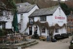
As we walked through a lane toward the quay, we stumbled on a bakery. Not any old bakery. Chough Bakery fronts the Quayside and has been famous for their Pasties for many years. All I can remember is that I saw a sign listing the awards they had won and took them at face value. Anyone can make claims, but “awards” are “judgements”. As I posted in Facebook:

“We have maybe the final contender in our search for best Pasty. The Ead family cleaned up in 2016 with 1st prize in the main category. Her son Jack (9) won junior champ. and other son Robbie (12) ... note the name! He won 3rd place in Open Savoury Junior category for Haggis, neeps and tatties pasty with a "wee dram". Louisa Ead won again this year in Open Savoury Professional category.”

We bought Pasties to take home as we had already decided that we would have fish and chips at Rick Stein’s takeaway shop. Actually, you can eat in. We had barely started to eat when the fire alarms went off. Ches was in the bathroom, so I gathered our food and went outside with all the staff (who’s been cleaning up ready to close when we finished eating).

Outside, we chatted with our waitress:

She: Where have you come from

Us: Mousehole

She: Mousehole!, so you’ll be staying here for the night?

Us: No, we’ll be driving back to Mousehole.

She: Her jaw was still dropped open when we left … amazed!

Actually, we had one last destination, Bedruthan Steps.

Carnewas & Bedruthan Steps (Cornish: Karn Havos, meaning rock-pile of summer dwelling and Cornish: Bos Rudhen, meaning Red-one's dwelling). It’s a stretch of the coastline that reminded us of the Twelve Apostles on the Great Ocean Road in Australia.

It certainly wasn’t summer. The wind was howling and the cliffs pounded by high seas. Scenically beautiful, it was also terrifying as the wind was almost blowing me off my feet as I tried to get close to the cliffs to photograph.

There have been people in the area since at least the Bronze Age with six barrows nearby to the north, and overlooking Bedruthan Steps is Redcliff Castle, which dates back to at least the Iron Age. Redcliff Castle has three ramparts divided by two ditches, part of which have been quarried to improve the defences. Much of the internal parts of the castle have been eroded by the sea. There is a second castle within a mile to the north at Park Head and two miles to the south at Griffin's Point, a third. Cliff Castles or Promontory forts are defensive structures which are thought by archaeologists to be permanently occupied. In 2009 a menhir or longstone was discovered in a boundary hedge close to the coastal footpath. The stone lies on its side and is 9 feet (2.7 m) long.

There is evidence of mining with shafts on the cliffs nearby at Trenance Point, and adits above the beach at Carnewas. The National Trust shop was originally the count house (office) of Carnewas Mine and the cafe was one of the mine buildings. Between 1871 and 1874, 940 tons of brown haematite were produced and it is thought that the ladders and steps to the beach were needed to reach the mine workings. The name Bedruthan Steps is said to be taken from a mythological giant called 'Bedruthan' who used the rocks (stacks) on the beach as stepping stones, and seems to be a late nineteenth century invention for Victorian tourists. The first written record of the name is from the West Briton newspaper in February 1847 and is likely to refer to one of two cliff staircases used by miners to get to the mine workings and now refers to the whole beach.

Each of the stacks has a name and from north to south they are Queen Bess, Samaritan Island, Redcove Island, Pendarves Island and Carnewas Island. Samaritan Island is named after a ship the Good Samaritan which was wrecked there in October 1846 with the loss of nine lives. A rhyme written at the time states "The Good Samaritan came ashore, To feed the hungry and clothe the poor, With barrels of beef and bales of linen, No poor soul shall want for a shilling"

As my photographs illustrate, it was getting dark and the wind was all too much. We headed for our Mousehole.

IMG_7584.JPGIMG_7588.JPGIMG_7595.JPGIMG_7631.JPGIMG_7640.JPGIMG_7648.JPGIMG_7650.JPGIMG_7678.JPGIMG_7721.JPGIMG_7730.JPGIMG_7760.JPGIMG_7790.JPGIMG_7796.JPGIMG_7584.JPGIMG_7588.JPGIMG_7595.JPGIMG_7631.JPGIMG_7640.JPGIMG_7648.JPGIMG_7650.JPGIMG_7678.JPGIMG_7721.JPGIMG_7730.JPGIMG_7760.JPGIMG_7790.JPGIMG_7796.JPGpadstow-alms-house.jpg
 
Last edited:
January 8th

Today wasn't particularly great. St Agnes wasn't particularly scenic and Falmouth a waste of time.
This is what we didn't discover about St Agnes:

"St Agnes is a picturesque village on the north coast of Cornwall. Steeped in mining history, the village retains a traditional friendly Cornish atmosphere and makes a wonderful base for your holiday. There's a thriving community with a choice of shops, as well as galleries and craft workshops where beautiful gifts are made by hand. There are also friendly hotels and bars serving good food in a warm and welcoming atmosphere.

From the main village, walk down to Trevaunance Cove with it's ruined harbour. There's four different beaches easily accessed from the village and dramatic coastal walks with some breathtaking scenery filled with relics from the past. These include the iconic Wheal Coates engine house, now part of Cornwall's World Heritage status and the inspiration behind the original Poldark books."

I now accept it was all my fault. We should have allocated the best part of a day to just St Agnes and I should have done more research. Drew and Keith had driven here on the way from Polperro to Mousehole on Thursday, and Keith had waxed lyrical about the town. It could have been that as it was still school holiday time, there were shops open and tourists around.

What we discovered was a pretty town, largely inland from the water and hidden among the trees, a beach that had a wickedly cold wind driving into our faces (that should have been a clue) and narrow streets and lanes clinging to the the cliff/hill.

Apart from a butcher and a grocery/fruit/veg shop, everything else was closed for the winter.

The highlight was reading a plaque down near the beach which explained how the town had tried on 4 or 5 occasions from the 1700's to the early 1900's to establish a sheltered harbour. Almost all fishing villages around Cornwall have sea walls built across from their headlands to create a harbour.

All that remains of the last wall is this pile of stone blocks in my photograph. Quite amazing to think that the storms are so powerful that they can wash away massive granite blocks.

St Agnes could never get it quite right.

The Tonkin family controlled the mining wealth of the area. They realised that opening up trade from Ireland and Wales had the potential to increase there turnover - so they began the construction of a harbour at Trevaunance Cove.

The harbour was finally completed in 1710 - after three attempt. The contruction of the harbour proved to be a costly venture, expending over over £6,000 on the harbour 'experiments' - leaving the Tonkin family in debt. As a consequence, the estate was relinquished in 1719 to settle the debts. the harbour stopped being maitained and was eventually swept away by the force of the sea in 1730.

The harbours story took a new twist some sixty years later when the copper mining boom caused massive expansion of trade in the area adding new impetus to requirement of a harbour at Trevaunance Cove

In 1798 the newly formed St. Agnes Harbour Company re-constructed the harbour enabling the growth and development of the local pilchard fishery and general seaborne trade. The harbour stood for 118 years, before it too was washed away in the storms of 1915/16 - lack of maintenance being a key feature of this second destruction of the harbour.

Leaving the beach was a chap and his aged dog. The beach itself is quite extensive and sandy and there's a suggestion that it's a place for experiences surfers. Given the history of the destruction of harbour walls, I suspect the seas not to be trusted. We photographed and left the beach as well.

The only other feature suggested in our guide book was The Beacon. I've since discovered a site with this report from a chap in 2007 "St Agnes Beacon is a landmark for anybody driving down the A30 towards the END. Surprisingly for such a large and conspicuous hill the barrows/cairns on the summit are just the opposite. My feelings are they have been robbed not only of any remains but also of stone over the years. What is left are a few scattered mounds, and even these can be mistaken for mining remains and vice versa. The hill is great for views..but don't make a special trip for the archaeology."

We drove around the headland, however all signage was for walking paths to the Beacon and nowhere to park. The roads were barely wide enough for a single car and the hedges high. On reflection, we didn't miss anything other than fine views and on such a windy cold day, they wouldn't have been worth it.

There was one final sight to attempt to salvage the morning ... the "Stippy Stappy" cottages. These are a row of 18th century miners cottages that stagger down the cliff side. Being on a one way street, as are most of the streets in St Agnes, we ended up doing several circuits of the town, from bottom to top and top to bottom, before finding a parking spot at the top of the town and then I dodged cars and buses trying to get close to the cottages.

Here I ran into our mate from the beach and his dog. They had walked up the stairs beside the cottages and the dog required a lengthy break to regain his energy. He claims to have expended it running on the beach rather than climbing the staircase. I suspect he hasn't managed to run in some time.

We had a chat about time being irrelevant when retired. No hurry to be anywhere. Actually, Ches didn't feel the same way. She wondered where in the name of hell I had gotten to this time.

Let's cut our losses and get on to Falmouth. That's right, Falmouth on the south coast as opposed to St Agnes on the north coast.

We arrived around 1.30 and well and truly in need of lunch. We couldnt find a tourist information office, the map in my guidebook was useless, there was only one carpark we could find with a 2 hour limit. The way things were going, I only wanted a couple of hours.

That was too long. What a waste of time? Well, lunch was worth it.

We discovered the Harbour View restaurant ... harbour glimpses. The food was excellent. We shared scallops with bacon, pork crackling and apple, Ches had Brie, bacon and caramelized onion sandwich with parsnip peeling crisps and I the pork and apple burger on brioche bun. This was the highlight of the day, as it continued its down hill slide when we went in search of Pendennis Castle.

After the event, we think its somewhere among the docks =, but who would know. The town is bigger than we now like to visit. Schools out and there are mums and kids everywhere, cars everywhere, ships everywhere ... no signs .... of course. Bugger. I really wanted to see a castle that is recorded as being one of the finest built by Henry V111.

I still have no idea where it is. Wherever it is, it was closed for winter anyway and the best I could have hoped for a was a photograph from outside the walls or whatever.

I'd like to tell you all about Falmouth, however I'm not that interested.

We returned home and salvaged the day by eating our pasties from Padstow .. Fantastic! The best in Cornwall.


200px-'Stippy_Stappy'_-_St_Agnes_-_geograph.org.uk_-_184685.jpg230px-Remains_of_former_harbour_at_Trevaunance_Cove_-_geograph.org.uk_-_184680.jpgIMG_7826.JPGIMG_7827.JPGIMG_7844.JPGIMG_7846.JPGIMG_7872.JPGIMG_7874.JPGIMG_7875.JPGPendennis Castle.jpgSt Agnes 3.jpgSt Mawes Castle 2.pngStippy Stappy Lane.jpgThe Regatta.jpgthX5DPGMX7.jpg
 
January 9th
Such a contrast with yesterday. I know the first filtered sunshine and patches of blue sky in 3 weeks makes a difference but it was as much the smaller fishing villages set in isolated coves out on The Lizard that were so much better than the bigger towns.

I've been conscious of The Lizard since the 1979 Fastnet race, as the 303 yacht fleet passed The Lizzard on their way to the Isles of Scillie and the Fastnet Rock. 19 lives were lost and 24 yachts abandoned in a major gale.

Fisherman have sheltered from storms in these small fishing villages for centuries. Cadgwith was stunning with dozens of thatched cottages clinging to the cliffs on each side of the village. We were the only visitors, all cafes etc closed and only three locals working on their boats.

The village has its origins in medieval times as a collection of fish cellars in a sheltered south-east facing coastal valley with a shinglecove. Fishing subsidised local farmers' livelihoods. Cadgwith was originally called 'Porthcaswydh', becoming 'Por Cadjwydh' in Late Cornish, and is derived from the Cornish word for 'a thicket', literally meaning battle of trees, probably because the valley was densely wooded. From the 16th century, the village became inhabited, with fishing as the main occupation. Subsequently, houses, lofts, capstan houses, and cellars constructed of local stone or cob walls and thatched or slated roofs were built along the beach and up the sides of the valley leading to Cadgwith's characteristic Cornish fishing village appearance. In recent times a very small Anglican church was built, next to the path from the car park down to the seafront, dedicated to St Mary.

The top of the village and the car park are still densely wooded, just as the name suggests and it's a pleasant walk down through the wood into the village. Much better than just walking down a street like most villages. As you walk, thatched cottages come into view and while most of them are holiday homes, there were a few with smoke drifting out of their chimneys. Not enough however to justify the "pub" staying open during the day in winter.

I would love to spend a week here in summer, however fear the rates would be astronomical. I just checked out a one bedroom self contained cottage on the harbour front and in July this year, it will be £768.00 for the week. A 2 bedroom on the hill behind the village (only a 300 yard walk) is £1,008.00. Dream on.

https://en.wikipedia.org/wiki/Cadgwith
https://www.cadgwith.com/

I could have stayed in Cadgwith all day. Loved it. Loved it. Photographed every inch of it.

We moved on to Kynance Cove which involved a walk down a goat track that goats would avoid. The view of the cove from half way down was stunning. Golden sands among granite cliffs and rocks.

Again, a pictures worth a thousand words and on that basis 20 thousand words or so later, we moved on to Mullion Cove. I'll post a second thread with just photos of Kynance Cove. I took 330 photos on The Lizard ... it's that photogenic.

We had taken sandwiches for lunch in the expectation that there wouldn't be any cafes open on The Lizard, so at Mullion Cove, we sat on a seat just below the summit of the headland and watched the sun stream out of the clouds, and down on the walls protecting the harbour.

I swear I've never been conscious of the rays of the sun radiating out from the sun in Australia. Here, they were like a fan.

We never made it down into the village, and I'm a little sad about that. Reading one of the most extensive reports I've ever seen on such a small village in Wikipedia, I think we missed an opportunity.
https://en.wikipedia.org/wiki/Mullion_Cove

It was sad to read:
In October 1984 three locations within the harbour area were granted Grade II Listed status. The List includes:

  • the two harbour walls or piers (English Heritage Building ID Number 1158181)
  • the net loft, listed as a "harbour cottage" (List Entry Number 1328501)
  • and the nearby Winch House (List Entry Number 1158171).
All are listed under the Planning (Listed Buildings and Conservation Act) 1990 (as amended) for their special architectural or historic interest. About 300 yards (270 m) to the east of the Cove, and visible from the approach road to the harbour, is a mill listed as "Criggan Mill" (List Entry Number 1141889) which was given Grade II Listed status in January 1980. It is one of three mills which were last known working together in the Cove in the mid 1840s.

The coastal environment has long been adversely affected by storms, sea level rise and climate change, and evidence shows that damage has occurred on an increasingly dramatic and costly level, most recently in the period from 2011 up until the present time. Beginning in 2003 the National Trust indicated that "Mullion Cove may not stand the ravages of the sea much longer". A survey in 2006 threw doubt on the future of the harbour.

On to Porthleven. Two harbour walls here. An inner and outer harbour surrounded by stately terrace houses and substantial buildings. No cafe ... no cream tea. In fact, nothing apart from a hotel appeared to be open, which was surprising for such a large town. A largish fishing town, but still only a few thousand residents, so maybe more reliant on tourism in summer than fishing.

"Overnight on 12–13 December 1978, Police Constables Joseph James Childs and Martin Ross Reid of Devon and Cornwall Police were killed when their patrol car was swept into the harbour during heavy storms. A stone memorial to them was later erected on the south-facing harbour wall."

Back toward home, I stopped at Newlyn. This is just a couple of kilometers from Mousehole, right beside Penzance. We had observed that of all the fishing ports, Newlyn has the biggest harbour and an absolutely massive fleet of gigantic fishing boats. The fish wholesalers had caught my attention every day we passed by on our way home. Tonight I stopped and bought two large Cornish Hake steaks and 16 scallops.

Ches pan fried one steak for dinner, with the scallops. Magnificent.

IMG_7893.JPGIMG_7894.JPGIMG_7901.JPGIMG_7908.JPGIMG_7909.JPGIMG_7911.JPGIMG_7917.JPGIMG_7918.JPGIMG_7926.JPGIMG_7936.JPGIMG_7944.JPGIMG_7952.JPGIMG_7961.JPGIMG_7962.JPGIMG_7979.JPG
 
January 10th

This mornings brilliant sunrise was due to the fact that we had clear skies overnight, and as a result a frost and 2c temps that didn’t begin to rise until 10.30. With clear weather, we had decided to go in search of iron age villages, quoits, castles and? The Lands End peninsular is crawling with them, however signage is almost non existent. I had searched guide books and websites to find clues to where they were and the most significant to visit.

We headed off at 9.00 and took advantage of the clear weather to photograph St. Michaels Mount across the bay from Mousehole. They are the sharpest images I’m likely to get at this time of the year. We passed the daily “late life crisis” male driver. All rugged up and driving his vintage sports car with the top down. Up onto the Penwith Moores.

Our first mission was to see if we could view Chysestor from above. That is, somewhere higher than this Iron Age village. It’s the only one fenced off and managed by The National Trust … and closed for the winter. Here it was that an entire village was uncovered and a 2,000 year old spoon found that was used to open and eat shellfish.

A passing equestrienne told us she though there was a hidden path that ran form 300 yards up the road, up onto the hill and then along behind the village and we might be able to view it through the brambles. Another local denied a path existed. We suspect she didn’t want us walking through her property. After she left, we returned and gave it a good shot. A path hedged on each side with 1,000 year old shrubs and brambles lead us up the hill but the gate to access the path across the top was roped closed. An hour for no result.

On to Lanyon Quoit. We missed the entrance across a sty several times, and only discovered it eventually because two other cars parked in a nearby lay bye. This is three large stones with a capstone placed across them. The capstone is over 5 meters long and weighs 12 tonnes. It used to be high enough for a horse rider to pass underneath however it blew down in a storm in 1815 and was re-erected 9 years later.

That was as easy as it was going to get. On to “Chun Castle” a mile or so further up the road. Actually, up the road and then a side track for several miles. This brought us to a farm and some swampy land to park and consider a direction in which to walk. Right behind us, a young local couple pulled up. We had seen them at Lanyon Quoit. They headed up and around a hill covered in bracken. I hadn’t seen them peel off to the right and forged on ahead, straight up the hill. The path had a channel dug down the middle, which serves as a creek in wet weather. 20 minutes later we came to the top of the hill and the Iron Age fort/castle residence.

“It is roughly circular in plan with two impressive stone walls, each with an external ditch. Within the interior are the remains of several stone walled round houses, heavily disturbed by later activity. One of these is oval in shape and may be connected with the later phase of re-occupation of the site in the post-Roman period. Traces of stony banks may be the remains of later animal pounds. The only entrance to the site is a stone-lined passage through the larger inner rampart on the west side with an offset opening through outer rampart, suggesting a defensive function, which is reinforced by a short length of bank outside of the opening through the outer rampart providing defence in depth.

A furnace was discovered during the excavations on the northern edge of the hillfort which contained traces of tin and iron slag, indicating that mineral processing was carried out on site in the Iron Age. Apart from pottery and stone artefacts, evidence for the character of the occupation were scant however, the acid soils having eaten away all traces of organic materials such as wood, leather, bone, basketwork and woven fabrics.

Originally the entrance through the outer rampart was set in line with the inner one and the entranceway was aligned towards the Neolithic chamber tomb known as Chûn Quoit, though three or four thousand years separates the builders of these two monuments. The modification to the entrance may have been part of the later re-occupation of the site. In addition to Chûn Quoit, which is sited 250 metres west of the entrance, there are two other prominent barrows on Chûn Downs, one sited to the north-west and another to the south-west.”

We spent around 30 minutes exploring the “castle” and the “quoit” and eventually came across the young couple again. I had noticed that below the castle on the lower slopes, there were three large fields with stone walls enclosing them. I asked if they had any significance, and they said that they were probably quite old and built by farmers.

It was only when researching what we had seen, when we returned home, that we discovered that they were part of Bosullow Trehyllys;
“one of the best preserved courtyard house settlements in the area. Much less visited than Chysauster or Carn Euny, this settlement has been dogged by restricted access and impenetrable vegetation, so we've never tried to visit before. But the barbed wire has rusted away and the little gate is open to us, so we go and have a mooch round.

Thanks again to Chrisbird for pointing out that the site had been cleared. The vegetation is actually already pretty high again, but we easily found simple round-houses in the south-western field and the impressive courtyard houses in the field next door. We're joined by a fellow enthusiast, who tells me this is his first visit to the site for over a decade.”

This record from 2010 gives you an idea about how difficult it is to access so many of these sites and how little is being done to maintain these 3,000+ year old sites.

When I checked my photographs later, I found I had photographed it from Chun Castle, but not close enough to actually see the remains of the houses.

It was now after 1.30 and a toilet and lunch were calling. We found a pub that possibly hasn’t served a lunch in the last decade. Certainly not in winter. In a village with probably no more than 50 residents, they took 20 minutes to prepare a hamburger, toasted sandwich and chips. It did the job ….. or the Crabbies Alchoholic Ginger Beer did.

We returned to search for “Men an Tol”. Possibly a mile up a dirt path with stones twisting our ankles most of the way, we again came across a “sty” off to the side of the path, over a narrow creek. Sever hundred yards across the field stood the stones. Three or four vertical stones and one large stone with a circle cut out of the middle:

“The Men-an-Tol has generated a wealth of folklore and tradition. It is renowned for curing many ailments, particularly rickets in children, by passing the sufferer through the hole. It was also said to provide an alternative cure “scrofulous taint”, also known as the “Kings Evil” which was otherwise only curable by the touch of the reigning monarch. The site’s reputation for curing back problems earned it the name of “Crick Stone”. The stones were also seen as a charm against witchcraft or ill-wishing, and could also be used as a tool for augury or telling the future; two brass pins laid crosswise on top of each other on the top of the stone would move independently of external intervention in accordance with the question asked. Age old myths of spirits associated with sacred places are echoes from prehistory."
I had read that another 300 yards further on was a solitary stone with engraving. I sent Ches back to the car while I forged on for the said 300 yards. Guess what? I think they meant 300 yards from the sty, not from the stones, so I missed finding it.

Back at the car, where I arrived at the same time as Ches, we decided that enough was enough. The remaining two sites would have to wait for another day …. Who knows when.

20190110_221032.jpgChun Castle.jpgIMG_8196.JPGIMG_8202.JPGIMG_8223.JPGIMG_8225.JPGIMG_8251.JPGIMG_8276.JPGIMG_8295.JPGIMG_8269.JPGIMG_8273.JPGIMG_8285.JPGIMG_8314.JPGIMG_8319.JPG
 
Last edited:
January 11th
Carn Euni then and now. Ches relented. After yesterdays trekking across cow paddocks and rock strewn tracks, Ches called it quits on exploring ancient villages and stone monuments. At some stage last night, she announced that we might attempt to find Carn Euni on our way to a repeat visit to St Ives.

Many of the roads on the Penwith peninsular are narrow. Just enough room for two cars to pass each other. That's the roads between towns and small settlements. Half the roads are to farms, and they are only wide enough for one car and are hemmed in by hedges 4m high and twist and turn. Every couple of hundred meters if you are lucky there will be a way bye cut into the hedge, barely long enough for one car. When you encounter an oncoming vehicle, the one closest to a lay bye reverses back to it. Yesterday, when returning to the main road (just the usual narrow road) from Chun Castle, we had a farm vehicle behind us and 200 meters from the intersection we were confronted by a truck. The truck had to reverse 100 meters to a lay bye.

The road in to Carn Euni is 5 kilometers. Thank god we only encountered a BMW series 5 .... seriously. We reversed to a lay bye. An hour and a half later when leaving, we encountered a truck ... just as we prepared to leave the farm. Thank god we hadn't left 5 minutes earlier. You can't drive much faster than 15kph because the straight stretches aren't any longer than 20 meters.

Carn Euni was worth all the effort. Magnificent. The jewel in the crown. The best site on the Penwith.

Carn Euny is one of the best preserved ancient villages in south-west England. The village was inhabited from the Iron Age until about the end of the Roman occupation of Britain (about 400 BC–AD 400) and has an excellent example of an underground stone-walled passage, known as a ‘fogou’, a type of monument only found in the far west of Cornwall.

The earliest houses on the site were Iron Age ‘round houses’, probably built of timber and turf sometime between 500 and 400 BC. These were replaced with stone houses probably between about 50 BC and AD 100.

The last phase of settlement, between the 2nd and 4th centuries AD, saw several earlier buildings replaced with larger, stone ‘courtyard’ houses. The visible ruins above ground mark the remains of these later houses.

Old field boundaries nearby show that the inhabitants farmed some 40 acres of land around the village. They grew oats, barley and rye and kept animals such as sheep or goats and probably cattle. The villagers are likely to have been traders, perhaps dealing in local tin.
The village appears to have been abandoned in about AD 400, although we do not know why.

Carn Euny remained uninhabited for more than a thousand years. In the post-medieval period, the ruins were used as pigsties and garden plots. A small cottage was built here in about 1750, but by the mid-19th century this had fallen into disuse.

In the 1840s, miners prospecting for tin discovered a ‘fogou’, or underground passage, on the site. This was excavated in the 1860s by the Cornish antiquary WC Borlase (1848–99).

No excavation of the wider settlement took place until the 1960s. The archaeologists excavated the stone houses and fogou, and also found the circular drainage gullies and postholes of the early Iron Age turf and timber round houses, which had otherwise completely disappeared.

We spent a good hour exploring the site. It backs into open fields, however access is through woodland and farm houses, some hidden in the woods. I suspect that the site has attracted people looking for a simpler life and there is quite a contract between the major farm buildings and cottages of potters and other hidden in the woods. There is only enough room for perhaps 6 cars to park.

We moved on to St Ives, which was quite different in the absence of hundreds of tourists as there had been last Saturday. We had a cream tea lunch in a cafe looking out on the harbour before once more revisiting all the shops. In the woolen wear shop where we had bought Drew his Cornish Chunky, I found myself a jumper. Ches also bought a jumper in another shop. We checked out the surf beach and headed home to pack in preparation for our move from Mousehole to Dartmouth.

Caen Unei.jpgCarn Euni.jpgcarn-euny-aerial.jpgcarn-euny-chamber.jpgIMG_8325.JPGIMG_8327.JPGIMG_8329.JPGIMG_8330.JPGIMG_8342.JPGIMG_8364.JPGIMG_8367.JPGIMG_8371.JPGIMG_8388.JPGIMG_8392.JPG
 
Last edited by a moderator:
12th January

This was the day we went in search of Cheryl's many grandparents in northern Cornwall.

With at least 4 hours driving time ahead of us, largely on 3 and 4 digit roads, we planned on leaving Mousehole by 9:00.

That reminds me. When we first visited England in the early 1980’s, we had read a travel article that recommended that if you want to see the real, quintessential England, you should only drive 3 and 4 digit roads. We did so then, and it was proved correct. It was very much slower driving on narrow roads hemmed in by hedge rows however now in the 21st century, the 1 and 2 digit roads are cluttered with roundabouts with traffic lights and traffic congestion, not much slower.

We woke at 6:30, so were ready to leave by 8:00. It was a dark, gloomy and drizzly morning and as I took luggage to our car, I came across a local walking his pet greyhound. There are as many rescue greyhounds here as at home. Retired from Cambridge, he moved here 3 years ago. His words “most people in retirement travel to see as much of the country or world as possible, I came here and haven’t felt the need to see anywhere else”. He’s seen many gloomy wet winter mornings here, but even he declared, “I didn’t see that coming”. The thick clouds over the sea parted and the sky lit up for just a couple of minutes. Amazing!

For 2 hours, we drove north to Bude. Here is a small town that for the last 4 years has won a gold medal in the British Travel Awards for “Best UK Seaside Town”. Cheryl, Cas and Shar’s antecedents, the Rowlands, lived in three communities within 3 miles of Bude from at least 1600 to the early 1800’s. I dare say they lived here a long time before 1600, we just don’t have the records to penetrate any further back. The mists of time.

Well, the mists were evident for the last hour as we drove across moor and sparse farming country. What they are growing, is wind and solar farms. By 2025, Cornwall will have reached “peak efficiency” in renewable energy. That means, they will be producing as much energy as they can use.

Our first destination is actually 1.5 miles short of Bude. It’s Marhamchurch, a sleepy village of thatch and cob cottages. The village takes its name from St Marwenna, a Celtic saint who founded a hermitage here in the fifth century.

We had decided that as we have no way of knowing exactly where her grandparents had lived, the best bet was that they were at least christened, married or buried at the village church, and that would be our focus. John Rowland and Richard Rowland the 1st and 2nd had lived here in the 1600’s.

Ches was quite taken by the fourteenth century church of St Marwenna, which has an impressive old oak door with wrought iron work, and a 'sanctuary knocker'. To think that her family had most likely touched that door back in the 1600’s, made it a personal connection.

They would also have walked upon the slate floor. Not slate tiles, but blocks of tiles laid vertically. At first we thought they were blocks of wood. They were amazingly soft and warm underfoot compared with the final two churches on our list.

Another feature of all three churches is that their scale is determined by the height of the columns making up the aisles. The columns are single blocks of granite, so around 4 meters was about as high as a single column could be made. This determined the proportions of the arches, often carved marble, and then again, they determined the proportions for the wagon vault roof.

The other notable feature of the church is the large embossed plaster coat of arms of Charles 11 which was installed after the local parish received a letter from him thanking them for their support in the civil war. Similar plaques were on the walls of St Olafs (Poghill – pronounced Puffil) and St Swithens (Launcells).

Marhamchurch, is so close to Bude that no shops have survived in this small village. Non but a village shop staffed by volunteers and largely there to sell newspapers, and emergency rations. We had a brief chat with two of the ladies who’ve lived there for over 20 years and are just beginning to feel like locals. We bought 2 packets of the village biscuits …. Oh! So good.

We drove through Bude, however being Saturday morning, there wasn’t much parking so we headed on to Poghill.

I think I’ve made the point previously that the Cornish aren’t much interested in sign posting anything other than towns. Any touristy site is left to those determined enough to do the research and have the perseverance to find. Kind of like “blind mans buff”.

After wandering “blind” for 10 minutes, we asked locals and were directed to St Olafs church. There was just enough space out front of the church to park. We explored the gravestones surrounding the church; no Rowlands.

Inside, we were again taken by the magnificent wagon vault ceilings. “The font dates to the 13th century. The south aisle dates to the 14th and 15th centuries. The porch and west tower are dated to the 15th century. The studded door is dated to the 16th century.

The church seats 300 persons and is dedicated to the Norwegian King and so-called Martyr, St Olaf (Olaf II of Norway). At the restoration in 1928 the foundations of the original Norman church were uncovered but nothing of this remains above ground. The pillars on the north side and south arch of the nave are of Caen stone (14th century); those of the south side are granite (15th century). The piscina and aumbry in the south chancel are 13th century.

Inside the church is a wall of frescoes. The frescoes date from about 1470, and depict St Christopher: they were discovered in 1894 beneath the whitewash. Such paintings were once common in churches; the Poughill accounts record the washing-out of the figures in 1550 at the time of the Reformation in the reign of King Edward VI. According to the legend, St Christopher was a heathen giant who, on turning Christian, was instructed by a holy hermit to carry travelers over a dangerous ford, and who, one stormy night carried the child Jesus on his shoulder.”

The frescoes are amazingly bright. To think that after being covered with whitewash for three hundred years, they are still so bright and vivid.

We found a laminated sheet of descriptions of the carvings in the end of the pews. Carved into Oak, around 2/3 of them are deep carvings darting back 500 years to the time of Henry V11. Largely religious but not controversial topics. The Rowlands would have sat in these pews in the late 1700’s.

We photographed most of the pew ends and filmed them as well. In fact, there isn’t much in this church that we didn’t photograph and film.

Once again the Charles 11 crest takes pride of place on the wall. A local told us later that while most of the country parishes supported Charles, pretty well all the fishing ports supported the Parliament.

On one of the walls, there was mention of a famous son of Poughill, Sir Goldswothy Gurney. Obviously much more worthy than the Rowlands. It’s an interesting read:

https://www.revolvy.com/page/Goldsworthy-Gurney

We said farewell to Richard Rowland (5th), who lived here in the late 1700’s before moving to Plymouth where he married Rebecca.

Finally on to Launcells.

This really only consists of St Swithin’s church. It’s a parish rather than a village and even the church is only posted with a small sign low down on the side of the road, and we had to scream to a halt and reverse to take the turn down a narrow road to the church nestled in a narrow valley.

St Swithin’s was described by Sir John Betjeman, as the 'least spoilt church in Cornwall.'

Sir Joihn was a poet, writer and broadcaster who described himself in Who's Who as a "poet and hack". He was Poet Laureate of the United Kingdom from 1972 until his death in 1984.”

As with the other two churches, we were struck by the wonderful wagon roof which was more highly decorated than the others and again the carved bench ends are wonderful and deserve much more time than we gave them. We did photograph and video and purchased a brochure that identified all the major bench ends.

At the end of the blog, I will add all the information I gathered from the internet. It wasn’t easy and I believe that what I have put together is more extensive than anything you might find published in any form.

Among the information I gathered was this:

1st of May 1821: Richard Vinner [? Venner] of Launcells, a labourer, was indicted for; "unlawfully drawing and extracting three quarts of Milk from an certain cow", property of Joseph Hawkey Esq. (who happened to be Landed gentry who resided at Launcells House, aka. now Launcells Barton!)

For stealing the milk. But NOT for stealing the cow.......!

Ches once again touched the door that the Rowlands may have touched between the late 1600’s and late 1700’s when Richard (3rd) and Charity and their son Richard (4th) and his wife Sarah lived there.

By now it was 1.30 and we still had to drive across Devon to the south coast and Dartmouth … and we were running out of petrol and hadn’t had lunch. We managed petrol, a service station sandwich and an ice cream and arrived in Dartmouth at 3.45. It’s not an easy drive on narrow country roads across moor land and through forests and the final 30 minutes is particularly winding narrow roads out to Dartmouth.

Our apartment for the week is a two bedroom penthouse on top of the old post office, right on the riverfront. There may not be a rental in Dartmouth with a better view. Just stunning … and the apartment is very well appointed and comfortable.

Just one hitch …. It’s up 57 steps and we did it frequently over the next week. Starting with this evening, as we discovered that there were to be road closures over the coming week. Instead of just taking up the basics, I emptied the car and took four trips up and down the stairs.

It was now dark and we were hungry however as luck would have it, we were next door to “Rockfish”. Rockfish Dartmouth was the first to open in 2010 and there are now 5 others along the southern coast. What luck. We had a fantastic chowder and followed with spider crab croquettes for Ches and F&Cs for me. Couldn’t fit in a desert, and that started a chain of events in following days.


If you enjoy history as much as I do, the following should be an interesting if long read. Apart from anything else, it's interesting to glimpse what life was like over several hundred years in this small area around Bude. Three communities where the Rowland family lived for several hundred years that we can trace. maybe even further back in time. Particularly, the history of Launcells I have gathered here, you would take days to find searching the internet. How much better would our experience have been if we knew it all before our visit.
20190112_190448.jpgIMG_8508.JPGIMG_8510.JPGIMG_8513.JPGIMG_8533.JPGIMG_8553.JPGIMG_8566.JPGIMG_8573.JPGIMG_8589.JPGIMG_8590.JPGIMG_8610.JPGIMG_8629.JPGIMG_8631.JPGIMG_8633.JPGIMG_8645.JPG

Marhamchurch John Rowland
1600 Honor ?

Marhamchurch Richard Rowland 1 1637 Mary Bate 1643

Marhamchurch Richard Rowland 2 1671 Susan Cowling 1680


Launcells died Stratton Richard Rowland 3 169 Charity Hockam ???

Launcells Richard Rowland 4 1740
Launceston Sarah Elliott 1741

Poughill Richard Rowland 5 1779
Devonport (Plymouth) Rebecca Launder 1776
Both died Antony (Plymouth)

Antony William Rowland 1807 Both emigrated to Australia
Antony 1813 Francis Corny Budge

Victoria Thomas Rowland 1847
1854 Marie Louise Courboules

Victoria Rosalie Rowland 1884 Thomas J Brown


Victoria Shirley Brown 1921 Sydney Steel


Victoria Carolyn, Cheryl and Sharon
Marhamchurch

The name derives from the Celtic Saint Marwenne (Morwenna) who is thought to have founded a hermitage here around the end of the fifth century. Marwenne was one of the twenty-four children of St Brychan , a Welsh saint and king.

Marhamchurch parish church is dedicated to St Marwenne. Most of the present church is of the 14th century; in the 15th century an aisle and porch were added. In the early 15th century the existence of an anchorite's cell occupied by an anchoress called Cecilia Moys is recorded. Features of interest include the four-holed cresset stone and a Norman quarter-capital (though this is unlikely to be a fragment of the Norman church which may have preceded the present building). St Marwenne was probably the same as Morwenna of Morwenstow. In the 9th century the district was probably on the border between Cornwall and Devon and the farms in the parish have Saxon names unlike those of Poundstock on the other side of the River Neet.

Marhamchurch was recorded in the Doomday Book (1086) when it was one of several manors held by Hamelin from Robert, Count of Mortain. There was one virgate of land and land for 2 ploughs. There was one plough, 1 serf, 1 villein, 2 smallholders, 20 acres of pasture and 20 sheep. The value of the manor was 6 shillings though it had formerly been worth 10 shillings.

Marhamchurch Revel is a festival held every year, on the Monday after 12 August in Marhamchurch. During the festival a Queen of the Revel is chosen from the village schoolgirls and crowned by Father Time in front of the church where St. Morwenna's cells are said to have stood. Following these events, a procession led by the local band and the newly crowned Revel Queen then proceeds through the village to the Revel Ground. Here the villagers are entertained with a show of various entertainments.

St Olaf's Church, Poughill

Poughill is a pretty village just a mile from Bude, full of picturesque cottages of cob and thatch. The medieval parish church is dedicated to St Olaf King and Martyr. The church dates to at least the Norman period, and foundations from that time were uncovered during restoration work in 1928.

One unusual feature of the church are a pair of St Christopher wall paintings, facing each other across the width of the nave. In the medieval period St Christopher was usually painted on the north wall, opposite the main entrance where he could be seen by those entering and leaving the church.

Both paintings have clearly been restored, and the north figure had a crown added. The frescoes date to around 1470 and were discovered hidden beneath layers of whitewash in 1894. The paintings were covered over in 1550, in the reign of Edward VI, when they were considered too Catholic.

Aside from the wall paintings the most interesting historic feature is a wonderful collection of 78 late medieval carved bench ends. Many of the bench ends are carved with the symbols of Christ's Passion, including a wonderfully grotesque carving of the Mouth of Hell. Look for the carving of St Luke's bull and a pelican plucking her own breast.

The nave has beautifully carved bosses dating to around 1537, and the studded south door also dates to the Tudor period. In the tower are the original lychgates.

On the wall is an ornate royal coat of arms dated 1655. The date is remarkable when you consider that 1655 was at the height of Cromwell's Commonwealth, when signs of loyalty to the Crown would have been illegal and quite probably land you in prison at the very least.

Why was the coat of arms installed at such a dangerous time? The most likely answer is that it relates to Sir Bevil Grenville, the exceptionally popular Royalist commander, who was based at nearby Stowe Barton during the Civil War.

The granite font is 13th century, with blind arcade carvings, and there is a 13th century piscina and aumbry cupboard in the south aisle. The south nave arcade pillars are made of granite, while those on the north are of Caen stone from Normandy.

Across from the church is Church House, built as a guild house around 1525 and notable because it is built entirely in stone, where most of the village is of cob. The house stands on land granted by William Dovell, Abbot of Cleeve in Somerset. Cleeve Abbey owned the manor of Poughill until the Dissolution of the Monasteries by Henry VIII.

St Olaf's is a fascinating historic church in a very pretty village. It is usually open daylight hours to visitors and was open when we visited.

Poughill (pronounced "Pofil" or "Puffil") is a village in north-east Cornwall, England, United Kingdom. It is located one mile north of Bude.

History and notable buildings:
Poughill is mentioned in the Domesday Book as Pochelle. Notable old houses in Poughill include Burshill Manor (medieval), an open hall house, and Church House, dated 1525.

The village's water-mill is located on the footpath towards Bush. Lying at the foot of Trevalgus Hill in thick woodland, it is believed to have been a manorial mill for Trevalgus Manor. The mill was powered by the stream which runs south towards Stratton called the Stratt. Part of the mill building was constructed of timbers from ships wrecked along the coastline.

St Olaf's Church

At the heart of the village is St Olaf's church. The church is of exceptional interest and dates from the 14th century. The frescoes date from about 1470, and depict St Christopher.

Battle of Stamford Hill

This battle was fought on the outskirts of Poughill on 16 May 1643. Each May, on the closest weekend to the anniversary, there is a two-day re-enactment of the battle, fought over the Saturday and Sunday, together with a procession through the streets of neighbouring Stratton village.

Notable residents

During the latter half of his life, Sir Goldsworthy Gurney, the surgeon, gentleman scientist, inventor, and pioneer of applying steam power, lived in Reeds, a small house on the outskirts of the village, until his death in 1875.

Sir Henry Lovell Goldsworthy Gurney, a Malaysian colonial administrator assassinated by Communist extremists during the Malayan Emergency, was born here in 1898.[1]

Launcells

Launcells is a small parish located in a wooded valley three miles inland from Bude. The parish is composed of scattered hamlets, the main ones being Grimscott and Buttsbear. The parish church is dedicated to St Swithin and was described by John Betjaman as the 'least spoilt church in Cornwall.' The holy well of St Swithin stands nearby. In the Middle Ages the church belonged to Hartland Abbey.

Launcells parish is very much a farming community which, over recent years, like all farming communities, has, through mechanisation, seen a marked reduction in its employment levels.

Totally rural, the parish has a population of nearly 600 people and an area of some 6,200 acres, with just one small community at Grimscott which has a vibrant parish hall (with catering facilities) and which acts as a hub for social, recreational and fundraising parish activities.

Within the parish the only major activities are its farms, a Retirement Home and a large Garden centre which is on the parish border with Stratton.

Launcells Church: The name Launcells or ‘Lancellys’ as it was probably known, means the Church of Cellys. It is likely that there was a Celtic Monastery on the site and St. Swithin’s Holy Well is by the bridge south of the church. The Manor of Launcells was mentioned in the Domesday Book, 1085.

Launcells church was first mentioned about 1200 when it was appropriated to the Abbey of Hartland. The font is early Norman. The church was first dedicated to St. Andrew and then rededicated to St. Swithin in 1321. The church was reconstructed in the C15, the granite north arcade being slightly later than the south arcade, which is of Polyphant.

The porch still contains its old seats and holy water stoup. The windows have perpendicular tracery and clear glass, some of which is very old. Those in the north aisle have been reconstructed.

The original C15 wagon roofs survive, those in the aisles having carved wall plates, purlins and bosses. The stairway to the former roof loft is in the north aisle. One painted panel survives of the original rood screen. The chancel is paved with C15 Barnstaple encaustic tiles. There are over 60 carved bench ends of C16 date.

On the west wall is a wall painting, recently conserved of Abraham and Isaac depicted in Tudor Costume and it is likely that there are paintings under the rest of the wall plaster.

The oldest tombstone, at the entrance to the S porch is dated 1574 and the Chamond monument in the SE of the chancel is dated 1624.

There is a Royal Coat of Arms of Charles II. The oldest of the 6 bells is dated 1751. The pulpit and tester, and box pews in the north aide are Georgian. In the churchyard three chest tombs are listed. They date from late C16 to mid Cl8

Surely weary wayfarers, shared this mysterious and magical place with wandering pilgrims who would have once stopped here at Launcells (Launcellis) on their monumental journeys, resting for a while to partake of its cool and healing waters.

Long before when St Andrew gave his name as its first true dedication, the paganus of this land may have questioned why but still revered its mysterious if not magical powers.

For this sacred spring was here long before disciples of Christ.

As legend would have it, the Holy men of Hartland Abbey who raised the first great granite walls here for Hugo de Moltone, their once powerful Abbot, can it is said, still be heard chanting as the wind sings through the mystical wooded glades of Launcells be it day or by night. And there are those who will swear that the clack of hooves and the swirl of cloaks can still be felt if not seen as daylight fades here, plunging Dub wood into the inky black of night.

In this aged land of legend, as Cornwall rolls back its history, take a closer look at the silent treasure that so many do not know.

A very special treasure that they call, St. Swithins in the Dell.

It is very clear that on this holy site a place of worship had stood as far back as Norman times. A simple structure surely it would have been, solid and forthright, serving purpose rather than offering overt decoration and majesty.

The great Doomsday book complied in 1086 at the order of William the Conqueror, itself cites the existence of the now long vanished Launcells Manor, once standing near here on the hillock behind the church. (This is later referred to as Launcells House, the seat of Richard de Launcells who was something of a mysterious character and a subject I will get onto later.)

Launcells then was cited then as 'Landseu' on the lands of the Count of Mortain.

Launcells entry in the Doomsday Book

Doomsday informs us that; "Alfred holds LANDSEU. Ælfric held it before 1066, and paid tax for 1½ virgates of land; 2 hides here, however. Land for 9 ploughs; 3½ ploughs there; 2 slaves. 3 villagers and 11 smallholders. Underwood, 30 acres; pasture, 50 acres."

Then, during the reign of King John, Matilda the widow of William of Lancells, granted a swathe of woodland and its buildings, known locally as Dub Wood, to Hugo, the Abbot of Hartland Abbey for the princely sum of ten shillings. Where upon tradition has it that henceforth the Abbot would use this secret place in the valley at Launcells as his summer residence and private contemplative chapel.

As with all ancient tales, no one is quite sure what is actually true, but what is known is that in 1261, Hugh de Moltone, sounding remarkably like our Abbot of Harteland, became the very first vicar of what later was to become Launcells Parish Church, so a goodly amount of the account is probably correct.

But time moves relentlessly on, even here in this enchanted valley and it's now been three centuries which have passed since the Augustinian monks of Hartland first built this holy place.

Change was about to come in no small measure and in one fell swoop, it fell upon their Cornish heads.

Henry the King of England, utterly disgruntled by the Papal refusal to grant him a divorce from Catherine of Aragon, made drastic changes to the British religious system, severing all links with Rome and making himself the majestic head of the church of England, principally in order to 'bend the rules so it suited him.'

The British people at this time, viewed the Roman Catholic church as just a money making machine, set and intent on making them pay for everything which traditionally should be free. This included marriages, baptisms and even gaining a rightful a place in heaven by being buried in hallowed ground. So they rallied in great numbers to their King in support.

Henry who was by now legally the self made Supreme Head of the Church of England by an Act of Parliament passed in 1534, now ordered the closure of all the religious orders of England and Wales, including around 800 monasteries, priories, nunneries and friaries and demanded the seizure of all their assets and lands as the wind gathered momentum.

Religious reform, or repression as it was more often termed, had arrived in Cornwall too. Though the country was still primarily Roman Catholic, the Pope’s great power here had finally been ended with Henry left completely in control.

In North Cornwall near the raging and wild Atlantic coastlands, Hartland's monks were granted no favours by King Henry. Unfairly judged by the monarchy as all religious orders were at this time as having been corrupted by the wealth obtained from renting their land.

By others, the brothers were seen as lazy idlers, unhelpful in the community and self centred in their ways. With some orders it was thought, encouraging multiple vices, copious drinking and behavior akin to gluttony.

The monasteries curried little favour in the eyes of the royal court.

So Cromwell was sent in to investigate them, but more so, to interrogate.

Now Cromwell was a hard line officer of the crown, overviewing all monasteries without exception as places full of superstition and excess. Secretive enclaves where veneration of saints and their images encouraged pilgrimages, adultery, unholy excess and purgatory. There could be no real holiness in stones & shrines, its Pagan holy wells and relics. So they would have to go.

Cromwell found these closed and often wealthy holy orders contemptuous and demanded answers to these charges from monks who had after all vowed nothing but silence in deference to God within in their holy order. But, incredible as it may sound, by the breaking of that very silence to which they had pledged and in reply to his insistent questioning, it was simply all that was needed for Cromwell to justify it as a sin in itself and thus sufficient to close them down.

Launcells Castle

Sometime after King Henry's death in 1135 someone decided to build themselves a castle in Launcells but who and why is something of a mystery.

Though little remains of the place called East Leigh Berrys or East Leighburys as others call it, it was probably more a fortified timber hunting lodge than a true blue castle as we know it, such as Launceston castle down the road.

These properties were designed to be more status symbols than castles, simply resembling traditional castles and certainly, with the site being overlooked from most sides, it would have been a poor defensive position to choose to build a fortified building of substance. So we can rule out Kings and Counts moving into the Parish sadly.

Even so it was still a hefty piece of engineering and many men would have been set to work there to construct what seems to be a mott and bailey castle or ringwork of a comparatively low construction but with three conjoined enclaves.

Aerial views are the best to get hold of its size and form because centuries of farming have almost completely erased the castle from the landscape.

At one time the medieval designers would have intended to build in a main entrance gate leading to a central mound on which the principal building would have been raised. All of this would be surrounded by defensive ditches which are clearly visible in the image above.

Quite a feat for marauding enemies or the unwanted to try and surmount, particularly with arrows and stones falling around your ears.

Staunchly Royalist were the fine men of Launcells in North Cornwall.

But this place they call Launcells was never really a village in the true sense of the word but more a grouped parish made up of four hamlets, including Prestacott, Grimscott, Butspur Cross and Hersham and scattered between them both small and great houses and prosperous farms. However, it once sported both Almshouses and a National school at one time but was too widespread to become just one unit and remains, though conjoined, separated by its own quite widespread geography.

For certain however, Launcells back in Charle's time was certainly a Royalist stronghold with Churchtown or Treveglos as it was known , the area around St Swithin's, comprising of but a few small cottages and buildings scattered around the church but long since gone, with the original occupants once serving those principal institutions of the area.

The great Manor of Launcells, rebuilt in George's time as a home also served as a vicarage to St Swithin's for centuries. Latterly this fine building was renamed Launcells Barton, so many people served its farms and offices and other imposing properties of the area and indeed the church itself.

But its one of the few places that does not have a traditional English pub within at least stumbling distance of a church.

The devoted Cornishmen from these rural parts must have played a clear and concise roll in the the defence of the area from Cornwall's enemy the Parliamentarians and even fought at the Battle of Stratton itself, less than a mile distant as the gull flies from the church of St. Swithin at Launcells.

Sadly records do not exist of those Launcells brave and true who bore arms to protect their kinsman and honour, but dimly remembered stories secretly told and proudly kept, bear witness to greater heroics of the Launcell's men and even boys from these parts.

Still visible is the recently uncovered painted text, high on the north wall of north aisle of Launcells church. It pays testimony to the hearts and minds of Launcells men in the days of Cromwell. It is in fact part of a copy of the the text from a letter from King Charles I, dated 1643, in which he thanks his Cornish subjects for their loyal support and sacrifice in their struggle against the Roundheads. ( Transcript below)

C.R

"We are so highly sensible of the Extraordinary merits of our County of Cornwall, of their zeal for our Crown, in a time when we could Contribute so little to our own defence, or to their assistance. In a time when not only no Relief appeared, but great & Probable dangers were threatened to Obedience & Loyalty, of their great & Eminent courage & patience, in indefatigable Persecutions, of their great work against so potent an Enemy, backed with so strong rich & populous Cities. & so plentifully furnish with men, & arms, ammunition, & money, & provisions of all sorts. & of Ye wonderfull success, it hath pleased Allmighty God, through with Ye loss of some great & eminent persons, who shall never be forgotten by us. to reward their Loyalty & patience, by many strange Victory's. over their & our enemies, in despite of all human probability & all imaginable disadvantages, as we can not be forgetful, of so great deserts, so we can not but ever publish to all Ye world, & perpetuate to all times Ye Memory of their Merits, & of our Acceptance of Ye fame & to that end, we do hereby render our Royal thanks to that our County in a most publick & lasting manner, we devise. Commanding copies, here to be printed & published & one of them read in every Church & Chappel, & to be keept & erected in the fame, that as long as the history of these Times & of this Nation, shall continue. Ye memory of how much that County hath merited from us & our Crown, may be delivered with it to posterity".

Given at our camp at Sudly Castle

September the 10th 1643

Every church in 'loyal' Cornwall had and still has the right to display a copy of this letter and many still do, including St Swithins at Launcells, with a proudly framed and well displayed reminder of its not so distant past hanging on the wall of the church adjacent to the organ.

Cornishmen are both devoted and proud men, so after Charles II's Restoration, examples of this letter were often painted on boards and like St Swithins variant, directly onto the plastered church walls, occupying prominent places in many Cornish churches.

No different then was this great Cornish convention at Launcells.

In the beginning of March 1641, near 200 men like those above would have gathered at St Swithin's church at Launcells to listen to their vicar (William) Thomas Warmington. Many of them would have had to stand outside and wait their turn to sign their allegiance to the protestant church and thus to their King.

Reverend Warmington would have likely said these words, reading from the protestation declaration each man in turn had been called to sign.

" Ye good men of Launcells , do ye in the presence of Almighty God, promise, vow and protest to maintain and defend, as far as lawfully you may, and with your Life, Power and Estate, the true reformed Protestant Religion."

Each Launcells man in turn who was in agreement with this proclamation then signed, or more usually made his mark by the side of his name, witnessed by the vicar and the other officials present. Each would testify that the oath had been taken, or refused.

Many in the nation, still of the Roman Catholic persuasion did not put their hand nor their will to it. Few men hereabouts would dare not to.

These long gone men of the parish who are listed below, likely did and irrespective of their status in the hamlet. Man or boy, pauper or the redeemed and revered.

The question is, how many of these men were true to their pledge and in a matter of just a year would be defending Cornwall from the wrath of the Roundheads?

That in itself is a very good question.

Records simply do not exist of those good men and true who fought at the Battle of Stamford hill, just a few miles distant for the freedom of Cornwall, nor of any who gave their lives for the cause.

Paintings of a more conventional type play an important role at Launcells church in Cornwall, with remnants of a huge 17th century wall painting depicting the Genesis story of Abraham sacrificing Isaac still prevalent on one wall, though fading.

Interestingly, as the central characters are depicted here dressed in the peculiarly contemporary dress of the Tudor age, it supports the dating of the artists handiwork well. Sadly, there was until recently great deterioration to the work of art at the hands of time, but has been at least halted by meticulous and expensive restoration. However much more work is required and it is a firmly held belief that St. Swithins at Launcells holds many more fine secrets buried somewhere beneath its replastered and often repaired walls. There is evidence of more throughout the church. But the investment needed to uncover them will be vast.

"The Ringers of Launcells Tower"

< This is an old oil painting inspired by a poem called 'The Ringers of Launcells Tower' by Reverend Hawker of Morwenstow. It was painted in 1887 by the artist Frederick Smallfield, A.R.W.S who was an English painter of genre scenes and a student at the Royal Academy Schools in 1840s.

S. Baring-Gould MA- author of Cornish Characters and Strange Events reminds us that:

"In the Western Counties bell-ringing was a favourite and delightful pastime. Parties of ringers went about from parish to parish and rang on the church bells, very generally for a prize — ''a hat laced with gold."

At Launcells, where the bells are of superior sweetness, the ringers who rang for the accession of George III rang for that of George IV, there not having been a gap caused by death among them in sixty years.

Quoting from Vol; IV of The Parochial History of Cornwall - Hals and Tonkin, the story Frederick Smallfield illustrates is thus:

"It seems the identical six men who rang the bells in Launcells tower on the Coronation of King George III, rang them also on the day of his jubilee, having continued the parish ringers during all that time.

Their names are recorded in the parish, and may there fore be inserted here.

John Lyle, Henry Cadd, Richard Venning, John Ham, John Allin, Richard Hayman.

And of these, John Lyle rang at the accession of King George the Fourth, and of his present Majesty King William IV, being then in his ninety-sixth year : but all are now gathered to their fathers."

The artist visited Launcells from his home in Willesdon in London in 1886 with the blessing of Launcells vicar John Whitmore Black and made copious studies of bell ringers and their movements. Unfortunately he had to work from models for the final product back in the nations capital so sadly, Launcells famous Bell Ringers are not the real gentlemen they represent.

Britain's most famous Poet Laureate, Sir John Betjemen is famously quoted in proclaiming his admiration for the lovely Church of St. Swithin at Launcells, once calling it after a visit; "the least spoiled church in Cornwall." A proudly held dedication which has stuck ever since.

Clearly his observations were very well founded. For it is a church by comparison far less cluttered with added embellishments, statuary and memorial monuments raised to the dear departed than most and not a stained glass window in sight. Of course, exactly as intended.

It is as pure and bright as it had originally been designed with much of its original glass intact. But what Sir John failed to remark upon is that St. Swithin's also holds an even more remarkable secret treasure than its simple beauty.

A visit here reveals row upon row of carved fifteenth century pew ends some 66 in all, each depicting different interpretations of biblical subjects. Ingeniously there is nothing but symbol here and not a trace of a human figure.

No one knows who the ingenious wood carvers were, for the sculpted panels remain unsigned and mysteriously anonymous. Though they are likely local craftsmen who did similar work in other churches nearby.

These ancient bench ends are indeed both unusual and simple in their design, the great hewn panels revealing the secrets of its heart wood to only the inspired medieval carver.

Other commentators have called them 'unrefined', which to a degree I would have to agree with, but they have missed out an additional and important two words here.

They are both absolutely unique and quite, quite beautiful.

Many other fine carvings are to be found here at Launcells church.

Down at the south east end of St. Swithins Church in Launcells are fine examples of intricately carved Jacobean panelling. There is also a Georgian Gothic pulpit and once upon a time, a rood screen, long since dismantled and lost, though the staircase to the rood loft is still intact.

There are parts of the rood screen structure though which seem to have been elaborately painted and decorated, with some that have been reused and incorporated into the pews. Most notably a charming but faded painting on panel of a lily plant forming the back of the pew next to the porch doorway.

Behind the altar, the Reredos is made of polished marble bearing inscriptions of the Ten Commandments. This was a gift of Sir John Call's architect who had rebuilt Launcells House, (now Launcells Barton and latterly the Vicarage) for Sir John's sister, completely without mishap or accident between 1765 and 1777. Clearly an expensive offering of great relief and thanks to God when building sites were dangerous places to work.

Set against the north wall below the arched windows to the left in the photograph above are good examples of Georgian box pews.

Prior to the 16th century Reformation, it was not customary to sit down in church, that is unless you were the Squire or Lord of the Manor. It became customary to do so only much later when the congregation were allowed to sit and then only as recompense for listening to lengthy Sermons.

So to maintain status and hierarchy, it divided 'them' from 'those.'

Box pews like these then allowed for both family privacy where relatives and the invited guests could sit together and were akin to todays status symbols. Private boxes at the theatre or at sporting events.

It was no different here at Launcells, where these private pews were afforded by only the noble and wealthy of the Parish. Unfortunately there is no indication of who sat where in this lovely church but we can guess as some bored adolescents have left us clues.

Another fine treasure this lovely church at Launcells has to offer are the very rare Barnstaple encuaustic tiles which are laid in the nave before the altar. These are in fact inlaid tiles made during the medieval period back in the late 1400's with the colours obtained by using different inlaid types of clay and not by using coloured glazes. The tiles depict Lions, Griffins,Pelicans and flowers and were probably taken up at the reformation for fear of them being destroyed as examples of pagan symbolism. Fortunately our wise vicar of the day who was probably John Grayne - Felde, vicar of Launcells, St Swithin's from 1533 to 1545. Throughout and during the dramatic events of the times. Clearly he was wise enough and knew only too well of their significance and had the foresight to hide them away, as they were found in the vaults when the old flooring was replaced in 1932.

The photograph below only goes to show just how many devout feet have passed this way before.

One mystery that the ancient Church of St. Swithins in Launcells teases us with concerns this great coat of arms. Set into the wall high above the box pews and the old entrance with its stone staircase to the Rood Loft. This is where once the 'Rood Screen,' a decorative barrier separating the 'Chancel,' the space around the altar and the 'Nave' the central approach to the Altar, would have once been fixed.

Now the word Rood comes from the Saxon word for Cross, so we know that at one time, in the church of St. Swithin in Launcells, such a construction actually existed. Likely with a depiction of Christ crucified atop or a more simple rendition of the crucifix set in its central and most symbolic position high above the congregation.

Traditionally the churches congregation was separated from the High Altar itself, which was a holy environment and only one that the priests had access to, so it had a real and perfectly natural purpose. Creating the border to a sanctuary beyond which only those with direct contact with God may tread, or be invited.

Whether the original Launcells church Rood screen contained too many monastic or iconic symbols for the Reformationalists in Henry's time to tolerate and it was hauled down at the order of the vicar, or whether it simply deteriorated with time and fell down, never to be replaced, we just don't know.

Interestingly we do have something of a clue buried in 'A History of Cornwall: from the earliest records and traditions ..., found in Volume 2" by Hitchens and Drew dated 1824:

In which the authors tell us that at the time of its writing, there is still the lower part of a screen" on which figures of the apostles are rudely painted." So at least parts of it were still there back then.

Anyway the mystery of the great Coat of Arms is a bit more of a puzzle.

As we have already seen, Cornishmen were staunch Royalists, supporting their King, Charles the II of England in his defence of the realm against the parliamentary roundheads of Cromwell to the very death.

Such a magnanimous and demonstrative display of support for the monarch that they loved and all that this feature symbolised, indeed all the King stood for, was a very powerful symbol to all. Least of all the local congregation.

It is quite clear therefore that the great work itself would have been created at the time of Charles' reign and unlikely erected as a monument to the King after his death in early February 1685.

After all, a newly ascended Monarch, in this case Charles' brother James II succeeded him and was now on the throne of England, so why put up the previous Kings coat of arms after he was gone?

Local Historians have cogitated and pondered over the years as to who actually made the fabulous coat of arms that hangs in the church at Launcells. But it must be asked. What really is the correct attribution to the creation of this wonderful work of art? It must be asked.

Who then did it?

As tradition has it and indeed is generally agreed upon by the Church of England itself, one man's name has been put forward as a candidate for the creation of it time and time again.

And his name was Michael Chuke, a fine master sculptor who lived locally in Kilkhampton, literally just up the road a pace.

Here was a fine craftsman indeed and a man whose name had also been linked to similar features, sculptures and carvings created in the west country and that are still hanging in churches throughout Cornwall.

So, put two and two together and it was bound to be him.

But there is one problem which emerges from this rather rocky foundation.

Michael Chuke was born in 1679 and the King dead by the year 1685.

So at any reckoning, if he had any part in carving this marvelous coat of arms of his King, he would have been no older than about five when he did!

The one and only tomb effigy in Launcells Parish Church is the one of this man, Sir John Chamond, vel de Calvo Monte, a quiet, well educated and distinguished leader of men and of De Calvo Monte stock.

A lawyer by trade and a noble Knight of the order of St. John, which was an honour bestowed upon him in Jerusalem by Sir Richard Guildford the Master of the Ordinance in the Royal Household of Henry VII. Sir John Chamond was dubbed Sheriff of Cornwall in 1529. Made Steward of the Priory of Bodmin and fully Knighted by his King on the same day as that of his nephew Richard Grenville, the highly respected English sea captain and explorer.

Sir John Chamond served both his Monarch and his successor, Henry VIII. For which he was granted both property, land and title of the Manor of Launcells where he resided following his second marriage into the Parish.

To this day, fallow deer, ancestors of those that Sir John Chamond once kept and bred in his private deer park at Launcells Manor , still follow the same paths around the estate and can be seen timidly feeding at dusk and dawn grazing near the banks of the Neet.

Sir John was succeeded by two sons, one each of two marriages depicted in kneeling positions either side of their father on the monument, (previously illustrated) His son John Chamond the Younger also succeeded his father as a Knight and Sheriff of Cornwall in his own right.

Sir Goldsworthy Gurney is simply put, Cornwall's forgotten genius.

He was a fine engineer and gentleman scientist, far ahead of his time and another great man who is buried at St Swithins church here in Launcells.

Sir Goldsworthy is rightly regarded as one of the leading scientific minds of his age, a brilliant man in his time, or rather, well ahead of his time.

A noted surgeon, prolific inventor, excellent builder and both a scientist and an engineer.

Sir Goldsworthy Gurney turned his hand to many a role, patenting inventions which were as dramatic an innovative in his day as any today.

Though hardly glamorous, his heating and ventilation systems were in use in both the Houses of Parliament and Westminster Abbey, earning him the attention, a national reputation and great the admiration of Queen Victoria who knighted him for his work.

Sir Goldsworthy Gurney is otherwise best known for inventing easily recognisable sequenced lighting for coastal lighthouses and for the implementation and use of of concrete rafts as foundations for buildings, certainly a world changing invention. Notable locally is the one used for the erection of Bude castle, which was raised and built very successfully and primarily on sand dunes much to the amazement of local Bude based sceptics.

But sadly, in the end, his patented Horseless steam driven coach got the better of him and he went bankrupt for nearly a quarter of a million pounds. An incredible sum given the time frame. But after all, the poor man was up against other great inventions and more so, more influential inventors of the time, with inventions and developments in which vast amounts of money were being invested. The railways for instance and his own personal investment and if you will, misdirection by taking his eye off the ball, lost him all of his early found fortune.

Launcells really does have a charmingly fascinating history and from the census of 1841 we know that it had grown considerably as around 860 people lived in this lovely Cornish Parish.

It's interesting to understand what those individuals of working age actually did for a living too, as it gives us a true insight as to what it was actually like here back then in the days of 'them that have' and 'us that don't!'


Primarily then, all that was here for the people of Launcells to enter into was the farming industry and the obvious option to aim for if you were a fit male with no great ambition to do something else in life. So the majority of young people in Launcells entered into employment locally, either working on the commercial farms run by the wealthy landowners of the time, or on the self contained farms supplying those households itself such as Launcells Barton, (above) Magses and Grimscott...


The British census of 1841 tell us that there were all in all 173 Agricultural Labourers living here, with no less than 44 Farmers and 1 Farm Servant.

Now the females of Launcells, excluding those who had a pretty penny tucked away in their petty coats, opted in the main for household duties and there were plenty of options hereabouts for under stairs, maid duty and scullery work, with the bigger houses and farms to choose from in this Parish built of gentry and nobility.

So Launcells back then supported 34, female servants and eleven male helping those out. Most likely the men in a butlering or managerial capacity. Interestingly though, no Gamekeepers are mentioned in the census, though undoubtedly there would have been several.


Serving this widespread community, a variety of other trades sprang up as service industries to the Launcells area.

There were 3 Millers here, no less than 6 Carpenters, a Journeyman who was a master craftsman but we don’t know of what, a Shopkeeper and 3 Cordwinders or ropemakers. There was also wwo Blacksmiths and a Shoemaker. One Mason, 2 Taylor's, 3 Dressmakers and one female apprentice, a Sadler, the Priest of course, an important man called Richard High Keats Buck. Then there was the Inn Keeper and a maltster.

Now this is interesting as back then the Local Pub is listed as the Hobbacott Down Inn, which was sited in the proximity of the canal.

Worthy of speculation is that it was replaced by the Red Post Inn, the name of which is the subject of a whole other chapter on the area and exactly how it got its name..

Moving on, there was one yeoman, a Canal Labourer, a 'Mershanery Man,' who could not spell too well (in other words the Mechanic). There was a blacksmith, naturally, an attorney, eight elderly souls supported by the Union and no less than 5 Paupers in the poor house.

Not to forget eight independently wealthy people who had no occupation at all to decare but plenty of money in the bank!


Although certainly not as built up as it once was, Launcells individuals from the earliest census tell us clearly that they lived both in Launcells Town

( the area around the church which is indicated by an arrow in yellow here) and in West Church Parks at the bottom of the map. Roadsways or tracks linked and circled the whole area back then some 200 years ago..

There seems to be plenty of physical evidence of long demolished workers cottages in the fields around the church near Launcels Barton itself (the old manor house.) As you can see in this early hand drawn map of 1805 with the Churchtown houses all arrowed in red.

Interestingly two more properties can be seen on the bottom left, at the end of the lane leading to Launcells church and where now only an old overgrown path can be found leading from Churchtown Lane ( Lanteglos) and swinging all the way around to Church Park.

Two more houses once stood here at this tiny cross roads.

There was also a cluster of properties where the new rectory now Ravenscourt was to be built and Barton Meadows now stands. That's to the right of the map. And two or three more properties are indicated to have stood in the lane to the west of Church Park in the centre bottom of the map.

We speak of justice in these olden times but has the 'in' been left out of the word?

What follows are not fiction, nor story or even hearsay. They are real and terrible accounts of the times.

All to terrible and real examples of Cornish justice as handed out to Launcells residents in history and as such, taken in the main from quarter sessions records of the time held in archive. Though some examples may be light heartedly amusing to the reader, others are in fact deadly examples of how the law protected the rich and noble of these parts, far and above the normal human being.

Other stories here, we will never forget

Spring of 1199:

Richard de Launcells attacked at his country seat by cohorts of a Lordly landowner, one Henry S. William.

The gang prised rings off his fingers and threatened his life. Some of the accused were; Hugh de Morton, Thomas of Dunham and Hugh of Staddon.

14th July 1741:

Elizabeth Bone of Launcells, aspinster, was accused of petty larceny but acquitted. A Lucky lady!

12th July 1743:

Nicholas Botrell of Launcells, was severally accused of assault and battery to which he confessed: he was fined 1s. and sentenced to remain in custody at Bodmin jail until the next sessions.

15 January 1789:

Elizabeth Herd and Grace Batten, both of Launcells were convicted of taking one goose, the property of John Martin, a yeoman of Launcells ( who happened to be a local wealthy farmer) Property valued at 2d : Sentence: They got one week's hard labour in Bodmin Gaol - each!

9th October 1783:

Thomas Hobbs; previously committed to Bodmin bridewell as a rogue and vagabond was passed back to Launcells, his legal place of settlement as they'd had enough of him.

1st of May 1821:

Richard Vinner [? Venner] of Launcells, a labourer, was indicted for; "unlawfully drawing and extracting three quarts of Milk from an certain cow",property of Joseph Hawkey Esq. ( who happened to be Landed gentry who resided at Launcells House, aka. now Launcells Barton!)

For stealing the milk. But NOT for stealing the cow.......!

Sentence: Six months' hard labour in Bodmin gaol for a glass of milk!

16th October 1821:

William Ham of Launcells, also a labourer, was indicted for taking an oak hurdle, property of Bude Harbour and Canal Co:

So Bodmin jail for him for stealing a piece of wood for the fire!

13th January 1824:

Francis Vinson of Launcells, another labourer, was indicted for stealing a pig, value 6d., property of John Lyle: He got three months' hard labour in Bodmin gaol.

Had this been 30 years earlier he would have probably hanged.


19th October 1830:

Elizabeth Hooper, a single woman of Poundstock ; accused George Simmons of Launcells, a pig-drover of being the father of her unborn child.

He too faced the wrath of the Cornish courts and he wouldn't be the last!

15th October 1841

A jolly old farmer, (who must remain unnamed) approaching to 70 years of age, the father of a family residing in the parish of Launcells, having made the acquaintance of a lady, proposed a walk on the Summer Lane and in his return found himself thirteen pounds lighter in purse, than when he first had the happiness to be introduced to her at the beer-shop, half an hour before. The lady walked off with her spoil without detection.


Friday 31st March, 1843

Mary Jane Fanstone, aged just 12, was charged with having stolen 18 lbs of hay, the property of Mary and Wm. BROCK, of Launcells. And Edward Fanstone, 40 with having received it, he knowing the same to have been stolen. The evidence presented was weak and her father acquitted.

But that did not save poor Mary Jane though and the court never the less sentenced her to One Month's Hard Labour - the second and last weeks to be passed in solitary confinement. Age Twelve eh?


1849 and 1850

Both the national killer Cholera and Small Pox took a heavy toll in Cornwall and more locally in the Parish during the latter half of 1849 and in the following year, it was primarily with the young and particularly Launcells' infants suffering badly with a spate of infant deaths. With all in all some 30 people that we know of perishing, including both adolescents, young adults and the elderly. Though not all will have come to the end of their lives here in Launcells as a result of contracting those diseases, almost most certainly, many did, as it was avast increase in the mortality rate.

Interestingly, there are no speculation or record by writers of anyone from Launcells perishing from the Black death, which decimated Bodmin's population, cutting it by half.


And lastly something etched deep the minds of of many people of these parts:


The day was the 15th of April 1912.

A young and adventurous William Dennis aged 26 a farmer of Treyeo Farm in Launcells, had been encouraged to emigrate to Saskatoon in Saskatchewan, Canada by his farmer relatives; Lewis Richard 29, and Owen Harris Braund 22 of nearby Bridgerule in Devon, so they could begin a new and better life in the Dominion.

An excited William couldn't wait and bade his parents farewel optimistically embarking on the long trip by rail to Portsmouth, along with his travelling companions; the Braund's, his younger brother Samuel just 22, a farmer also and other close relatives, John Henry Perkin (22 of Ashbury, Devon) and John Henry Lovell (20, of Holsworthy, Devon) all apart from one, an ironmonger were farmers. They were joined by a Miss Susan Webber, aged 37 and a family friend of nearby North Tamerton in Cornwall, who was to visit her brother who had emigrated to Canada earlier, for the first time in years.

Tragically with his family and friends, William embarked on the Titanic at Southampton on third class ticket.

His body was never recovered
 
I enjoyed your trip report Gavin, especially day 1 when you were in my town, Bridport! Shocking that the hat shop closes for lunch! We’ve purchased some hats there too.
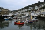
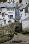
We’ve done a few vacations in Cornwall and always loved it. We visited the prehistoric sites on Penrith that you mention. I loved Men en Tol, the stones that look like 101. We crawled through the circle stone, which is supposed to bring good health. On our last trip we stayed in a vacation rental right on the water in Marazion, with a view of St Michaels Mount. And, like you, we love the villages on the Lizard (we stayed there on one trip).
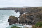
Cornwall is a special place!
 
Drew was particularly upset with the hat shop as he had phoned ahead and explained that he was looking to replace a hat he had bought from them, but he had lost. They weren't much interested in his description of the hat, just said "drop in and have a look". Then they closed with us standing at the door.

Yes, Cornwall is special. I have a feeling we will return there when over in July/August 2020.

Now I'm about to start writing our Devon report. I'm really enjoying reliving each day as I write about it. Quite a contrast writing about winter days in UK while back here in Australia it late summer and still very hot days. Lucky today will only be 28C (high 86F)
 

How to Find Information

Search using the search button in the upper right. Search all forums or current forum by keyword or member. Advanced search gives you more options.

Filter forum threads using the filter pulldown above the threads. Filter by prefix, member, date. Or click on a thread title prefix to see all threads with that prefix.

Sponsors

Booking.com Hotels in Europe
AutoEurope.com Car Rentals

Recommended Guides, Apps and Books

52 Things to See and Do in Basilicata by Valerie Fortney
Italian Food & Life Rules by Ann Reavis
Italian Food Decoder App by Dana Facaros, Michael Pauls
French Food Decoder App by Dana Facaros, Michael Pauls
She Left No Note, Lake Iseo Italy Mystery 1 by J L Crellina

Share this page

Back
Top