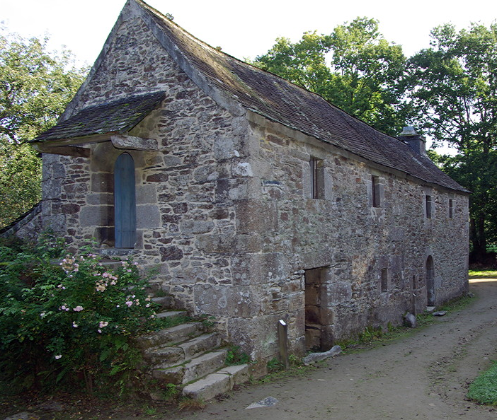
• CONTACT US if you have any problems registering for the forums.

Brittany Megaliths, Parish Closes and Cider - Part 3 Northern Finistère

St-Herbot

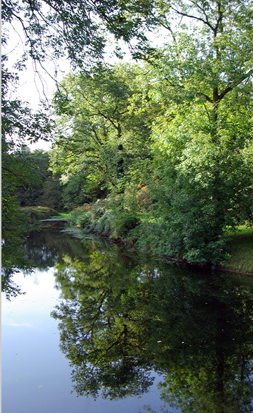
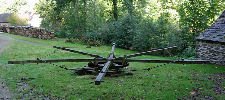
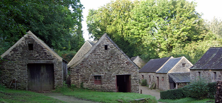
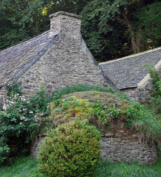
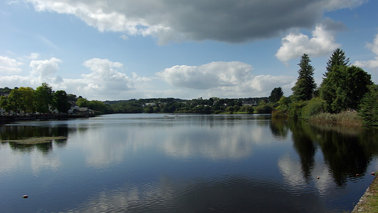
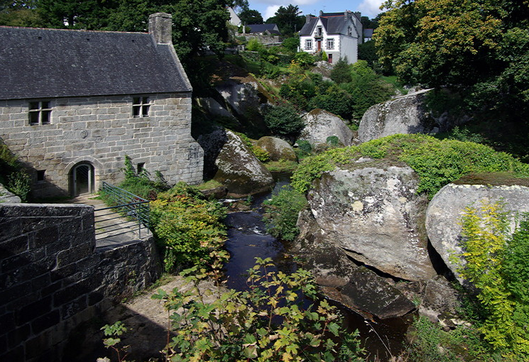
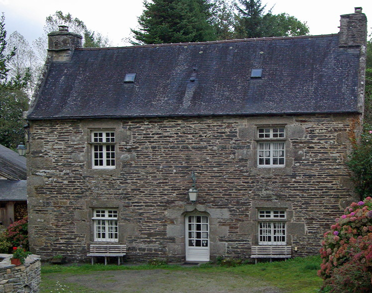
St-Herbot is a small settlement just off the main road that runs along the southern edge of Monts d’Arrée. It is a neat and well kept village with a lot of money.

full


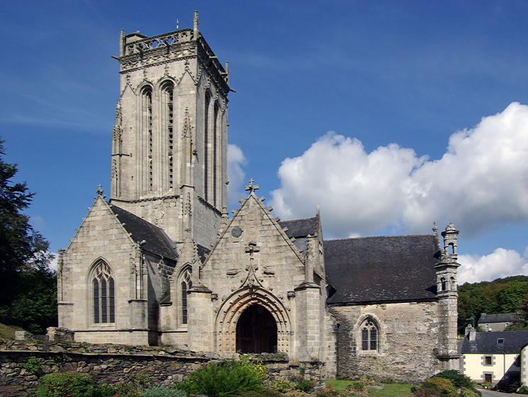
The main reason to visit is for the church, which is delightful. It was built between the C14th and C16th and has a massive square tower. This is thought to be the burial place of St Herbot and was an important pilgrimage site in the Middle Ages and their money helped build the church.

full


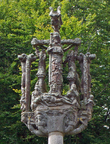
There is a simple calvary in the churchyard.

full


Entry is either up steps to the north door or else through the porch on the south side. There is a small ossuary attached to the side of the porch.

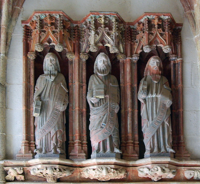
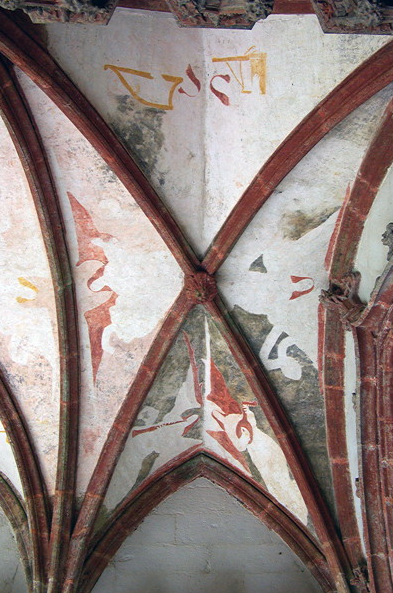
The porch is a splendid structure with three carved arches surround the opening with figures carved on them. Above is God the Father with two angels. Inside are carving of the 12 apostles, still with traces of paint on them. The ceiling is vaulted and the ribs are painted red and there is the remains of a painting of an angel.

full


full


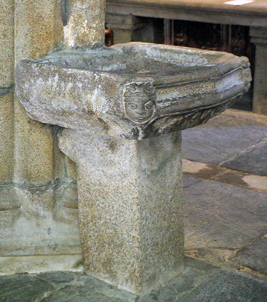
There is a lovely old stone stoup just inside the church.

full


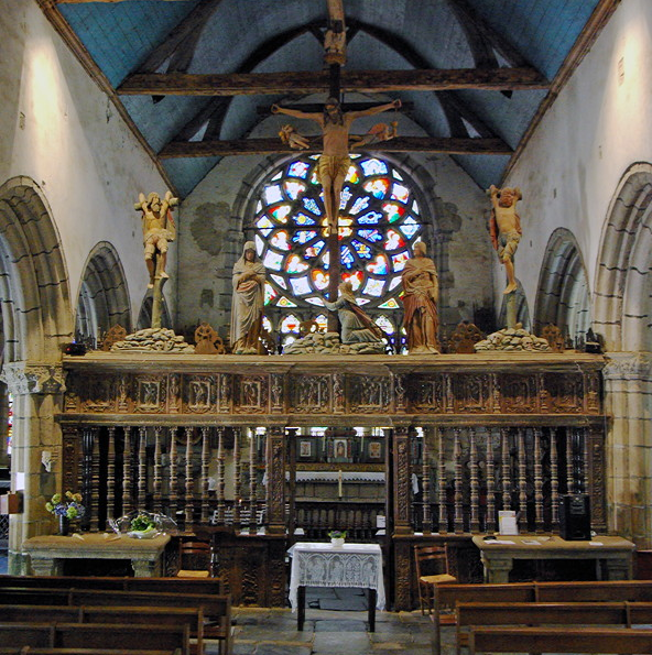
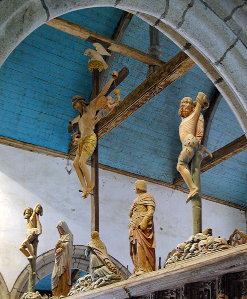
Once inside, attention is immediately caught by the massive carved rood screen with Christ nailed to the cross. On either side of him are the two robbers who have their arms tied to the cross and are tying to support themselves by looping their arms over the cross and resting their foot on the base. There is a figure of the weeping Mary Magdalene clutching the cross with the Virgin Mary and St John on either side. Angels are catching the blood from Christ’s hands in cups. There are skulls and bones piled up under each of the crosses.

full


full


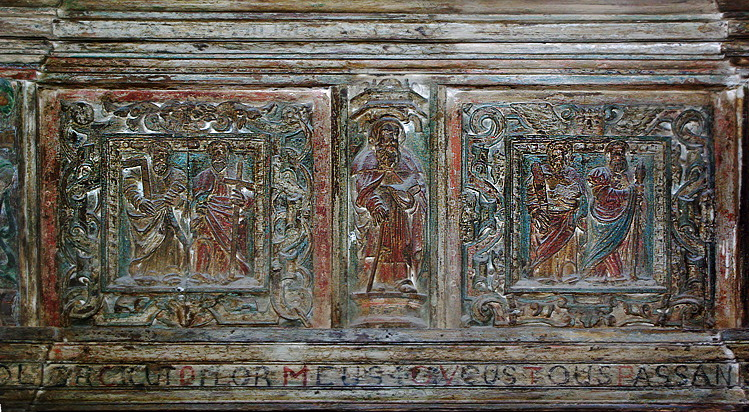
Above the door into the chancel is a small carving of St Herbot, with the apostles on either side.


full


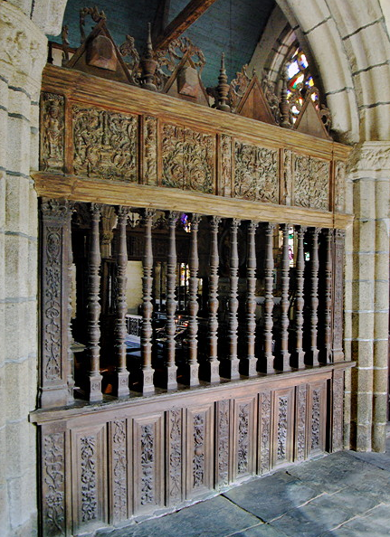
The chancel is separated from the side aisles by beautifully carved wooden parclose screens.

full


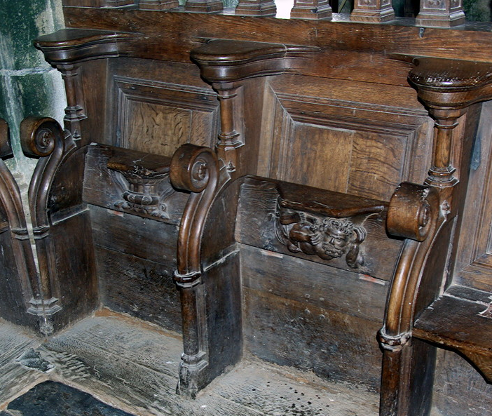
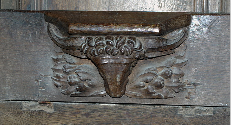
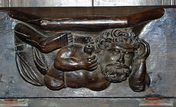
The old choir seats have wonderful misericords.

full


full


full


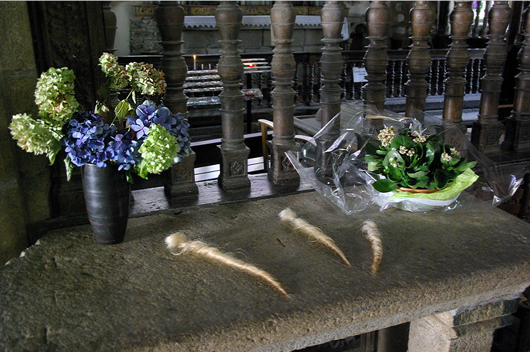
On the nave side of the rood screen is a stone table which had three offerings of twisted cow hair to St Herbot who is the patron saint of cattle and had a reputation of being able to cure them. Villagers traditionally brought curls of hair cut from the tails of their cattle as an offering to the saint.

full


The walls of the nave are whitewashed. The ceiling is wood and painted blue. It has massive wooden beams and arches across for support, which have the remains of paintings on them.

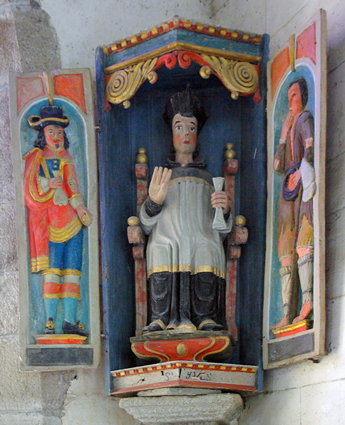
The south altar has statues of St Corentin and St Yves on either side. These are colourful carvings, both set in a box with the doors open. St Yves is the patron saint of lawyers and is set between a rich and poor man.

full


There are other equally impressive saints around the church including a C15th carving of the Virgin with the dead body of Christ on a pillar in the nave and a granite slab with a carving of St Herbot.

This really is a delightful small church. This time it is the woodwork rather than the altars which holds the attention. It doesn’t feature in the guide books and gets few visitors. It is well worth finding.
 
Moulins de Kerouat

This is a lovely small industrial museum tucked away in a wooded valley off the Commana to Sizun road. There is a large car park with a Visitor Centre selling a few craft items and books. We were given a map and an audiotour in English.

The hamlet of granite houses with slate roofs is about 300m walk down a leafy lane, surrounded by fields and woodland. A mill and water wheel was built here in the C17th and a small hamlet gradually grew up round the mill. The last inhabitant left in 1965. The hamlet was taken over by the the Department of Finistère and opened as an ecomuseum.

The river Stein was dammed to form a large mill pond with sluices controlling flow into the leat supplying the mill. The river valley would have been used for hay meadows but is now a wet area with marshland plants.

full


The small hamlet is tucked into the bottom of the valley. It has been forgotten by the modern world and is a delightful place.

The track goes past a stone barn with a horse threshing machine beside it.

full


There is a small barn covered with broom on the walls. Beyond is the bakehouse to the left of the track with the upper mill and miller’s house with cowshed and stables. Opposite these on the right is an early 20thC stables. There were older stable buildings next to these with a cart shed. A lower mill is set back behind them. Next to this is the 19thC bakery with house attached. The hamlet formed a compact self contained unit and shows how the hamlet grew and developed. Having seen this we began to understand how the modern hamlets have developed as barns and stables have been converted into houses.

full


Some of the buildings are furnished as they would have been in the C18th. Others now house exhibitions about the history, life and industry around the area. These were all in French.

The old bakery still has its wood fired oven and working table. The oven was covered with a clay roof with a grass top to protect it. This is occasionally used on special bread making days.

full


full


The Upper Mill was built in 1610 and ceased working in 1942. The wheel originally had scoops for the water but this was replaced in the C19th by a more effective paddle wheel which was able to turn the three millstones at the same time. Inside the wooden mechanism has been restored and still works.

full


full


The miller’s house dates from 1777. The doorway has a rounded arch, unlike the stables and cowsheds which have rectangular doors. It has a beaten earth floor and open fire. There are box beds along the walls, a clock, round table and big cupboard.

full


The attics were used for storage and contains several grain chests. These were massive open boxes with carved sides.

full


The cowshed was built on later next to the house and had a stable next to it. These now have exhibitions, as do the C18th buildings opposite. The floors were built from granite to resist trampling by the horses hoofs and the bays were separated by slabs of slate. The stable lads or servants would live above. The roof of the cart barn is supported on granite pillars.

full


The lower mill has the date 1812 but existed before then. It was powered by water from the upper mill. It was abandoned at the end of the C19th.

full


full


A bakery was built next to the lower mill in 1812 with pig styes behind. This was a large building with an external staircase leading up to a storage area which was later used as a bedroom.

full


This has a collection of highly carved box beds and cupboards.

full


full


Beyond is a room furnished as a living area/bedroom typical of the mid/late C19th. It had a small fireplace with table and chairs, a bed and cupboards lining the walls.

full


Downstairs, the floor was paved with slabs of slate. It is furnished as it would have been about 1830s. There was a big open fireplace with coffee makers above, dressers displaying china and a grandfather clock. There were butter churns and household utensils. Beneath the stairs is a large granite tub used for salting bacon.

full


The house was built for a wealthy family. At the back is an apoteis (a wing built off the main building) which was furnished as a dining area. There was a box table with a wooden bench built into the wall.

full


The hamlet was surrounded by fields and pastures. Buckwheat would have been one of the main crops. There was a small washing area away from the hamlet. There is a small fountain in the middle of one of the fields which is all that is left of the chapel.

On the way back to the visitor centre is a late C19th tannery building from Lampaul-Guimiliau which has been reconstructed here. There wasn’t a tannery in the hamlet although in the C18th there were over tanneries in the local area. They were always built away from the settlement because of the smells.

full


On the ground floor are the vats which were used to soak the skins, wooden scraping boards and big barrels to rinse the skins. Upstairs reached by a an external staircase is the drying area where skins were hung to dry on poles suspended from the ceiling. It has moveable wooden shutters which are characteristic of all tannery buildings.

full


This makes a fascinating day out for anyone who is interested in the social history of the area. It was very quiet when we visited on a weekday in September. It is easy to spend several hours here.
 
Huelgoat

Huelgoat features in all the guide books for the forest, river and rocks and the legends that are woven round them. There is the Fairies’ pool, the Virgin’s kitchen, Arthur’s Cave, path to Hell, the trembling rock, Devil’s cave…

The village lies on a large artificial lake which was dug by German miners in the late C16th to supply water to the local lead-silver mines and now supplies a small power station. The area was once an important industrial centre with mines and granite quarries. It is now a tourist centre.

full


It is a large and busy settlement with a lot of shops and eateries. In early afternoon it was busy with many parked cars. We walked to Moulin de Chaos where there are good views down to the river.

full


There was a highly decorative (but pretty useless map) showing walks up the river valley. However all did seem to be well signed. There were signs warning that the paths were unsuitable for the elderly and children and the authorities took no responsibility if you had an accident…

The stream bed is a mass of huge granite boulders formed from magma which was pushed to the surface and has weathered. The sides of the valley are covered with the remains of the native oak, beech and chestnut woodland which was once widespread across Brittany.

full


full


The paths pick their way through, round and under the boulders. There is a steep ladder down to the Grotte de Diable which I didn’t attempt. You then had to scramble under a low rock for views of the river, which Michael didn’t manage. Apparently the views were good.

It was a lovely walk along the stream bed through the trees. Further up the boulders were covered with moss. We climbed up the side and along a flat rock for views of la Roche Tremblant, which is a massive boulder. If touched in just the right place it will rock.

Walking got more difficult as there were large roots, many rocks and steps to negotiate. We saw the steps up to La Grotte d’Artus but didn’t bother to explore. We didn’t bother with the Ménage de la Vierge (Virgin’s Kitchen) either. The rock formations are supposed to resemble different cooking utensils: a cauldron, a ladle, a butter dish...

Ignoring the mystery and legend, this is delightful river valley and we enjoyed the walk even though we didn’t get very far.

We took the scenic D769A from Huelgoat which follows the river valley. There were footpaths signed off from the different parking areas. It would be good walking country.

We found the road signed off to the site of the old mines. It was a good road at first but then degenerated into a rough track with a large notice board indicating no motorcycles. Our French wasn’t up to working out whether it meant no cars or 4x4 only. The road did look pretty rough, so we decided discretion was needed and turned round.
 
Côte de Granit Rose

Côte du Granit Rose gets 5* in all the guide books so I decided we ought to include it during our stay in Brittany. The photographs on the internet and tourist literature looked good.

However I began to have my doubts when I looked at the Michelin map and realised just how built up this stretch of the coastline is.

There were breaks in the morning cloud and some blue patches. We decided as it looked as if it might be a good day to finish off the coastline. This was a bad mistake. It got more and more cloudy as we approached Lannion which was a nightmare to navigate and was very busy.

We picked up the Treburden road and took the road past Porz Mabo Plague, a nice sandy cove to Pointe de Bihit which has an orientation table. There were good views down to the tip and across to Roscoff, but limited views of the coastline to the north, with its small offshore islands and rocks. We watched Roscoff disappear under the cloud as it began to drizzle.

We dropped back into Trebuden past all the new development and drove along the coast road which doesn’t have many views of the coast, to find Menhir de St Uzec This is a massive menhir which was Christianised by the addition of a small cross on the top and C17th carvings showing the passion of Christ.

Tregastle is solid modern housing and real tourist country with marinas. We took the road down to ST GUIREC which had narrow roads and a small shopping centre. It was very busy even on a wet day and there was nowhere to park. Perros Guirec was a large sprawling holiday/seaside settlement and further confirmed my fears that Côte de Granit Rose was built up and busy. By now, it was raining steadily with low cloud.

The scenery (what we saw) didn’t live up to the hype or the stretch along the coast at Meneham, which is much better and much quieter. We didn’t take any pictures either!
 
The medieval village of Goenidou - a cautionary comment

I do a lot of reading and research using the internet before a holiday. We like to find the secret places not mentioned in the guide books and not visited by the average tourist.

When reading up for a holiday in Brittany I found a couple of references to the the medieval village of Goenidou on the web. It was described as the ruins of a deserted C13-15th village which was discovered in 1983. Only part of the site has been excavated, revealing a group of three buildings around a courtyard, with a separate fourth building. The buildings uncovered were typical of a type common in Middle Ages. They were made of granite walls without mortar and turf roofs. The family lived in one end with a fire place. The animals lived in the other end of the building.

It was thought that either the monks of St Relec or St John of Jerusalem in La Feuillée were responsible for clearing the land and establishing the village. The land was given to a tenant at a minimal rent to clear, build house and cultivate.

Pictures showed the excavated foundations surrounded by short grass. It sounded just the kind of place we liked to visit.

The nearest directions I could find was that it was between Keraden and Quinoualch to the west of Berrien. I should have been alerted when emails to the Marie at Berrien didn’t get a response. However, I found all three places on the Michelin map and it seemed easy sailing.

Roads in the area are narrow and signing is erratic. We drove through Keraden, a delightful small hamlet, took a wrong turning and and reached Quinoualch the long way round. There was no sign of Goenidou.

Michael was all for giving up but I bravely said turn left (keeping my fingers crossed). We did another loop but still no village. In the end we decided to give up and head to La Feuillée. We’d not gone very far when I saw a small sign to the medieval village which also (rare in Brittany) gave a distance of 1500m. I could hardly believe my luck - the description was wrong, not my navigation. “That way” I said pointing firmly.
This took us down a grass covered, rutted sunken lane. Michael took one look and asked “are you sure about this? I hope I will be able to turn round….” By now I had the bit between my teeth and wasn’t going to be thwarted. “Yes” I replied.

The grass got longer and the trees met above our heads. Apart from one very empty house there was no sign of any human habitation or life. We eventually came to a cross roads. Other cars had been ahead of us and we could see where they had had difficulty turning round. The road ahead was rutted with mud and standing water. The side roads were overgrown and unused by vehicles.

We think the site was in the field at the cross roads. There were the posts that might have held a sign once. With the eye of faith we could see banks which may have been old walls which were covered with vegetation and bracken. The grass was long and wet. If this was the site then it had been left to return to nature.

We gave up and returned to the main road. There was a terse comment from Michael “That was not one of your better ideas”. He had a point….
 

How to Find Information

Search using the search button in the upper right. Search all forums or current forum by keyword or member. Advanced search gives you more options.

Filter forum threads using the filter pulldown above the threads. Filter by prefix, member, date. Or click on a thread title prefix to see all threads with that prefix.

Sponsors

Booking.com Hotels in Europe
AutoEurope.com Car Rentals

Recommended Guides, Apps and Books

52 Things to See and Do in Basilicata by Valerie Fortney
Italian Food & Life Rules by Ann Reavis
Italian Food Decoder App by Dana Facaros, Michael Pauls
French Food Decoder App by Dana Facaros, Michael Pauls
She Left No Note, Lake Iseo Italy Mystery 1 by J L Crellina

Share this page

Back
Top