• CONTACT US if you have any problems registering for the forums.

Brittany Brittany, a general introduction

Eleanor

1000+ Posts
We spent three weeks in Brittany in September 2011. This report was originally published on Slow Travel and Pauline has asked me to post it here. As it is so long I've divided it up to make it more manageable. This is a general introduction and I have written separate reports for the three different places we stopped.

Part 1 covering Southern Finistere (Guengat) is here.

Part 2 covering Morbihan (Plumelec) is here.

Part 3 covering Northern Finistere (St Thegonnec) is here.


A three week holiday in Brittany in September 2011

“Let’s go to Brittany” said Michael.

I’d been to France in 1960 with my aunt which doesn’t really count and Michael had never been. We were complete novices.

We bought a copy of the Michelin map for Brittany, borrowed or bought guide books and sent off for information for companies renting gites in Brittany.

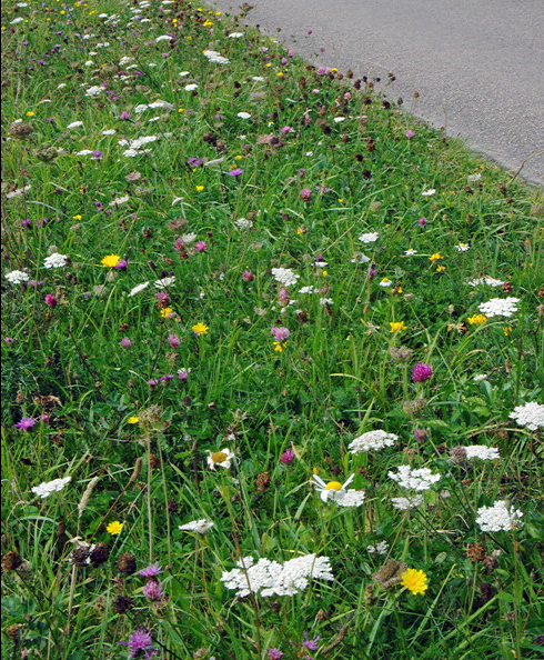
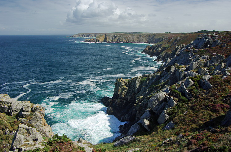
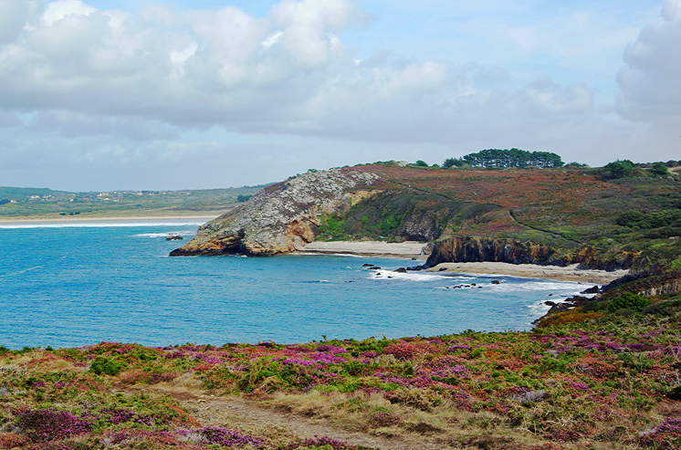
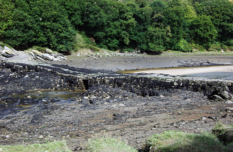
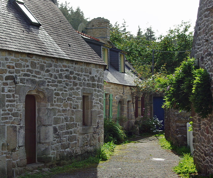
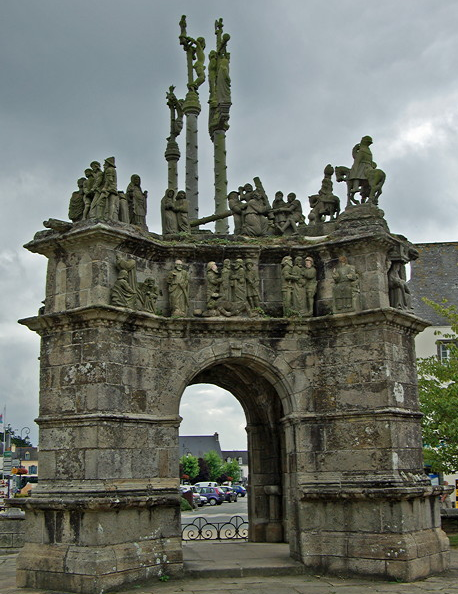
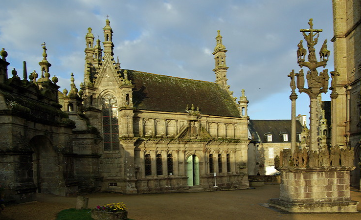
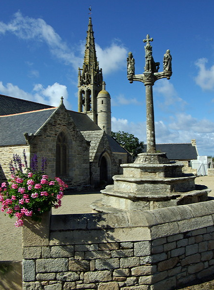
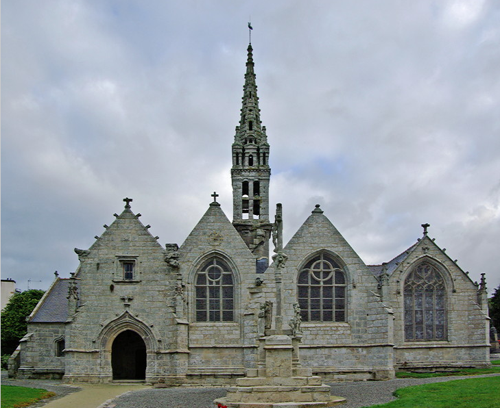
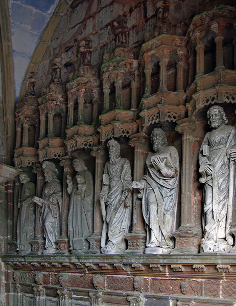
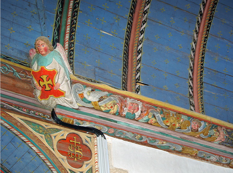
Although Brittany isn’t very big and it would be possible to reach all parts from a central location we decided to base ourselves in three areas to cut down on the amount of driving each day. I quickly identified Northern Brittany for the Parish Closes, Southern Brittany for the coastline and Morbihan for the megalithic remains.

We decided to use Brittany Ferries to book ferry crossings and also accommodation. They have a lot of gites scattered across Brittany. Coastal properties in the major tourist areas like Côte du Granit Rose were quite expensive but prices dropped if you moved inland or chose less popular areas.

Brittany Ferries produce a very detailed brochure and their website is easy to use. My only criticism is there is no logic in the order of gites in their brochure and if you are looking for a specific location it may be scattered across several pages. Check out locations carefully before booking as many can be at the end of a country road and not at all close to the village in the address.

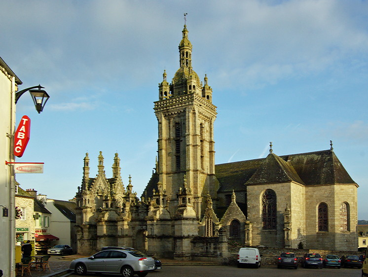
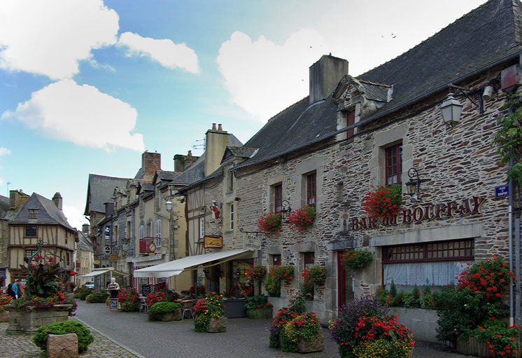
We eventually settled on Guengat for Southern Finistère, Plumelec for Morbihan and St-Thegonnec for Northern Finistère.

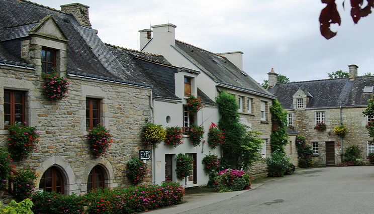
We found descriptions of the three gites we booked accurate and directions for finding them were too. All were spotlessly clean and well maintained. Standards are high. The owners did speak a certain amount of English. Michael’s school boy French stood up better than mine.

We decided to use the night sailing between Plymouth and Roscoff both ways. We knew we would sleep at it would give us an extra day at each end of the holiday.

It is not possible to book more than one location on the web so we had to ring up to make a booking. This was quick and easy and paperwork sent out promptly. Final paperwork was sent out 3 weeks before we left.

The ferry crossing was smooth both ways. It was a pleasant boat with a couple of shops; one selling perfumes and alcohol, the other gifts and some clothes. There is outside seating at the front. We had an inside cabin. Being an overnight sailing there didn’t seem much point in paying extra to have a window. There were four beds, so we could each have a lower bed. As in all ferries there was a reasonable amount of space for two people but might have been cramped with Four. My only complaint would be the towels let them down as they were thin and got damp quickly.

Loading and unloading was quick and efficient. Immigration at Roscoff hardly looked at our passport before waving us through. Coming back, Plymouth immigration was slower. Passports were studied and driver and passenger identified. We were also asked where we were going to and how long it would take before being waved through. We weren’t sure whether this was just making conversation or quizzing.
 
Last edited:
Impressions of Brittany

Brittany is very pretty. Around Roscoff area is flat with sandy soils. This is one of the main vegetable growing areas. As well as onions and cabbages, globe artichokes are big news here. We saw field after field of globe artichokes and the heads were for sale in all the super markets. Elsewhere potatoes are grown and a tremendous amount of maize for animal feed. It seems to be preferred to grass silage.

Away from the coast the land is gently rolling with a lot of deciduous woodland and pastures. We saw cows but no sheep. There are few hedges. Field boundaries are usually a bank of earth which gets overgrown by bracken. In other places, boundaries are marked by trees. The centre is quite hilly with open heathland with heather, gorse and rocky tors.


full


The roads are very good. A lot of money has been spent on the infra structure and many roads have been recently resurfaced with new roundabouts. The same couldn’t be said about the signing. Map reading was a nightmare. Michael’s patience often began to wear thin and there were muttered comments about sat nav, especially when I mixed up right and left yet again. Signing was inconsistent. Often there were no signs or different place names were used on successive signs.

We deliberately avoided the larger towns, apart from a visit to Concarneau for Ville Close, concentrating instead on the smaller towns and villages. Parking was never a problem. In small towns there was always plenty of parking in the main square or by the church. On street parking is allowed although some places operate a disc parking system in the centre. In large towns there may be a fee for parking in the centre or disc parking. Further out there are no restrictions and parking is free.

Shops including many supermarkets shut for lunch between 12 and 2 o’clock and parking restrictions are lifted. Bakers are usually open from about 7am and close about 7pm. A few may stay open over lunch.

Everywhere was clean, neat and tidy everywhere was. Vegetation was lush and there were many wild flowers around in September.

full


Many road verges had been planted with a wild flower mix with cornflowers, pink cosmo, yellow corn marigolds etc. There were flowers in all the towns and villages - window boxes, plant pots, flower beds. In some places the flower pots were carefully placed to stop parking.

full


There was no litter (or fast food culture) and very little graffiti. Most of the towns have preserved their medieval town centre with timber frame houses.

full


Away from the coast there doesn’t seem to be the dormitory development that spoils so many of our villages. There are no high rise flats. New buildings are traditional with large granite window surrounds, and very often it is difficult to tell the age of a building. Older houses have and still use wooden shutters. In newer houses these are replaced by metal roller blinds which are pulled down at night or when the owners are out.

Most of the larger towns had a supermarket, usually advertised for miles around on billboards telling you where it was. Most of the smaller settlements have kept their bakery and many still have a butcher and charcuterie. All seem to have a chemist, advertised by a large flashing green neon sign. The bakers open about 7am and there is a steady stream of customers collecting bread and baguettes for breakfast. Shops (including many of the supermarkets) shut between 12-2 but then shut at 7pm. There are few post offices and these just sell stamps and are open very restricted hours 10-12, 2.30-3.30.

full


The bread was excellent but didn’t keep very well. Supermarkets do sell sliced bread. We did try some for toast but it was pretty gruesome. There weren’t as many fancy cakes as I’d expected. We did like the Breton cake which is a bit like a cross between shortbread and a sponge. It is made with a lot of butter and you could smell the butter as you walked past the bakers in the morning. They also make something called Kougan Amann which is a bit like lardy cake but made with butter. That was decidedly more-ish! There are small biscuit factories scattered around the countryside. Most are open to the public and you can go and watch the biscuits being made and sample them. Many have a gift shop attached selling a wide range of biscuits, cakes, local produce, china, linen and gifts. We had bought all our presents and Christmas presents by day three of the holiday which must be a record.

Brittany is cider county and there were a lot of orchards and apples growing wild in hedgerows. Cider is made small scale locally and it is possible to visit and buy direct from the producer, as at Domaine de Kerveguen, near Guimaëc. There is a wide range of different ciders on sale in the supermarkets.

Most of the coastline is unspoilt with glorious beaches as well as superb rocky coastline with headlands and jagged rocks.

full


full


It is a pity we didn’t discover the area ten years ago as there is an excellent coastal footpath all round the coast. We did some shorter stretches of it and hardly saw a soul - as long as we avoided the honey pots and guide book must sees. Pointe de Penhir is an example of how tourism can destroy an area. We could see all the parked cars and people swarming everywhere. In places the footpath is fenced off to stop damage to the vegetation. Just a few miles away is Pointe de Dinan which scenically was even better and there was hardly a soul there.

full


Some areas of coastline are heavily developed with massive marinas and so much new housing that the villages run into each other. The Côte du Granit Rose is one of the must sees in the guide books. It has a beautiful coastline with sandy beaches, small off shore islands and massive rocks running out to sea. Everyone raves so much about it that I felt we really ought to explore the area. It was a mistake - it really is tourist central and we hated it. Even on a wet day in mid September, everywhere was busy and it was almost impossible to find space to park.


Brittany is stuffed with megalithic remains. The best well known are concentrated in Morbihan. The main must see area is Carnac where there are thousands of stones varying in size for 2-10 feet are arranged in rows that run for miles across the landscape. Visitor pressure means the stones are now fenced off and during the summer entry is by guided tour only to protect the vegetation.There are other smaller stone alignments which receive few visitors and it is possible to wander freely among the stone. Good examples of these are at Erdeven and at Les Pierres Droites near Monteneuf. The Michelin map marks many megalithic sites but there are also a lot of small sites not marked on the map which just have a small signpost from the road

full


The wealth of medieval Brittany was based on linen. Flax thrived in the temperate moist climate and was used for making paper, twine, ropes,towels, damask and fine linen as well as sail cloth. The remains of the small stone kanndis where the flax was washed and bleached can still be seen scattered around the countryside. Le Kanndi du Fers near St-Thégonnec has been restored and is open any time.

full


Linen was in great demand for sails for the navies of Spain and England and Morlaix was a major port. The money was used to fund large and lavish churches ( a bit like the wool churches in East Anglia and Devon) and neighbouring parishes would try and outdo each other in grandeur. The Parish Closes are the result of this rivalry.

full


Most of the Parish closes are found in Finistère, especially in the north, with St-Thégonnec, Lampaul-Guimiliau and Guimiliau being the ‘must sees’. Their baroque altars and retables are particularly impressive.

full


Everywhere we went we found delightful churches with amazing architecture that don’t merit a line in the guide books and were equally as good as the ‘must sees’. Nearly all the churches were open and we always found something to admire from the magnificent Baroque altars to the carved woodwork.


Some of the churches still have remains of wall paintings. Kernascleden has the remains of a marvellous C15thC Danse Macabre painted on the the walls.

full


Many of the older churches have a Holy well (or fountain) attached to them. The water drains into a large slate lined tank (lavoir) which was the communal washing station. Holy water must be better for washing clothes…

full


Brittany is definitely the place of legends. We went to find some ‘romano-gallo stepping stones’ across a river mouth. This is in fact a causeway of large granite slabs with gaps to allow the tide to flow between them. According to legend a local miller was fed up of having to make the long detour around the river. He made an pact with the devil who would build the bridge in exchange for the first soul that crossed it. Next morning the bridge was built. The miller loaded a sack of flour containing his cat. When he reached the bridge he pretended to be tired, put down the sack and released the cat. Apparently drunk peasants going home at night would fall off the bridge and drown - the devil’s revenge.

full
 
Map reading around Brittany

Map reading isn’t my strongest point and inability to to get right and left correct when giving directions doesn’t help.

I was using a copy of Michelin 1:2000,000 map which is a scale of 1cm to 2km. I was sure this would be detailed enough.


However, once we arrived I soon realised that many many of the minor roads are not marked on the map, a sure recipe for disaster.


Plans were often thwarted by lack of signs or my map reading skills. Inability to get right and left correct when giving directions doesn’t help. Michael’s patience often began to wear thin and there were muttered comments about sat nav.
Signing was inconsistent. Often there were no signs or different place names were used on successive signs.
On rural roads signing seems to be designed to help the postman or white van man rather than tourists. At each junction there was a small sign listing all the names of farms or hamlets, none of which were marked on the map. If in doubt we took what we thought was the more important road. Lack of road markings didn’t help in trying to work out which road was the ‘main’ one.


 Cross road signs are used for all junctions regardless of the number of roads. Advance warning signs are rarely used and when used nearly always seem to be placed near a minor road junction quite a long way before the actual junction. We would look at each other and ask “do they really mean this turn?”

In the countryside there are rarely advance warning signs before a roundabout. Where there are, names of major towns (eg Nantes, Brest, Rennes, Lorient) which can be up to 50 miles away, or tiny villages a couple of kilometres off the junction are used. This led to rapid scanning of the map trying to find out where these places were which I’d never heard of, as Michael kept saying ‘I need to know which way to go’.

We would drive slowly round the roundabout scanning the signs off which all used different names to those on the advance warning boards. There were several times we when we went round twice. Perhaps that explains why we saw so many cars which sides stove in. To add further confusion, the upright arrow is rarely used and an angled arrow used.This means it is not always clear whether signs meant straight on or turn right or left.

On the outskirts of smaller towns or villages there are no signposts. Instead there is a large board at the junction which looks a bit like a railway map as it has a diagram showing all the road junctions off that side turning with the names of the places they went to.

Although road numbers are shown on the Michelin map the number changes along the road and road numbers are not used on road signs.

We missed out turn many times. We took the wrong turn several times. Tempers got frayed and we missed some of the sights on my todo list. But we found some amazing places by chance...
 
Last edited:
Finding the hidden gems…..

Having read the different guide books for Brittany I was very disappointed. By the time you took out information on accommodation, traveling by public transport and eating, there wasn’t much detailed information about many areas. The ‘must sees’ were covered but the rest was skimmed over.

The older I get the more I have come to the conclusion that many ‘must sees’ are places to be avoided. There are some like the Carnac megaliths which have to be seen, but even then there are similar, although smaller alignments to be found close by at Le Petit Menec and the Alignments de Kerzerho at Erdeven. As these get fewer visitors, it is possible to wander freely round the stones.

full


I don’t want to spend all my holiday following the crowd and ticking off the must see. I want to explore and get off the tourist beat.

I used the Michelin 1:200,000 map for planning and map reading in France. This has symbols for all kinds of historical/touristy interesting things such as châteaux, ruins, churches, abbeys, scenic view points, caves, Roman sites, megaliths. Designated scenic roads are marked in green. Some of these places do get a mention in Michelin Green Guide, but the vast majority are ignored by other guide books. Smaller places may not have a web site either.

Michelin also produce departmental maps are of the scale 1:150,000 which have a lot of detail. These are excellent if you are wanting to concentrate on a small area or are wanting to walk. The downside is that you will probably need several as they don’t cover a very large area.

When planning routes I use the map to identify scenic drives looking for small towns and villages with the icon for a historic church or chateau. I then do a google image search to see what I can find out. Many of these places see few foreign tourists and repay exploring. Parking is rarely a problem. Churches are usually open and we have them to ourselves. Even the churches in small villages are lavishly decorated. Some like Commana with its Baroque altars and St Herbotwith its carved woodwork are the equal of the must sees of St-Thégonnec and Pleyben.

full


full


Places like Loncronan and Pont Aven are very much on the tourist route and at times it is impossible to park. There are many other unspoilt towns in Brittany which have preserved their medieval centres but get few visitors. La Vraie Croix, Pont-Croix and Malestroit are just three examples.

full


full


full


full


We found some amazing places using this method, like the Grotto at Callac near Plumelec.

full


There are the occasional disasters like the medieval village of Goenidou near Berrien, but they are few and far between.

I found a couple of references to the the medieval village of Goenidou on the web.

It was described as the ruins of a deserted C13-15th village which was discovered in 1983. Only part of the site has been excavated, revealing a group of three buildings around a courtyard, with a separate fourth building. The buildings uncovered were typical of a type common in Middle Ages. They were made of granite walls without mortar and turf roofs. the family lived in one end with a fire place. The animals lived in the other end of the building.

It was thought that either the monks of St Relec or St John of Jerusalem in Feuillee were responsible for clearing the land and establishing the village. The land was given to a tenant at a minimal rent to clear, build house and cultivate.

Pictures showed the excavated foundations surrounded by short grass.

It sounded just the kind of place we liked to visit.

The nearest directions I could find was that it was between Keraden and Quinoualch to the west of Berrien. I should have been alerted when emails to the Marie at Berrien didn’t get a response. However, I found all three places on the Michelin map and it seemed easy sailing.

Roads in the area are narrow and signing is erratic. We drove through Keraden, took a wrong turning and and reached Quinoualch the long way round. There was no sign of Goenidou. Michael was all for giving up but I bravely said turn left (keeping my fingers crossed). To my relief (surprise) not only did we find a tiny sign post for the medieval village it also gave a distance of 1500m.

This was down a grass covered, rutted sunken lane. Michael took one look and asked “are you sure about this?…..I hope I will be able to turn round….” By now I had the bit between my teeth and wasn’t going to be thwarted. “Yes” I replied.

The grass got longer and the trees met above our heads. Apart from one very empty house there was no sign of any human habitation or life. We eventually came to a cross roads. Other cars had been ahead of us and we could see where they had had difficulty turning round. The road ahead was rutted with mud and standing water. The side roads were overgrown and unused by vehicles.

We think the site was in the field at the cross roads. There were the posts that might have held a sign once. With the eye of faith we could see banks which may have been old walls which were covered with vegetation and bracken. The grass was long and wet. If this was the site then it had been left to return to nature.

We gave up and returned to the main road. There was a terse comment from Michael “That was not one of your better ideas”. He had a point….
 
Last edited:
The Parish Closes - one of the glories of Brittany

Les Eclos Paroissiaux are one of the highlights of a trip to Brittany. The largest and most impressive are concentrated in the area around St-Thégonnec, but they are found throughout western Brittany and occur as far south as Guehenno in Morbihan.

full


Brittany grew rich from the linen trade. Constant warfare meant there was great demand for hemp to rig ships and linen for sails. Parishes rivalled one another to build the biggest and finest close. Most of the Parish Closes were built during the C16thC. During the C17th, money was used to embellish the insides with splendid altars and statues.

Churches do need to be visited on bright sunny days when there is plenty of light to enjoy the detail.

The close has a wall surrounding the churchyard. Originally this would have contained the cemetery but many have now been moved to a separate site away from the church. Entry was through a triumphal archway giving access to the church and churchyard.

full


The arch at Pleyben has a small calvary on top.

full


The archway was only used for funerals and weddings and the rest of the time was closed off. There were smaller stepped openings beside it with flat slabs of stone to keep animals out of the close which were used by the parishioners.

Inside the close was an ossuary where bones exhumed from the graveyard were kept. Later as in St-Thégonnec, this became a Funerary chapel with crypt and altar where prayers could be said for the dead.

full


The calvary varies from a simple cross like Rochefort-en-Terre to massive structures like that at Guimiliau which has over 200 carved figures round the base, all in C16th dress. Some just have Christ crucified. Others have the two robbers on either side. There is usually a carving of Mary with the body of the crucified Christ. Round the base are carvings displaying different scenes from the life of Christ. Guimiliau had a platform so the preacher could point out the biblical references. Others had a table so the faithful could leave offerings for the upkeep of the church.

full


full


full


The churches may have massive towers topped with a tall narrow spire above. Many of these are copies of the beautiful Kreisker Chapel spire in St Pol de Leon. They stand out for miles as landmarks in the surrounding landscape. Some have an open belfry so the bells are visible. Others have openwork carvings on the spire. Some have a smaller circular tower next to the main tower which contains the stairs.

The side aisles have massive dormer windows with pointed roof which give the church the appearance of being multi-aisled.

full


Most have an ornate south porch and many have still have their carvings of the twelve apostles, often with remnants of the original paint. Others lost their statues when they were destroyed during the French Revolution.

full


Some churches are plain inside with few statues or decoration and no pulpit.

full


Most have plain stone or whitewashed walls, although the remains of frescoes can be seen in some churches , as at Le Martyre and Kernascleden.

full


Very often the roof of the chancel is painted blue and may also have stars.

Those in the wealthy linen areas are dominated by lavish Baroque decoration and statues.

full


St Herbot has a massive carved rood screen and lovely carved misericords.

full


At the back many churches have a massive organ above the west doorway which often has a highly decorative front. The font is usually in a back corner. Most are simple but others like Locmélar and Lampaul-Guimiliau have a highly decorated canopies.

full


Many churches had a carved wooden frieze running round the top of the walls. These had human heads, green men, mythical beast, oxen pulling a plough, a woman pulling a pint of beer from a barrel…Some were plain wood, others painted.

full


All the churches had confessionals although in many these were tucked away in corners and looked as if they were no longer used.

The thing that really struck us were the altars. These are splendid and many are backed by a huge retable that stretches from floor to ceiling. Lampaul-Guimilau and Commana are some of the best. These are are painted with lavish applications of gilt and have carved pillars with leaves and grapes as well as paintings of statues.

full


In Lampaul-Guimiliau there is a glorious carving of the birth of the Virgin Mary with Anne in bed being congratulated by the proud father and the midwives washing the baby.


Many churches have a holy fountain close by.

full


In some, like thje tiny Chapelle St-Thégonnec near Plogonnec, it is actually inside the building.

full


Each church celebrates the feast of its patron saint with a Pardon. These are only found in Brittany and involve the whole community and everyone either dresses in traditional costume of their best clothes. The night before, everyone goes to confession. The day begins with prayer and mass and then the statue of the patron saint is taken from the church and paraded around the streets along with the processional banners, some of which date back to the C16th. This is seen as an act of faith when the community asks for forgiveness and celebrates the joy of redemption.

My knowledge of Saints, especially Breton Saints has improved rapidly. There is St Sebastian pierced by arrow, St Roch showing the wound in his leg. St Hervé with the wolf who had eaten his ox and was so repentant he pulled the plough for St Hervé. St Margaret got swallowed by a dragon but the cross she was carrying irritated the dragon so much, it changed its mind. She is shown stamping on a dragon. So is St Pol de Leon who subdued the dragon terrorising and island… Then there was St Hubert, not to be confused by St Herbot… Oh and don’t forget St Lawrence who was roasted on a grid and now carries a grid iron.
 
Guide Books

I spend a long time with the guide books and on the internet researching our holiday. The following are my comments on the guide books available.

MICHELIN BRITTANY (GREEN GUIDES) - Verdict 5*

If you want detailed information about Brittany (including places off the usual tourist beat) this is the book to choose.
It is an excellent reference book with plans of the major towns, with suggested walking routes and details of things to do around the area as well as suggestions for sleeping and eating. There is an estimate of the time needed to see a place as well as suggested driving tours (with distances and times) from each of the major settlements.

You do need to 'work at' this book. It is not the sort of book you can skim through area by area and pick out must sees. The book is arranged alphabetically rather than regionally so is more of a reference book rather than guide book. The index is poor and many of the smaller places are not listed. I ended up having to make my own index to refer to.You have to know your geography to know which section of the book to find them. This is my major criticism of the book.
The maps are poor so I bought a copy of the Michelin Map France: Brittany 512 at a scale of 1cm to 2km which I used for planning.

We kept this in the car during the holiday to read up on places before visiting – having made sure I had a note of the page.

DK EYEWITNESS TRAVEL GUIDE: BRITTANY
- Verdict 5*

Anyone familiar with DK Eyewitness guides will know what to expect. For those who aren't, they are way ahead of Lonely Planet and Rough Guide when to comes to area maps, pictures and information.

The guide has a brief introductory section on history and culture. It is then divided into the 6 main regions of Brittany. At the start of each section is a reasonable map marking the main towns/attractions. The text gives details of things to do and see for each as well as other villages close too. There are plenty of excellent colour pictures as well as smaller more detailed maps and also some 3D maps of town centres. There are 2 page colour spreads of some of the major attractions eg Altarpiece of the ten thousand martyrs at Crozen, Abbaye Mont-St-Michel, Ville Close Concarneau….

Suggestions for accommodation or places to eat are found in a final section 'Traveller's Needs' which also covers shopping, general information on outdoor activities as well as general information on how to get to Brittany, and a survival guide.

The book is packed with information and lots of suggestions on places to go and things to do and see. It covers many smaller places not included by the other guide books.

Visually it is good to look at. As well as being used for pre travel planning, it is also the kind of book you will want to keep as a reminder of a holiday.

THE ROUGH GUIDE TO BRITTANY AND NORMANDY - Verdict 3*
This is a typical Rough Guide production – and you know what you are getting. There is a reasonable amount of information about different places with lists of restaurants and accommodation. It is upfront in telling you that places are not worth visiting, or those which are busy with tourists.

It divides Brittany up into the different coastal areas. The centre of Brittany is lumped together under the heading ‘Nantes Brest Canal’ and coverage of this area is a bit thin.

The maps at the front of each section showing the area covered are not detailed enough for planning purposes so you will need to use a larger scale map.

This is way, way better than Lonely Planet and Footprint Brittany. However for information on those out of the way places, Eyewitness or Michelin are better.

BRITTANY FOOTPRINT TRAVEL GUIDES - Verdict 2*

Superficially this looks good as it is printed on good quality paper with some nice photographs. It is the kind of book you can leave lying around to impress friends.

POSITIVES

• The Introductory section has a useful run down on history, culture, activities, shopping.

• There are some nice photographs.
• Few towns are covered in detail, some have a map.

• The section on sleeping, eating and shopping at the end of each region are good with plenty of ideas and sufficient detail to help make a choice.
NEGATIVES

• There is only one small map of Brittany. Many places mentioned in the text are not marked on the map.

• There are no detailed regional maps.

• Most places are covered in a few lines. Even descriptions of important sites like Carnac are very superficial with no map or information to help find the sites mentioned.

• Opening times and entrance fees are not always given.

• Information to find tourist attractions is not given or is so vague as to be useless. "…follow roads round a triangle to find them.' May be it is obvious when you are on the spot?

• The two page spread on walking was spoilt because it was printed on a sepia and brown background picture which made reading the print difficult to impossible. The double page spread on sports and activities is printed on a pale grey/green/blue picture of coastline and equally as difficult to read.

I've used Footprint books for India, Patagonia and Bolivia and although maps have been poor, I have been impressed by the amount of detail and information in them. They are solidly written fact. I was very disappointed by this guide book.
Only buy if you want information on sleeping, eating and shopping. If you want detailed information about towns, villages and sights in Brittany, don't buy this book.

BRITTANY AND NORMANDY – LONELY PLANET COUNTRY AND REGIONAL GUIDES - Verdict 1*

This is the guide for those who don't want to do any preliminary research or find anything out about the history and culture.

About the only good thing to be said for it is that it is logically arranged into driving itineraries. However there is little or no information for route finding. Places are mentioned which aren't shown on their maps. Area maps are not detailed enough to be used for map reading on holiday, so you need to buy maps for this. More town plans would be appreciated.

The naff sub titles also irk. "Bring out your inner twitcher"

If this is the 'new look' Lonely Planet then I won't be buying any more as it is dumming down on information. If you want a guide book with detailed information then don't buy this one.

MICHELIN REGIONAL MAPS: BRETAGNE

This is at a scale of 1:200000 (1cm to 2km) and shows all of the smaller unclassified roads between the villages. There are maps on both sides of the paper. The maps are clear and easy to use. There is a good place index although the grid squares are large so it can take a time to find the smaller settlements.

Attractions (Churches, Chateaux, ancient remains etc) are marked on the map by symbols. There is table showing distances and driving times between major settlements.

The map is a bit big for easy use and we had to strengthened the corners with clear sticky tape before use to stop them tearing.

MICHELIN FRANCE 2011 TOURIST AND MOTORING ATLAS

The folding map was a bit too big to use easily in the car, so we bought a copy of Michelin France Tourist and Motoring Atlas to use when we were in France. The maps are the same scale of 1:200,000 and has the same symbols. It also has smaller scale planning maps.

The book is 462 pages and heavy. It is also spiral bound which meant by the end of the holiday the more used pages were beginning to tear. There were some days when we were needing to use several different pages, which could make advance route planning ‘interesting’ and the folding map came into its own here. I also disliked having to navigate across the spiral bound joins.
 
Last edited:

How to Find Information

Search using the search button in the upper right. Search all forums or current forum by keyword or member. Advanced search gives you more options.

Filter forum threads using the filter pulldown above the threads. Filter by prefix, member, date. Or click on a thread title prefix to see all threads with that prefix.

Sponsors

Booking.com Hotels in Europe
AutoEurope.com Car Rentals

Recommended Guides, Apps and Books

52 Things to See and Do in Basilicata by Valerie Fortney
Italian Food & Life Rules by Ann Reavis
Italian Food Decoder App by Dana Facaros, Michael Pauls
French Food Decoder App by Dana Facaros, Michael Pauls
She Left No Note, Lake Iseo Italy Mystery 1 by J L Crellina

Share this page

Back
Top