• CONTACT US if you have any problems registering for the forums.

Two Weeks on Tenerife, Canary Islands, Spain

Pauline

Forums Admin
Trip Report 2020-02 Spain, Tenerife

This was our first trip to the Canary Islands. We spent two weeks there at the end of January, into February 2020. We liked Tenerife and will return for another winter holiday. I am not writing a day by day trip report as I usually do, but instead an overview of the whole trip.

For those who don't know me, I have traveled a lot in Europe but always in Italy, France and Switzerland, not in Spain. My husband Steve and I are American but we moved to England 10 years ago.

GEOGRAPHY

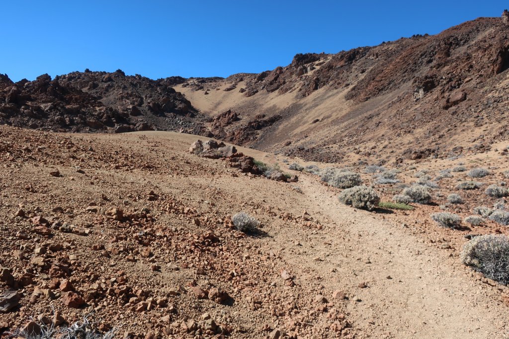
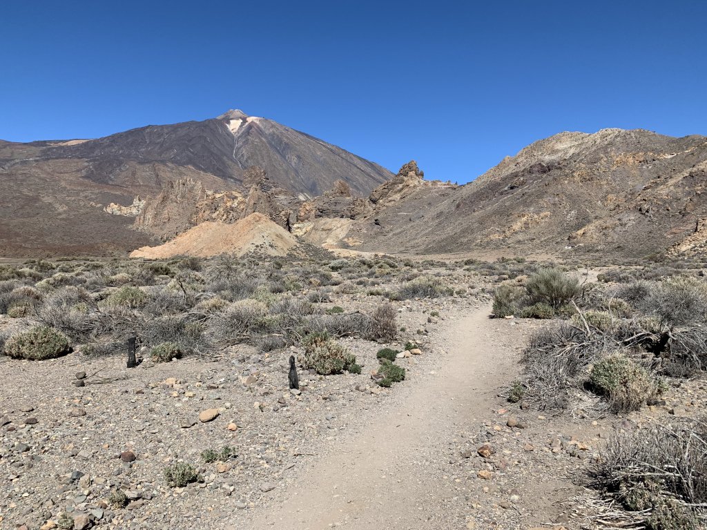
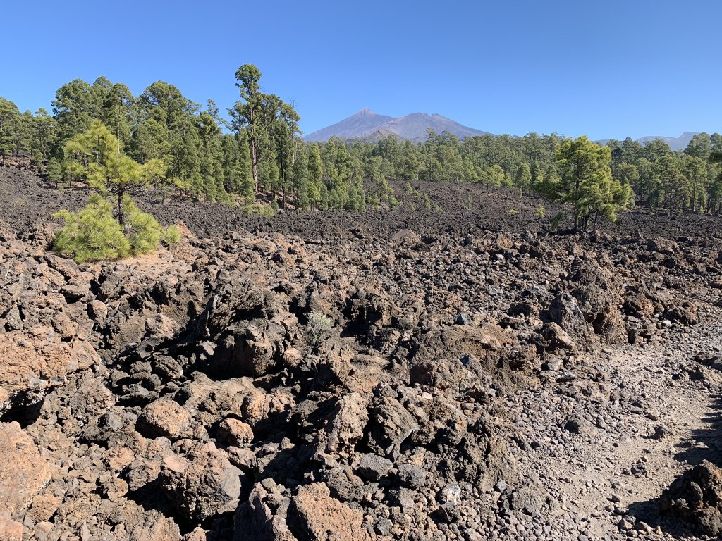
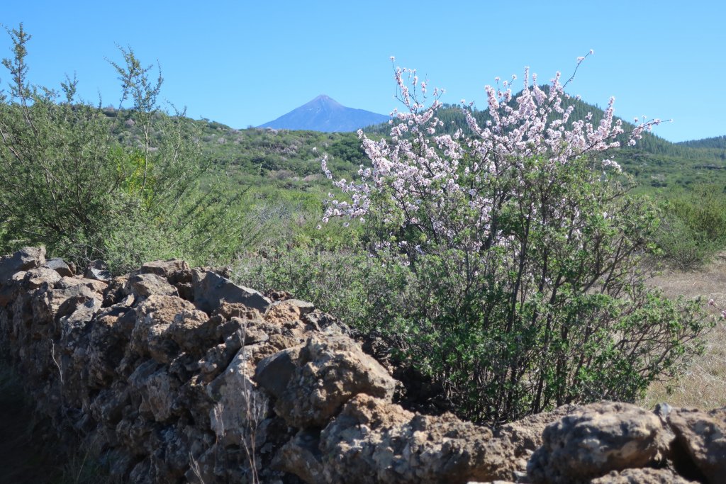
The Canary Islands, part of Spain, are off the western coast of Africa less than 200 miles from southern Morocco. Tenerife is the largest and most populated island (population of 933,000). It is the most touristed island with large resorts on the south west coast. A large volcano, Mount Teide (summit at 12,000ft), is in the center of the island. Mount Teide is considered active and last erupted in 1909.

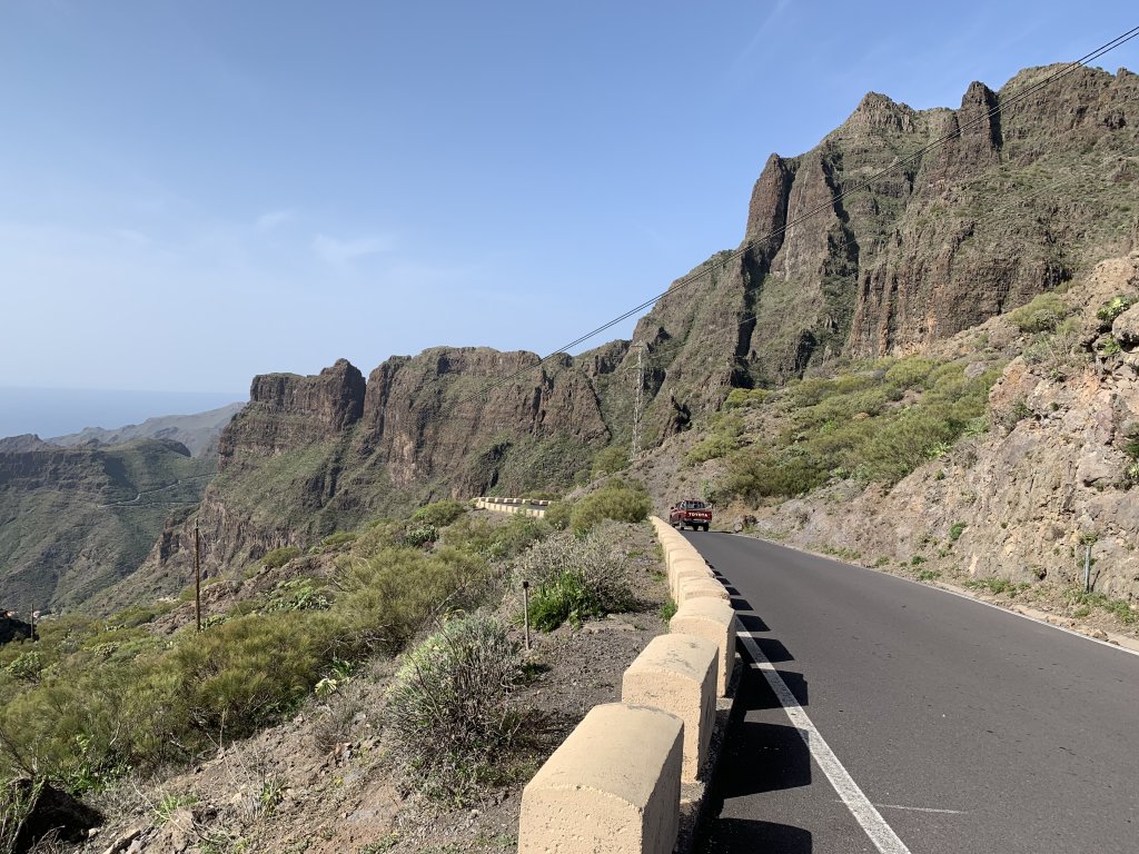
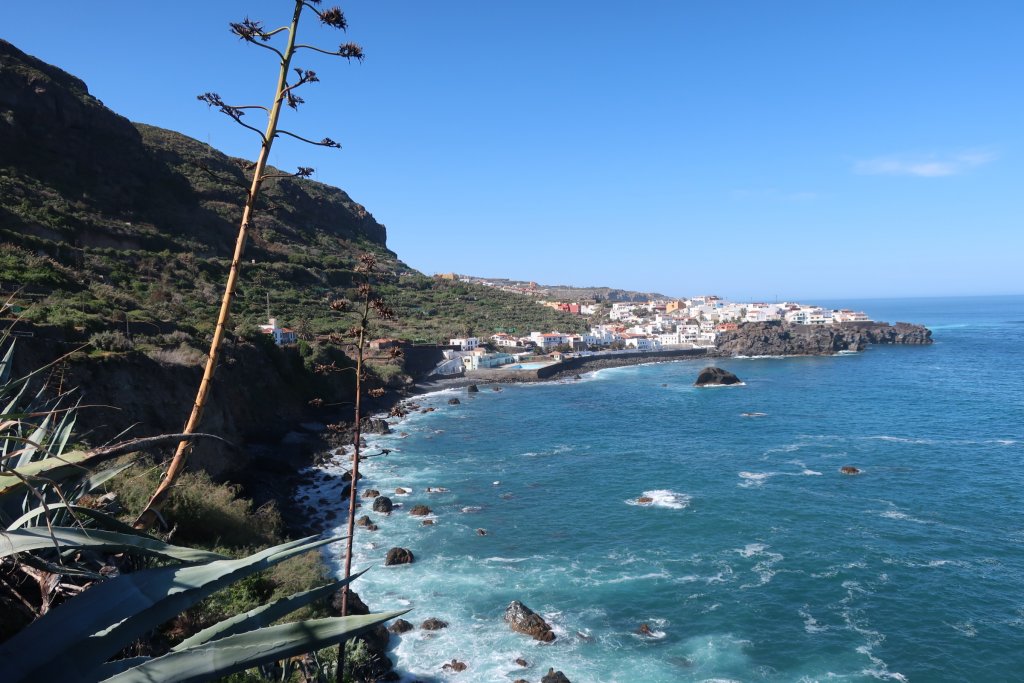
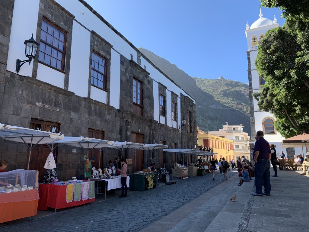
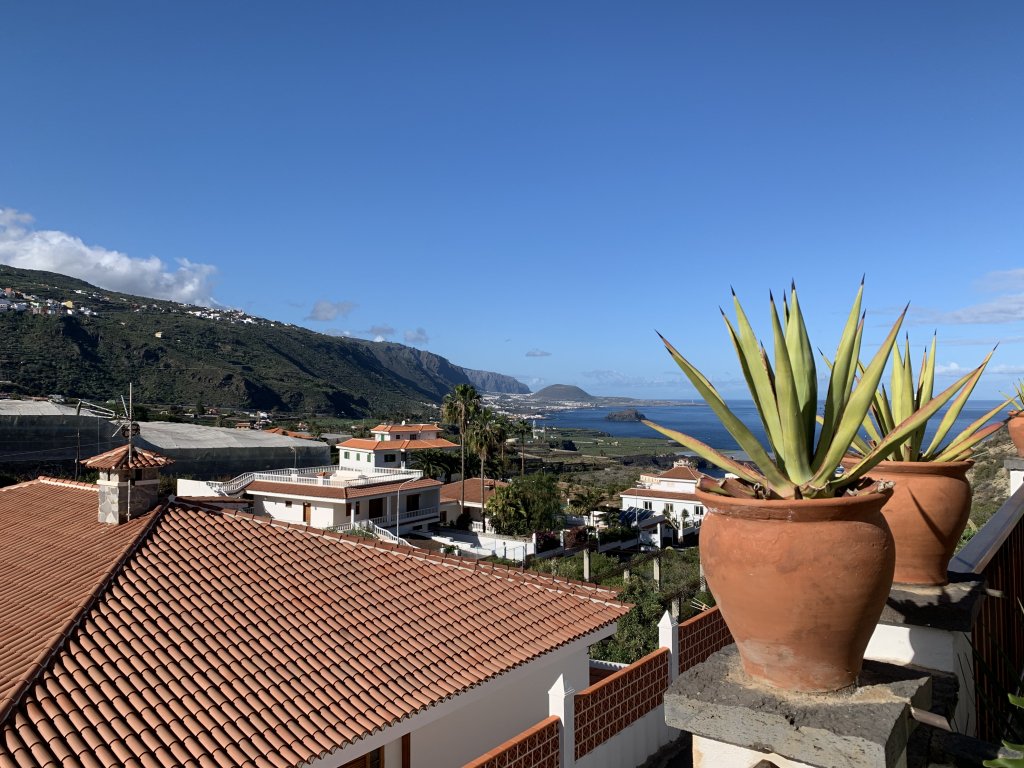
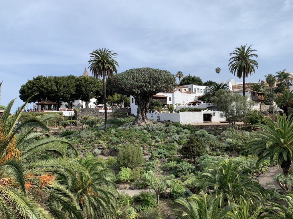
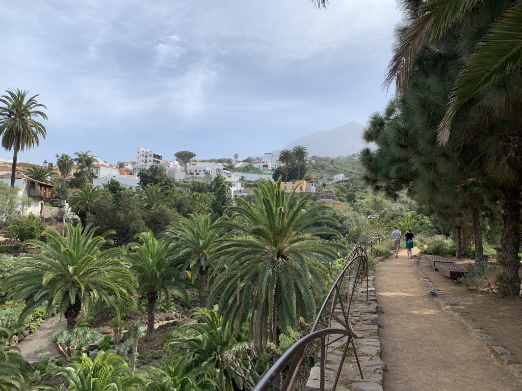
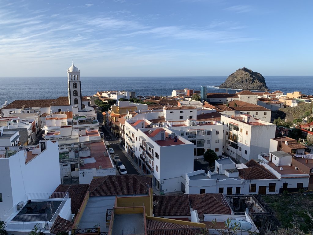
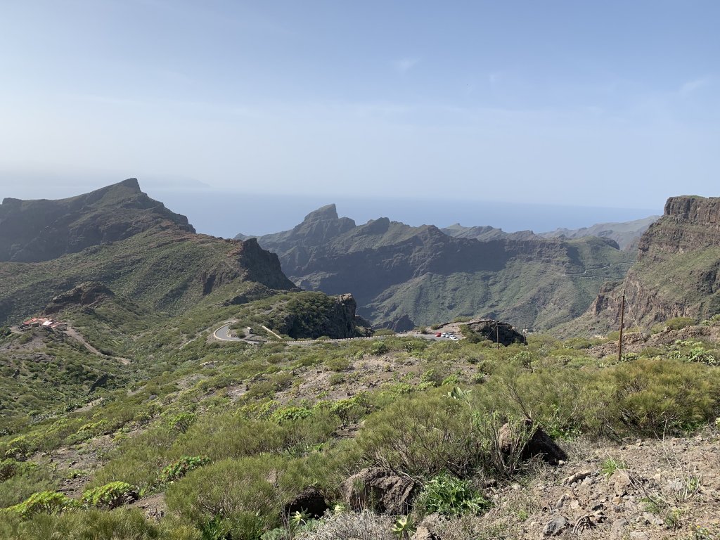
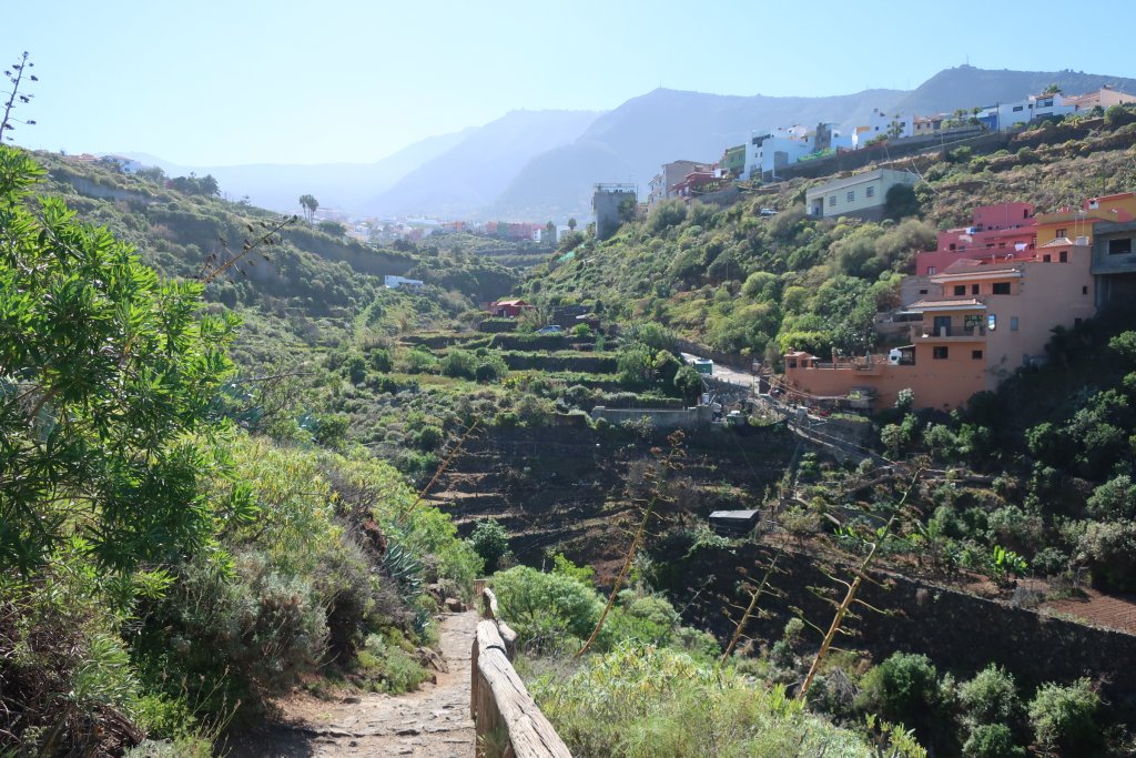
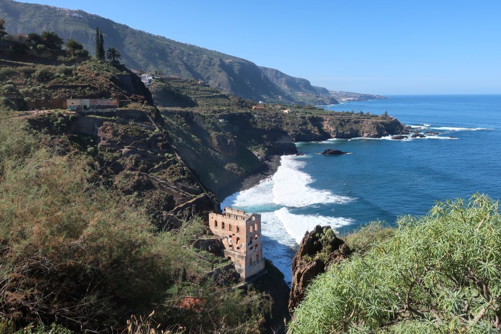
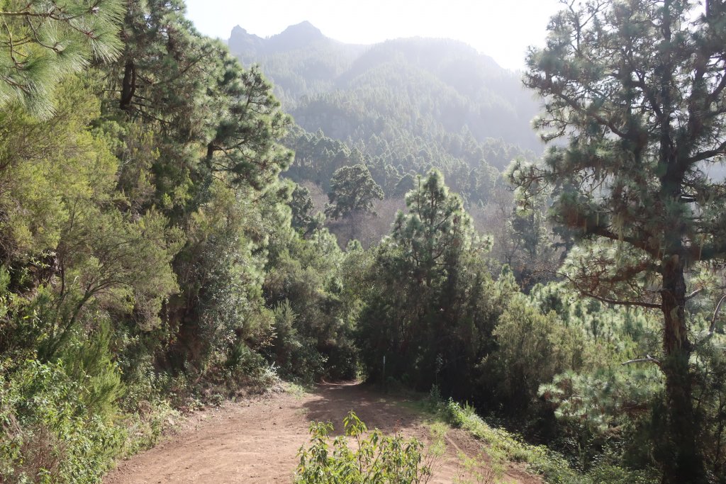
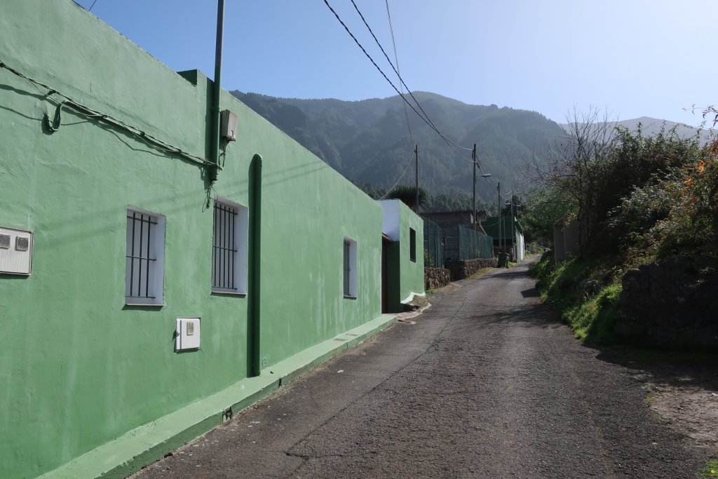
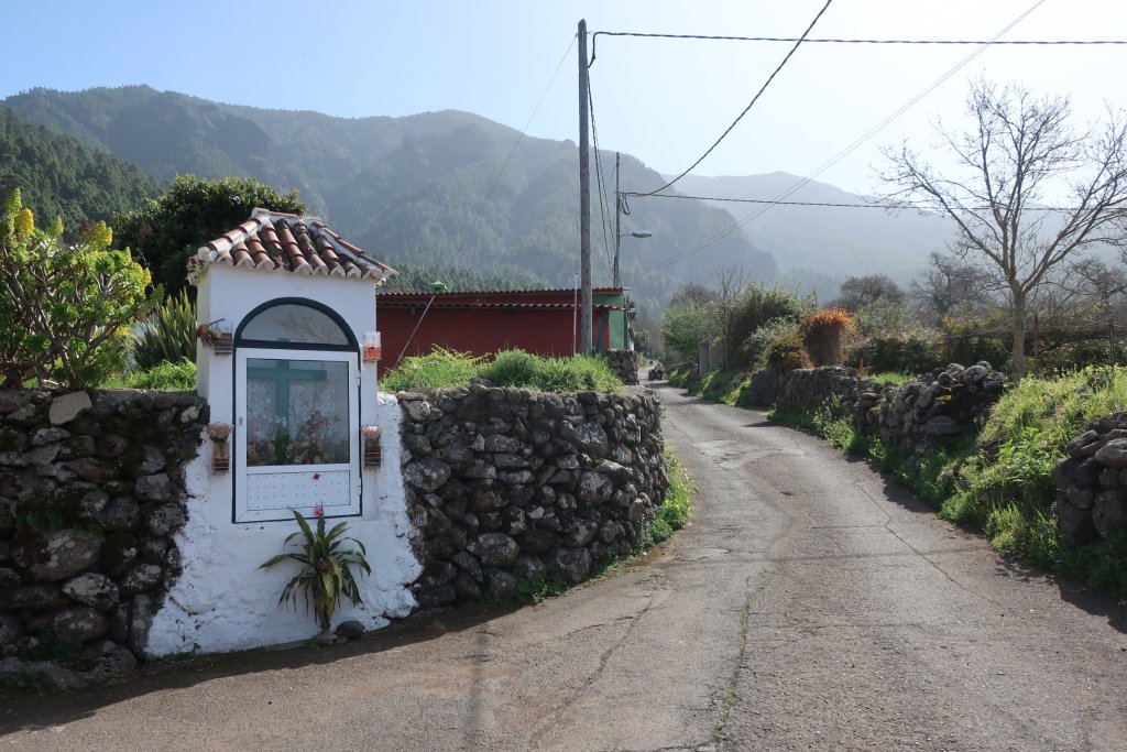
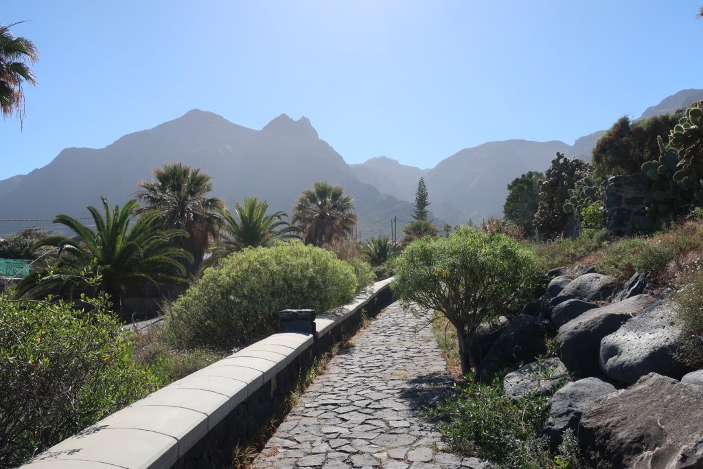
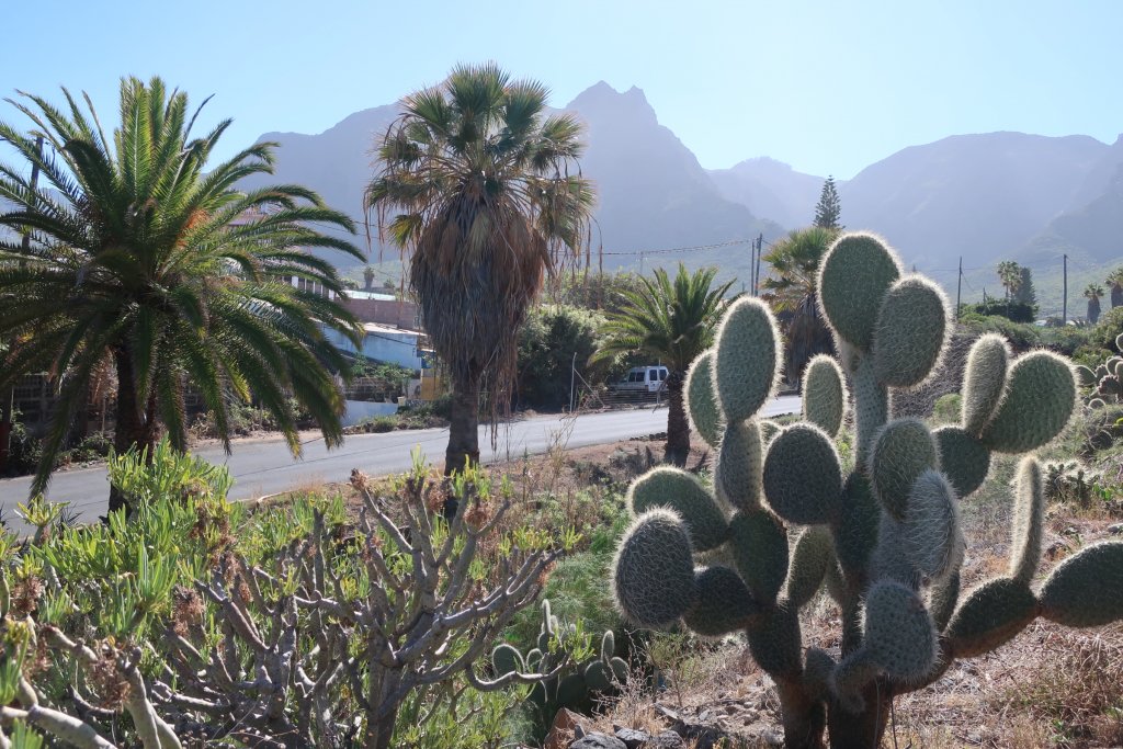
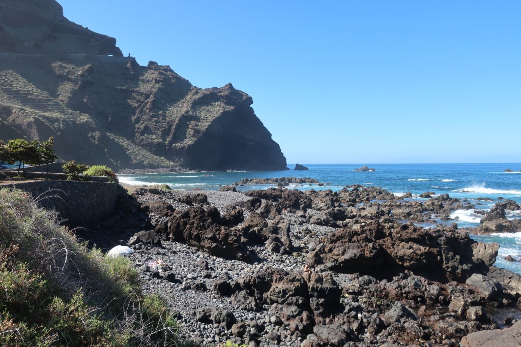
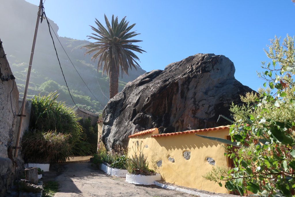
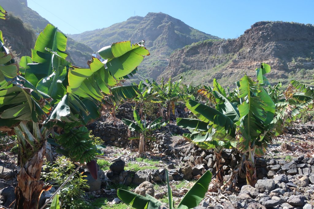
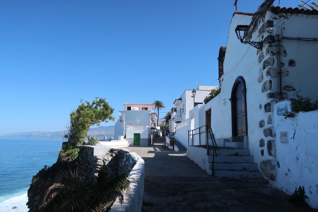
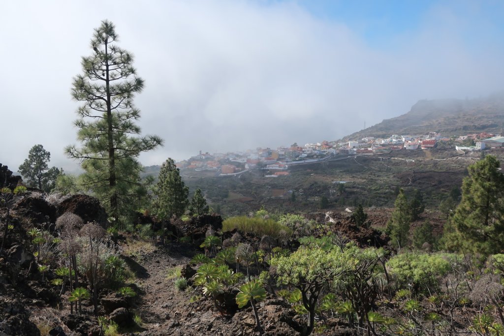
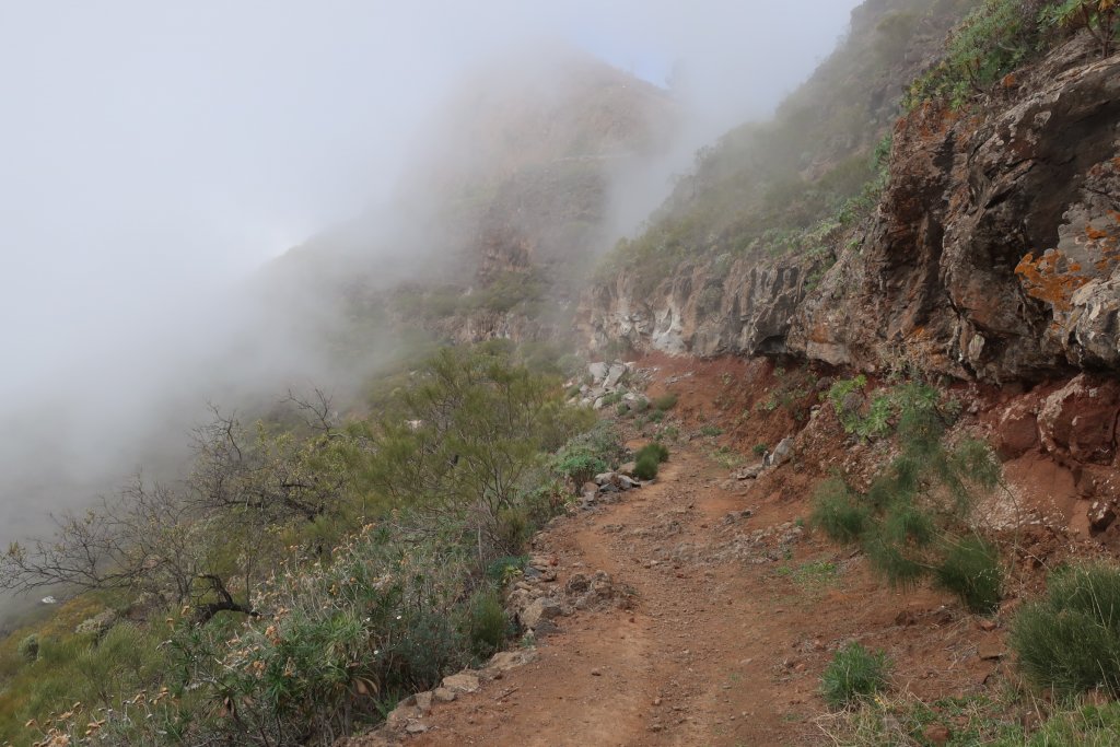
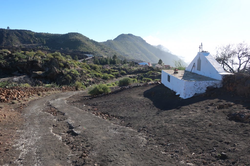
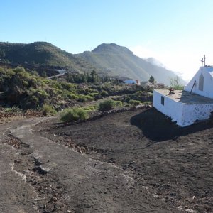
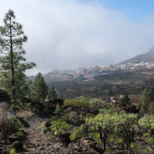
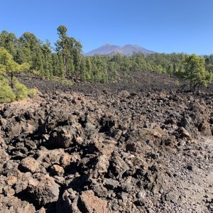
The island feels like one big mountain with flatter coastal areas on the edges where the resort towns and some of the older towns are located, steeper slopes rising up with agriculture and towns until the pine forest starts at about 1000m. There are many deep canyons (barrancos). Above the pine forest the volcanic area is covered in rubble and lava from the Mount Teide eruptions. You can drive from the south side to the north side over the volcanic area. The Anaga Peninsula in the north above Santa Cruz, the main city on Tenerife, is mountainous and has rainforest-like areas.

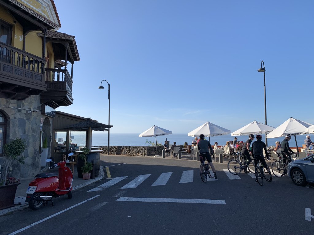
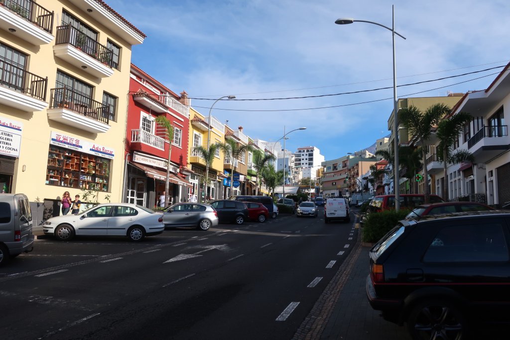
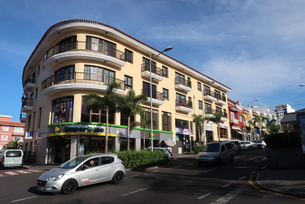
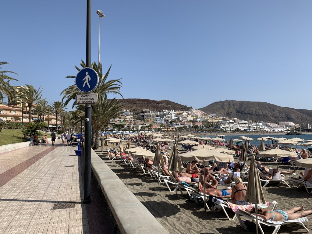
The island divides into two distinct geographical areas with Mount Teide on the dividing line. The southern part of the island is dry and barren, with the most sunshine and hottest temperatures. Instead of one long southern coast, the island comes to a point in the south with a south west and a south east coast. The main airport is at the southern tip. Most of the tourist development has been on the south west coast from Los Cristianos which runs into Playa de las Americas and on to Costa Adeje. Further along the coast are more resort areas ending at Los Gigantes with its steep cliffs. These areas are well developed with streets of hotels, condos and shops reaching well back from the coast and starting up the mountain.


The largest city, Santa Cruz de Tenerife, and nearby La Laguna are at the top of the south eastern coast. We only drove through this area and did not stop to visit. It is very built up.

View: https://www.google.com/maps/embed?pb=!1m18!1m12!1m3!1d449683.4808638654!2d-16.802852933033225!3d28.293713461525424!2m3!1f0!2f0!3f0!3m2!1i1024!2i768!4f13.1!3m3!1m2!1s0xc4029effe8682ed%3A0xb01a4bf1c84baf3c!2sTenerife!5e0!3m2!1sen!2suk!4v1581864415684!5m2!1sen!2suk


MY IMPRESSION

The Canaries is a sunny winter destination for Brits and Northern Europeans. It is perfect Brits because it is close (4.5hr flight) and in the same time zone. They mostly go to the resort towns on the south west coast. The northern Europeans seem to go more for the sunny weather and hiking. We came across many Germans on the hiking trails.

The only tropical places that we’ve gone to for winter breaks previously are Hawaii, where we vacationed many times, and Tahiti, where we went once. We visited these places from the US or Canada. We currently live in the UK. If I still lived in the US and was looking for a sunny winter break, I would not consider the Canaries because there are many similar or better destinations close by. I loved Hawaii but it is too long of a flight from the UK. I’ve never been to the Caribbean but have heard how much people love it. Those destinations would be better than the Canaries I think.

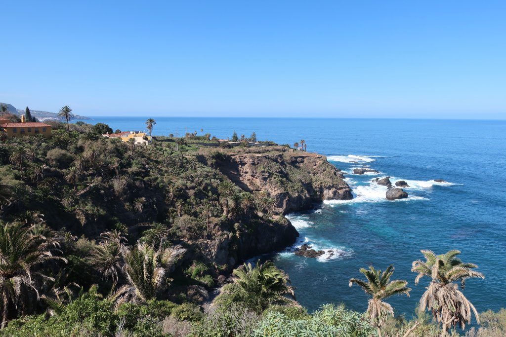
I loved the north west part of Tenerife where we stayed. I disliked the south west coast with the resorts. The beaches are beautiful but the resorts were too built up and busy. They are not like the resort areas on the Hawaiian Islands where you get a few big hotels and a small neighbourhood. There were not many high rises, which was nice, but many low rise apartment buildings. I imagine that if you found the right place in one of these resorts it could be nice, but it isn’t the place for me.
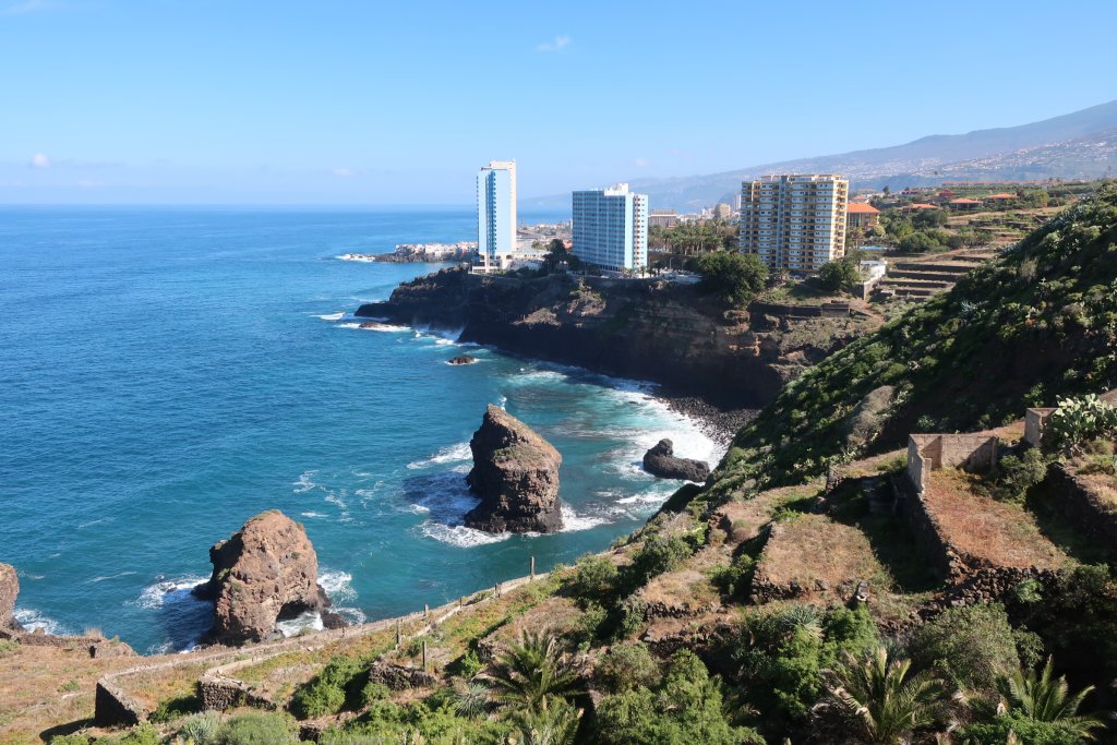
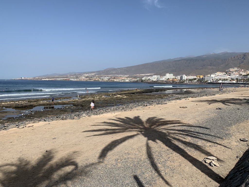

GENERAL

The time zone is GMT, the same as the UK but the Canaries are west of the UK and it feels like you are an hour or two off the time zone. In the UK the sun sets at 4:30pm in the winter but in Tenerife it set at 6:30pm. I know Tenerife is much further south, but I was surprised how late the sun set and how late it rose in the morning.

Many people speak English, but not all. We did fine with the language because there really are a lot of similarities with Italian.

There are no bugs! We did not come across mosquitoes or flies or any other annoying bugs in towns or out on the hiking trails.

The roads are not as steep as I thought they would be from what I read and the mountain roads were easy to drive.

There is a lack of public toilets in the towns and at the beaches but you can easily go into a restaurant or café to use the facilities.


WEATHER

We were looking for a place to get sunshine and warmth during the winter months and we found it. The weather was very good. We had sun most days, only one day with rain, and the temperatures were usually in the low to mid 70sF. One day was quite hot – over 80F.


Continued in the next post.
 
FOOD AND DRINK

The restaurants were mostly small and family run. There was always a vegetarian choice, but it is harder for vegans to find dishes. Most small towns had a couple of restaurants and cafes. Some restaurants are located away from towns on the mountain roads. The lunch hour is long. We had lunch as late as 4pm.

The coffee was the best I’ve had, and I’ve had some great coffee. There are a lot of cafes. My favorite was a kiosk in the central plaza of Garachico.


The fruit and vegetables on Tenerife are very good. We bought ours at small weekend markets or a fruit and vegetable shop in town.

Bananas everywhere and the bananas are great! The place we stayed had a big basket of bananas at the entrance so we were well supplied with them. There are large banana plantations along the coast in most parts of the island. Some are covered in plastic/cloth – large greenhouses, some are open air.

We don’t drink but I saw signs for wineries and saw a few vineyards.

RESTAURANTS

We did not eat out often but there were a few places that I recommend.

Restaurante Mirador de San Pedro, located at a viewpoint (mirador) on the highway between Icod and Puerto. Outside seating with an amazing view, good food and service.


Q'Arepas, a casual Venezuelan restaurant in the center of Icod, below the main plaza. Great vegetarian plate of rice, beans, fried banana.


Pizzería Rugantino in Garachico, weekends only. We did not get there but it is supposed to have great pizza.

Kiosko Plaza La Libertad in Garachico where I had my first, and best, cortado of the trip. Most towns in the north have a kiosk café in the center of their plaza. The one in Icod is also good.


Restaurante El Limón, a vegetarian restaurant in the center of Puerto de la Cruz. We had a good lunch there. The seitan dishes are very good.

El Guanche, vegetarian restaurant in Masca. We did not get here because the mountain road to this village was too much for us.

DRIVING

There are big highways (autopista) around most of the island. They end above Los Gigantes on the northwest side of the island where you are put onto slower, mountain roads. You are on these until you are west of Icod, then you can get back on a main highway heading to Puerto (to get to Icod you have to continue on mountain roads). It looks like they intend to connect these highways in the future. The autopista let you move around the island quickly. It would take about 2.5 hours to drive around the entire island.

The secondary roads are very good. Some parts of the island reminded me of the Amalfi Coast in Italy with the main road twisting along cliffs and going through towns perched on the cliffs. But the driving was completely different. The roads were in good shape and well signed. There were hardly ever cars parked along them. Drivers seemed to keep to the speed limits. Some small towns had speed bumps to remind drivers to slow down. The traffic was not heavy.

There are some very narrow and steep roads. Waze unfortunately took us on these twice. Once we were driving to the road up to Mount Teide (to hike at Aguamansa) and Waze told us to leave the autopista one exit before the one signed for Mount Teide. Foolishly we followed Waze and ended up driving through a town with the steepest roads I have ever seen. This went on for about 15 minutes until we joined up with the regular road to Mount Teide. Another time it directed us to a shorter route from Santiago del Teide back to Icod, ignoring the signed route, and we drove on very steep roads from the top of Icod down to the bottom. But, these are the exception. My advice is to follow the signs, not Waze.


SWIMMING

It was not hot enough for me for swimming in the ocean but we did go into our small pool a few times.

On the north side the beaches were not busy but there were some people out and a few swimming. The ocean is rough on the north side at this time of year. There tidal pools in the rocks that some people swim in.


On the south side in the main resorts the beaches were crowded and some people were swimming. Some areas have sea water pools beside the sea that looked like they would be good for swimming.

Continued in the next post.
 
STAYING ON THE NORTH SIDE

We stayed in an apartment in a villa on the outskirts of Icod de los Vinos, on a hillside with a view of the sea and of the town. The San Marcos beach is only a mile away, as is the town.


I liked this north west side the best of any area that we saw on Tenerife. For me the south west coast is too built up and busy. It could have been a beach resort anywhere. The north west side, west of Puerto de la Cruz, is charming with small towns and a rugged coastline. There are some areas of new development but many of the towns retain their historic look. There is a lot of hiking in this area or close by.

GROCERY SHOPPING ON THE NORTH SIDE

Icod de los Vinos
: There are two large supermarkets in Icod: SuperDino and Mercadona. You find these chains around the island. I liked SuperDino because it has a good natural foods section. We bought our fruit and vegetables from a small shop on the main street across from the SuperDino.


Garachico: There is a small but good market on Saturday and Sunday mornings (in the main plaza). There are a couple of fruit and vegetable sellers (mostly organic), a table full of homemade desserts and someone selling the best bread that we found. We had a hard time finding good bread. It is mostly very white, even from the local bakery in Icod.


Puerto de la Cruz: This larger city has good bakeries in the main area and larger supermarkets. We found one bakery with good German-style bread on the promenade (Calle de San Telmo), east of Calle de Santo Domingo. Another similar bakery was in Columbus Plaza on Calle Quintana, east of Plaza del Charco. There is a good natural foods shop in Puerto, La Vida Es Bio, Calle la Hoya, 45, in the town center.


ACCOMMODATIONS ON THE NORTH SIDE

Alberto Dorner
: https://albertodorner.com/ Seven two and three bedroom apartments in two villas on a small road a mile from Icod de los Vinos. We rented a two bedroom apartment with a small plunge pool and a huge terrace. The apartment was beautiful, spotlessly clean, had great views and the terrace was well furnished. Considering that we were in a building with four or five apartments, it was very quiet and private. We could hear our neighbors out on their terraces and see the terrace next door, but it was not a bother. The apartment was very comfortable and the kitchen was good. These apartments are well run. During the day you will see some staff around and you can contact them by text if you need anything. They have a small bodega where you can buy bottled water, nespresso coffee (apartments have nespresso machines) and wine. We loved staying here. The only downside is that the apartments are expensive. I booked directly instead of through Airbnb so got a better rate.


There are a lot of Airbnbs on the north coast. Many are in Puerto de la Cruz or La Orotava. These would be good locations. I loved the area we were in and would happily stay here again. These towns would be good locations: Icod de los Vinos, Garachico, San Juan de la Rambla. These are all in a good location and close to or on the water. There are other towns higher up that might be fun to stay in.

Continued in the next post.
 
TOURING ICOD DE LOS VINOS AND AREA

Icod
is a pretty town that makes its way up the steep hillside above the coast. The beach town of San Marcos is on the coast is only a few minutes from Icod (a bus runs frequently). In the center of Icod there is a large botanical gardens which features the 800+ year old Dragon Tree. You can see the tree from the main plaza, beside the church if you don’t want to go into the gardens. We toured the gardens and spent a nice hour walking around them. Icod has some nice streets lined with old houses around the central plaza.


About 10 minutes by car from Icod, and on the coast, is Garachico, my favorite town in the area. The guidebook (Rough Guides) says it is too touristed and other nearby towns are better (Los Silos) but they are WRONG! Garachico is lovely. There is parking along the road or at a lot at the western edge of town. There are a lot of visitors but because of this there are lots of shops and restaurants. On the weekends they have a small market in the main plaza (organic fruit and vegetables, etc). We walked on the promenade along the water. Garachico was once the main port on Tenerife but a lava flow in the 1700s destroyed the port and part of the town. You can see the lava still where it has formed pools along the water’s edge. People swim there. There is also a small beach. In the town are narrow streets lined with old houses. You can see the Land Gate (Puerta de Tierra) remaining from 16th century Garachico Port. We climbed up the town on steep staircases to the upper town where there are good views. We visited Garachico several times. I liked sitting in the main square at the kiosk café.


In the other directions is San Juan de las Ramblas. The town is higher up, with Las Aguas on the beach. We did a hike from Las Aquas. San Juan must have tourist accommodations because it has several cafes and restaurants. If you drive to the coast from the start of the town you can see Charco De La Laja, large volcanic pools where people swim.

Santiago del Teide sits almost on the south side, in the mountains above Los Gigantes. It is a small town but situated in a beautiful valley with blooming almond trees. You can drive out to Masca from here (if you are brave enough to try the road).


I liked the drive from Santiago to Icod. From Santiago you snake up and over the mountains that divide the south from the north. There is a good viewpoint at the top where you can look down into the Erjos Valley towards the ocean on one side and the Arriba Valley on the other. Erjos has pools formed from old quarries but they were dry when we were there. The road continues on along the mountain through villages perched on the edge of steep cliffs. Just past El Tanque you see a sign for Icod and the main highway starts again. But take the other road for Garachico and drive through San Juan de Reparo to come into the lower part of Icod. A beautiful drive.

Continued in the next post.
 
TOURING THE SOUTHERN COAST

We spent one day exploring the resort areas on the south west coast. Traffic was thick going in and out of Los Cristianos. The street parking was full but we found an underground paid lot near the beach. The area was very busy with lots of restaurants and shops, a shock after our days in the smaller towns of the north side. We walked along the promenade but it was very crowded and we did not get that far.

From there we drove on to Los Gigantes where I had thought we might stay when planning the trip. This town is more interesting than the Los Cristianos/Playa de las Americas area, but it was also crowded with cars and people. We drove then into the town but could not find any parking. Driving out we got lost in an endless modern suburb. We probably gave up too easily on this area. I have read that there are pretty coastal areas between the main resorts and Los Gigantes and there are supposed to be pretty towns up the mountain above them.

We hustled it back up into the mountains to Santiago Del Teide. I had read about Masca, a beautiful village perched out in the mountains above the water. The one restaurant in town is vegetarian! It is reached by a narrow mountain road that goes from Santiago del Teide. We started out on the road to Masca but turned back at the first viewpoint (six minutes into an 18 minute drive). The road was paved but had no center line, was very narrow in spots, and there was a lot of oncoming traffic. From the viewpoint we could see how much further it was. If we hadn’t spent the morning dealing with the traffic at the resorts we might have been brave enough to do this drive. Many others were doing it. Next time we will walk to Masca and take the bus back. (Note: I really get nervous on narrow mountain roads. Steve would have continued but I called it.)


We went back to Santiago and had lunch. Steve had very good fish and I had omelette.

I drove back to Icod and let Waze take us on a different route which was lovely at first. We went higher up through pine woods but Waze kept telling me to turn left on steep, narrow roads and I refused. Finally I made the turn and was on very narrow, very steep lanes that brought us into Icod. Too steep!

Continued in the next post.
 
DRIVING OVER THE VOLCANO, MOUNT TEIDE

On a sunny and clear day (like most days) we did a driving tour of Mount Tiede. From Icod we took the main highway to the autopista, then on to the La Orotava/Mount Teide exit. A few days earlier we had come this way to do a hike at Aquamansa. That time Waze had us exit before the signed turnoff and took us on the steepest, narrowest streets I have ever experienced, driving in a residental area with people standing on their doorsteps talking to each other. How they could cope with living on such a steep road is beyond me. This time we took the signed exit and were on a good mountain road that went up through the town of La Orotava and into the countryside, then through Aguamansa and into the pine forests. Once through the forests we were in the volcanic area.

We stopped for coffee and huge donut at a restaurant near the park entrance, then we drove across the volcanic area, stopping in a few places where you could park and then walk out. The area is stunning. Many of the parking areas were busy but we always found a spot except for Roques de Garcia where we had a longer hike planned. The lot was full and so was the parking area for the hotel across the road. We could have parked in a spot a bit further on road but we were past it by the time we realized. Instead we parked at lookout further on, found some marked trails and did a hike in the valley below Roques de Garcia. Beautiful!


We continued driving and took the mountain road to Santiago del Teide. We stopped at a roadside restaurant that I had read about, Le Fleytas near Erjos, and had a mediocre lunch. Too bad. We had passed a few restaurants that probably would have been better.

Continued in the next post.
 
HIKING ON TENERIFE

Tenerife is said to have the best hiking on the Canary Islands. There are several hiking guidebooks for the island and many hiking websites. There is almost too much information. After weeks of pouring over the hiking guides I realized that much of the hiking is difficult - long climbs up or down steep valleys (barrancos). This is hiking for the younger and more adventurous. But I persisted and found a good selection of easier hikes. For me an easy hike is three to five hours, with an ascent/descent under 500m (1600ft).

I bought all the hiking books I could find.
  • Walk this Way Tenerife, written by locals Andrea and Jack Montgomery. Also available in PDF from their website. I used this book the most. The maps are not good but they have a good selection of walks and have an appendix where they list walks by difficulty. This let me find easier walks.
  • Sunflower Tenerife, Car Tours and Walks. A few easier hikes but many are one way hikes where you need to figure out local buses.
  • Sunflower La Gomera and Southern Tenerife, Car Tours and Walks. The first books has southern hikes, but this books has more.
  • Cicerone Walking on Tenerife. Some overlap with the Sunflower Guides and mainly longer hikes but good maps and photos.
  • Rother Walking Guide for Tenerife. Good maps and photos.
  • The tourist office has a free brochure showing some of the trails.
The trails are well signed and marked. We ran into a lot of other hikers on the trails but they were not crowded. Some of the most popular hikes like Barranco del Infierno and Barranco de Masca may be crowded. We did not do these. I think the Masca hike is closed until this summer and you have to get tickets ahead for Infierno because they are trying to limit the numbers of people.

These are the main hiking areas on Tenerife (a rough outline):

Mount Teide. There are a lot of hikes in the National Park in the volcanic area. These hikes are on fields of rubble or lava and are exposed. No trees up here. We did two shorter hikes up here and enjoyed them.

Orotava Valley. Hikes start from Aguamansa or higher up at the La Caldera recreational area. Many of these hikes are in the Pine Forest, or down to the agricultural area around Aguamansa. I loved this area.

Anaga. This is the northern point of the island and a national park. There are a lot of hikes here. This area is supposed to be like a rain forest. We did not hike here because the day we had set aside to go there I could see from the webcam that the area was foggy. There is one popular hike through old forests that you have to reserve in advance.

Teno. This covers the north west coast where we stayed but most hikes are higher up near Santiago del Teide.

Arona. This is up the mountain on the south side. We did not get to this area.

Continued in the next post.
 
HIKING ON TENERIFE continued

These are the hikes that we did. Three of them are short and easy coastal walks on the north west coast near Icod. One is in the Orotava Valley and the other in Teno, near Santiago del Teide. This is a pretty short list of hikes for a two week trip but I was having some back problems so we didn’t want to do long hikes so we spent several days walking around the towns in our area instead of hiking.

Rambla del Castro - on the north coast west of Puerto de la Cruz
Sunflower Guide Hike 1b (also Walking in Tenerife pg 133)
3 hrs return, 6 miles, ascent 1068ft

The Walking in Tenerife guide recommends starting from the Mirador San Pedro, a viewpoint on the main highway, but I could see from Google Maps that there was limited parking, so we started from their turnaround point, the Hotel Maritim outside of Puerto de la Cruz. There was street parking but we found a big field that people were parking in. The Sunflower version starts in Puerto and goes to the Hotel Maritim, then onto the mirador, so we used that book for the hike.

This hike was well signed and stone paths, dirt paths and small lanes. No hiking gear needed for this one but there were a couple of steep climbs – one down into a valley, the other up to the mirador.

The first part of the trail was closed but we (and others) walked around the barrier. The hike goes along the coast, walking on above the cliffs, with great views to the water, beaches and down the coast. We saw a lot of Germans on this hike.

We could have stopped at the restaurant at the mirador for lunch but instead we walked back, then drove to the mirador for a late lunch. The hike and the view from the restaurant was stunningly beautiful. It was a warm, sunny day.


La Caldera to Aguamansa - in the Orotava Valley, starting from the La Caldera recreational area
Walking in Tenerife – Rural Life, pg 55 (Cicerone hike #24 is in the same area)
5 miles, 2hr30min, 929ft ascent

This was a lovely hike. It started with a long gentle downhill through woods, then steeper down to farms. We walked along flower-lined lanes outside of Aguamansa, looking at the small farms, then into Aguamansa with a steep uphill to return to La Caldera.


Buenavista del Norte Coastal Hike – on the north coast west of Puerto de la Cruz
Walking in Tenerife - Way out West, pg 128

We drove out past Buenavista del Norte, almost as far as you can go on the Teno peninsula, and parked at a popular beach area with lots of parking. From there you can walk west or east. We did both.
  • Part 1 - from parking lot west - 1.68 miles, 42min, 120ft ascent. We walked as far as you can go. Passed several small beaches. The stone path goes along just above the sand with great ocean views.
  • Part 2 - from parking lot east - 2.05 miles, 1hr, 245ft ascent. The same kind of well made stone path in this direction. We could have walked into Buenavista on this hike but we turned around on the outskirts at a small church. Walking beside the golf course was not great but the cliffs and ocean were beautiful.


Las Aguas Coastal Hike – on the north coast west of Puerto de la Cruz
Walking in Tenerife - Merchant's Highway, pg 138
3.79 miles, 2hr30min, 777ft ascent

We loved this walk. It was harder than other coastal walks and we did not bring hiking poles but should have. We parked by the beach in Las Aquas. The hike starts out on a good dirt path through a few hamlets, then there is a scrambly steep path down into a canyon and up again to another hamlet. Along the path for a while more and then down to another canyon to the end of the trail. We did not do the last down to a canyon. The hamlets we passed through and the views down the coast were beautiful. A lovely, and pretty easy, hike.


Arriba Valley to Arguayo to Las Manchas Cirucular Hike – near Santiago del Teide
Walking in Tenerife - Into the Valley, pg 71
9.5 miles, 5hr22min walking time, 2000ft ascent

This hike was listed as under 4 hours but it took us much longer. We had intended to hike at the north end of the island but the webcams showed fog so we headed the other direction to Santiago de Teide. Just after Icod we were in fog. We came out of it before Santiago . The Arriba Valley is near Santiago . We drove into the valley and parked in residential area near start of hike. There were several other hikers on the trail - a group of Germans, some Americans. The hike started with a steady climb to El Calvario where the lava stopped in 1909. This is a beautiful area with blooming almond trees, views and the start of the lava fields. You can clearly see the path of the lava coming down from a small mountain in front of Mount Teide. We walked across lava fields to the pine forest of Corona Forestal. There were more lava fields on the descent to Arguayo, a quiet village. Then the trail went across the mountain face with views to coast and other islands but we saw nothing of it because heavy fog had moved in. It was a good path but with a very steep drop off. We descended to the autopista where it ends near Santiago del Teide, then had a steep ascent to Las Manchas, another quiet village. From there we crossed more lava fields above the Valle de Arriba. Eventually we joined the path where we started and back to the start.

This hike was fantastic but about an hour too long. We didn’t finish until nearly 6pm. It was difficult walking on the lava fields. The path was well defined and we did not have to climb over lava boulders, but the path was lava and it was easy to trip or slip on the small lava rocks. I was worried that one of us would fall but we didn’t. I loved this area and will look for a hike with fewer lava fields.


Other hikes in the area:

Garachico to San Juan del Reparo
- on the north west coast
Walking in Tenerife - Following the Lava, pg 120, Rother pg 64
2.5hrs return, 500m ascent

The trail starts at sea level in Garachico and goes up through the town on staircases and then zigzags up the mountain to San Juan del Reparo, the town you drive through to get to Icod. We started up the staircases so we could see where the trail went and got to a nice viewpoint in the upper town. We will do this hike another time.

Cruz del Carmen to Chiramada - in the Anaga National Park
Walking in Tenerife - pg 23
3.5hrs, some steep parts, climb

The day we wanted to go, it was fogged in. Check the webcam before going.
http://www.meteosurfcanarias.com/webcams/
http://www.meteosurfcanarias.com/en/00668-webcam-weather-live-inland-tenerife-anaga.php
 
That is the end of my trip report! We had a great time. The weather was great. We loved the place we stayed in and the area. Tenerife is not perfect. Hawaii 20 years ago was perfect. Tahiti almost 40 years ago was perfect. Tenerife 40 years ago was probably perfect.

I have more photos in my photo album.


Thanks for reading!
 
Interesting! I've never been to Tenerife. Re GPS, they are terribly unreliable in Spain. You *need* a paper Michelin map to check the route it's proposing ... or else look at Google satellite view before you set off. I must have already mentioned the time I told the GPS I wanted to avoid unpaved roads and it sent me on a short cut along a dry riverbed ...

I think you'd like the area we're in now, the Costa Tropical east of Málaga. It has a wonderful microclimate in winter; we've been here since October and the coldest daytime temperatures have been around 14C. Most days it's 16C up to about 22 or so. Very little wind and not many rainy days. There are enough northern Europeans wintering here to make it lively without being overcrowded. There's great hiking on both the coast and in the mountains. And being on the mainland gives you the option of city trips (Málaga, Granada, Seville ...).
 
Thanks @veronicafrance . I am not sure if I have the relationships correct, but I think I saw a post from your husband on Twitter about hiking in that area and seeing a young ibex. It looks like a beautiful area. Do you have any hiking books or websites to recommend?
 
Thanks @veronicafrance . I am not sure if I have the relationships correct, but I think I saw a post from your husband on Twitter about hiking in that area and seeing a young ibex. It looks like a beautiful area. Do you have any hiking books or websites to recommend?
Yep, you have made the connection! I took the photo yesterday on the way back from the beach; we often see ibex there.

We don't use books much. There are a number of walking groups here, so we go out with them, and also use Wikiloc.com to find/record routes. We've got a couple of books though: The Mountains of Nerja (Cicerone, ISBN 9781852847548) and one in English and Spanish: Salobreña countryside paths and walks (no ISBN, we got it from the tourist office in Salobreña).

You can have a look at my recent photos on Flickr (sorry about all the cats) to get an idea of what it's like.
 
Thanks. Great trip report. I have never been to the Canaries and this gives me a better idea of what I might expect.
 
Very interesting to read how the Canaries compare/contrast to Hawaii. I can see a lot of similarities in some of the landscape photos. The apartment you stayed in seems lovely. Thanks for such a detailed trip report. Seems like a fun place to visit and the cortado looks deelish!!
 

How to Find Information

Search using the search button in the upper right. Search all forums or current forum by keyword or member. Advanced search gives you more options.

Filter forum threads using the filter pulldown above the threads. Filter by prefix, member, date. Or click on a thread title prefix to see all threads with that prefix.

Sponsors

Booking.com Hotels in Europe
AutoEurope.com Car Rentals

Recommended Guides, Apps and Books

52 Things to See and Do in Basilicata by Valerie Fortney
Italian Food & Life Rules by Ann Reavis
Italian Food Decoder App by Dana Facaros, Michael Pauls
French Food Decoder App by Dana Facaros, Michael Pauls
She Left No Note, Lake Iseo Italy Mystery 1 by J L Crellina

Share this page

Back
Top