
-
CONTACT US if you have any problems registering for the forums.
You are using an out of date browser. It may not display this or other websites correctly.
You should upgrade or use an alternative browser.
You should upgrade or use an alternative browser.
Berner Oberland Lenk, Switzerland in 2019
- Thread starter Pauline
- Start date
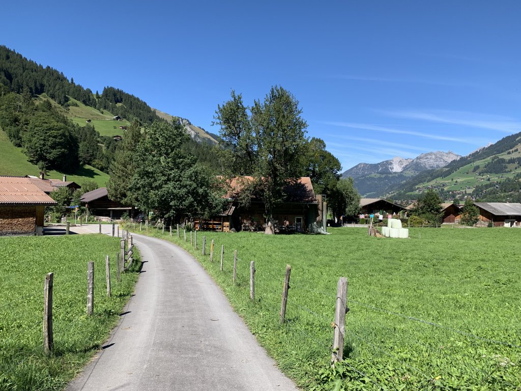
The Alps in Switzerland in the Bern Canton.
Pauline
Forums Admin
Monday September 9, 2019
Sun and cloud, 55F, snow on mountains.
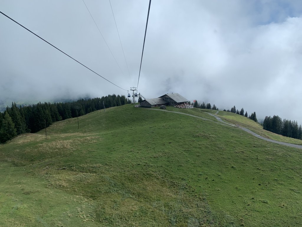
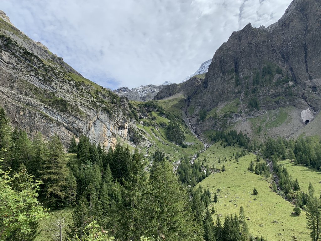
Hike: Leiterli (1943m) to Lenk (1068m), 6.2 miles
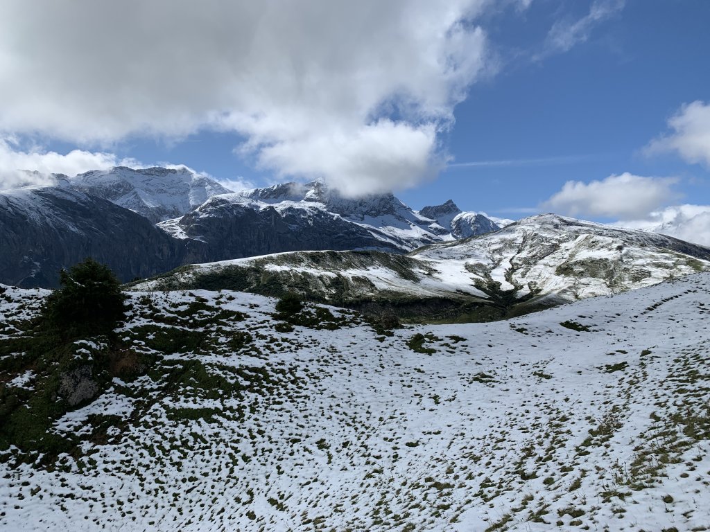
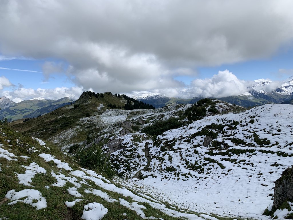
Woke up to sunshine! Finally! We took the gondola up to Leiterli at the top intending to do the long walk down that we did our first week here. We came up through cloud on the gondola and there was cloud in spots at the top. And snow! It was cold and we wore all our layers plus wool hats and gloves. We started the hike and it was muddy. We walked for 40 minutes and decided it was too difficult walking in the mud.
It was fabulous walking through the fields of snow looking out at the snow covered mountains. The trail had melted so we were not walking in the snow. Snow is unusual this early. We’ve run into snow here, at high levels, but at the end of September.
We walked back to the gondola station. There are 3 routes down to Lenk. The long route was out so we tried the middle route. We hadn’t done that one in years. It takes 2-3 hours and the long one takes 4-5 hours. It is steeper going downhill because it does the same descent in a shorter time. But it isn’t really much steeper because the long hike starts by walking back into the mountains and the descent starts 1 1/2 hours into the hike.
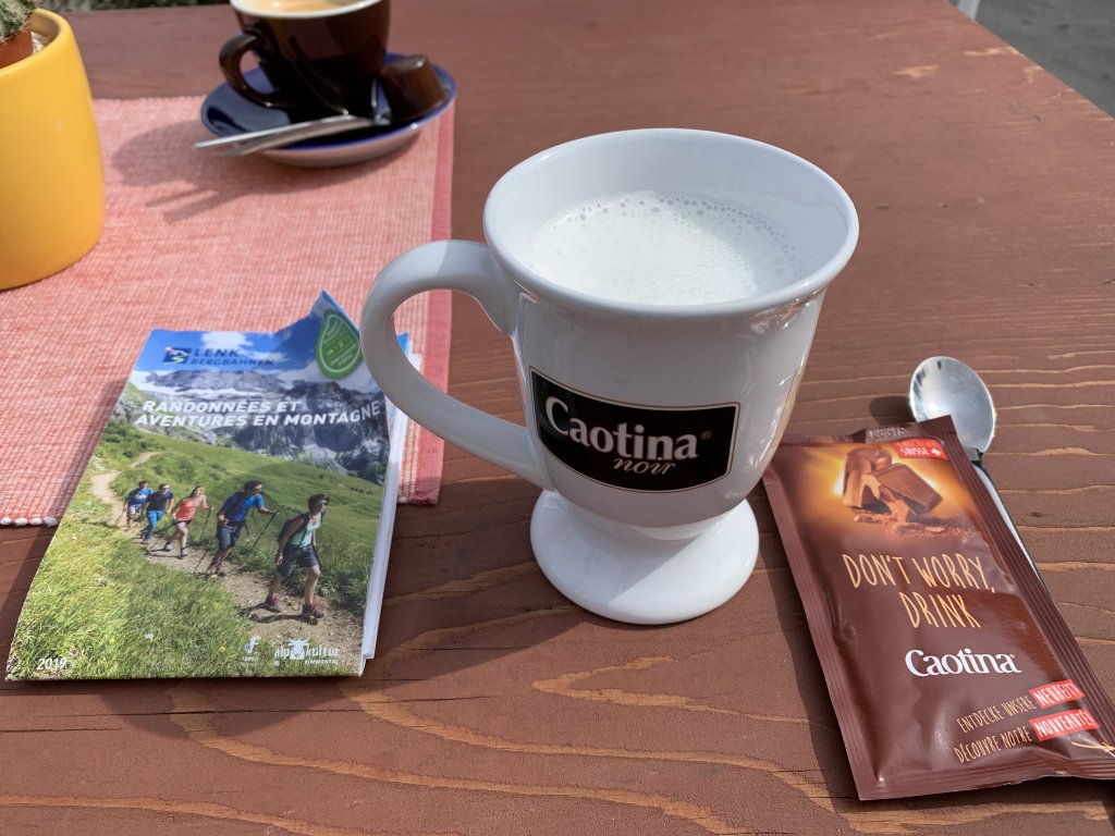
This route started down at the gondola station. The path was not muddy and there was no snow. It was a lovely long walk. We stopped for hot drinks and kuchen at Wallegg, sitting out on their terrace in the sun. It was warmer now that we were down lower and my wool cap was replaced by a sun hat. I had my first, and probably only since it is warming up this week, hot chocolate of the trip.
We got back to town at 4:30. We started just after 10:00 this morning so it was a full day out. Nice to have this after our shorter walks of the last few days. We walked over 10 miles when we added in our false start.
We met an American long distance hiker on the trail today. He started in Lichtenstein and was walking the Via Alpina across Switzerland to Lake Geneva. He had been walking for weeks. He was stuck in a hut up in the snow a couple of days ago. He was pretty intense as these guys can be, making fun of people who have their luggage moved for them each day and staying in hotels. He stopped us to check on his route and I know the trails up here so showed him where he was going.
I get annoyed with Americans/Canadians who are dismissive of the UK. It is usually the weather or the food. This was only the second time it has been about the hiking. He could not believe that the hiking was good in the UK and said that all the great hiking writers say North America is the best place to hike. Yes, for wilderness hiking maybe, but what about people like us who want easier trails? We are hikers too! Maybe we don’t hike for weeks and sleep beside the trail, but we walk for hours every day and love being in the mountains. Needless to say he has done the Appalachian trail and many other US trails. One wonders why he was bothering with Switzerland.
Anyway, fabulous day and I had to lay on the sofa for an hour to recover.

Sun and cloud, 55F, snow on mountains.
Hike: Leiterli (1943m) to Lenk (1068m), 6.2 miles
Woke up to sunshine! Finally! We took the gondola up to Leiterli at the top intending to do the long walk down that we did our first week here. We came up through cloud on the gondola and there was cloud in spots at the top. And snow! It was cold and we wore all our layers plus wool hats and gloves. We started the hike and it was muddy. We walked for 40 minutes and decided it was too difficult walking in the mud.
It was fabulous walking through the fields of snow looking out at the snow covered mountains. The trail had melted so we were not walking in the snow. Snow is unusual this early. We’ve run into snow here, at high levels, but at the end of September.
We walked back to the gondola station. There are 3 routes down to Lenk. The long route was out so we tried the middle route. We hadn’t done that one in years. It takes 2-3 hours and the long one takes 4-5 hours. It is steeper going downhill because it does the same descent in a shorter time. But it isn’t really much steeper because the long hike starts by walking back into the mountains and the descent starts 1 1/2 hours into the hike.
This route started down at the gondola station. The path was not muddy and there was no snow. It was a lovely long walk. We stopped for hot drinks and kuchen at Wallegg, sitting out on their terrace in the sun. It was warmer now that we were down lower and my wool cap was replaced by a sun hat. I had my first, and probably only since it is warming up this week, hot chocolate of the trip.
We got back to town at 4:30. We started just after 10:00 this morning so it was a full day out. Nice to have this after our shorter walks of the last few days. We walked over 10 miles when we added in our false start.
We met an American long distance hiker on the trail today. He started in Lichtenstein and was walking the Via Alpina across Switzerland to Lake Geneva. He had been walking for weeks. He was stuck in a hut up in the snow a couple of days ago. He was pretty intense as these guys can be, making fun of people who have their luggage moved for them each day and staying in hotels. He stopped us to check on his route and I know the trails up here so showed him where he was going.
I get annoyed with Americans/Canadians who are dismissive of the UK. It is usually the weather or the food. This was only the second time it has been about the hiking. He could not believe that the hiking was good in the UK and said that all the great hiking writers say North America is the best place to hike. Yes, for wilderness hiking maybe, but what about people like us who want easier trails? We are hikers too! Maybe we don’t hike for weeks and sleep beside the trail, but we walk for hours every day and love being in the mountains. Needless to say he has done the Appalachian trail and many other US trails. One wonders why he was bothering with Switzerland.
Anyway, fabulous day and I had to lay on the sofa for an hour to recover.
Hot Chocolate
This is how it is served. Hot milk and a package of chocolate mix.
Pauline
Forums Admin
Tuesday September 10, 2019
Sun and cloud, 55F, snow still on mountains.
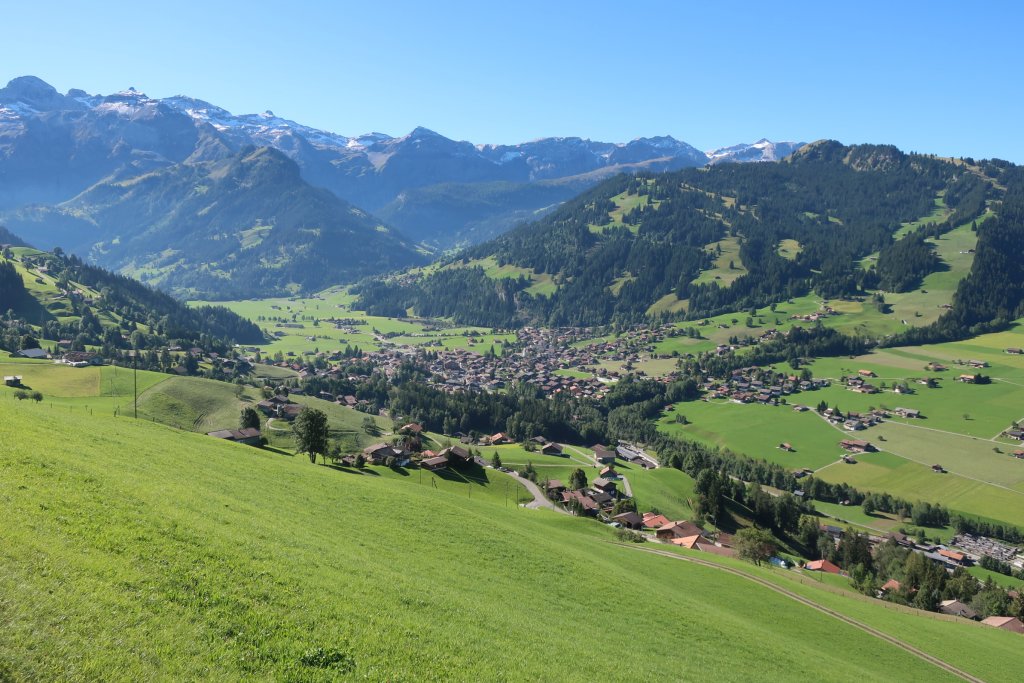
Hike: Weissenburg (782) to Weissenburgbad (856) to Leiternweide Suspension Bridge (1100m ?) back to Weissenburg, 6.5 miles
We drove 40 minutes down the valley to Weissenberg to do a hike. There was no parking in this very small town. The only parking lots were for businesses and it was not possible to park at the side of the road. We tried to drive up to the train station but from one side the road was blocked for construction and from the other side the road was very narrow. We drove on 1/2 mile to the next town where we parked at the side of the road. This was marked as parking for a business but there were lots of spots.
We followed a small road back to the Weissenberg train station where the trail starts. Looked like we could have driven there and there were some places to park.
These villages are tiny and once you get off the main road the few roads are narrow and steep.
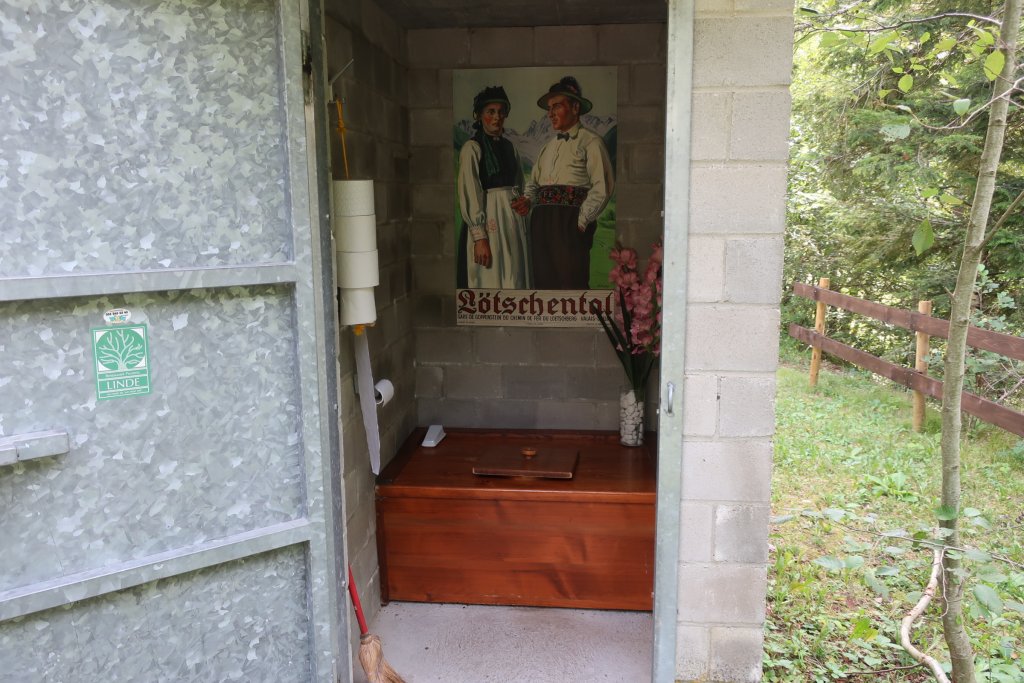
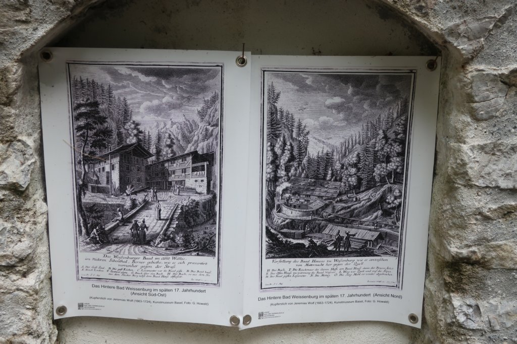
The hike was fabulous. It started out on a good trail, gently uphill, following a river. In the 19th century there was a big spa hotel up there. A bit remains and is now a picnic area with a fancy outhouse (see photos). Further up the river are more remains of the bathing buildings. All the information is in German so I did not understand everything.
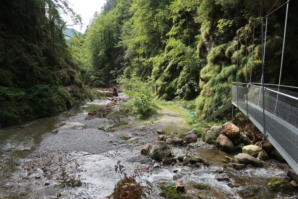
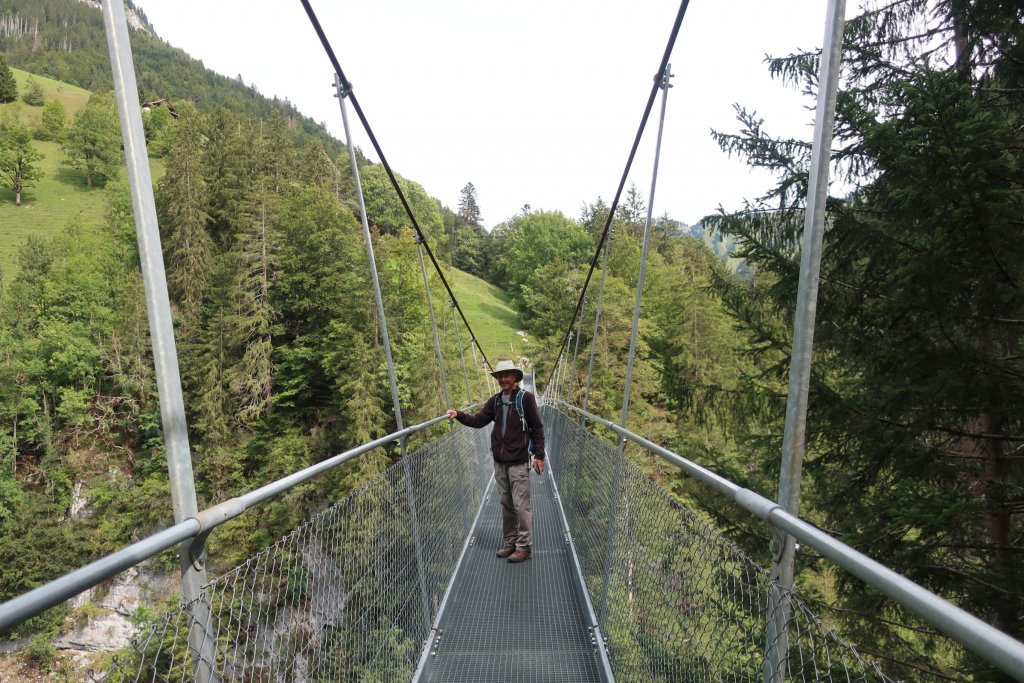
We followed the trail further up the canyon and came to a high canyon wall that we had to climb. Ladders and stairs were attached in places and it was steep. We spoke to some hikers coming down and they said the suspension bridge above was fine but going up this canyon wall would be difficult. They were coming down.
We were heading to the suspension bridge because I wanted to see it but I did not think we would cross it. But once I was halfway up the canyon wall I knew we would have to cross it because I was not going to climb down this. I am nervous with heights and just forced myself to keep going.
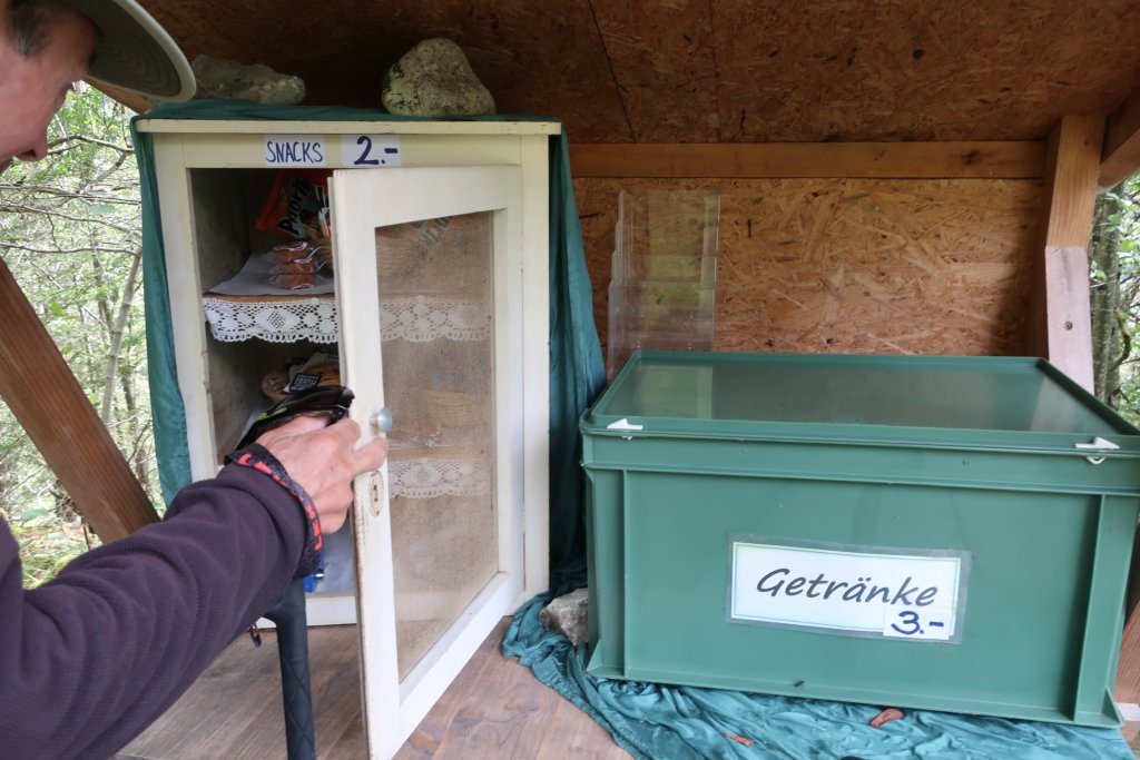
At the top a farmer had a self serve snacks and drinks table set up. We bought snacks because we bloody well deserved them!
The suspension bridge is not long, 111m, but the canyon it crosses is deep (111m). Nice coincidence of numbers. I did not look down but did get across.
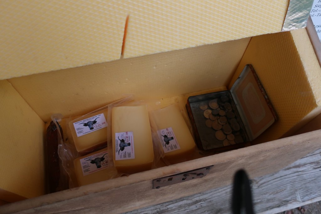
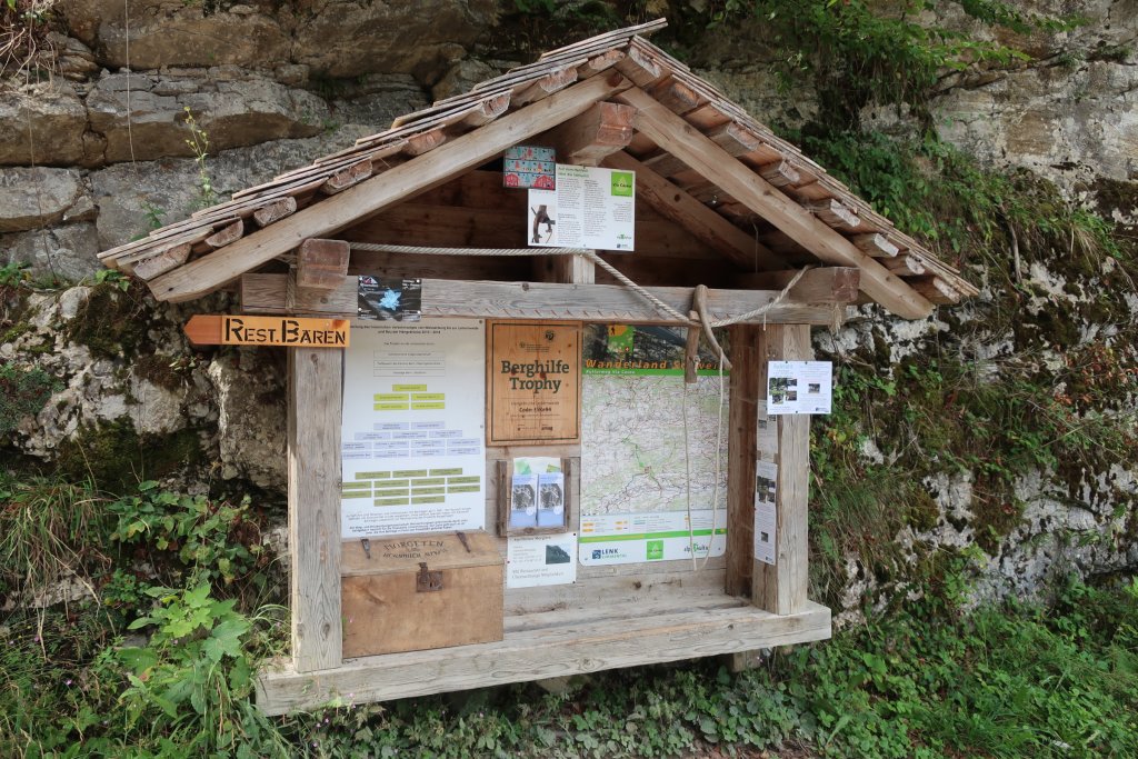
On the other side we were on a road to the alpine farms and saw a couple of cars. There was a notice board with maps and information and a self serve cheese box. We bought cheese. Hiking and shopping!
I thought it would be all downhill from here but we climbed up and up again through woods to another dirt road. We passed prehistoric caves but did not see them because we didn’t want to do more climbing and really, they were just caves.
Then we missed a turn and ended up walking back across the Farm fields, on a road, to the valley we had walked out on. We had planned to go further to Oberwil, the next town. We went back into the canyon and crossed the river on a small bridge. We saw the remains of a casino that was built for the hotel. Then we are back on the trail we started out on and back to the train station.
We stopped at the Swiss Alpine Herbs factory store, just down from where we parked, and did more shopping. I always bring home these herbs and use them all year long. We get them in Lenk usually.
Fun to explore a new area. It was more of a walk than we intended but I like this area. Next time park in Oberwil where they have an actual visitors parking lot on the main road and hike from there. There are a lot of trails in this area. Lenk Simmental tourism has a new brochure showing them.
Sun and cloud, 55F, snow still on mountains.
Hike: Weissenburg (782) to Weissenburgbad (856) to Leiternweide Suspension Bridge (1100m ?) back to Weissenburg, 6.5 miles
We drove 40 minutes down the valley to Weissenberg to do a hike. There was no parking in this very small town. The only parking lots were for businesses and it was not possible to park at the side of the road. We tried to drive up to the train station but from one side the road was blocked for construction and from the other side the road was very narrow. We drove on 1/2 mile to the next town where we parked at the side of the road. This was marked as parking for a business but there were lots of spots.
We followed a small road back to the Weissenberg train station where the trail starts. Looked like we could have driven there and there were some places to park.
These villages are tiny and once you get off the main road the few roads are narrow and steep.
The hike was fabulous. It started out on a good trail, gently uphill, following a river. In the 19th century there was a big spa hotel up there. A bit remains and is now a picnic area with a fancy outhouse (see photos). Further up the river are more remains of the bathing buildings. All the information is in German so I did not understand everything.
We followed the trail further up the canyon and came to a high canyon wall that we had to climb. Ladders and stairs were attached in places and it was steep. We spoke to some hikers coming down and they said the suspension bridge above was fine but going up this canyon wall would be difficult. They were coming down.
We were heading to the suspension bridge because I wanted to see it but I did not think we would cross it. But once I was halfway up the canyon wall I knew we would have to cross it because I was not going to climb down this. I am nervous with heights and just forced myself to keep going.
At the top a farmer had a self serve snacks and drinks table set up. We bought snacks because we bloody well deserved them!
The suspension bridge is not long, 111m, but the canyon it crosses is deep (111m). Nice coincidence of numbers. I did not look down but did get across.
On the other side we were on a road to the alpine farms and saw a couple of cars. There was a notice board with maps and information and a self serve cheese box. We bought cheese. Hiking and shopping!
I thought it would be all downhill from here but we climbed up and up again through woods to another dirt road. We passed prehistoric caves but did not see them because we didn’t want to do more climbing and really, they were just caves.
Then we missed a turn and ended up walking back across the Farm fields, on a road, to the valley we had walked out on. We had planned to go further to Oberwil, the next town. We went back into the canyon and crossed the river on a small bridge. We saw the remains of a casino that was built for the hotel. Then we are back on the trail we started out on and back to the train station.
We stopped at the Swiss Alpine Herbs factory store, just down from where we parked, and did more shopping. I always bring home these herbs and use them all year long. We get them in Lenk usually.
Fun to explore a new area. It was more of a walk than we intended but I like this area. Next time park in Oberwil where they have an actual visitors parking lot on the main road and hike from there. There are a lot of trails in this area. Lenk Simmental tourism has a new brochure showing them.
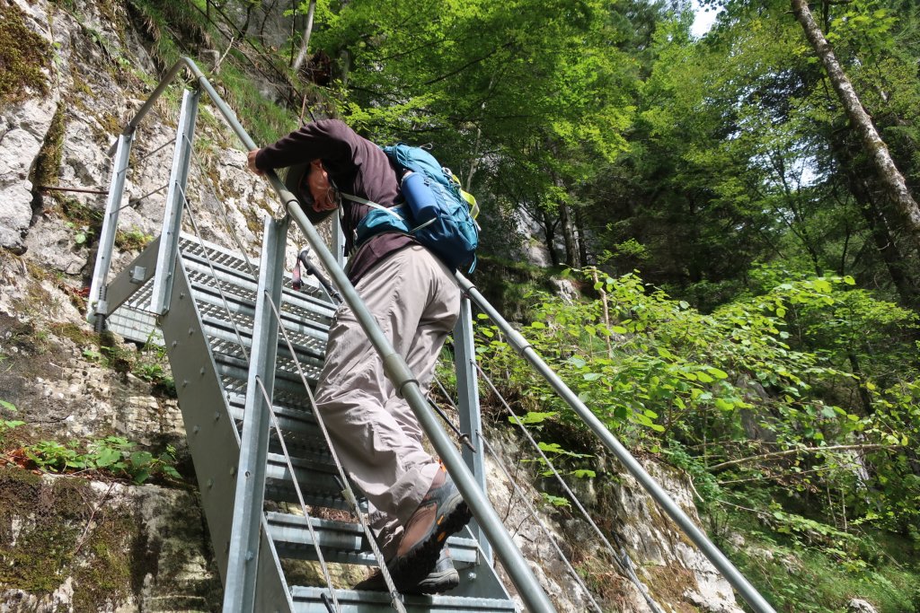
Climbing out of the canyon.
A long, steep climb on ladders and steps up the canyon.
Snacks for Sale
At the end of the long climb the farmer set up self serve snacks and drinks.
Self Serve Cheese
On the other side of the suspension bridge, a chance to buy cheese.
Notice Board on the Trail
On the other side of the suspension bridge, a chance to buy cheese (box on lower left).
Pauline
Forums Admin
Wednesday September 11, 2019
Sun and cloud, 60F.
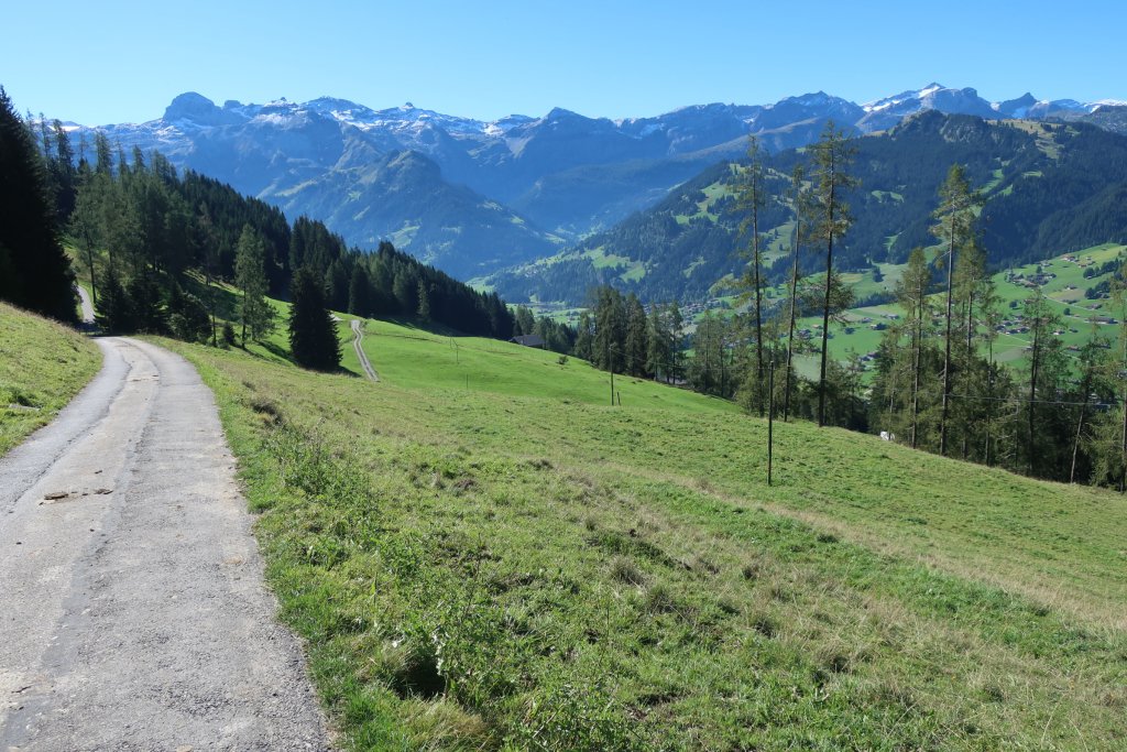
Hike: Bus to Buhlberg (1664m), walked to Metsch - Launen - Nessli (1645m) - Simmenfalle (1102m). Bus back to Lenk. 7.5 miles
Another wonderful day! We did this hike a few years ago when the Metsch gondola was running. It runs only on Swiss school holidays so is not running now. Last year we tried to do this hike starting from Buhlberg but took a wrong turn early on and did the high route across the hillside. That was a good hike but this time we wanted an easier walk, across the middle of the hillside.
The hike takes you through farms and forests that are stunningly beautiful. Ahead of you are the Lenk mountains, looking glorious. It is one of those hikes that takes your breath away. There is one steep climb up a canyon, about 30 minutes and 200 meters, just before Nessli. After Nessli it is a long slow downhill, maybe a bit too much downhill.
On the way down we took a different trail just to see where it went. We walked out for 30 minutes going uphill until we could see the valley the trail was going through. This was the Ammerten Valley and was beautiful. Unfortunately the trail goes on into the high mountains and is too difficult for us.
We walked back to the trail and continued down. As we reached the main trail that goes from Simmenfalle to Sieben Brunnen, a trail we have done many times, a group of about 50 French-speaking teenagers appeared. Instead of trying to walk down with them, we went uphill to Sieben Brunnen, then turned around and went down. We passed all the teenagers having a rest in a field.
We had planned to walk back from Simmenfalle, another hour, but had already walked 7.5 miles and that was good enough, so we got the bus back to town.
We treated ourselves to cake and coffee (cake from the bakery had with coffee at home), went to the tourist office to pour over hiking maps with them. I always have questions. We have two hiking days left and we have to figure out which hikes to do. The next two days are forecast to be warmer and sunny.
I love this area and this town. I am not sure if 3 weeks is perfect for the number of trails here or if we should try staying longer.

Sun and cloud, 60F.
Hike: Bus to Buhlberg (1664m), walked to Metsch - Launen - Nessli (1645m) - Simmenfalle (1102m). Bus back to Lenk. 7.5 miles
Another wonderful day! We did this hike a few years ago when the Metsch gondola was running. It runs only on Swiss school holidays so is not running now. Last year we tried to do this hike starting from Buhlberg but took a wrong turn early on and did the high route across the hillside. That was a good hike but this time we wanted an easier walk, across the middle of the hillside.
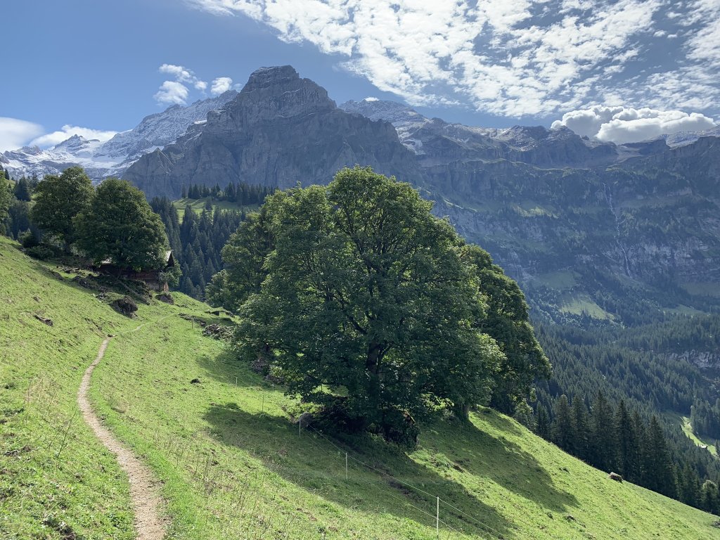
The hike takes you through farms and forests that are stunningly beautiful. Ahead of you are the Lenk mountains, looking glorious. It is one of those hikes that takes your breath away. There is one steep climb up a canyon, about 30 minutes and 200 meters, just before Nessli. After Nessli it is a long slow downhill, maybe a bit too much downhill.
On the way down we took a different trail just to see where it went. We walked out for 30 minutes going uphill until we could see the valley the trail was going through. This was the Ammerten Valley and was beautiful. Unfortunately the trail goes on into the high mountains and is too difficult for us.
We walked back to the trail and continued down. As we reached the main trail that goes from Simmenfalle to Sieben Brunnen, a trail we have done many times, a group of about 50 French-speaking teenagers appeared. Instead of trying to walk down with them, we went uphill to Sieben Brunnen, then turned around and went down. We passed all the teenagers having a rest in a field.
We had planned to walk back from Simmenfalle, another hour, but had already walked 7.5 miles and that was good enough, so we got the bus back to town.
We treated ourselves to cake and coffee (cake from the bakery had with coffee at home), went to the tourist office to pour over hiking maps with them. I always have questions. We have two hiking days left and we have to figure out which hikes to do. The next two days are forecast to be warmer and sunny.
I love this area and this town. I am not sure if 3 weeks is perfect for the number of trails here or if we should try staying longer.
Hike Buhlberg to Simmenfalle
Start of hike where we got off the bus at Buhlberg.
Pauline
Forums Admin
Thursday September 12, 2019
Sunny, 70F.
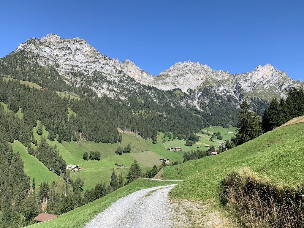
Hike: Laubbargli Bus to Gutsch (1258m), hiked to Bleike Stafel (1443m), Sitebach (1386 m), Stalde in the Fermeltal (1343m), then down the valley to Matten (1030m), and back to Lenk. 10 miles, 5 hours.
Another great hike. It was hot and sunny with no clouds in the sky. There is a valley off of Matten, the next town down the main valley from Lenk, that I have read about but could not figure how best to hike in. It is called Färmeltal, or Fermeltal, which means Fermel Valley. There is a road into the valley but it is one of those paved but very narrow mountain roads that we don’t like driving.
The topographic map for Lenk shows a 4.5 hour hike from Lenk into the valley and back but the people in the tourist office said it is 4 hours just to get to the valley (they were wrong). I searched for information online but only came up with Wikiloc hikes up into the mountains from the Fermeltal - too difficult for us. We decided to take a chance and do the hike as recommended by the topographic map. I figured out how to save the initial 200 meter climb from Lenk by taking the Laubbargli bus up the mountainside for a few stops.
We arrived in good time for the 10:25 bus but there were already over 30 people waiting for the bus. This is a small bus, holding about 20 people, because the road is so narrow and steep. Looked like we would have to do the climb after all. But no! Lenk is very organised with their transport. They loaded the bus and told the rest of to wait. A few minutes later another bus arrived and the rest of us got on that one.
We got off after 5 minutes but it saved us an hour climb. I noticed people getting off at this stop two weeks ago when we were going to Laubbargli and wondered what hike they were doing.
The hike was long but not difficult. It was well signed. Most was on road, some paved but used only by farmers, some dirt road. It was a lovely walk high up on the hillside, 400m above Lenk, with good views. It started with a steady climb then went up and down only slightly.
After a couple of hours we turned into the Fermeltal. It is a wide valley surrounded by high rocky peaks. Over one peak is Seebergsee, the small lake we drove to last year. Over another is Adelboden in the next valley over from Lenk. Close as the crow flies, but a hour and a half driving.
We walked down into the valley. There is a hotel with a restaurant, a few farms, a few houses. We started down the valley to Matten and came across a pretty picnic area with benches beside the river where we had our lunch. They even had the river water coming into a basin so I bathed my tired feet.
We walked on a dirt road along the river (this is not the road you drive in on) for an hour to Matten. We were mostly in shade which was nice because it was hot.
We could have taken the train from Matten to Lenk, but we decided to walk. This was another 1 1/2 hours on small roads and footpaths along the side of the valley above the main road. We walked through steep hillsides where people were haying.
The hike was over 4 hours but we were out for 5 hours (several rest breaks). It was good to get home and sit out on the terrace.
Tomorrow is our last day!


Sunny, 70F.
Hike: Laubbargli Bus to Gutsch (1258m), hiked to Bleike Stafel (1443m), Sitebach (1386 m), Stalde in the Fermeltal (1343m), then down the valley to Matten (1030m), and back to Lenk. 10 miles, 5 hours.
Another great hike. It was hot and sunny with no clouds in the sky. There is a valley off of Matten, the next town down the main valley from Lenk, that I have read about but could not figure how best to hike in. It is called Färmeltal, or Fermeltal, which means Fermel Valley. There is a road into the valley but it is one of those paved but very narrow mountain roads that we don’t like driving.
The topographic map for Lenk shows a 4.5 hour hike from Lenk into the valley and back but the people in the tourist office said it is 4 hours just to get to the valley (they were wrong). I searched for information online but only came up with Wikiloc hikes up into the mountains from the Fermeltal - too difficult for us. We decided to take a chance and do the hike as recommended by the topographic map. I figured out how to save the initial 200 meter climb from Lenk by taking the Laubbargli bus up the mountainside for a few stops.
We arrived in good time for the 10:25 bus but there were already over 30 people waiting for the bus. This is a small bus, holding about 20 people, because the road is so narrow and steep. Looked like we would have to do the climb after all. But no! Lenk is very organised with their transport. They loaded the bus and told the rest of to wait. A few minutes later another bus arrived and the rest of us got on that one.
We got off after 5 minutes but it saved us an hour climb. I noticed people getting off at this stop two weeks ago when we were going to Laubbargli and wondered what hike they were doing.
The hike was long but not difficult. It was well signed. Most was on road, some paved but used only by farmers, some dirt road. It was a lovely walk high up on the hillside, 400m above Lenk, with good views. It started with a steady climb then went up and down only slightly.
After a couple of hours we turned into the Fermeltal. It is a wide valley surrounded by high rocky peaks. Over one peak is Seebergsee, the small lake we drove to last year. Over another is Adelboden in the next valley over from Lenk. Close as the crow flies, but a hour and a half driving.
We walked down into the valley. There is a hotel with a restaurant, a few farms, a few houses. We started down the valley to Matten and came across a pretty picnic area with benches beside the river where we had our lunch. They even had the river water coming into a basin so I bathed my tired feet.
We walked on a dirt road along the river (this is not the road you drive in on) for an hour to Matten. We were mostly in shade which was nice because it was hot.
We could have taken the train from Matten to Lenk, but we decided to walk. This was another 1 1/2 hours on small roads and footpaths along the side of the valley above the main road. We walked through steep hillsides where people were haying.
The hike was over 4 hours but we were out for 5 hours (several rest breaks). It was good to get home and sit out on the terrace.
Tomorrow is our last day!
Haying on the steep slopes
The trail from Matten to Lenk takes you through farmers fields.
Last edited:
Pauline
Forums Admin
Friday September 13, 2019
Sunny, 70F.
Hike: Easy walk along the river to Simmenfalle. 6 miles.
Last day! I’ve already booked for next year! Even though it was perfect hiking weather we needed an easy walk because we had to get packed up and get ready for a long drive tomorrow.
We had a nice walk along the river to Simmenfalle. We’ve done this walk several times on this trip. The mountains looked spectacular today.
Tomorrow we drive to Saint Saturnin in Provence, a 7 hour drive. It will take us longer because we take breaks every couple of hours. For the sake of my back, I have to walk around for 10 minutes. We switch drivers frequently too. I will pack a lunch so we don’t have to waste time going into the usually crowded rest areas.
Another thing that I’ve done which sounds pretty stupid is to buy some groceries to bring with us. Groceries are at least twice as expensive in Switzerland but if we arrive in Saint Saturnin at 7pm, the shops will be closed and I checked Google Maps and it looks like even the supermarket is closed Sunday.
I bought two Audible books of short stories so we can listen to them on the drive. I love our new car. I can attach my IPhone to use Waze for navigation and also play my audible books through the car system. I just have to remember to drive on the right! Being the passenger on these narrow Swiss roads is not easy. You feel like the cars are coming right at you.
Thanks for reading this Trip Report! I know most people are not interested in all my hiking details but I hope the photos made up for that. We’ve both had an excellent holiday.
I’ll post about the France portion in the France Trip Reports forum, but will post after the trip. Next week will be more busy, unless it is too hot for us and we don’t do that much. The forecast shows temps in the mid 80s.
How to Find Information
Search using the search button in the upper right. Search all forums or current forum by keyword or member. Advanced search gives you more options.
Filter forum threads using the filter pulldown above the threads. Filter by prefix, member, date. Or click on a thread title prefix to see all threads with that prefix.
Recommended Guides, Apps and Books
52 Things to See and Do in Basilicata by Valerie Fortney Italian Ancestral Journeys by Bryan Schneider Italian Food & Life Rules by Ann Reavis Italian Food Decoder App by Dana Facaros, Michael Pauls French Food Decoder App by Dana Facaros, Michael Pauls She Left No Note, Lake Iseo Italy Mystery 1 by J L Crellina Tuscan Traveler, Living in Italy by Ann Reavis