• CONTACT US if you have any problems registering for the forums.

Brittany Megaliths, Parish Closes and Cider - Part 2 Morbihan

Eleanor

1000+ Posts
This trip report covers a week we spent in Plumelec in Southern Brittany in September 2011. It was originally written for Slow Travel and Pauline has asked me to enter it on Slow Europe.

This is week two of the trip. Week 1 covering southern Finistere (Guengat) is here. week 3 covering northern Finistere (St Thegonnec) is here.

There is general information about Brittany here.


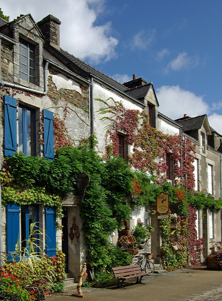
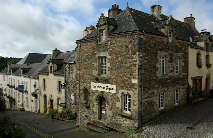
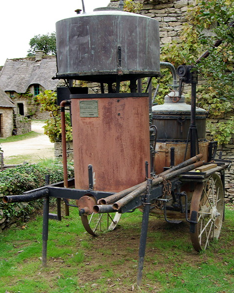
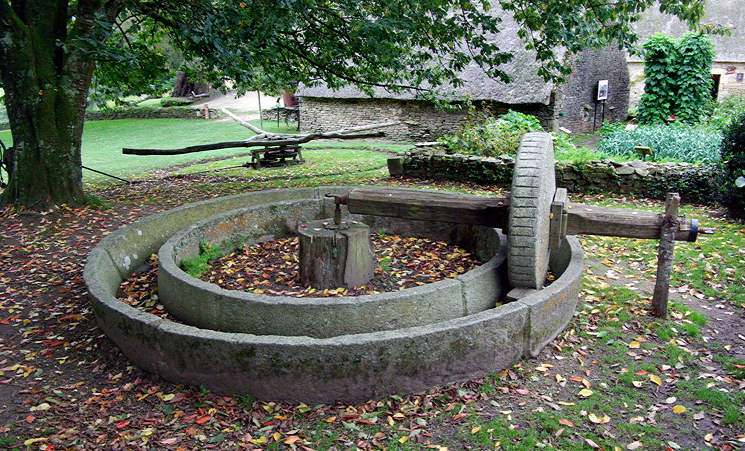
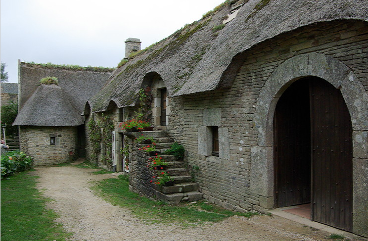
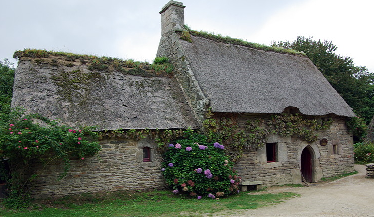
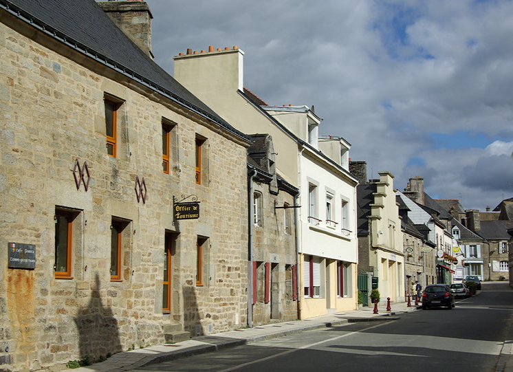
Plumelec and the surrounding area

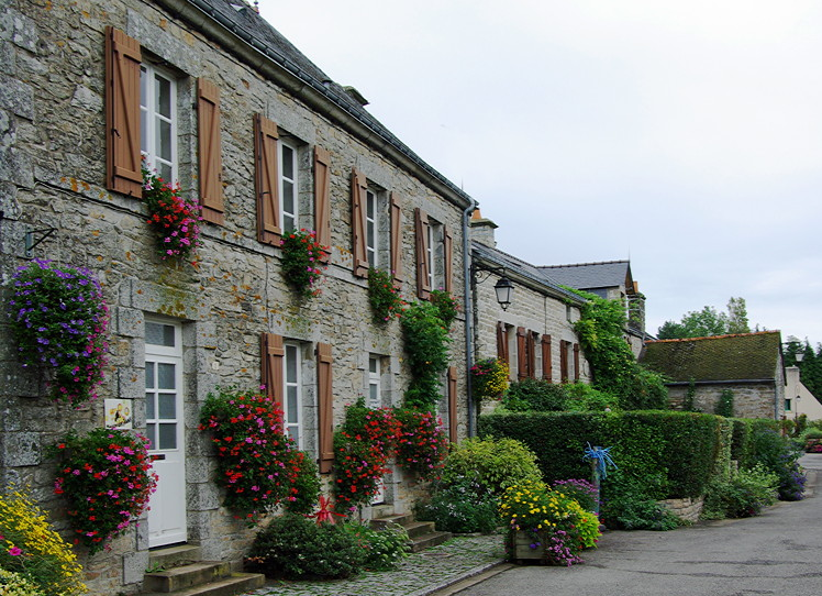
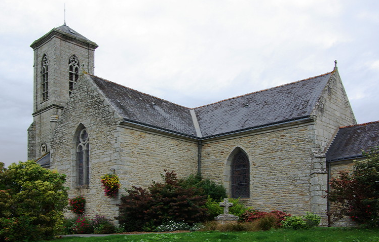
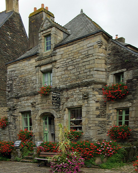
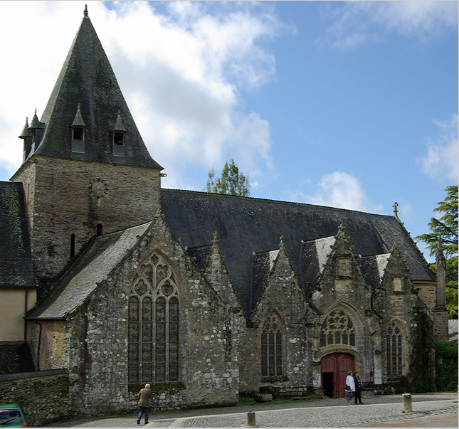
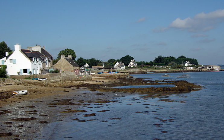
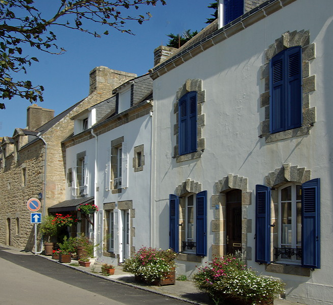
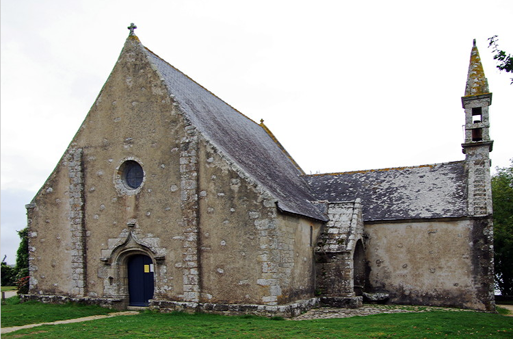
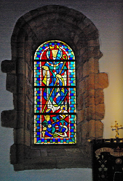
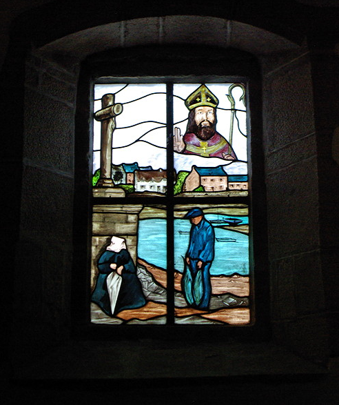
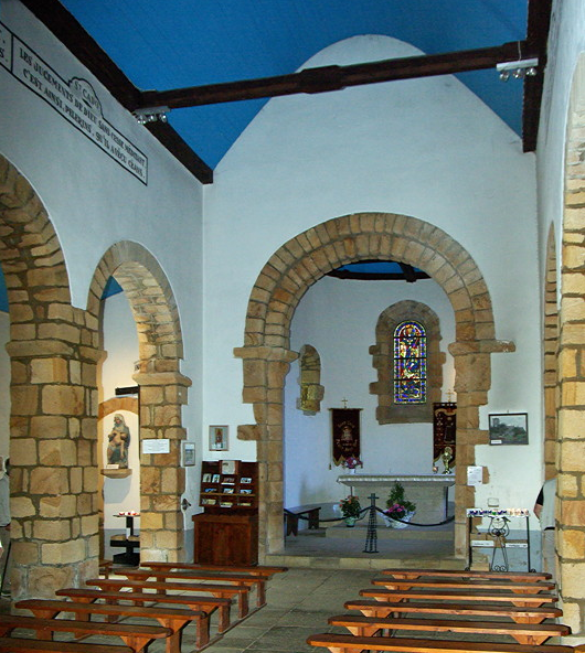
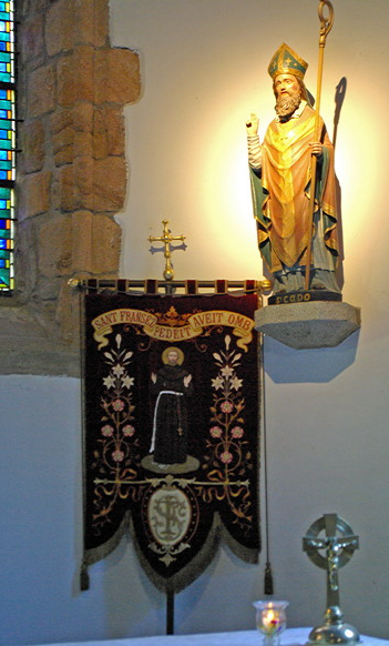
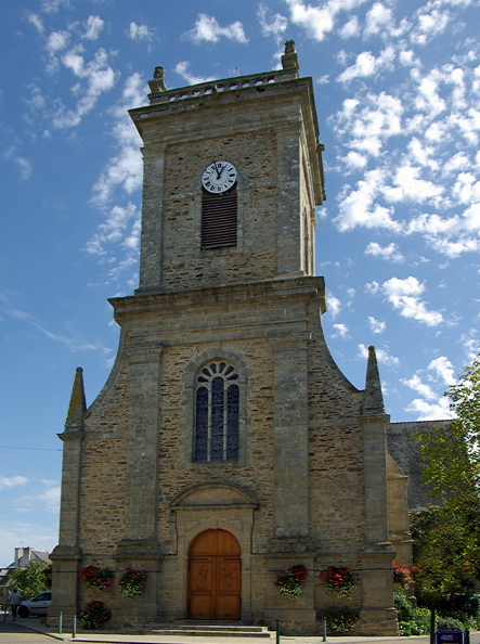
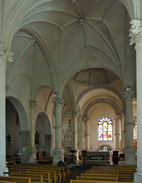
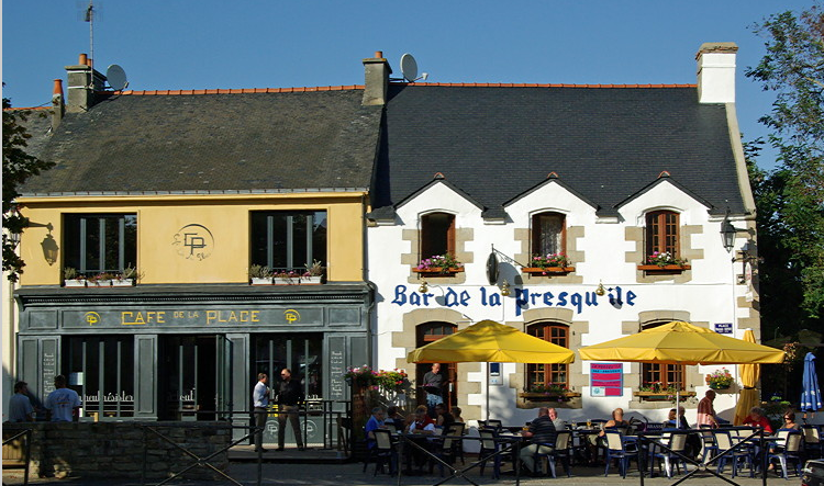
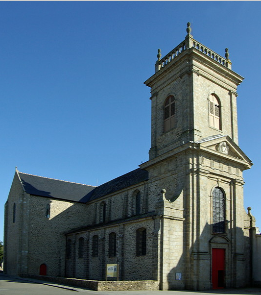
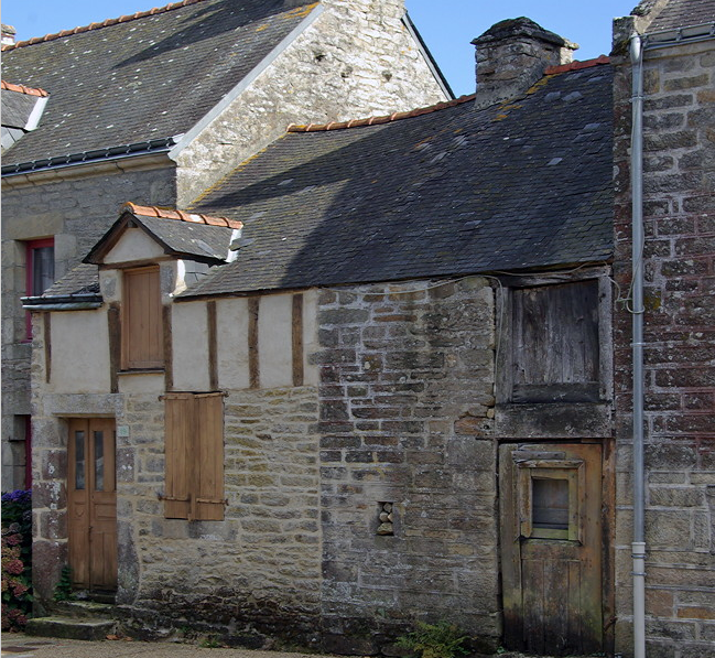
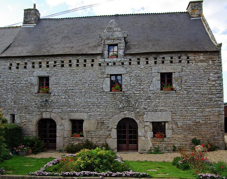
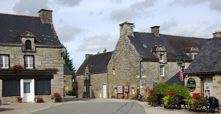
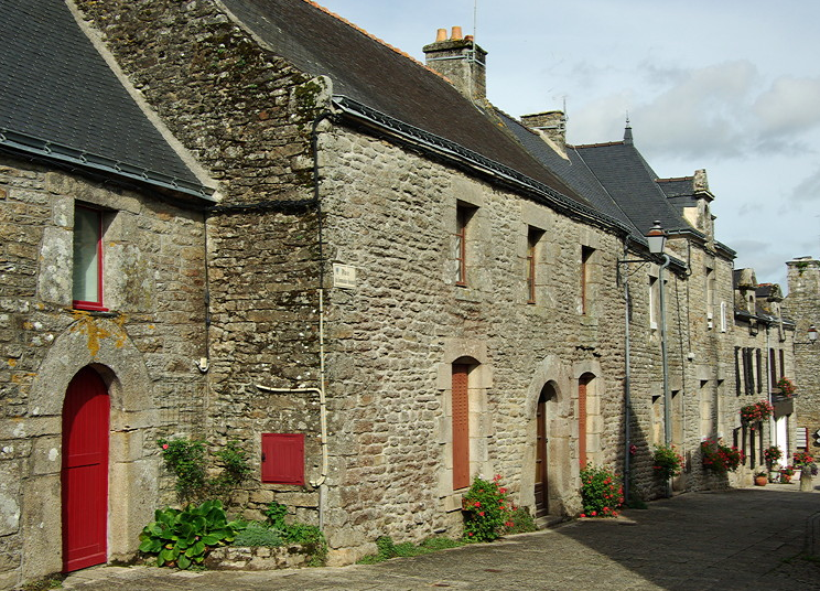
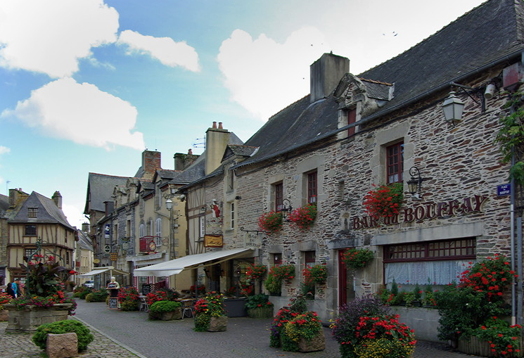
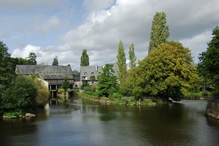
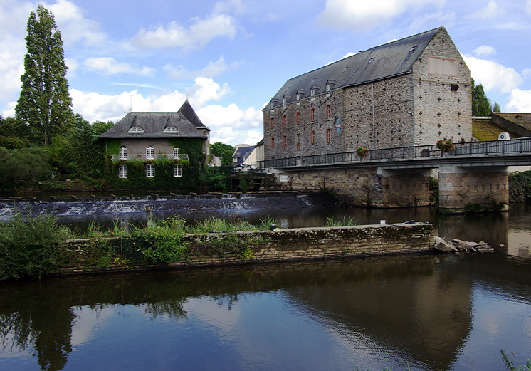
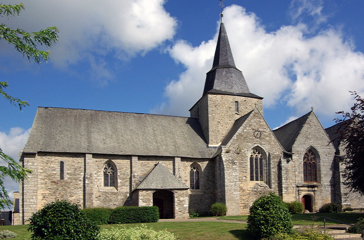
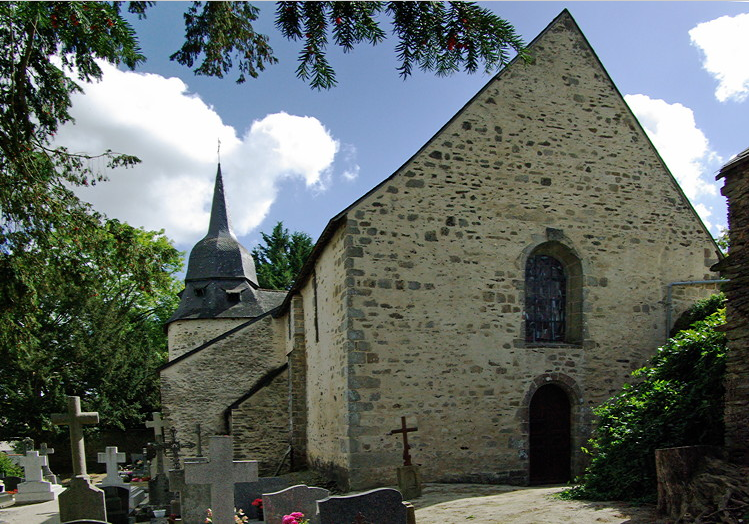
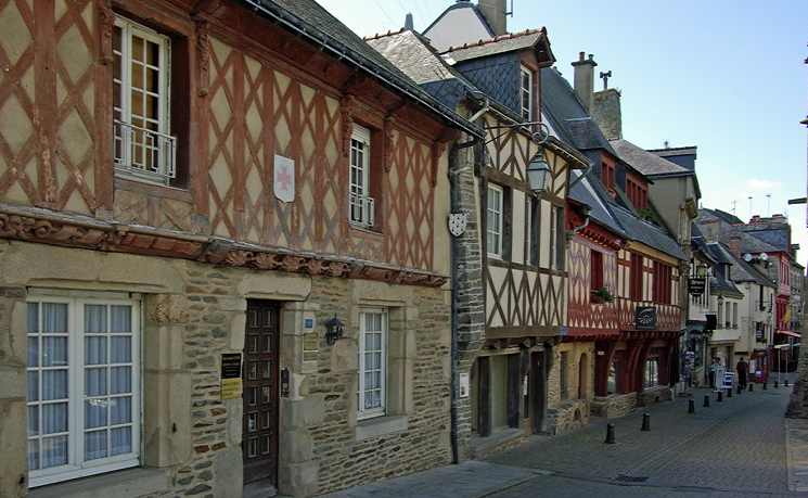
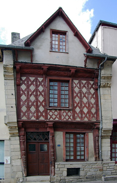
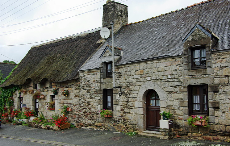
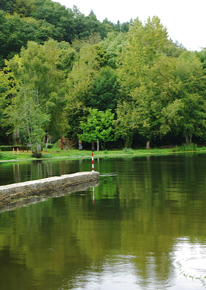
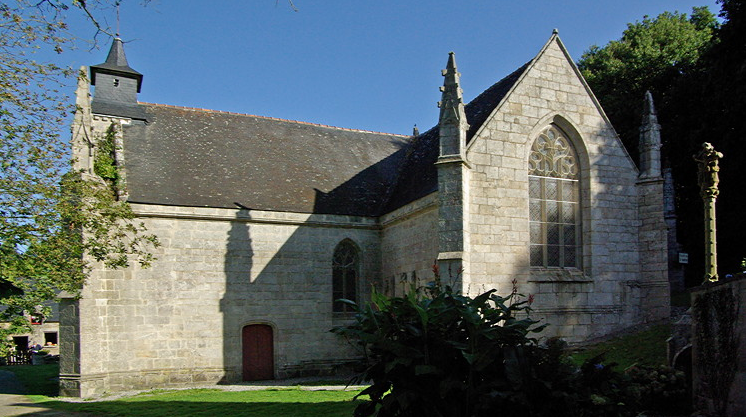
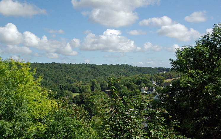
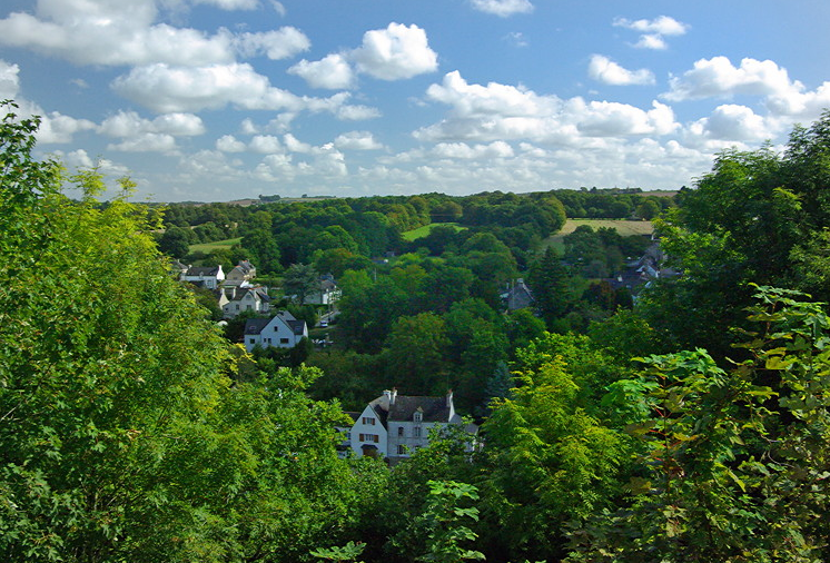
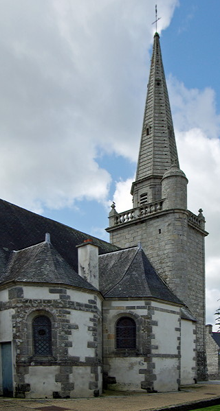
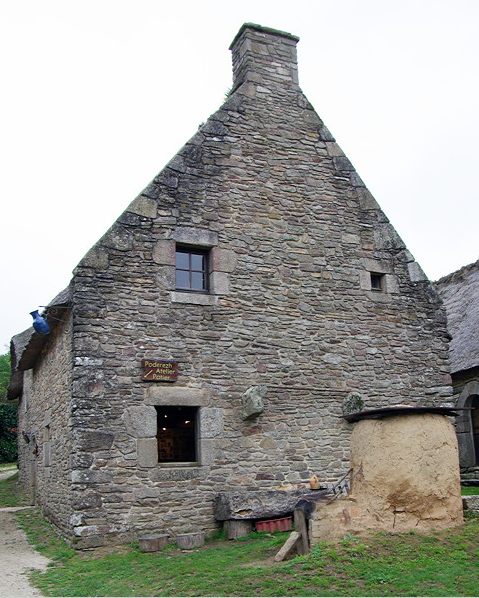
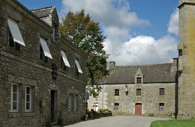
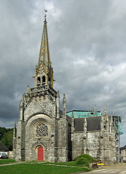
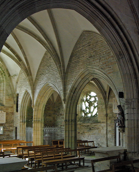
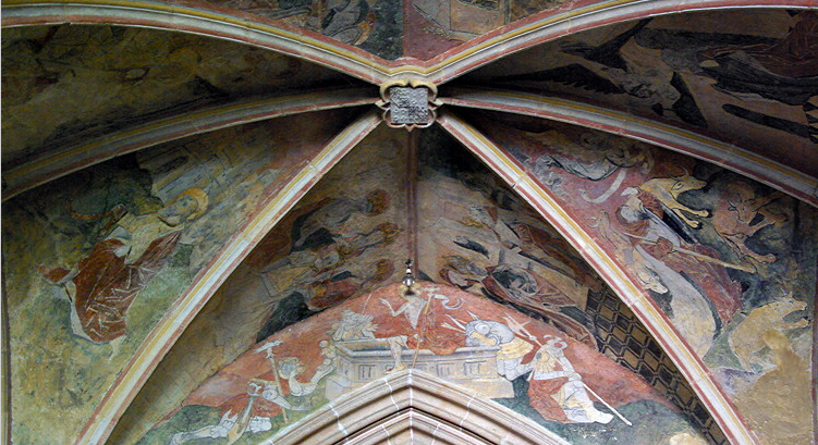
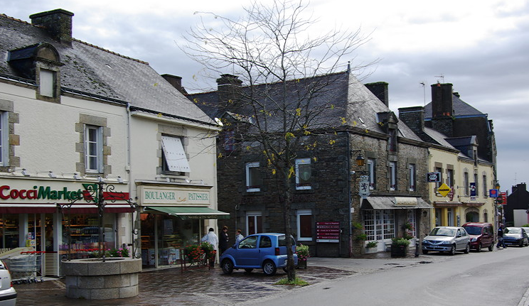
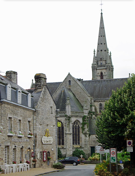
Plumelec is a thriving small town with the C19th church at its centre. It has two bakers, two butchers and a small supermarket. Although it doesn’t feature in the guide books and there is little information on the web, we found it was an excellent base for exploring Morbihan.

full


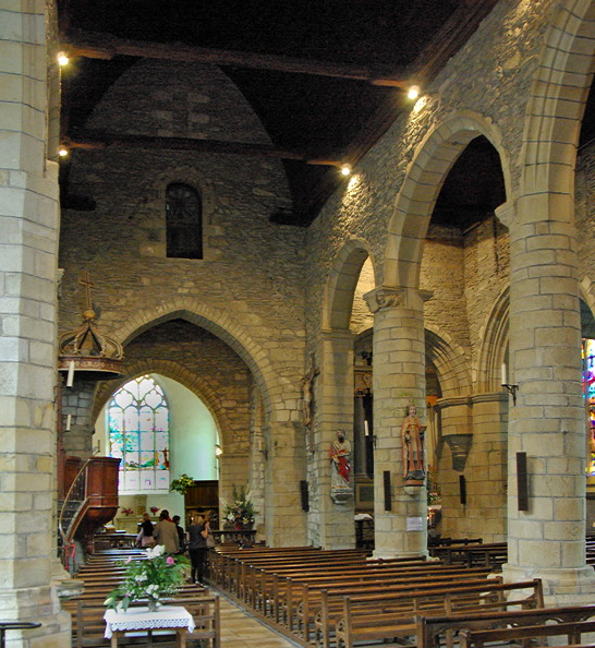
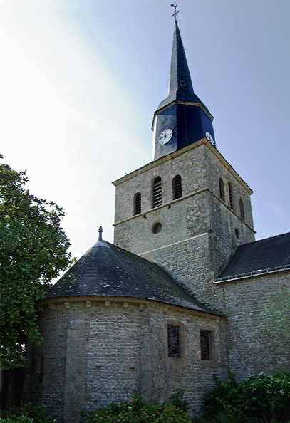
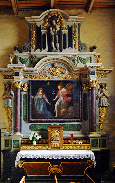
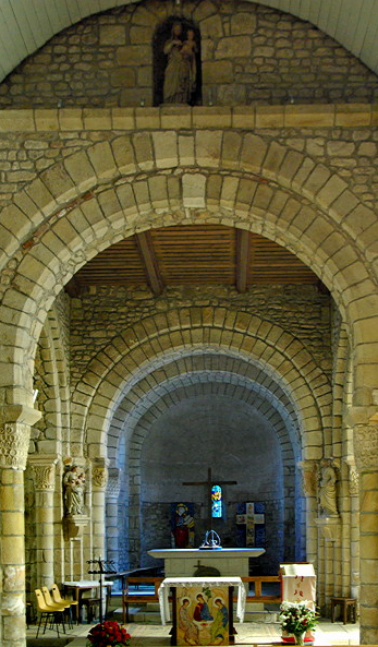
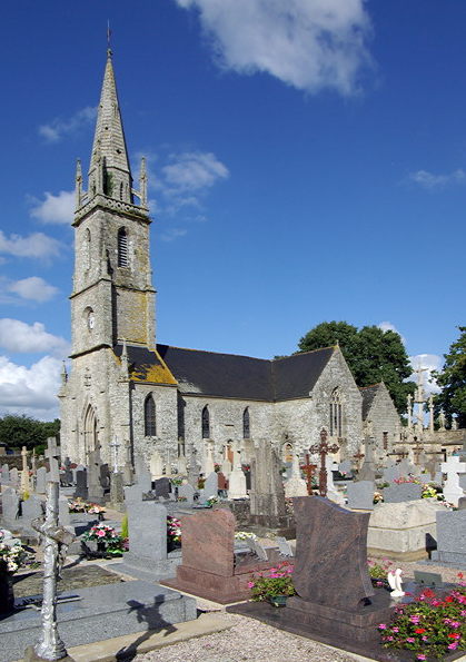
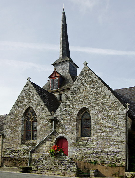
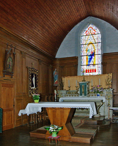
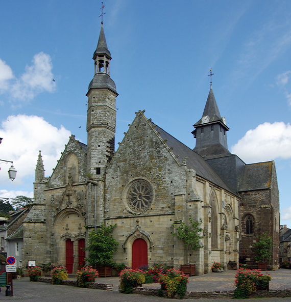
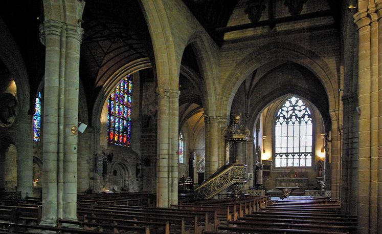
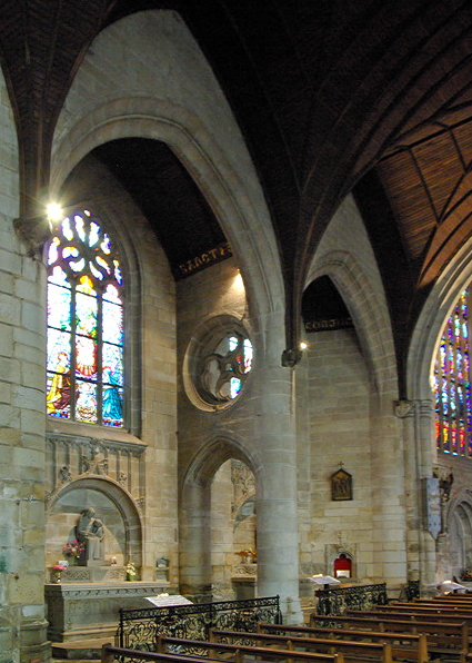
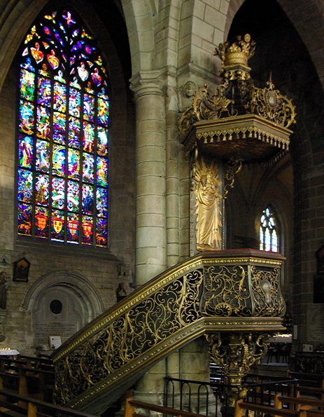
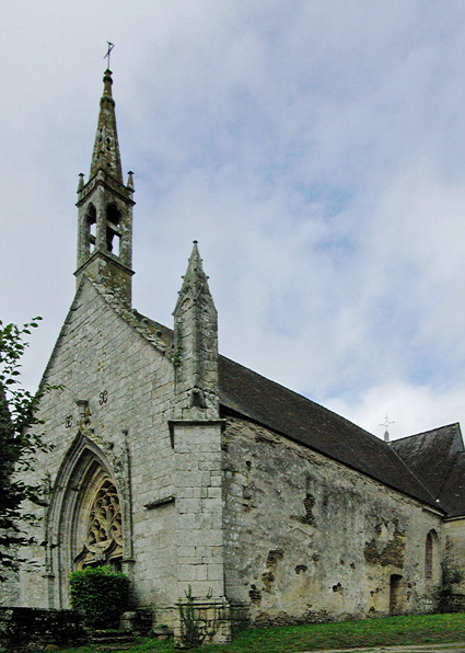
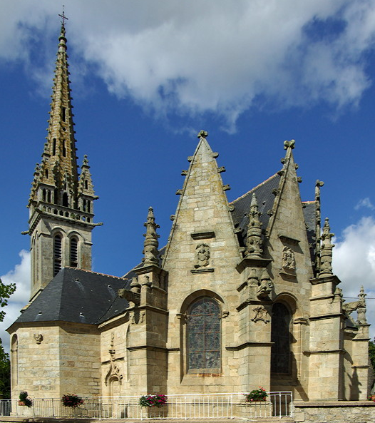
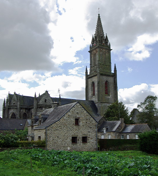
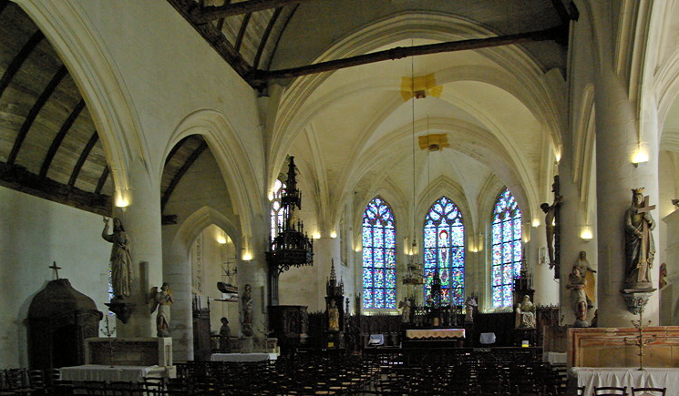
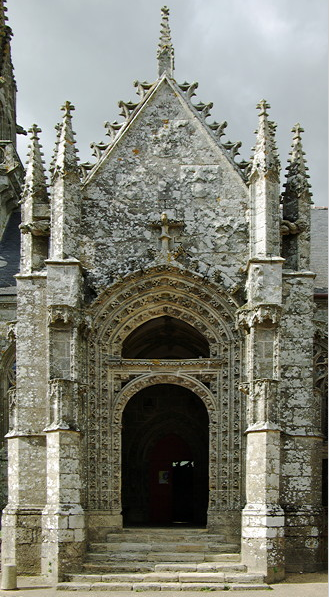
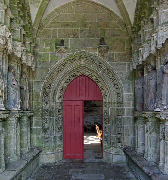
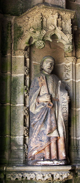
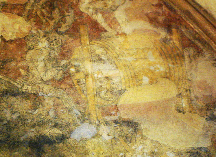
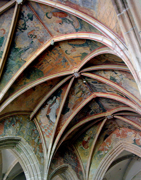
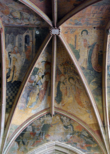
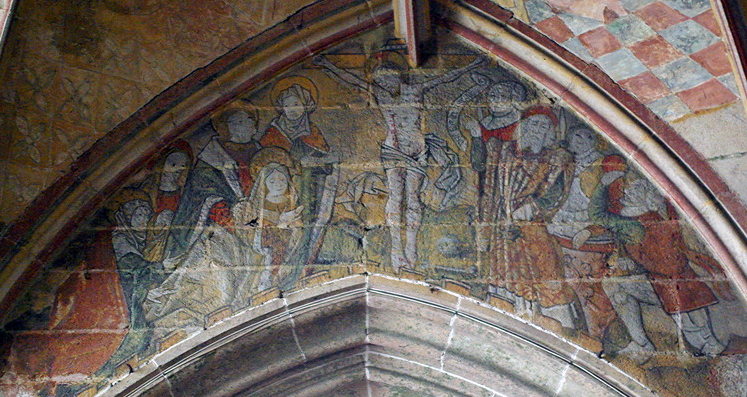
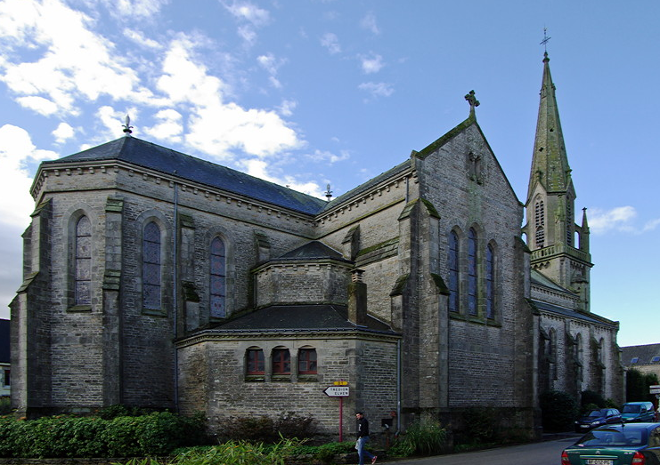
The Church of Sacré-Cœur is a large grey stone building with typical Neo-Gothic style church.

full


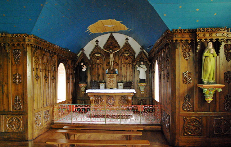
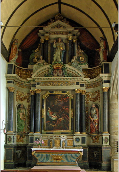
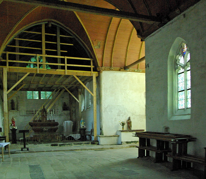
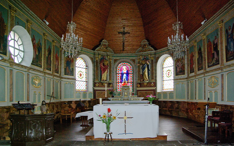
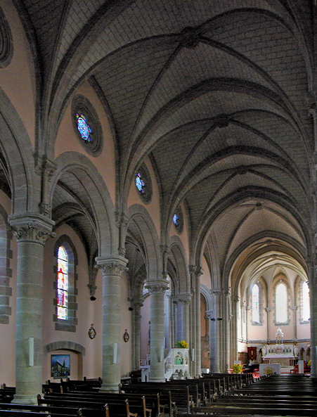
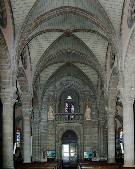
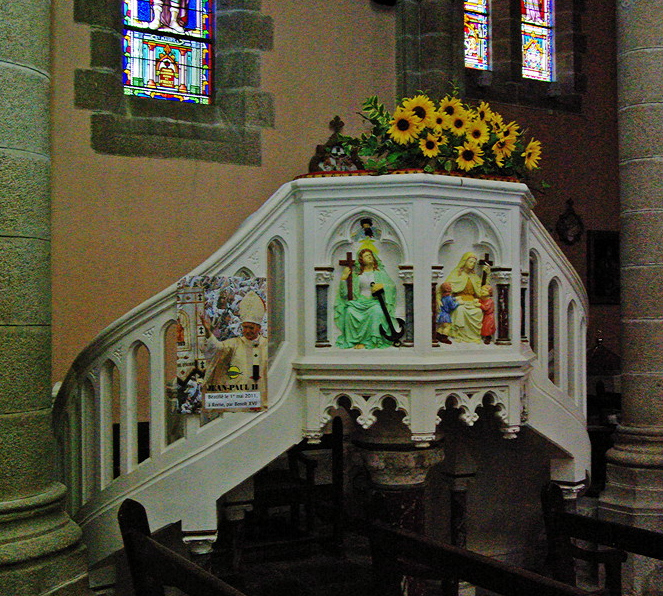
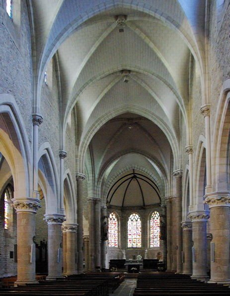
Inside it is a very simple and rather dour building, with rather a nice pulpit.

full


full


full


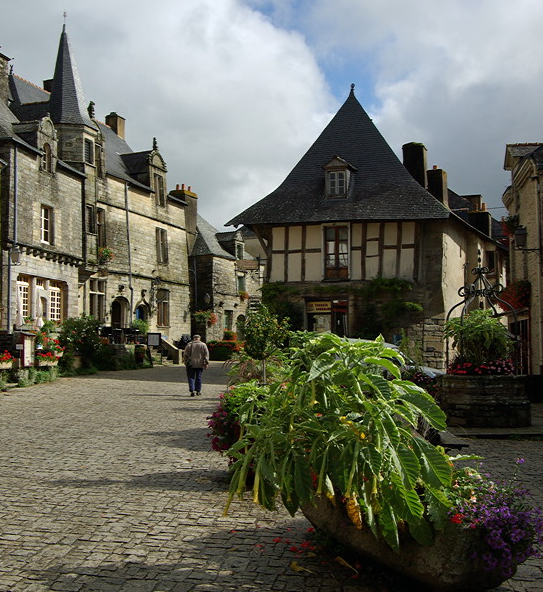
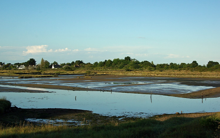
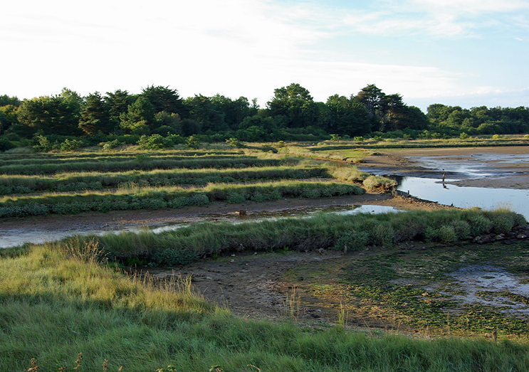
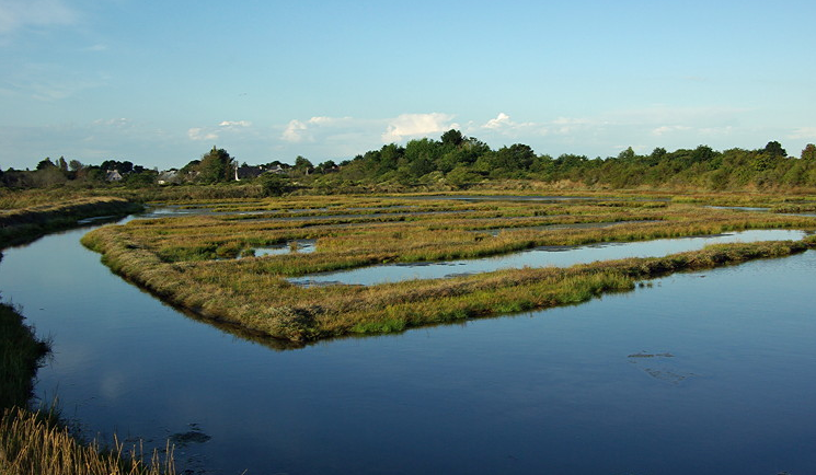
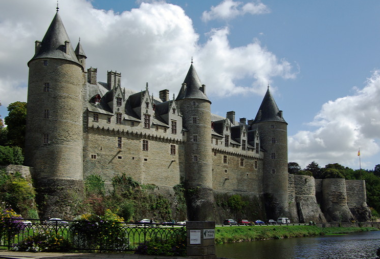
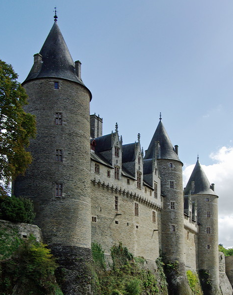
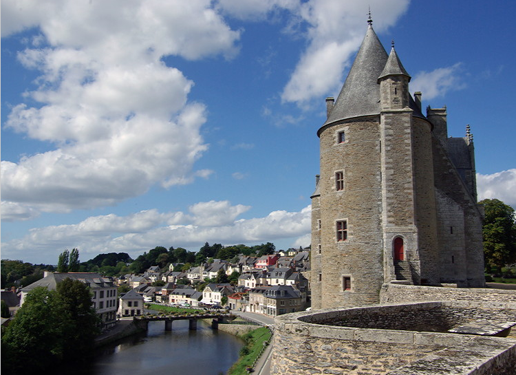
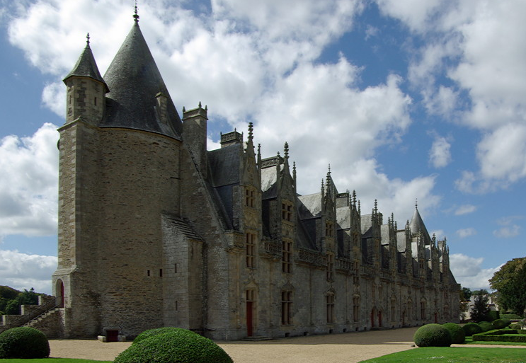
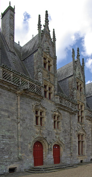
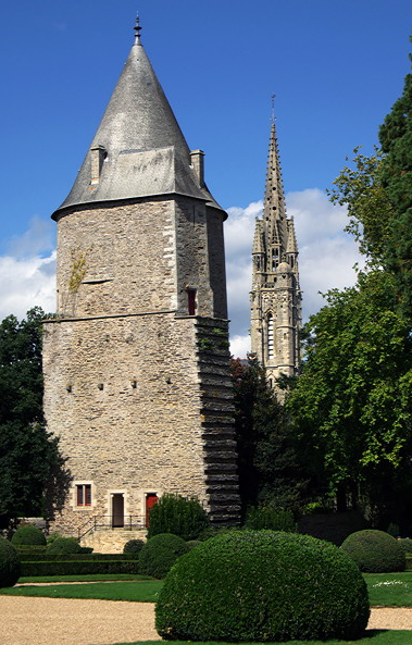
As well as the recognised tourist attractions of Josselin nearby we found there were many places within a few minutes drive of Plumelec which repaid stopping to visit.

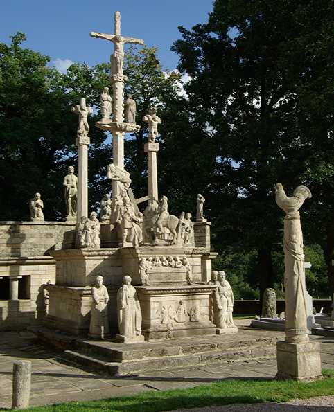
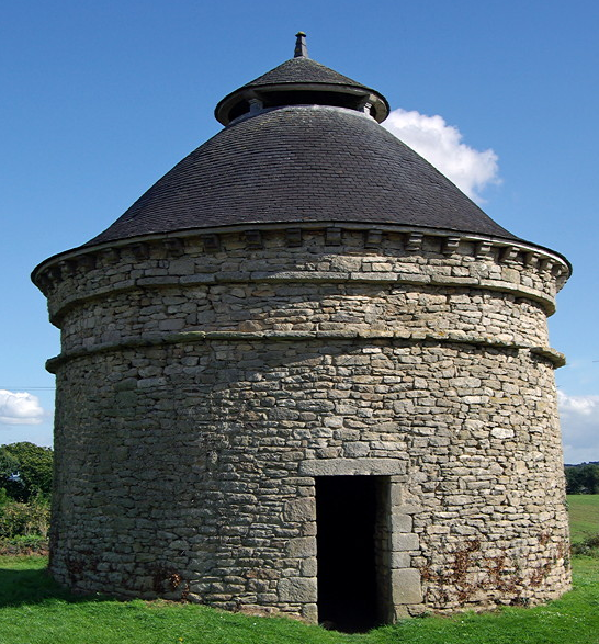
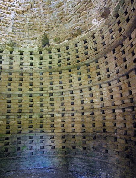
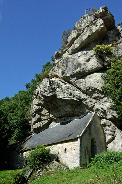
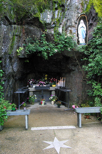
CALLAC is signed off the Plumelec to Tredion road. I had seen a grotto marked on the Michelin map and was intrigued. There is no mention of it in the guide books or on the web. We dropped down through the tree lined road into the valley bottom to find a huge car park set among the trees. A large cliff face had been turned into a grotto in 1947 by the parish priest as a money making venture to attract pilgrims. He added three crosses on top of the hill and restored the ruined chapel of St Joseph, where he is now buried.

The grotto is across the road from the car park. There is a statue of the Virgin Mary, similar to that at Lourdes, which is surrounded by Christmas fairy lights. There is a small altar below with flowers and lit candles (available at the desk to the right). There were a lot of stone plates attached to the walls saying ‘Merci’. A steep footpath leads to the three crosses on top of the hill with the 14 stations of the cross.

full


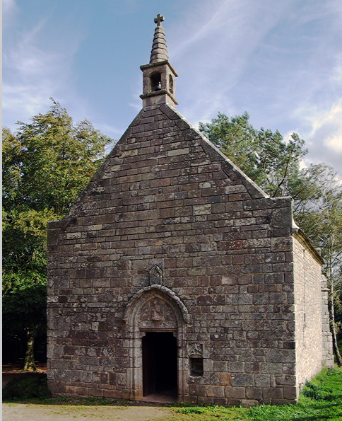
St Joseph’s Chapel is a lovely old stone building set on top of the hill, surrounded by trees and at the edge of fields. Don’t worry, you don’t have to walk there as the road runs past it. It has been beautifully restored. It is a very simple building still with old stone altar. The crosses can be seen from the chapel and there is access to them.

full


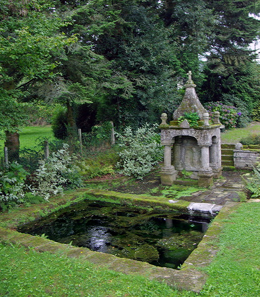
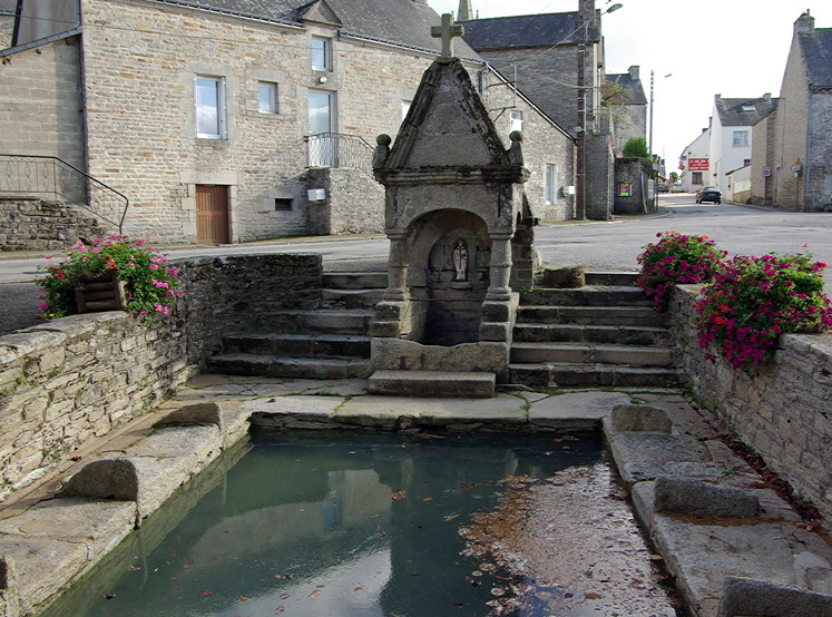
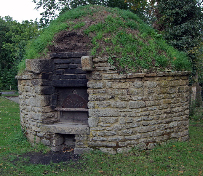
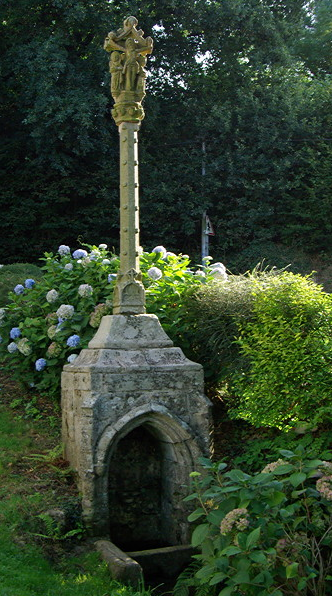
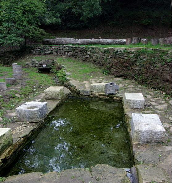
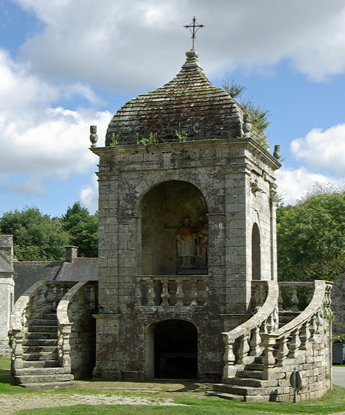
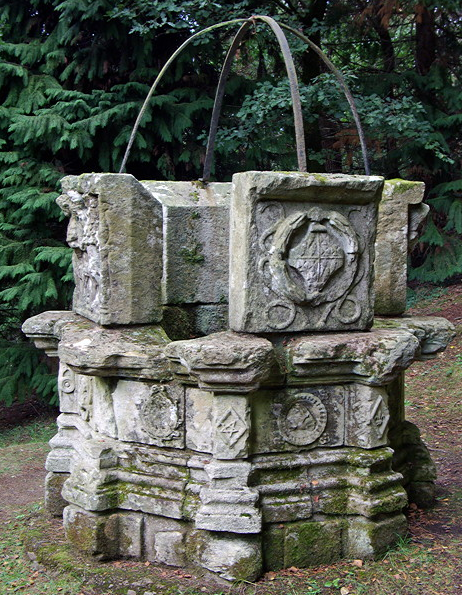
Below the grotto on the road to the village, a few stone houses clustered round the church, is a C16th fountain surrounded by a carved stone wall. Water trickles into a small bowl and then into a rectangular basin below.

full


It was certainly different. We are glad we went out of our way to find this.

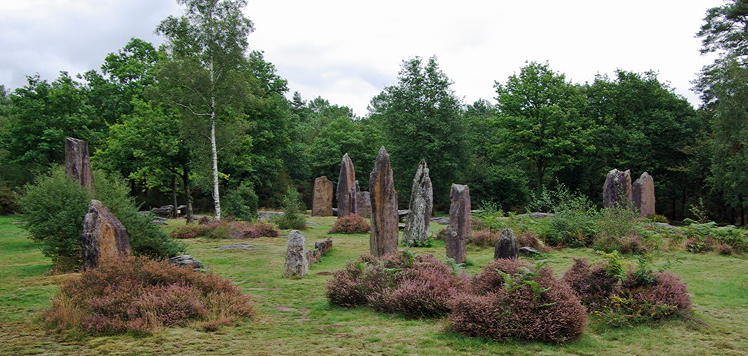
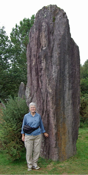
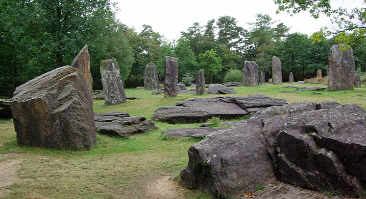
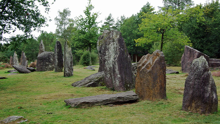
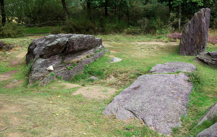
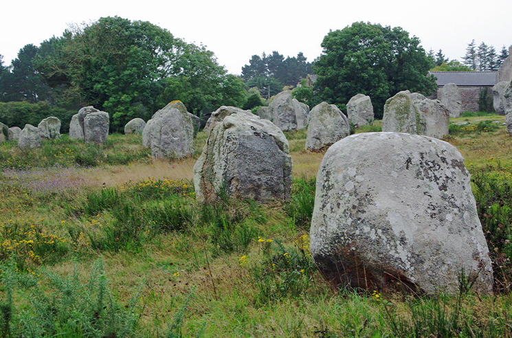
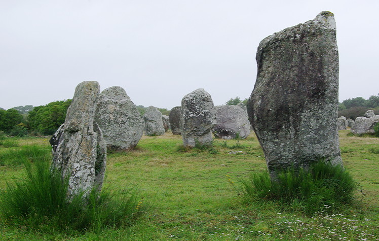
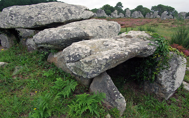
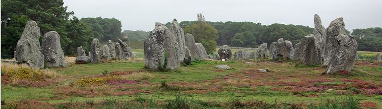
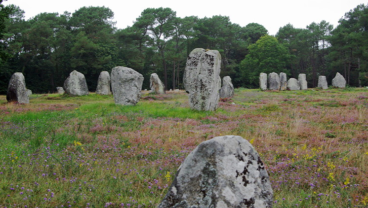
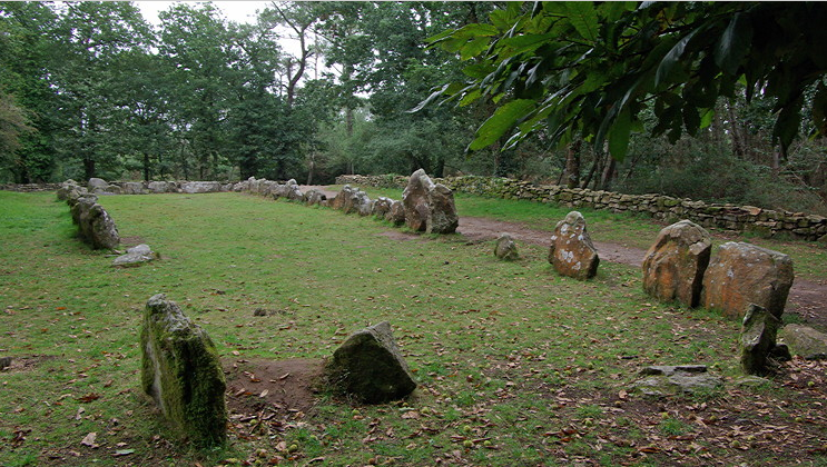
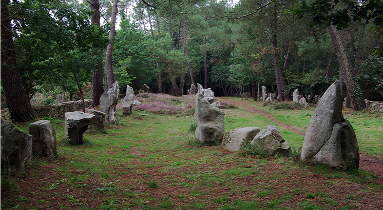
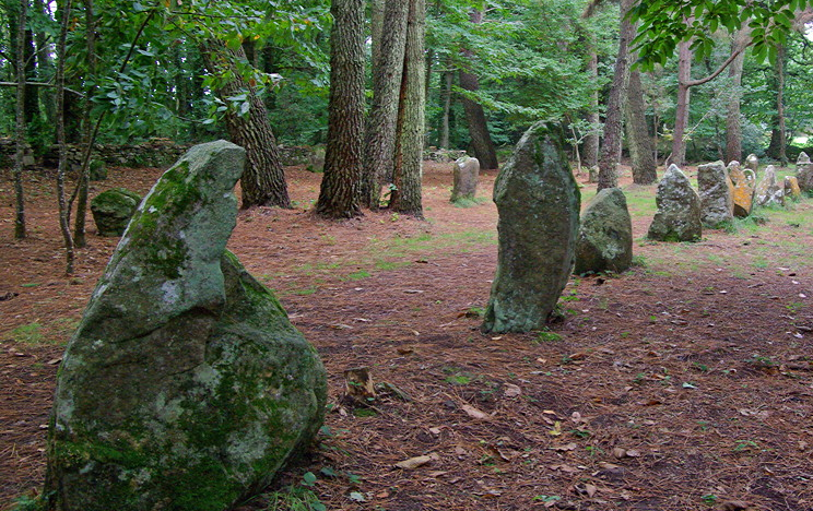
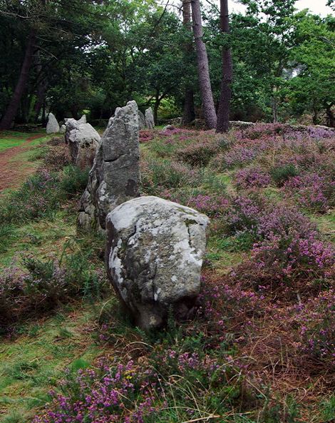
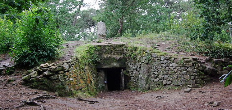
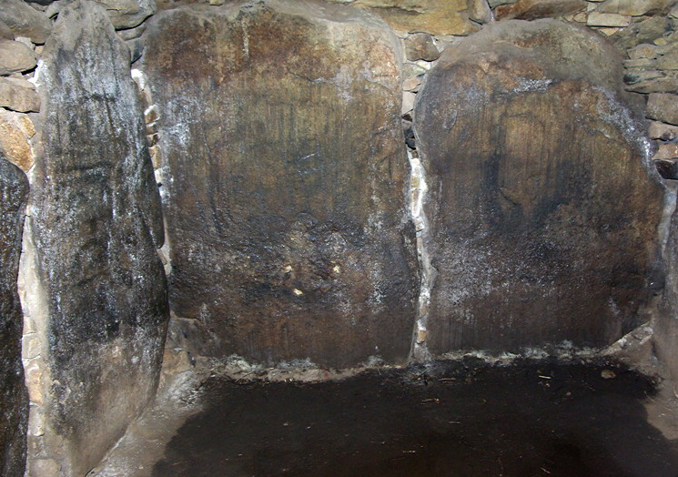
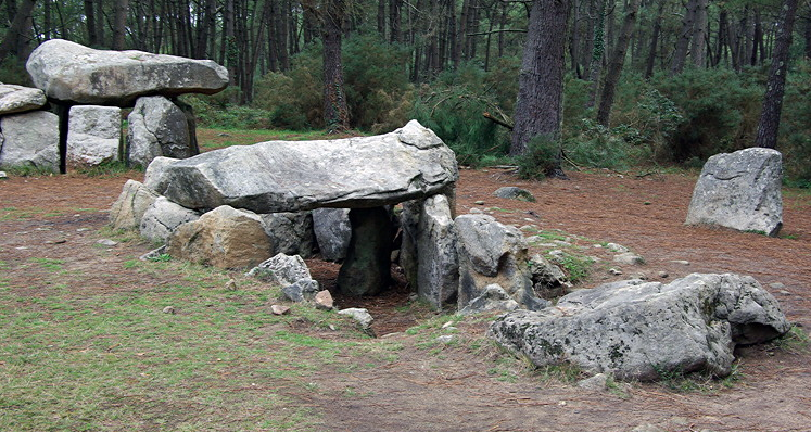
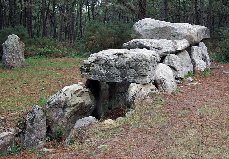
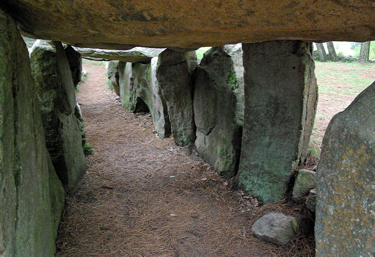
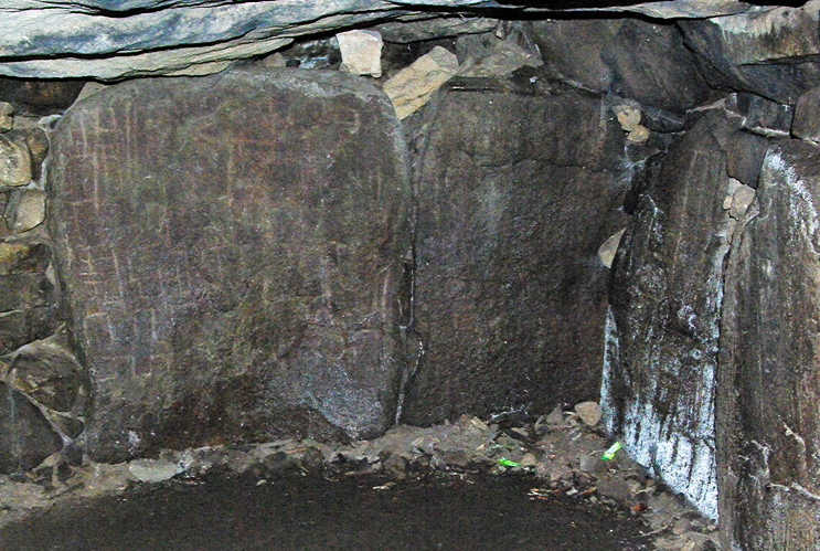
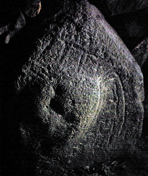
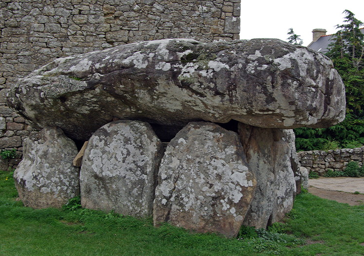
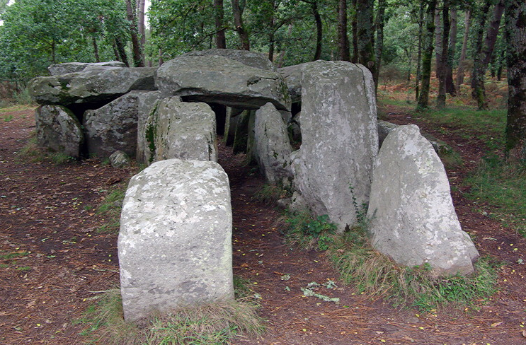
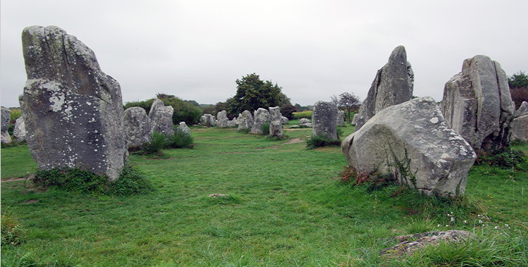
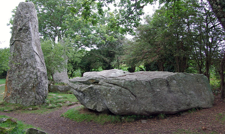
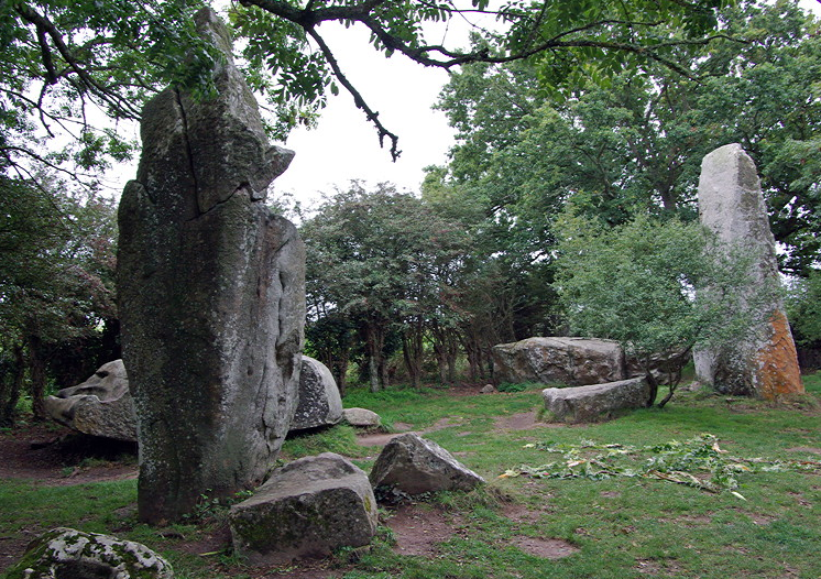
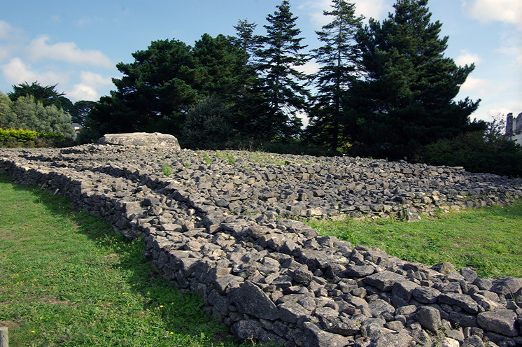
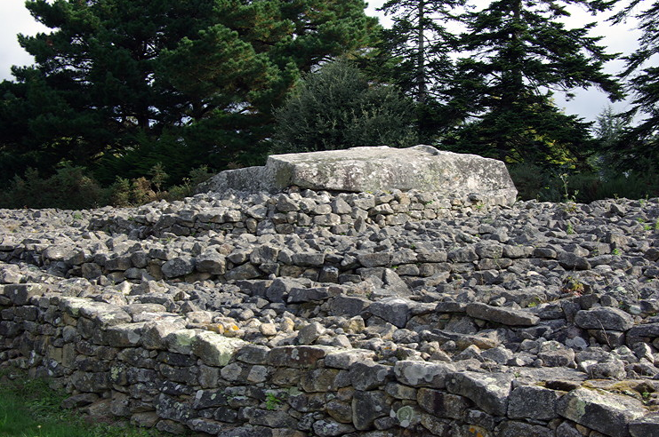
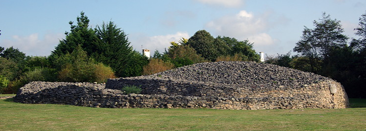
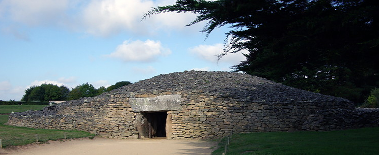
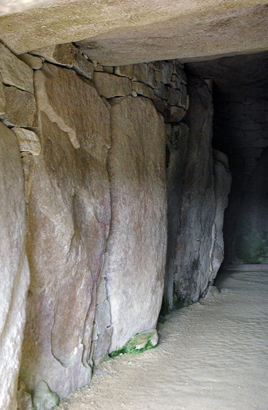
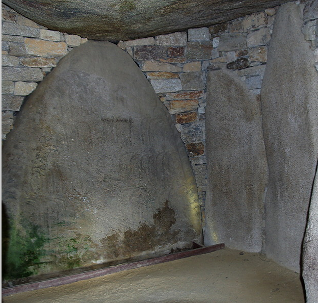
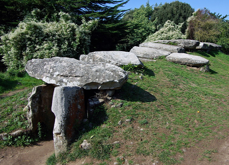
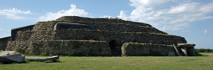
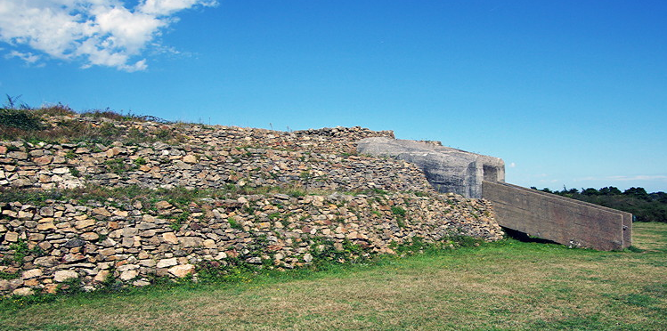
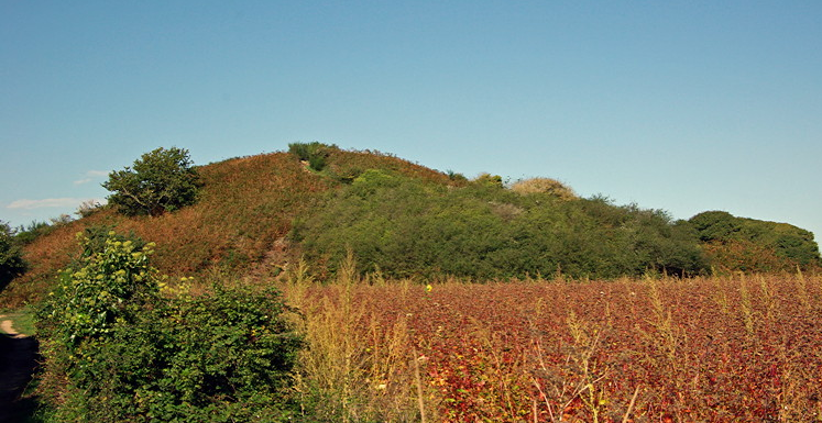
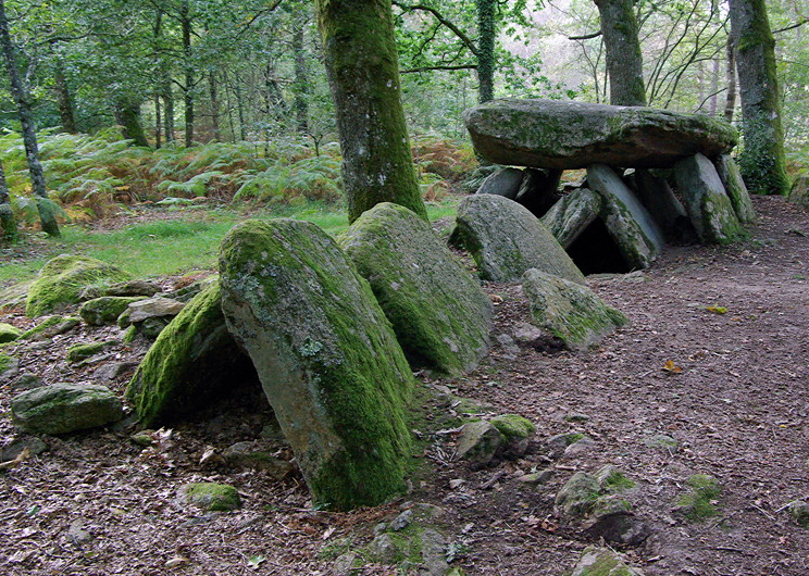
Between Tredion and Elven to the south of Plumelec, DOLMEN DE LOGE DE LOUP is signed off the road. There is a small parking area off the road and it is a 5 minute walk along a track through the forest. An encouraging sign part way along the track says dolmen 80m. It’s probably double that. The earth covering has been lost so it is easy to see the structure of the stones. It is unusual as it is a gallery grave made up of two rows of supports on each side which lean against each other and support the capstone. It repaid the 30 minutes we took to visit.

full


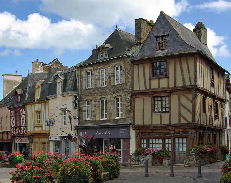
ELVEN is a workaday small town with a good range of shops and quite a bit of new development.

full


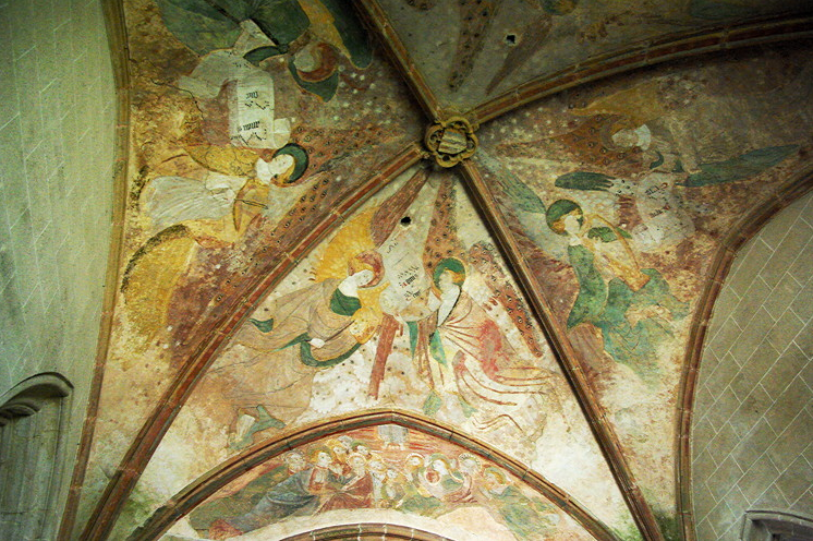
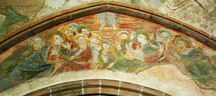
The church was rebuilt in 1879, although the C16th chancel survives. It is massive. It is very plain inside with bare stone walls, no side altars or pulpit and few statues of saints.

full


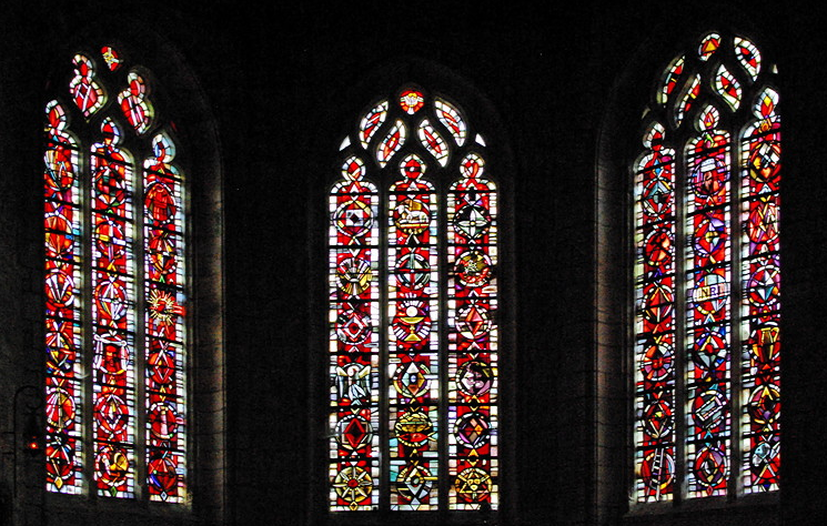
The modern stained glass windows had abstract designs rather than pictures. There were different colours for different windows in themes of blue, red etc.

full


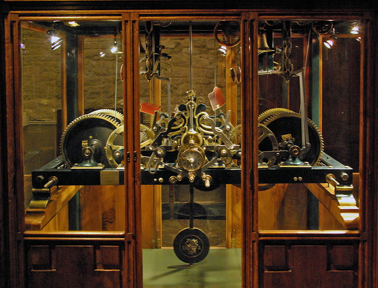
A new electric clock was installed in 1970. The clock mechanism of the 1925 clock has been beautifully restored and is now in a display case in the church.

full


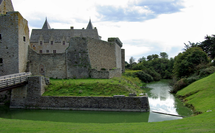
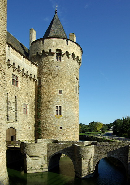
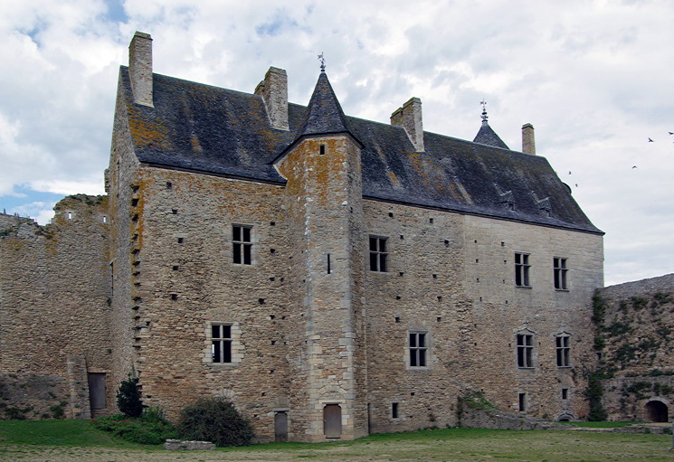
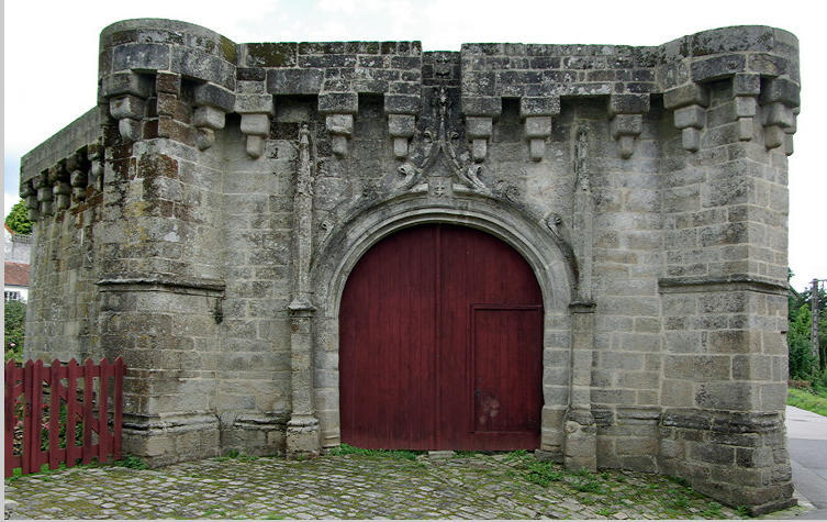
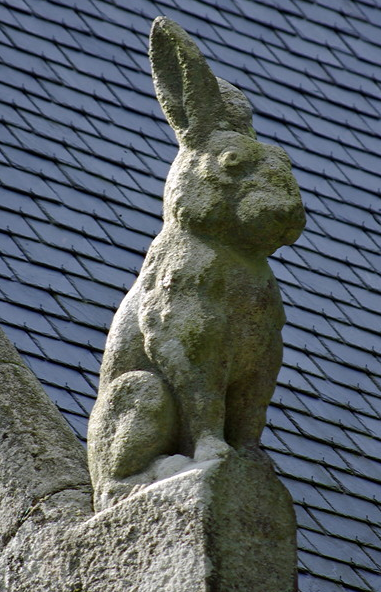
FORTRESSE OF LARGOËT is just beyond Elven and is reached down a side turn off the main road to Vannes. There is parking by the gatehouse. This is a splendid structure with carvings of rabbits on the roof. Each is different and all have character. There is no entry to the gatehouse.

full


The castle ruins are 10-15 minutes walk along a forest track. We hadn’t realised this dropped gently until we started to walk back. There are tracks off but these are private.

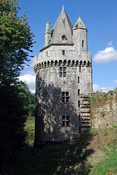
Rounding a bend, the fortress comes into view, with the remains of the gateway, massive donjon tower and smaller tower with a pointed roof and lake beyond.

full


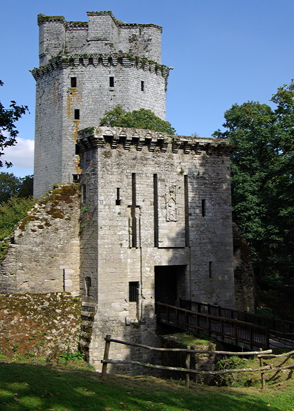
It is a pretty setting among the trees and surrounded by grass. The fortress was constructed in stages from the C13th. It is surrounded by a dry moat. A wooden bridge replaces the drawbridge. Above the doorway is the family crest of the Rieux family.

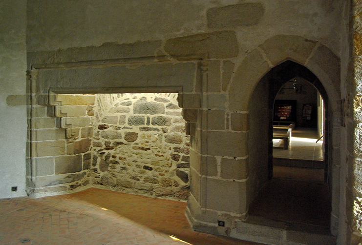
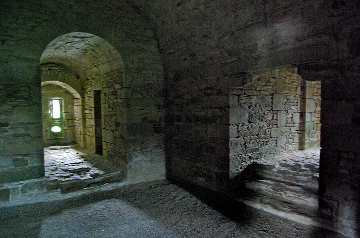
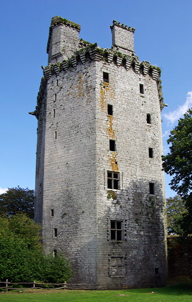
The fortress is surrounded by a curtain wall and bumps in the soil show there were several buildings inside. The donjon tower is a massive hexagonal structure. It is now a roofless shell. There are the remains of the guard rooms on either side of the doorway. There are dire warnings about using the spiral staircase.

full


full


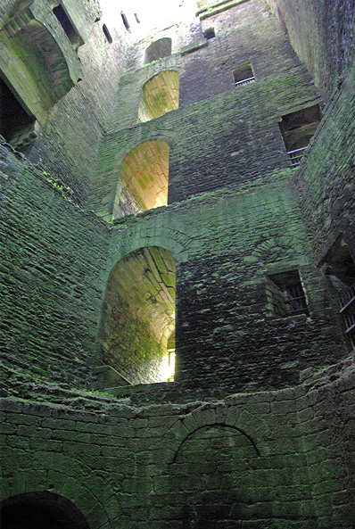
The smaller tower was restored early in the C20th and according to the leaflet given to us ‘once inside four floors can be reached by a spiral staircase which ends with a rampart walk ‘. The tower was locked and judging by the cobwebs had been locked a long time.

full


It is a romantic ruin and pleasant place to drop out, however, we did not feel it was worth the €5 entry or the walk.
 
Last edited:
La Vraie-Croix

This is a delightful small settlement signed off the D477 Vannes to Redon Road. It is thriving with a baker, general store, crêperie, bar and hairdressers. We parked in the large car park beside the infant and junior schools. It was playtime and the children were outside playing. We walked past the junior school and could see the classrooms laid out with two children to a desk and all facing the front. There was no sign of ‘group work’.

full


There is a small information room in the square which had leaflet about the village and a map showing a walk around the gardens and open spaces.

full


There are flower beds and hanging baskets everywhere in the town and the leaflet gives details of a circular walk around the gardens.

full


full


This takes you round the lake with ducks and down to the fountain and lavoir.

full


The main parish church is C19th and was shut.

full


The small 13thC Chapelle Sainte-Croix is in the centre of the town and the old road used to go under the chapel. There are fenced off shrines at ground level. Stone steps lead to the upper section which was rebuilt in the C16th. (Try both doors as one may be locked).

full


Inside is very plain and simple with a blue painted ceiling with stars. The main altar has a carved and painted depiction of the crucifixion. There are two carved heads on the wall.

full


According to the legend, a Breton crusader returning from the Holy Land with a piece of the Holy Cross slept here and had a dream. He built the chapel and the piece of cross is preserved in a small reliquary with a replica of a C15th bronze cross.

full


La Vraie-Croix hardly merits a mention in the guide books and there is little information on the web. Few tourists discover it. This is a shame as it is a truly delightful place.
 
Rochefort-en-Terre. 


Rochefort-en-Terre is an attractive small town which is popular with tourists who arrive in large numbers. There is a large car park on the edge of the town (€2.50 all day in September 2011). There are no obvious parking restrictions in the town (unlike at Locronan) and there were a few cars parked in places. However streets are narrow and there are a lot of pedestrians so attempts to park are difficult.

The town is built on a promontory above the Guezon river and the site has been fortified since Roman times. A defensive keep was built in the C12th and town walls in the C15th. The only bits left are the gateway and a small section of walls and some outbuildings. These were restored by the painter Alfred Klotts and are now a small museum with some of his paintings and some furniture. We gave this a miss.

There were flowers everywhere, especially bright red geraniums. Even the old well in the square is now a flower display. Large troughs of flowers along the side of the road not only look attractive they also make parking difficult. Houses have window boxes with more geraniums.

full


full


full


There is a mixture architectural styles with stone and timber frame houses along the main street with narrow cobbled alleyways and steps off. There are a number of eateries as well as a craft bakery. There were quite a few gift shops aimed at the tourists. We found a small toy shop selling beautifully made traditional wooden toys which you rarely see in the UK. There were dress shops (usually specialising in the more way out fashion) and an antique shop full of old Breton furniture and a large sign saying ‘no photographs’.

full


full


We dropped down to the C16th lavoirs along the river. The water was diverted into the washing pools which had slate floors with slate dividers and a slate roof.

full


We had to wait for a christening to finish in Eglise Notre-Dame-de-la-Tronchaye. It is a huge church with a short tower with a pyramid slate roof and a very simple calvary outside.

full


full


Inside it is a plain stone building with two main aisles and statues on the pillars and a carved wooden pulpit. The north aisle had a highly carved balcony at the back. There was a side chapel with font and altar. There were carved wooden seats in the choir with carved misericords. There was a large carved and painted altar to one side of the main altar and another massive altar in the south aisle. The stained glass windows are modern.

full


full


full


Rochefort-en-Terre is popular with the tourists and does get busy. It is a very attractive town and is worth visiting
 
Les Pierre Droites Standing Stones


LES PIERRE DROITES are one of the less visited megalithic sites in Brittany and one of the places where it is possible to wander freely among the stones. They are ignored by most of the guide books which just concentrate on the megalithic remains around Carnac. The stones are just off the D776 road between Malestroit and Guer, and are signed about 2km beyond the small settlement of Monteneuf. There is a large car park on the opposite side of the road which is used by walkers as there are many tracks through the woodland. There are no amenities at the site, which is one of its attractions.

There are a large number of standing stones are set in an open heathland setting with heather. In mid September there was free access to the site. The box containing information leaflets was empty. There are a few information boards around the site in French.

full


Some of the stones are massive. The biggest is 5m tall and weighs 38 tonnes.

full


Some are arranged in lines; others are a more random distribution. There was a short row of quite small stones.

full


full


A quarry site for the stones has been found which shows how the blocks of stones were chipped out. Grooves were carved out and wooden wedges pushed in to split the rocks.

full


The stones are in a delightful setting and we were pleased we had made the effort to visit.
 
Carnac Alignments

The Carnac area contains one of the largest concentrations of megaliths in Europe. There are stone circles, alignments, dolmens, menhirs, passage mounds and tumuli. It features on everyones ’must see’ list and rightly deserves to be.

The area has been inhabited since 5700BC and the megaliths were built in a moorland/grassland landscape after trees had been cleared for agriculture. Rows of standing stones march across the landscape for as far as the eye can see. No-one really knows why they were erected and there are suggestions they were part of a giant astronomical observatory. One thing is sure. They were designed to be seen.

full


If the land reverts to forest, the tree roots can disturb the foundations. The area around the Carnac Alignments is now grazed by sheep to stop regeneration. Pressure of visitors is also a problem and was causing damage to the vegetation. The alignments are now fenced off and during the summer season and entry among the stones entry is by guided tour only. However during the winter months it is possible to enter the site and walk around the stones.

Most people head to MAISON DES MEGALITHS at the western end of the alignments where there is plenty of parking and free entry. It is possible to climb onto the roof for aerial views.There is a video presentation and the shop has a good selection of books with several in English, although mark up on those priced in pounds sterling is big. Postcards are also expensive. The toilets are in the car park and let them down. They do provide a free guide in English.

We spent a whole day exploring the area and even then didn’t have chance to see everything. There are about 3000 stones arranged in lines which stretch for 4km across the landscape. Most are 1-2m tall. They split up of the Alignments of Ménec, Kermario and Le Manio. Most people visit the Ménec alignments and then drive past the rest.

full


The road (rue du Tumulus) runs along the side of the stones and has good views of the stones. It is busy and although there is a grass verge it in not advisable to walk along the road. Small car parks are provided at the main sites, but many people pull off and park on the verge. When driving there is a need to watch out for pedestrians who in their excitement to see the stones forget about traffic. There is also a Tonka Train which trundles slowly along the road while passengers take photos. Traffic builds up behind it and it is impossible to overtake.

We began at Maison de Megaliths and crossed the road to admire and photograph the ALIGNEMENTS DE MÉNEC before walked into the small hamlet of Ménec where you get good views along the rows of the alignments. Even though this is so close to the stones it has turned its back on tourism. From here it is possible to pick up the footpath which runs along the alignments on the side away from the road. The first section does get busy but you soon lose the crowds.

full


full


There are smaller car parks for the ALIGNEMENTS DE KERMARIO. We parked here and walked to take a picture of the KERMARIO DOLMEN at the corner of the alignment by the roadside.

full


Beyond, there is a layby on the roadside near a footpath which cuts across the alignment to the old windmill. If there is space park here as the the view from the top of the windmill gives one of the best views of the alignments. It is much better than that from the top of Maison des Megaliths.

full


full


There is a small parking area just off the road before the Equestrian Centre for the ALIGNEMENTS DE KERLESCAN.

full


It is 15-20 minute walk through the trees to the MANIO QUADRILATERAL, a large rectangle of stones, thought to be the remains of an enclosure round a long gone dolmen. Close by is the impressive 6m high GÉANT, a single standing stone.

full


There is a footpath signed to LE PETIT MÉNEC from Kerlescan but they are not signed from the road. These are rarely visited by tourists and Michelin describes then as an “enchanted place”. They are reached by turning left onto D186 and after about 250m there is a right turn onto a minor road into the forest. There is a small parking area on the left after about 400m and the stones are on the right. There are three rows of stones among the trees. Some have been used as part of a stone wall. Few people find these stones and you are able to wander freely among them. It is a delightful place and we had it to ourselves.

full


full


full
 
Other megalithic remains in the Carnac area.

Most people visit Carnac for the alignments and don’t bother to visit the other remains. This is a shame as there are some equally splendid ones to be found.

TUMULUS DE KERCADO is signed off the rue du Tumulus. Coming from Carnac it is a right hand turn just after the lake. The tree lined road road takes you down to a gateway (locked) into the Chateau and there is a small restaurant. There is a small stone entrance hut with information leaflets and an honesty box. Entry is €1 which helps pay for the electric light in the tumulus.

It is a short walk to the tumulus which is a large earth covered mound with a menhir on top and another facing the doorway. Dating from 4800BC it is one of the oldest megalithic site in Europe. It was used as a hiding place by the “chouans” (insurgent Breton royalists) during the Revolution. It was exposed in 1863 and excavated in 1925 when the remains of a chief were found with 147 callais beads (sea green precious stone), decorated pottery, flint implements and human teeth. The large entrance leads to a low doorway (mind your head and back) and long passageway to the big chamber at the far end, lit by an electric light.

full


full


TUMULUS DE ST-MICHEL is just to the north of Carnac Ville and there is parking at the bottom of the road. A small chapel has been built on top of a tumulus. It was a dull day with poor visibility so we gave this a miss.

Coming from Carnac, the DOLMENS DE MANÉ KERIONED are reached by a right turn onto the D68, Auray road. They can be seen from the road. There is a small car park opposite and a short walk to the three dolmens. There are two large dolmens with upright stones and massive capstones.

full


full


full


The third dolmen is underground and there are steps down into it. It has a massive end chamber with a carved end stone. There is no electricity and only a limited amount of day light reaches the end chamber. Unfortunately we had forgotten to take a torch. It was too dark to focus for photographing with flash so Michael had to use manual and guess the distance. With the eye of faith the stones along the passageway could also have had carvings.

full


full


There is a big dolmen in the hamlet of CRUCUNO, reached from a side turning off D781.

full


A sign in the village pointing to “Cromlech” takes you along a rough track to the ‘QUADRILATÈRE’, a large rectangle of stones surrounded by smaller menhirs, in a field. The purpose of this is unknown. It was restored in 1882 as only nine of the stones were still standing. It lies exactly along the cardinal points with the diagonals orientated towards the rising and setting sun. However it is not known whether this was intentional or the result of enthusiastic and over inspired restoration.

full


MANÉ CROC’H is a bit further along the road beyond Crucuno. There is a large park on the left side of the road with a signed walk to Mané Braz and Kerzerho, with a smaller park on the opposite side of the road for Mané Croc’h. This is a long T shaped dolmen with side chambers.

full


The ALIGNEMENTS OF KERZERHO are on the main road from Carnac, just before Erdeven. The road cuts through the alignments and there is a large car park. The stones are arranged in several lines but there aren’t as many as at Carnac. Few people get this far and the stones are unfenced and you are able to wander freely around them.

full


At the left hand corner is a small sign pointing to the giant menhirs. A track took us to about 20 massive menhirs among the trees. Some had fallen. A sign said the tallest were 6-7m high. The day we visited, star shapes made from maize heads, Russian vine and hawthorn had been arranged on the ground by some of the menhirs - it had a definite pagan feel.

full


full
 
Locmariaquer

After Carnac this is probably the second most important megalithic site in Morbihan. The area has been settled since about 6000BC. There was a high population density and strong hierarchical structure. As well as the three main structures at the Ensemble Megalithique de Locmariaquer there are smaller dolmens scattered around the area.


ENSEMBLE MEGALITHIQUE DE LOCMARIAQUER is signed coming into the town. There are two large car parks. The site is surrounded by tall coniferous hedges. A raised platform on the footpath along the road may give some views. The Visitor Centre is carefully designed not to intrude too much. It has some books and assorted tee shirts. The toilets were basic. There is a video and earphones with English and German translation are available. There are steps up to a viewing area on the roof. This is probably the best place to photograph Er Grah.

full


The megaliths are surrounded by grass and a fence controls access to the site. The best photos of Er Grah need to be taken from the end and this is impossible.

ER GRAH was begun about 4500BC when a tumulus with small cairns on top was constructed. About 4200BC a small burial chamber surrounded by a circular stone cairn was added. It was further extended about 4000BC to the north and south by the addition off a mass of clay held in place on each side by dry stone facings. In the C19th, the northern part was destroyed by quarrying. At the start of the C20th the monument had collapsed in places and was covered in vegetation. It was restored to its original condition in 1992. The main cairn is a massive stepped structure. All that remains from the 4000BC extension are the two long dry stone facings.

full


full


GRAND MENHIR BRISE is huge. It now lies broken in four pieces. Intact it is over 20m long and would have stood about 18.5m high. It is thought it was erected about 4500BC. The stone was quarried about 12km away and was smoothed using quartz hammers. It is assumed it might have been part of a lunar observatory.

full


Behind it is an area of stony ground which was originally a row of 18 smaller menhirs. These and the Grand Menhir were destroyed between 4300-4200BC but it is not know whether it was accidental or deliberate. Parts of the stones were reused in other dolmens and tumuli in the area. It is thought the Table des Marchands may contain some.

full


TABLE DES MARCHANDS is a passage grave aligned to the summer solstice and erected about 3700BC. A massive mound of stones covers a passage way to the central chamber. Entry is allowed into the dolmen.

full


full


There are two upright stones and a massive capstone at the entrance. This is quite low so you need to mind your head and back.

full


The passage gradually gets higher and it is possible to stand upright in the central chamber. This gets quite claustrophobic if there are more than about 5 people in it. The passageway and chamber are lined with massive stones. The only light comes down the passageway.

The capstone is thought to have been brought from an older carved dolmen that was broken up before reusing. The carvings of an axe and a plough pulled by oxen are quite difficult to make out. The end stone has whorls and arches. These are best seen by standing in the passageway as this blocks some of the natural light entering and the carvings are much clearer. Take pictures from here too. We could see carvings on some of the large stones in the passageway. The large uprights are packed in by beautifully laid smaller stones.

full


There are other smaller dolmens in the area. DOLMEN MANÉ LUD is on the edge of the town. There is a large parking area and it is a 5 minute walk along a well made track through the trees. The dolmen is set in woodland behind the village. It is built into the ground. There are narrow steps down to the entrance and a long passageway to the end chamber. Gaps between the cap stone and end stones let in a little natural light.

DOLMEN DE MANÉ RETHUAL is signed down a narrow passage way in the centre of the town. It is in a small enclosed grassy area among houses. It is a long covered alley grave but the entrance was too low for us to enter easily.

full


We then parked in the centre of LOCMARIAQUER and found a bakers to buy lunch which we ate on a wall over looking the Golfe du Morbihan. It was a glorious day and very warm in the sunshine. There were views of the boats, islands and the Golfe du Morbihan. We went for a walk around the town which had great character with old houses and not too many shops and eateries.

full


full


EGLISE NOTRE-DAME-DE-KERDO has a beautiful C11th choir and transept.

full


The rest of the church is C17th. The steeple was repaired in 1817 and the nave widened and made higher in 1838. The stained glass windows date from 1960. It is a solid stone building with big square pillars in the nave which has big round topped windows. The glass is made up of a mosaic of small pieces in shades of yellow and white with pale blue and green glass round the edge. The nave is plain with no pulpit and just the stations of the cross on the walls. There are two huge and ornate side altars in the north and south transepts with lots of gilt decoration, with a painting in the centre and statues.

full


The small C11th apse has an arched roof and small round windows. The round pillars have highly carved capitals. There is a plain main altar in the apse with a smaller, modern communion table in front.

full


There is a carving of the Virgin and child on the transept arch and a ship on the north wall.

full


full
 
St Cado Island

ST CADO ISLAND is a small island in the river Etal joined to the mainland by a causeway. Driving across the causeway is discouraged as there is little parking on the island. A large park is provided in the small settlement on the mainland.

full


On an isolated rock in the river is an former oyster farmer’s cottage, a popular photo shot.

The Welsh missionary Cado arrived here in the C6th and established a teaching centre on the island. There is a legend that Satan helped him build a bridge across to the island on condition Satan was rewarded with the soul of the first person to cross the bridge. Cado made sure a cat was the first across.

The small island is delightful with old granite or white painted houses taking up the whole island.

full


full


It is a steep climb up the cobbled street to the CHAPEL.

full


The present building dates from the C12th with the sacristy and a large side chapel added in the C19th. In 1960 the chapel was restored as best as possible to its original state but with modern stained glass windows. The east window has a picture of St Cado with his cat and the devil.

full


The side aisles have pictures of seaweed gathering with a horse pulling a cart pilled high with seaweed. Another window shows a fisherman with two large fish.

full


It is a beautiful stone built structure with square pillars supporting round arches and a round arch leading to the choir with its semicircular apse. The processional banner is in the choir. There is a modern stone altar but one of the original stone altars can be seen on the south wall.

full


full

The south chapel has a C16th altar. There are statues of the Apostle Mark with a lion at his feet, St Yves holding a coin and St Roch holding a crook with a dog. A model boat hangs from the ceiling.

The chapel became a pilgrimage centre and St Cado was believed to cure deafness if the sufferer lay his head in a hollow of a large flat stone labelled St Cado’s bed. This stone can still be seen.

Outside the chapel is a large C19th calvary reached by four sets of stairs. The clergy still preach a sermon from the calvary, celebrate vespers and direct the procession on the annual pardon. There is a fountain below the church near the shore and a large pool that is covered at high tide.

St Cado Island can get busy duing the day. Time a visit for early morning or late afternoon to miss the worst of the crowds.
 
Presqu’île de Rhuys - To Château de Suscinio


Presqu’île de Rhuys is the long peninsula that loops round to the south of Golfe du Morbihan. We left the main road at the Maison du Cider Junction and wiggled round the unclassified roads which took us through ST ARMEL and an expanse of old SALT PANS. A causeway with two sluices controlled the flow into the pans which had earth banks round them to hold the water. The tide was just beginning to come in.


full


full


full


We drove down to the end of Le Tour du Park road but there were too many trees along the roads to be able to see the salt pans there. It was rather boring scrubby scenery and a waste of time.

Next stop was CHÂTEAU DE SUSCINIO, on the south side of Presqu’île de Rhuys. It is very photogenic with its pointed turrets and moat. There is a large car park surrounded by trees which has views across the salt marsh.

full


full


The original building was a C13th manor which was later enlarged. A small chapel was built outside the moat as was the dove cote. The chapel burnt down in 1370 and was replaced by a chapel in the C14th range. The Château was originally used as a hunting lodge but later used as a main residence of the Dukes of Brittany. Jasper and Henry Tudor lived here for a while. The Château fell into ruins in the C16th when the family moved to Nantes. Stones were taken for use in local buildings.

When it was taken over by Morbihan Council in the 1970s it had no roof or internal floors. Restoration work began in 1986 and the C15th range of buildings was still to be completed in 2011.

Entry is across a drawbridge, though a massive wooden doorway with carvings of two stags above into the C14th building. A curtain wall separates this from the later C15th buildings.

full


There are sign boards in each of the rooms. We were given a leaflet and excellent audio guide in English. There are guided tours in French.

The tour began in the eastern C14th buildings.

full


The general apartments were on the ground floor. The Duchess and children lived on the second floor and the Duke’s apartments were on the top floor. There was a household of 665 which included a personal bodyguard of 254. There were two large round towers in this part of the building which house spiral staircases. The layout on each floor was similar with two large rooms with smaller rooms off. There were two latrines on each floor which emptied into the moat.

The first room on the tour is the chambre à Parer which was the general reception area and had smaller sleeping quarters off which would have been used by important guests. It has a large relief sculpture on the wall of Olivier de Clisson from Château de Josselin. This dates back to the time when the Museum of Breton History was here. Beyond is the Salles des Banquets where meals were taken. The serving hatch in the wall can be seen. Meals began with strong cheese, soup, meat and vegetables, deserts, goats cheese and cakes. There are displays of tiles in both rooms.

The Chambre à Parer contains samples of C13th tiles which were found in the moat. The tiles are 2-3” square. The patterns on the tiles were made by pressing a mould into the surface of the tile and pouring in a paler coloured clay before firing. There are tiles with fleur de lys, oak leaves and flower designs.

full


full


full


In the Salles des Banquets are examples of C14th tiles discovered when the ruined church was cleared and an almost intact floor was found, dating from 1330-50. These tiles were coated with lead oxide before firing which gives a deep red glaze. Adding copper oxide gives a deep green glaze. If white clay is used it was possible to get yellow and pale green shades. The tiles were air dried before firing. They would be laid in geometric patterns of different colours or else in large squares containing a decorative roundel with pictures of animals etc.

full


The Duchess’s quarters on the floor above contained the ceremonial bedchamber where she received honoured guests. There would have been a bed and a dresser displaying expensive silverware and china. The Duchess had her own personal steam room (Etuve). This is a sort of Turkish bath and the stoke hole is still visible. The upper wooden floor is missing but the drain hole can be seen. Her private bedchamber was beyond. Only the wardrobe mistress was allowed in here. The Duke had access by his own private spiral staircase from his rooms above. Any children would share these quarters with the Duchess.

Next to it is Sal du Duc, the Ceremonial Hall where the more important guests were received and entertained. It has a large stone fireplace. On the opposite wall were a series of stone steps which which were used to display expensive treasures. The private chapel is off this room. It had two small oratories. The Duchess sat in one and the Duke in the other. Each had a small fireplace and they could watch mass through a small window.

The Duke’s rooms are on the top floor. The rooms were lined with wooden panels which would have been lime washed to improve insulation. The main room has an exhibition on the restoration of the Château. Behind is the Duke’s private bedroom with latrine and his private staircase to the Duchess’s floor. There is a late C15th loggia off this room which has good sea views but was probably built to give access to the ramparts and western buildings. There is a walkway over the main doorway with machicolations which gives access to the Guard’s quarters. The Duke’s personal body guard lived, slept and ate in these quarters while on duty. The rest of the time they were based on the ground floor. There are holes in the walls from where the support beams went during building. The support arches above the fireplace, windows and doors are very obvious. These were structurally important as it meant that lintels and stones could be removed and replaced without harming the strength of the building.

The eastern buildings are connected to the later C15th western block by a curtain wall which has the remains of a C13th defensive tower. The walkway along the top gives good views of the surrounding countryside and down into the courtyard.

The roof has been replaced on the C15th buildings but the interior is still an empty shell with the remains of fireplaces on the walls and pigeons. The ground floor was reserved for storage and the living quarters were above. It is thought this building was used to house important guests.

full


The casement in the base of Tour Neuve has alcoves for 4 cannons. Each had a small recess to protect the person firing the cannon.

full


We really enjoyed out visit. There is a small village on the seaward side of the château with stone houses and a road to the beach. There is a large car park behind the beach with lagoons and salt marshes. From the car park we walked across a bar of coarse gravel to the long sandy beach. This would be good tramping country.
 
Presqu’île de Rhuys - From Château de Suscinio to St-Gildas-de-Rhys

From Château de Suscinio, we continued clockwise round the peninsula. SARZEAU is one of the largest settlements, with a lot of eateries and shops. There is a lot of new development and not as many “fine C17th and C18th houses” as the guide books had led us to expect. It was disappointing and lacked character. The church is a large C19th rather soulless building with white walls, ceiling and pillars. The round arches had crudely carved tops. The main alter has a carving of the last supper. There is an ornate open carved arch in the choir and a massive balcony at the west end with open carved front. There is a small display case with censor, communion plate and the processional cross.

full


full


After Sarzeau, we decided to follow some of the unclassified roads around the inland shore of Morbihan hoping to get views. At BÉNANCE there are lots of oyster beds in large concrete tanks on the shore. The end of the road had large private signs and no views.

full


full


The next headland, POINTE DE RUAUT has a large parking area along a busy quay. Flat oyster boats were anchored in the bay. Some were being loaded up with large open mesh ‘sacks’ containing oysters which were being planted in cages in the open bay.

full


We drove to the tip of the headland beyond BRILLAC, where there is a small parking area. The footpath round the headland ran through tall shrubs but there were good open views from the end across the Golfe du Morbihan to the islands. There were a lot of sailing and pleasure boats anchored in the Golfe. The peace was shattered by one of the cruise boats with loud speaker commentary.

full


full


Next was ARZON to visit Cairn de Petit Mont. This area is very built up with many new houses. The marina is full of boats and it has a definite holiday atmosphere. It was not a place we wanted to linger.

CAIRN DE PETIT MONT is on a headland covered with tall scrub. There are a series of footpaths across the headland but no views as the vegetation is so tall. It would be easy to get lost. It is a 5 minute walk from the car park to the ticket office in a small shed, selling a few books and postcards. There are guided tours in French. We were given a leaflet in English. No photography is allowed in the cairn and bags and cameras have to be left in the ticket office, although you can collect the camera to take pictures of the outside of the cairn.

The cairn is made up of four layers of stones and was built and extended over a considerable period of time. About 4600BC there was a low oval burial mound. Around 4000BC this was replaced by the first cairn which was built in the shape of a trapezium without a passageway or internal chamber. Around 3500BC the cairn was extended with a passage way leading to an internal chamber. Some stones were decorated. Around 2700-2500BC a further extension was added round the whole structure. This had two new chambers but blocked the entrance to the original chamber.

full


There is access to the undestroyed 3500BC chamber. We wished we were able to take pictures as one of the stones had a series of snake like patterns and another had two very clear footprints.

In 1943 the Germans built a bunker and flak emplacement in the south east corner of the cairn. This destroyed one of the newer chambers. All that can be seen are some fallen stones around the entrance. However, the bunker did break into the blocked original chamber.

full


The German bunker is reached down a long tunnel into the underground rooms which now house an exhibition. There are steps up to the the flak emplacement on the top of the Cairn which has good views across Port-Navalo, Arzon and the coast. There is access from the German Bunker into the original chamber which is lined with massive slabs and has huge stones on the floor. The central chamber had more carved stones. One had a prominent L near the base. This is thought to be a crook, a sign of power. Another had wavy lines.

We drove to the port at PORT-NAVALO for the views. This was very busy with parked cars everywhere and nowhere to park so we continued to POINTE DE BILGROIX where there was some parking at the end of the road. There is a grassy headland with views across the to the end of the Locmariaquer peninsula. It was quite busy with people. There were a lot of boats in the bay and a pleasure boat with a commentary. The tide had turned and was beginning to rush into the Golfe du Morbihan.

full


full


We did the drive round the Pointe du Kerners. It was a narrow road with few views and a lot of buildings and we decided it was a waste of time. We drove over the causeway and stopped to look at C17th MOULIN DE PEN CASTEL which was a small tidal mill built on a causeway. Entry is free and it now houses a small art gallery. There are glass panels in the floor so you can see the water channels.

full


full


TUMULUS DE TUMIAC (Butte de Caesar), stands up as a pimple in an otherwise flat landscape. It was built between 4790-4530BC. It is unusual as it is made up of clay and not stone. Inside was a small stone lined tomb containing a body and burial goods. There is no historical basis for the legend that Caesar watched the sea battle against the Veneti here in 55BC.

full


There is a small car park beside the main road and it is a short walk to the bracken covered tumulus. There is a rough path to the top, which involved a bit of a scramble which ruled it out for me. There is no access to the central tomb. This was a waste of time. Admire from the road.

We finished of the day by visiting ST-GILDAS-DE-RHUYS

We really enjoyed Château de Suscinio and St-Gildas-de-Rhys, and these repaid visiting. However we felt the rest of the peninsula didn’t live up to expectation. Sarzau was a modern town with little character and the tip around Arzon was busy and spoilt by all the holiday development. Scenically it was only so-so.
 
Presqu’île de Rhuys - St Gildas de Rhuys

ST GILDAS DE RHUYS is a small town on the southern coast of Presqu’île de Rhuys reached by small unclassified roads. Even though I had printed off a google map, we got lost several times as there are many one way, narrow streets with poor signing.

It is a delightful town with fewer shops but a lot more character and old buildings than Sarzeau.

full


full


full


The main reason to visit is EGLISE ABBATICALE which still has a working convent attached to it. St Gildas was a celtic missionary who arrived here in the C6th and built a small wooden monastery on the site. It was completely rebuilt in the C11th (possibly after being destroyed by Vikings) by St Felix, at the request of the Duke of Brittany. The choir and transept survive from this time. The nave collapsed in the C17th but was rebuilt in the original style. In 1796 the monastery lands were sold off and the abbey church became to parish church. In 1824 the Sisters of Charity of St Louis built a school and orphanage attached to the abbey. Later they added a guest house. This is still open as a guest house and for spiritual retreats

The Abbey Church is a huge stone building with a slate roof. The square tower above the west door doesn’t quite fit with the rest of the romanesque architecture.

full


The nave has massive square pillars supporting rounded arches with round topped windows above and a vaulted ceiling. The two side aisles are very narrow. There is no pulpit.

full


There are several old carved stone fonts scattered around, some now acting as flower containers.

full


There is a modern font to the north of the west door, surrounded by decorative wrought iron railings. A stone staircase leads to the tower.

There is a massive C17th carved reredos in the south transept with a painting of the crucifixion and statues. The north transept has a large model boat hanging from the ceiling. There is the carved tomb of St Goustan, a C10th saint and his bones are in a reliquary box on the altar. The tombs of St Felix and St Roic are in niches on the north wall of the north transept.

The east end has a large apse with a large round arch with smaller round arches on either side. Behind is a semi circle of round pillars with highly carved tops supporting smaller round arches. Behind is a smaller apse with small round topped stained glass windows. This contains a small stone altar and a modern statue of St Gildas and his plain stone tomb. On the walls behind the main altar are old tombstones from the C13th onwards of abbots and members of the family of the Dukes of Brittany that had died at Château de Suscinio. These include Jeanne de Bretagne, the daughter of Joan of Navarre.

full


The high altar is a white and green painted table with a small box for the host and candlesticks. In front is a modern mass altar with modern furniture. The old wooden pews can be seen by the north wall of the nave.

Stained glass windows are modern , predominantly in shades of blue with some white and deep red.

This was a good visit.
 
Area to the north and east of Plumelec

GUÉHENNO is the only example of a complete parish close in Morbihan. It is a beautifully maintained settlement of old granite houses from C16th & C17th.

full


full


The church dates from 1859 and has a splendid carved calvary from the mid C16th. During the Revolution, soldiers set fire to the church and broke up the calvary, using the heads of the statues to play boules. The villagers gathered up the pieces and hid them in the ossuary. In the mid C19th, the local priest and his assistant arranged for the heads to be recarved and replaced. You can still see the joins on some of them.

full


Around the bottom of the calvary, standing on a step are statues of the four major prophets Isaiah, Jeremiah, Ezekiel and Daniel. Above are scenes showing the crowning with thorns, the Flagellation and Jesus carrying the cross under the watchful eye of mounted Roman soldiers.

In front of the calvary is a cockerel on a post. Behind is the Ossuary Chapel which has three rooms with the remains of a tomb in one.


MANOIR DE LEMAY is about 2km north east of Guéhenno on the Josselin road. There are the remains of a splendid C16th chateau with bread oven, well and circular dove cote. It is now a gallery/exhibition centre open Wed-Sun.

full


full


full


CRUGUEL is a small settlement 4km south east of Guéhenno. It is ignored by the guide books and there is little information on the web. We found out about it on a leaflet about things to do and see around Josselin. It has some beautiful old buildings including a house dated 1675 which had holes for pigeons around the top.

full


St Briec fountain feeds a large lavoir which has granite sides separating the different washing stations. It is allegedly still used although could do with some clean water. It was a busy place with bakery, small supermarket and a couple of bars.

full


LIZIO another 8-10km to the east is also off the usual tourist beat. It had been a wealthy linen town, but is now a sleepy village. It supports a restaurant and bar but no shops. There is a large main square surround by C17th & C18th stone houses.

full


full


The church is C16/17th.

full


full


The C18thC bread oven on the edge of the village was rebuilt in 1993 and is still used on special occasions.

full


MALESTROIT is a picturesque town on the Oust Canal about 30km east of Plumelec.

full


full


full


full


There is plenty of parking in the main square. The town has a lot of character. The streets are narrow and winding and lined with C16th stone and timber framed houses. There is a large C19th mill on the river.

full


The church is large with a carved stone arch and highly carved orange doors. It was undergoing massive restoration inside in September 2011.

full
 
Josselin

Approaching Josselin from Plumelec, we drove through GUÉGON, a lovely settlement of granite houses

full


The C11/12th Eglise St Pierre et St Paul has been rebuilt at various times.

full


This is a plain building with a stubby tower topped with a slate roof. This contained a painted reliquary box with bones from St Benigne, St Celestine and St Candice the Martyr and has a splendid Baroque altar

full


full


We dropped down the hill into LA CROIX, a delightful small village across the river from Josselin.

full


full


The chapel is supposed to be the oldest in Morbihan but was shut.

full


We parked and walked across the bridge which is one of the best places to take pictures of the chateau towering above the river with its massive C14th towers and later C16th walls.

full


JOSSELIN is a delightful town whose wealth came from the linen industry and there are many C15/16th timber frame houses, some with highly carved fronts as well as later stone buildings. It wasn’t as busy as we had expected. The area between the Chateau and Basilica was full of eateries. There was an English Bookshop selling a good range of post cards as well as books. There is also a large tourist shop selling good quality gifts.

full


full


full


full


The BASILIQUE NOTRE-DAME-DU-RONCIER was founded over the spot where a farm labourer found a statue of the Virgin Mary in a bush of brambles. The statue had miraculous properties and cured the farmer’s bind daughter. Stained glass windows show this story.

full


Only two pillars at the east end remain from the C12th church. One has a carving on the top of a fox chasing and catching hens. The other has a dog on it. The arch and transept square are C13th. The rest of the church is C15th with a few later additions. The spire was finished in 1949.

full


full


The stone altar has a statue of Notre Dame du Roncier which is removed for the annual pilgrimage around the town. She is flanked by statues of St Dominique and St Francis.

full


In the north aisle is the white alabaster tomb of Olivier de Clisson and his second wife Marguerite de Rohan with two greyhounds at her feet, which are a sign of faithfulness. The mourning figures on the base of the tomb no longer have heads as they were removed during the Revolution. A granite grille separates the tomb from the choir.

The pulpit is made from wrought iron in the C18th and has the symbols of the four evangelists; ox (St Luke), Lion (St Mark), Eagle (St John) and young man (St Matthew).

full
 
Château de Rohan

CHÂTEAU DE ROHAN dominates the town of Josselin from the river.

full


When we visited, the main entry gate near the river bridge was shut and entry was through the Doll’s Museum which has a basic toilet. We ignored the museum and and headed for the gardens laid out with grass trees and shrubs.

full


There are nice views from the wall at the end of the castle overlooking the river.

full


The chateau has a very ornate carved front with carvings and pinnacles around the dormer windows. Each one is different.

full


full


There is an isolated prison tower and a well.

full


The present building dates from the C14th when Olivier de Clisson built a fortress above the river. Four of his original nine towers are still standing. The curtain wall and battlements date from the C16th. Much of the Chateau was destroyed in the C17th under the orders of Cardinal Richlieu during the Wars of Religion as the Rohans supported the Protestant Huguenot cause. During the C18th English prisoners and victims of the Revolution were held in the isolated tower which is now called the prison tower. The Chateau was partly rebuilt in the C19th and lived in by the Rohan family.

Entry to the chateau is by guided tour only which do get very busy.

The tour begins with the dining room. This is a massive room - just as well as the 50 of us only just got in to the unfenced area. It was remodelled and redecorated around 1880 when the massive statue of Olivier de Clisson was put on the wall. The Clisson motto is carved above the fireplace. Carved wooden panels around the base of the room are decorated with the christian names of the wife and children of Duke Alain de Rohan. There is a massive central table with candlesticks and a few decorative bowls and three smaller tables. There were large dressers on each of the long walls displaying chinese pottery. The ceiling has wooden beams and beneath are coats of arms of all the families the Rohans were related to.

The dining room leads into the antechamber which has a wooden bench round the walls. There was competition for seats. It has several family portraits which were explained to us in great detail including the clothes.

This leads into the main drawing room, another splendid room and a similar size to the dining room. There is a massive C16th fireplace carved with the family motto. It has decorative painted walls and ceiling. C18th chairs are scattered round the room; red upholstery at one end, green at the other. There are occasional tables and more paintings.

The final room of the tour is the library. This is a much smaller room and it was a squash to fit us all in. The walls were lined with wooden shelves full of books. There was a big chandelier and red upholstered furniture and a big desk. There was a display cabinet with some examples of Sevres china. By the fireplace was a gaming table surrounded by chairs called ‘voyuses’ as people sat astride these chairs as they watched the card players. And more pictures …

The tour took 45minutes and we felt the Lonely Planet comment “the finest interior of any Brittany Castle’ was an over hype. May be there aren’t many furnished castles in Brittany?

Entry to the castle was expensive at €7.60 per person, especially as only four rooms are on show and the antechamber doesn’t really count. At 50 our group was much too big. We only just fitted into the space available in the rooms and it was difficult to see everything being pointed out. (The group before and the group after seemed to be as big.) Tours are in French, although they do run an English tour in July and August at 2.30.

Photography is not allowed inside the chateau, although we were surprised to see that people were allowed to eat during the tour or take small dogs in with them.

It may be worthwhile if there is an English tour otherwise admire from the bridge and take your photos but don’t bother to go inside.
 
Blavet Valley - St Nicholas-des-Eaux and surrounding area

ST NICHOLAS-DES-EAUX is a small town built on the side of the hill overlooking the River Blavet with C18th stone houses.

full


At beginning of the C20th it was an important trading port, importing foodstuffs, coal and fertiliser and exporting pit props. Now there is little traffic along the river apart from pleasure boats.

full


The church is at the top of the hill and is a large building which was completely empty apart from a wooden swirling sculpture (part of the art in churches exhibitions in the area) which filled the church. We found this very intrusive and it meant we couldn’t enjoy the architecture of the church. It also made photography difficult. The church was very plain with lime washed walls and a wonderful carved frieze along the top of the walls. It had a splendid west doorway.

full


full


Close by is the CHAPELLE ST-NICODÈME whose elegant, open work spire stands above the countryside as a landmark for miles. In September 2011 this was undergoing a major restoration project and a notice on the door said the chapel was open daily in August but only on certain days in September. There is a massive fountain by the west door which empties into three pools.

To the south of St Nicholas-des-Eaux reached along a network of minor roads is ST-ADRIEN, a tiny settlement in the middle of the nowhere with a few old houses around the C15th chapel.

full


full


This is cross shape with equal size ‘arms’. Inside it felt neglected and unloved, although there was scaffolding up in the nave in 2011, as work was being done on the roof.

full


There were no pews. The walls were lime washed and there were the remains of wall paintings above the south door and on part of the roof.

full


There was a very primitive carved frieze round the top of the walls.

full


There were simple stone altars in the north and south aisles with old, simply carved and painted statues. The high altar at the east end is a painted table with little decoration.

Outside there is a small calvary and fountain to the south and another small fountain to the north. This is a hidden gem which doesn’t merit a mention in the guide books or on the internet. It is well worth finding - it is different.

full


Close to St Nicholas-des-Eaux on the main road going west is SITE DE CASTENNEC which gets one star in Michelin guide to Brittany (who use a three start rating system) with the comment “this celtic site became an oppidium and then a fortified Roman camp”. I couldn’t find out any further information on the web.

It is signed off the the D1, the road between Guemene sur Scorff and Plumeliau, near St Nicholas-des-Eaux. As we were going past we decided to stop and find out what it was.

There is a small car park and a sign to the viewpoint. This is a short walk with a few steps to a viewing platform, high above the river Blavet. There are good views across green pastureland and woodland or the other way to St Nicolas des Eaux. The river here makes a big loop and the neck of the peninsula is only 100m across at its narrowest point. The peninsula was the site of a fortified Roman Town. It is worth stopping for the views.

full


full


Continuing on this road, we took the turn for Bieuzy, a tiny settlement around the C16th church.

full


full


First left is signed CHAPELLE ST-GILDAS. The road drops steeply down the side of the valley to a parking area by two old stone houses (a real sun trap) and there is a track which drops down to the chapel. This is C15/16th and built into the side of the massive cliff face we had seen from Site de Castennac. The chapel was built in two separate phases. There is a bell set in the cliff above. Steps lead to a large rock which may have served as an outside pulpit. Unfortunately the chapel was closed. There were nice views of the River Blavet and woodland. This would be a good spot to drop out.

full


MELRAND is a large and pleasant settlement with old houses around the 1774 church. This was fairly simple inside. The choir had pale grey/aqua paneling with gold decoration and paintings in the panels.

full


full
 
Blavet Valley: Village de l’An Mil

This is in a rural setting near Melrand, with hilly scenery and woodland. Fortunately it is well signed.

VILLAGE DE L’AN MIL is a reconstruction of the medieval village of Lann Gouh which was deserted after the black death. This has been excavated and the foundations of the original houses can still be seen.

The ticket office has a small shop and a video about the site. We given a laminated guide to the site in English to be returned at the end of the visit. There were a few information panels as we went round. From the ticket office a track leads through the woods with exhibits of the different types of fencing that might have been used around the original village. We picked up a friendly cat who followed us past the experimental area used for school visits.

full


Beyond are fields growing medicinal plants and crops. By now it was beginning to rain steadily and puss left us.

The ruins of LANN GOUH VILLAGE are set among the trees in an area of heathland with heather. The house foundations are still visible. From here it is a short walk to the reconstructed area which has five buildings, surrounded by a few fields with goats and sheep.

full


There is a large barn on the edge of the village.

full


Near it is a thatch covered bread oven with bread store.

full


There are two reconstructed houses.

full


One had a single doorway. The doorway on the opposite wall was blocked off and would only have been opened up to remove a body for burial. The living area with a stone seat round the base of the walls, was on one side with a barn for hay storage on the other.

full


full


The second house is larger with a through hallway with two doors. There is a walled off section for the animals which had wooden sides to stop the animals eating the thatch. The goat had broken its chain and appeared in the house, presumably to keep out of the rain.

full


full


The family lived in the other half. The bed was on the floor with a wooden surround - box beds hadn’t been invented yet.

full


full


There was a central hearth in the middle of the floor but no chimney. Herbs were hanging from the rafters. There is a hand operated quern and a basket bee skep.

full


Outside was a small shelter for the sheep.

full


This is a fascinating place, but does need to be done on a dry day as most of the site is outside and there is little shelter.
 
Blavet Valley - Poul Fetan

POUL FETAN is in a delightful setting on the cliff high above the Blavet valley. Fortunately it is well signed as it is reached along a maze of small roads. The village was lived in until 1970 and has now been restored as a typical example of a working C19th hamlet. There is a daily tour in French at 11am. In the afternoon costumed interpreters are around demonstrating some of the traditional activities.

full


The small settlement of stone houses with thatched roofs dates from the C16th and is surrounded by woodland and fields. The hamlet contained a bakery and tavern but no church.

full


full


The houses have been restored and have gardens growing traditional varieties of vegetables. The small shop has a basic range of gifts, post cards, cider and home baked bread.

One is a working pottery.

full


The others contain exhibitions on spinning flax or wool, ironing and traditional clothes. There is cider house with the remains of the cider press and bottle corker. There is even a mobile cider distilling unit.

full


full


full


full


There is an apple press and horse windlass.

full


The house with the circular tower has been furnished as in the C18th. It has a beaten earth floor made from a mix of earth, clay, ashes and water which was compacted by people trampling it down in their clogs. All the villagers would have joined in to help with this.

full


The circular tower contains the spiral staircase which leads to the storage area above, where buckwheat, oats, rye and hay were stored. Wood for cooking was stored under the stairs.

Near it is a smaller house which has been furnished as it might have been in the C19th.

full


Inside there is a large fire place which provided heat and some light as well as being used for cooking. Niches inside the chimney were used to store salt. Milk would be left in front of the fire to curdle to be eaten with potatoes. Ashes were kept for bleaching the laundry and making soap. Sausages would be left to hang in the smoke.

full


In winter the cows would have shared the ground floor, separated from the living quarters by a wooden fence and would have provided heat. There are recesses alcoves in one wall which were used as nesting boxes by the hens

full


There are two box beds. The parents would have slept in the one nearest the fire. The children bed was close to the animals. Up to 4 children might sleep in the same bed. The mattress was made of sheets of course linen sewn together and filled with oat husk. They were replaced each year after threshing. Between the beds is a large grandfather clock. There was a plain wooden table, chairs and a large linen cupboard. This would contain piles of sheets and was kept locked as the mistress of the house might keep any spare money stored beneath the sheets. If visitors came the doors would be partly opened to show off the linen as the more sheets one had the more well off you were.

full


There is a large stone trough at the side by the door which provided water and could be used to keep butter cool. It may also have been used as a salting tub for the pig. The pig would be killed in winter and the meat had to last all year. Above it are stone shelves.

Meals were either gruel made of buckwheat, oats or millet or vegetable soups with a piece of pork on Sundays. Fridays were meatless days with buckwheat pancakes. Milk, buttermilk and cider were drunk. Rye bread was baked three times a month in the communal bread ovens.

Butter, eggs, milk and poultry were the only sources of money from the farm.

Each family would keep a few sheep for their fleece. After shearing in the spring, the fleece was washed, carded before spinning.

Flax was grown and there were three large pools below the lavoir where the harvested flax could be soaked (retted) to help break down the stems and release the fibres.

full


Down the track from the hamlet is the large lavoir (washing pool). Sheets and linens would be washed twice a year in Spring and Autumn. It could take several days. Laundry was soaked for 24 hours in a big bucket with hot water and sifted ashes and stirred well. The next day the laundry would be taken to the lavoir in a wheelbarrow. Every woman had her own place. The laundry would be scrubbed with soap beaten, wrung out and left to dry on the grass. (The wood stumps beside the lavoir are modern, for spectators to sit on during demonstrations.)

full


There are a couple of way marked walks which take you past the pigsties and through the fields with nice views of the valley. This is a delightful place and it is easy to spend several hours here.

full
 
Quelven and Guememe-sur-Scorff

These are two small towns on the way to Kernascléden. Again they do not feature in the guide books and receive few visitors.

QUELVEN is a delightful small settlement with a bread oven, long rows of stone houses and some more substantial houses.

full


full


Chapelle Notre Dame de Quelvern was begun in 1470 by orders of the Rohan family and finished in 1590. In 1760 a sacristy was added at the east end and the tower was reconstructed in the C19th. It was an important place of pilgrimage and before the French Revolution more than 30.000 visitors came here. It still has an annual pilgrimage every 15th August.

full


Outside the church is a Scala Santa (Holy Staircase) built in 1738 which was used during the annual pilgrimage when there were too many pilgrims to fit inside the church.

full


It is fairly simple inside with a carved wooden frieze around the top of the walls. There are three altars at the east end and old wooden choir seats with carved misericords on the end wall behind the altar.

full


There is a splendid organ above the west door with painted wood angels playing a harp and blowing trumpet. There is an unusual statue of the Virgin Mary which opens up into three pieces covered with paintings. (It was firmly closed.) There are many old statues on the walls including one from 1350 of St George killing the dragon.

full


St Herve is shown with his wolf. Herve was a C6th saint who was born blind. A wolf devoured the ox (or donkey) Hervé used for ploughing. On hearing one of the saint's sermons the wolf was so repentant that begged to be allowed to pull his plough in future.

full


There is a beautiful C15th alabaster carving of the Assumption of the Virgin Mary.

full


GUEMEME-SUR-SORFF is an unspoilt little market town with a main street lined with small shops.

full


At the bottom of the town is a large and splendid Hotel de Ville, in a building described as the new chateau. The town had been the seat of the Dukes of Rohan from the C13-15th and you can still see part of the town wall with one gateway near the Hotel de Ville.

full


The Bains de la Reine have been excavated. These look a bit like a small turkish bath with two stoke holes and wooden slats in the floor above which had a bench to sit on. There was a small exhibition about the medieval town and chateau which was demolished and the stones used for building.

full


full


There is a small plain modern church without a tower, although there may have been a separate belfry above the calvary. Inside was bare stone walls with no pillars in the nave. Wooden pillars support a balcony at the west end. The east end was rounded with a simple high altar with crucifix behind.
 
Kernascléden

KERNASCLÉDEN is a small town between Le Faouet and Guémene-sur-Scorff. It was a long drive from Plumelec, but we wanted to visit the church to see the C15th frescoes.

We arrived and parked in the square by the church. Our hearts sank when we saw that the whole of the east end was surrounded by scaffolding and polythene and had visions of the church being shut. A lot of money is being spent restoring many of the churches in Brittany.

The church was begun in 1420 by orders of the Rohan family and was consecrated in 1453 although the choir vaulting was not finished until 1464. It has a very ornate steeple with open carvings of flowers and a network of delicately carved roses. Apparently there are 100 small pinnacles (we didn’t count them).

full


Entry is through a highly carved south porch which has painted statues of the 12 apostles each with a sash with his name.

full


full


full


The church is huge with pillars and plain glass windows.

full


At first glance it seems fairly plain with a simple vaulted ceiling in the nave and more complex vaulting in the choir. Then you see the wall and ceiling paintings which are mind blowing. These are some of the most complete and best preserved C15th frescoes.

In the south transept is a painting of DANSE MACABRE round the walls. The figures are outlined in black with the remains of orange and red colours. The Preacher explains that when death sounds all are equal and none can escape.

full


There is a written frieze above and you can see death blowing his trumpet and a series of paintings showing a pope, emperor, king, cardinal, nobleman, rich and poor lining up for death. Not all are clearly visible.

full


Above on the west facing wall are images of the C15th vision of hell. There are two large cauldrons full of bodies being boiled and below the devil is prodding further bodies with his fork. Above is a thorn tree with bodies impaled on the spikes. Their hands are tied to stop them trying to escape. To the left is a barrel containing bodies which is being turned by another devil.

full


full


The choir has 24 paintings in the different ‘panels’ representing the life of the Virgin Mary. The first six show her parents, St Anne and St Joachim. These are followed by her marriage to Joseph, annunciation through to her death and assumption into Heaven.

full


full


The eight paintings in the arches below show the agony and passion of Christ and rising from the dead.

full


full


The paintings on the roof of the north transept have winged angels in paradise playing drum, rebec, violins and a harp.

full


There is also a painting showing the ascension of Christ on the south facing wall, with his feet disappearing up into Heaven.

full


The colours of the roof paintings are still bright with green, black, grey, orange, red and yellows being the main colours used.

There was a carved granite altar with altar rail and a small wooden mass altar in front. Statues include C15th Our Lady of Kernascleden, St Anne the patron saint of Brittany, St Sebastian (who you pray to for easing of pain and suffering) and a carving of the Virgin holding the body of the crucified Christ.


This was a very well worthwhile visit and definitely repaid the long drive.

And this completes the second of the three trip reports....
 

How to Find Information

Search using the search button in the upper right. Search all forums or current forum by keyword or member. Advanced search gives you more options.

Filter forum threads using the filter pulldown above the threads. Filter by prefix, member, date. Or click on a thread title prefix to see all threads with that prefix.

Sponsors

Booking.com Hotels in Europe
AutoEurope.com Car Rentals

Recommended Guides, Apps and Books

52 Things to See and Do in Basilicata by Valerie Fortney
Italian Food & Life Rules by Ann Reavis
Italian Food Decoder App by Dana Facaros, Michael Pauls
French Food Decoder App by Dana Facaros, Michael Pauls
She Left No Note, Lake Iseo Italy Mystery 1 by J L Crellina

Share this page

Back
Top